
Ribadesella & dinosaur coast · Ribadesella
Playa de Santa Marina
A town beach with dinosaur tracks at its western end
McBodes / Wikimedia Commons, CC BY 3.0
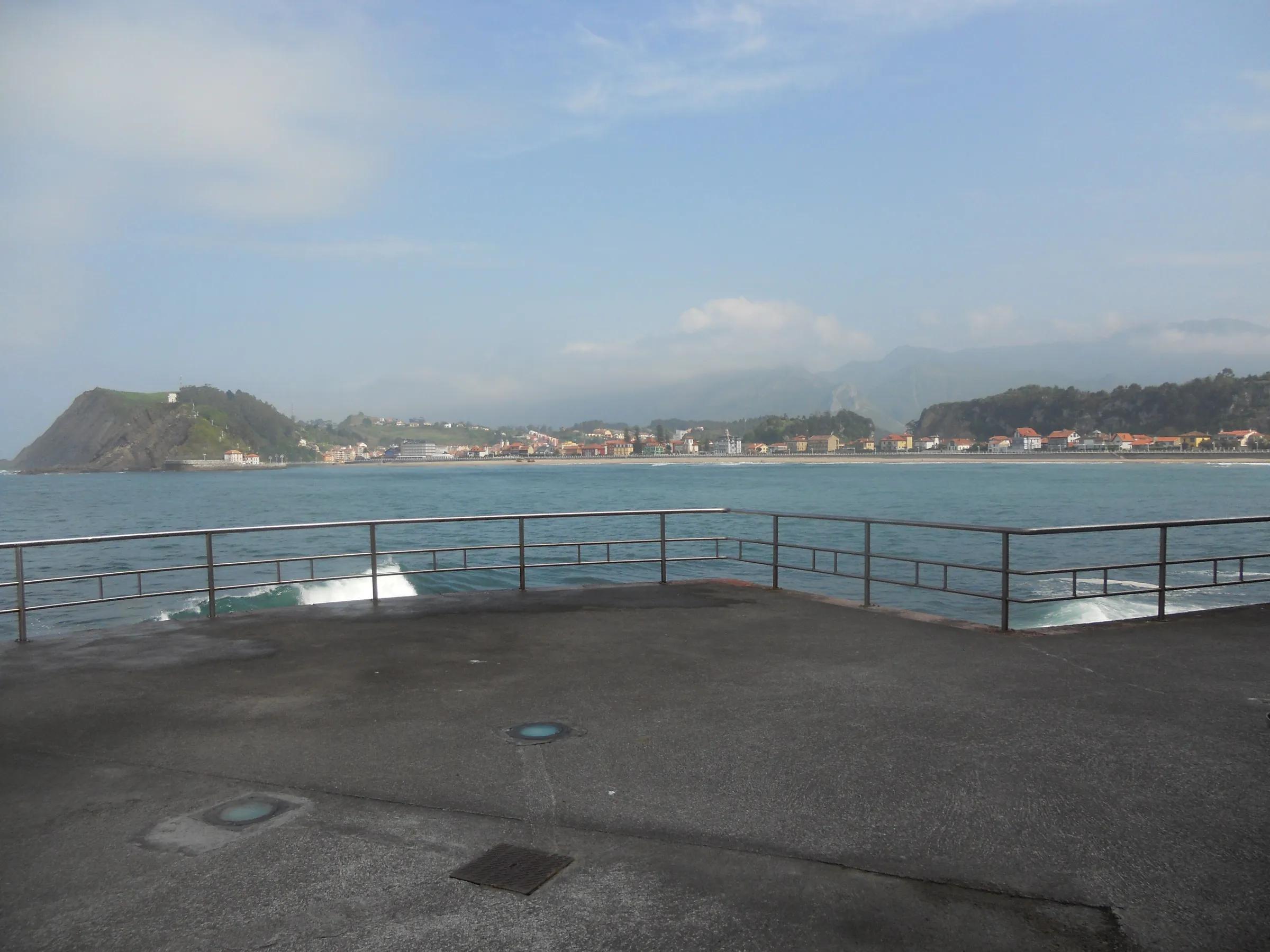
A long sandy beach lined with early 20th-century villas. At its western end, at Punta'l Pozu, Jurassic dinosaur footprints are visible in the rock at low tide.
Why go
- Beach day plus real dinosaur tracks.
Travel, stay and experience
Getting around, where to stay and what to experience around Playa de Santa Marina, from the guide's own records.
Getting around
- Aeropuerto de Asturias (OVD) · 78 km in a straight line
- Estación de Ribadesella · 1 km in a straight line
Where to stay
73 registered places to stay within 10 km (straight line). Nearest:
- Don Pepe · 1 km in a straight line
- Don Pepe Ria · 1 km in a straight line
- Hotel Villa Rosario · 1 km in a straight line
Mapped by volunteers on OpenStreetMap; nothing is booked here.
Things to experience
Straight-line distances, not travel times. Tierra Luma shows no availability or prices and takes no bookings.
What to do here
Family
Find the footprints
Go at low tide to the western end and look for the information panel.
Leave room for discovery
Ideas, not instructions: take what suits your day.
- Food and a break
- For lunch, Ribadesella is about 1 km away in a straight line: wander its streets and see what tempts you. Or bring a picnic and stay outdoors.
- If you have time
- Check the tide, then walk the shore as it changes.
- Leave time afterwards to rest and look around.
Activities here
Things to do nearby
Activities whose place lies within 25 km in a straight line (not a road distance).
- Activity · 0 km awayBoat trip along the Acantilados del InfiernoThe coast east of Ribadesella (Acantilados del Infierno).
- Caving · 0 km awayGuided beginner caving in eastern AsturiasCueva de Pando (Ribadesella) or Cueva de La Huelga (Cangas de Onís); departures from Arriondas, Cangas de Onís and Ribadesella.
- Horse riding · 0 km awayHorse riding near Ribadesella: woods, rivers and coast viewsRibadesella and Villaviciosa area (eastern-central Asturias).
- Culture · 1 km awayTito Bustillo cave and rock art centreRibadesella, by the mouth of the River Sella (Avenida de Tito Bustillo).
- Gravel cycling · 1 km awayGravel ride from Ribadesella to VillaviciosaRibadesella/Ribeseya to Villaviciosa, eastern-central Asturian coast.
- Caving · 3 km awayWalking through La Cuevona de CuevesOn the road to Cueves, 4.9 km from Ribadesella (eastern Asturias).
Related places
- Located within
- Ribadesella· Town
About this place
Protected as: The footprint site belongs to the Monumento Natural Yacimientos de Icnitas (Decree 45/2001), which covers stretches of coast between Cabo Torres (Gijón) and Ribadesella.
Landscape and rock
Santa Marina is Ribadesella's town beach, a golden sweep of sand of around a kilometre that opens right where the River Sella meets the Cantabrian Sea. A promenade runs along its whole length, separating the sand from the town. The river mouth keeps reshaping the sandy bottom, and the beach is often hit by lively swell, which is why surfers and surf schools gather here. On calmer days it is simply a broad, easy urban beach with the estuary at one end and open sea in front.
How to get there
Transport and visitor services nearby
- Oficina de turismo de RibadesellaTourist office · 1 km
- Estación de RibadesellaTrain station · 1 km
- Oficina de turismo de CaraviaTourist office · 10 km
- Oficina de turismo de ParresTourist office · 13 km
- Estación de ArriondasTrain station · 13 km
- Estación de autobuses de Cangas de OnísBus station · 13 km
Straight-line distances, never travel times.
Plan your visit
- Across the bridge from Ribadesella's old town.
Accessibility
Promenade along the beach.
Visit with care
The dinosaur tracks are a protected natural monument, so look and photograph but don't chip, scrape, chalk or stand inside the prints, and leave every loose stone where it is. Check the tide before walking to the rocks at the western end. On the beach, use the bins on the promenade or take your rubbish home, follow the lifeguards' flags in season, and give surfers space where the waves break. Asturias's 'Respeturismo' campaign sums it up: care for shared spaces and respect the people who live here.
Local services nearby
- Canoas OrienteAdventure operator · 1 km
- Jaire AventuraAdventure operator · 12 km
- Frontera VerdeAdventure operator · 12 km
- Los Cauces AventuraAdventure operator · 12 km
- Cangas AventuraAdventure operator · 14 km
Straight-line distances, never travel times.
Safety
- Rocks at the tracks are slippery.
Getting here & services nearby
The nearest published airport, stations and visitor centres, in a straight line from this place. Check routes and timetables with the operator.
- Aeropuerto de Asturias (OVD)Airport · 78 kmView details
- Estación de RibadesellaTrain station · 1 kmView details
- Estación de ArriondasTrain station · 13 kmView details
- Estación de autobuses de Cangas de OnísBus station · 13 kmView details
- Canoas OrienteAdventure operator · 1 kmView details
- Oficina de turismo de RibadesellaTourist office · 1 kmView details
- Oficina de turismo de CaraviaTourist office · 10 kmView details
- Jaire AventuraAdventure operator · 12 kmView details
Also in Ribadesella
Nearby
Within 30 km in a straight line. Distances are not travel times: valleys and mountain roads decide those.
More places nearby
- Playa de La AtalayaBeach · Asturias · 1 kmExplore place
- Faro de RibadesellaCape · Asturias · 1 kmExplore place
- Playa de AberdilBeach · Asturias · 2 kmExplore place
- Playa de ArraBeach · Asturias · 3 kmExplore place
- Playa de TereñesBeach · Asturias · 3 kmExplore place
- Entrepeñes y Playa de VegaBeach · Asturias · 6 kmExplore place
Continue exploring
- All places in Asturias
- About Asturias
- Coast & beaches
- Family days: dinosaurs and caves
- Three days: Picos de Europa and the Sella