Discover northern Spain
Explore northern Spain
Begin in Asturias and discover seven nearby provinces, from Atlantic shores to mountain valleys and historic towns. We help you find a starting point; the discoveries are yours. Travel lightly, with respect for the places, wildlife and people you meet.
- 8provinces
- 1392places
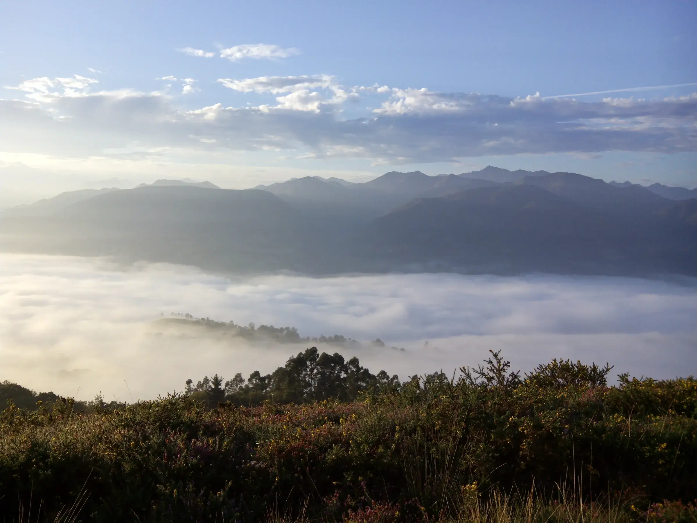
The Picos de Europa and the valley of the river Piloña seen from Monte Cayón · Photo: jacilluch / Wikimedia Commons, CC BY-SA 2.0
Choose a province
Select a province to discover its landscapes, places and things to do. Start with Asturias or explore further.
Map key
- Cities & villages
- Nature & landscapes
- Beaches & coast
- Rivers, lakes & waterfalls
- Culture & heritage
- Outdoor & adventure
Tap a province on the map
Sentinel-2 cloudless 2016 by EOX (CC BY 4.0) · Natural Earth
Where we're looking for land
Asturias
A green strip between the Cantabrian Mountains and the sea, where Tierra Luma hopes to grow.
Home ground. Several of its mountain areas are UNESCO biosphere reserves, among them Somiedo, Redes and the Picos de Europa.
Where we're looking
The search starts in eastern Piloña and rural Parres, around Villamayor, Sevares, Fíos and Bode, with Margolles–Peruyes, inland Ribadesella and some Cabrales valleys also considered. No land has been chosen or bought: this outline is a search area, not a site.
The road to Tierra Luma39 on the map
No places in Asturias match this filter yet.
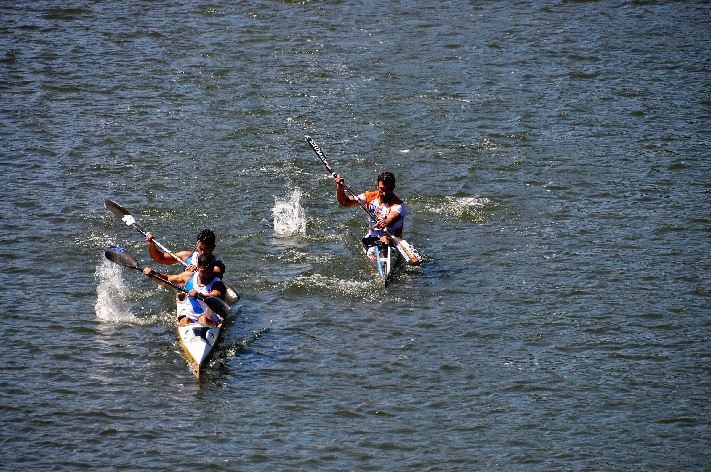
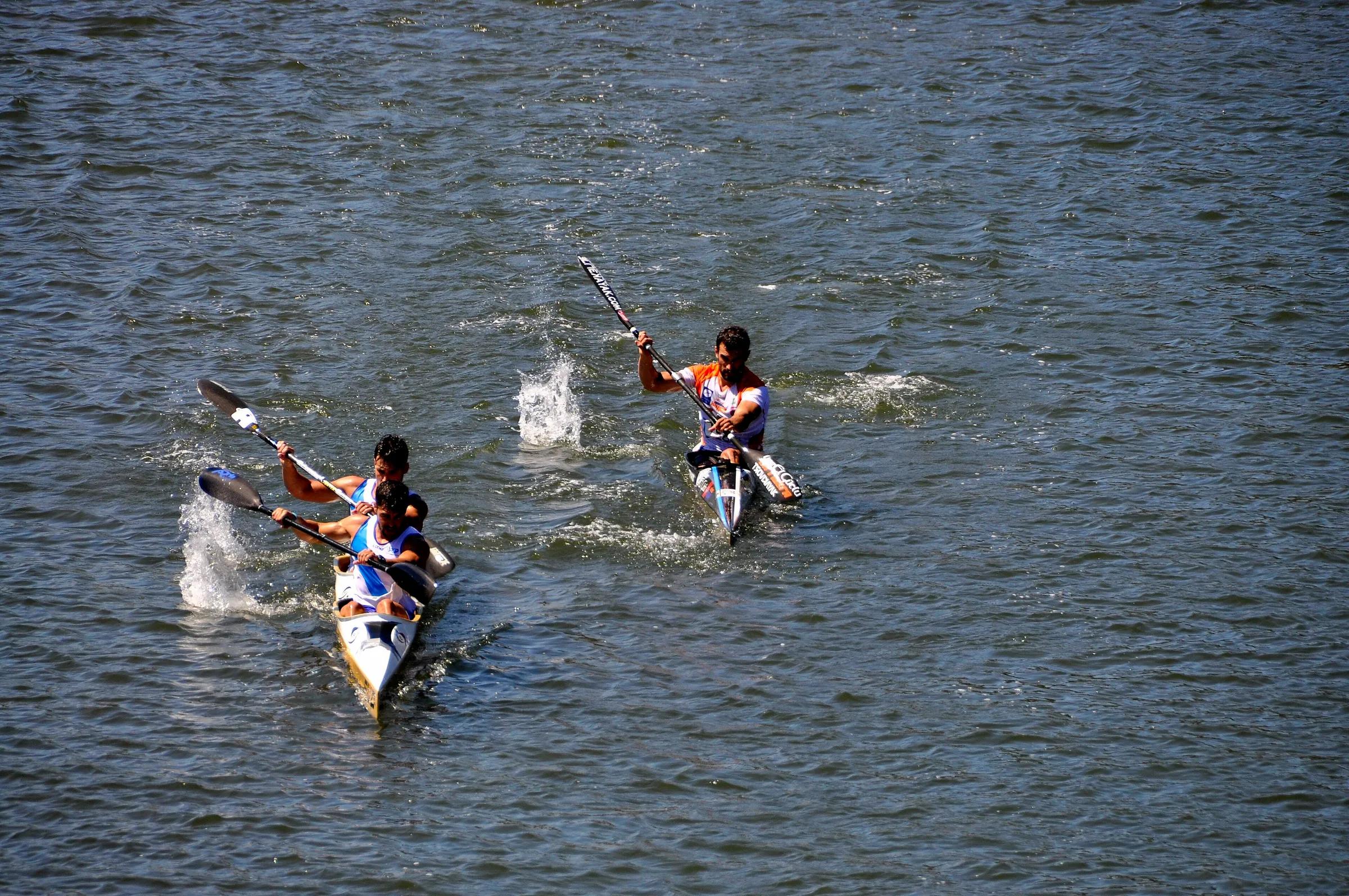
- TownArriondasThe river town where the classic canoe descent of the Sella begins.
- TownCangas de OnísThe historic gateway town to Covadonga and the western Picos de Europa.
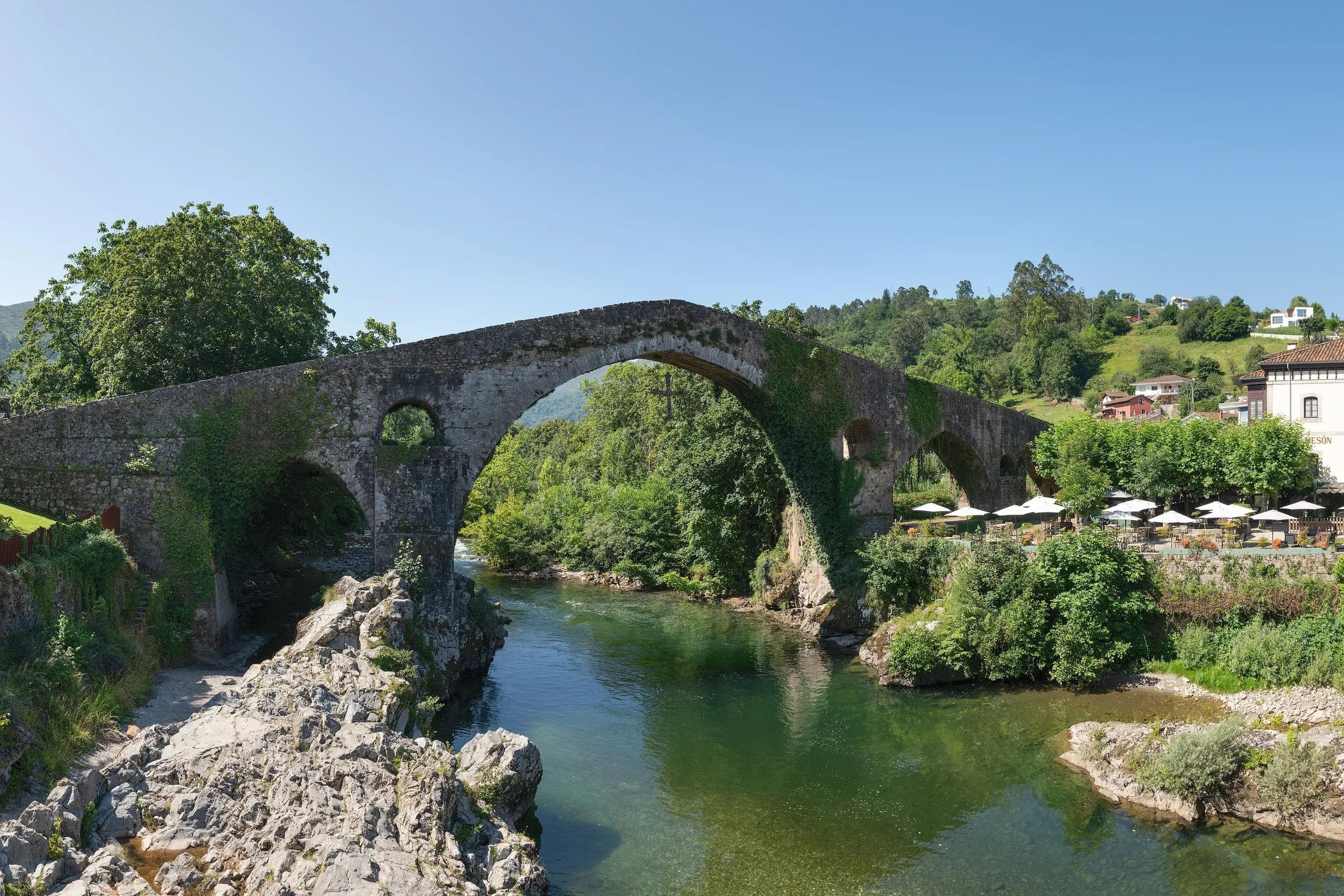
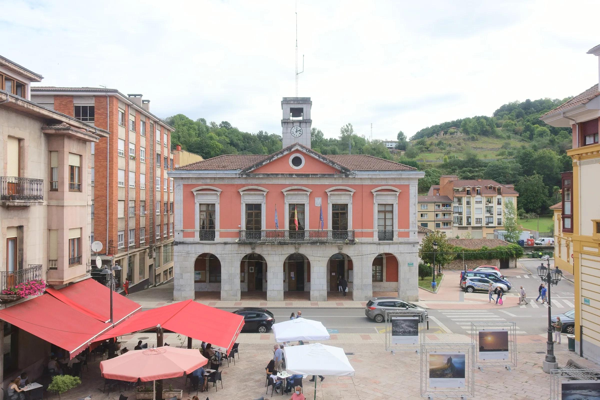
- TownInfiestoThe market town of the green Piloña valley. On the first Sunday of October it hosts the Festival de la Avellana, Piloña's hazelnut festival.
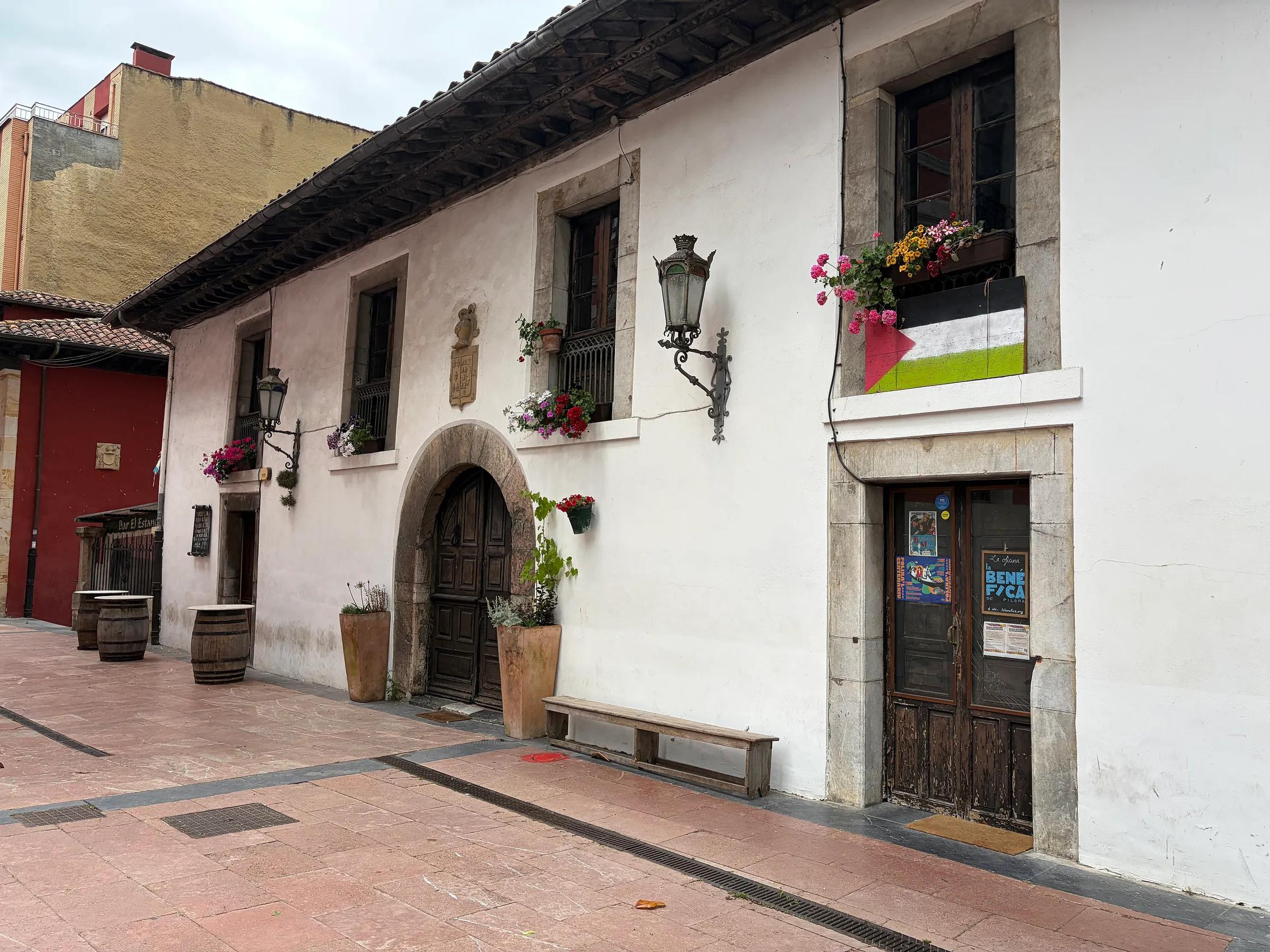
- TownLlanesA fishing town with a medieval core, harbour and clifftop promenade.
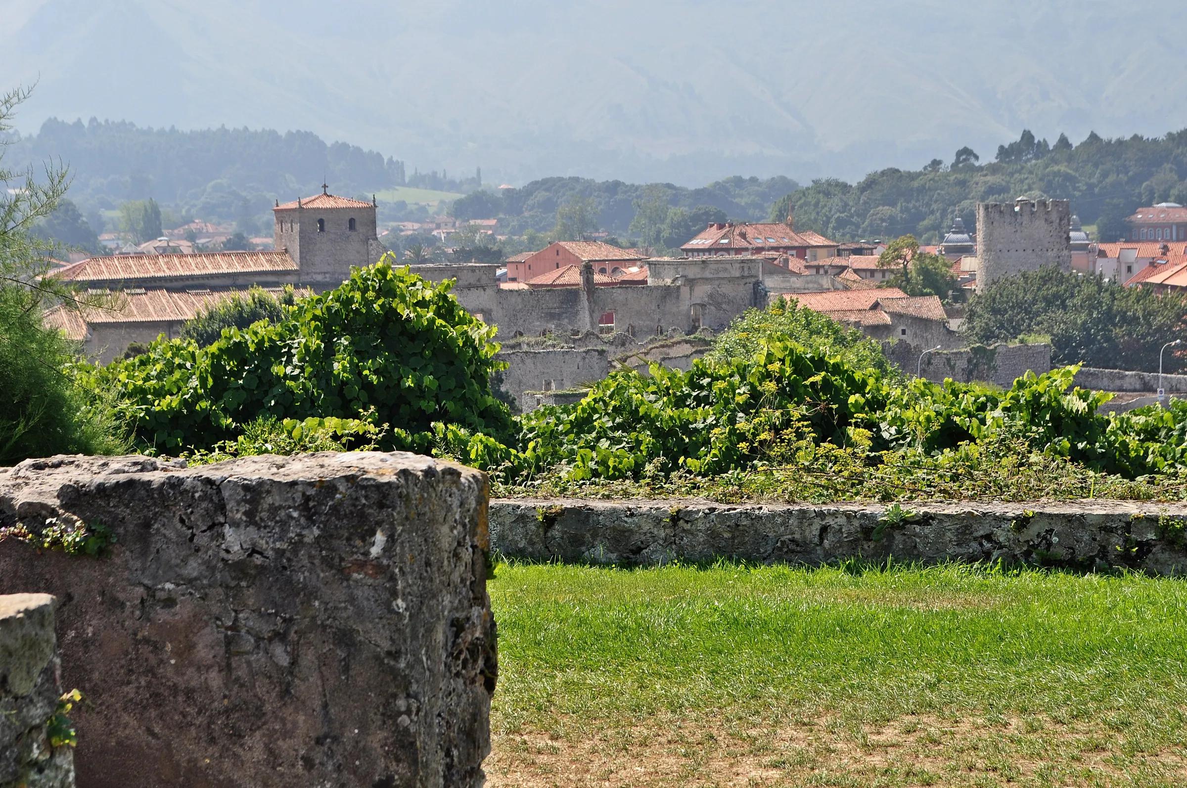
- MunicipalityPiloñaA green river valley of hórreo villages, Neanderthal history and the free-roaming ponies of the Sueve.
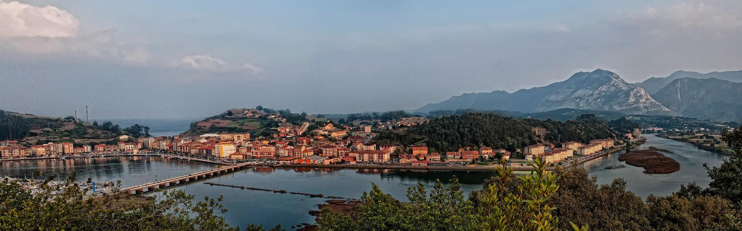
- TownRibadesellaA harbour town at the mouth of the Sella, where the canoe race ends.
- VillageBulnesA stone village with no road, reached on foot or by an underground funicular.
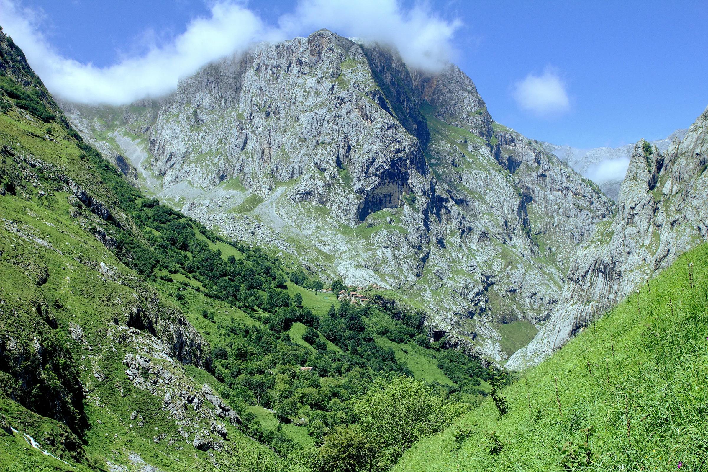
- LandmarkCovadongaSanctuary, cave chapel and pink basilica at the foot of the Picos.
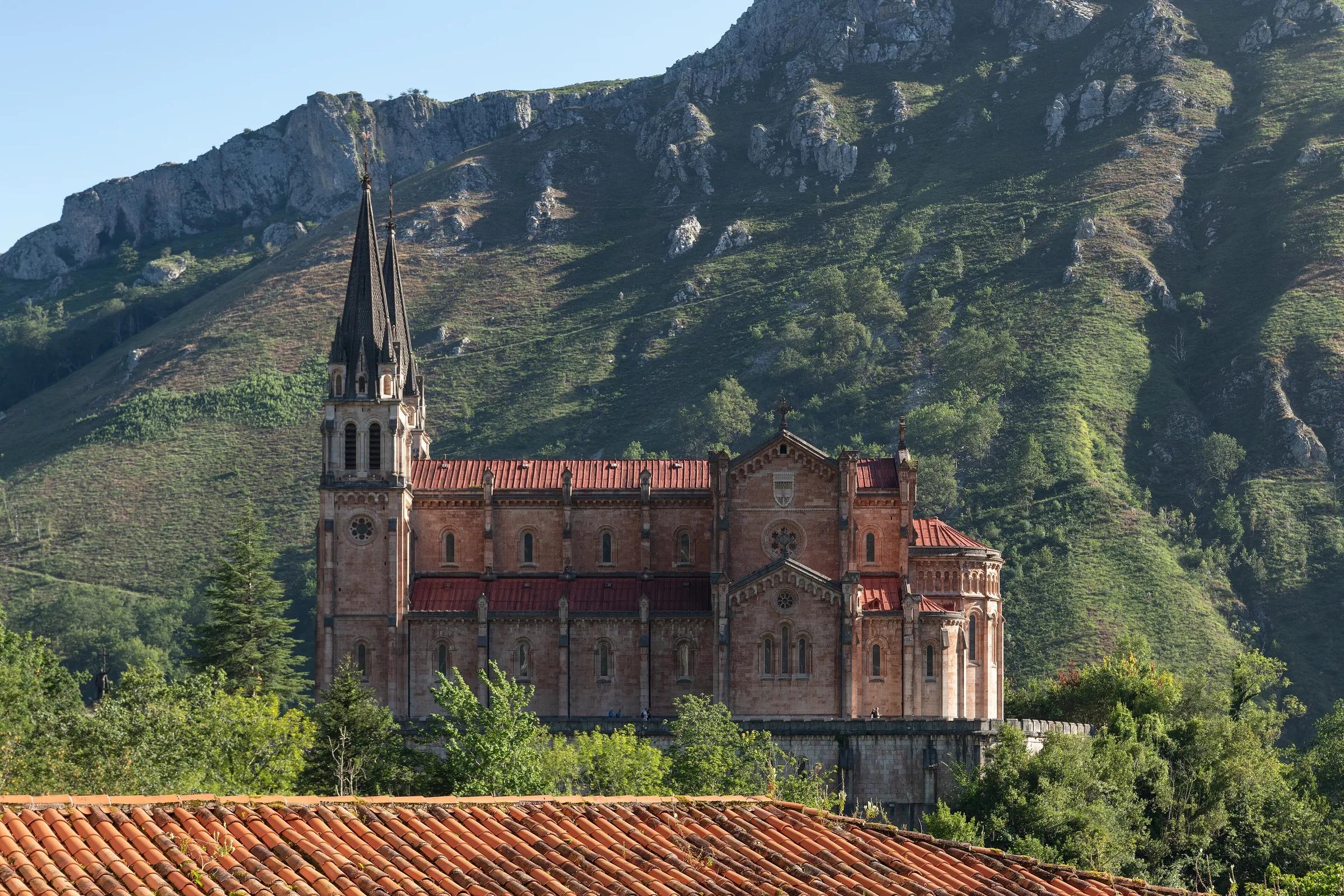
- LandmarkCubos de la MemoriaAgustín Ibarrola's painted concrete blocks on the Llanes breakwater.
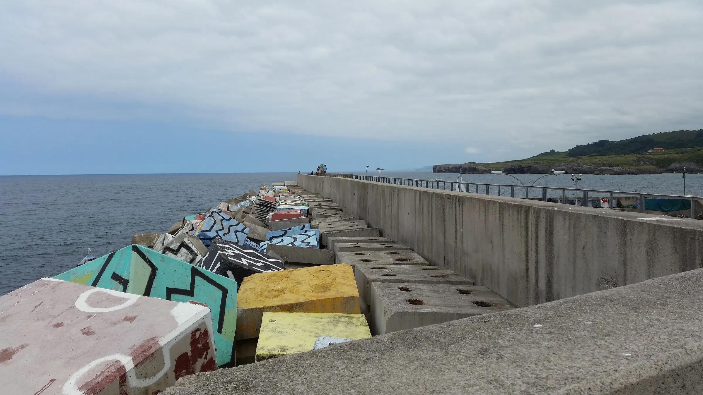
- LakeLagos de CovadongaTwo glacial lakes, Enol and Ercina, high in the Picos de Europa National Park.
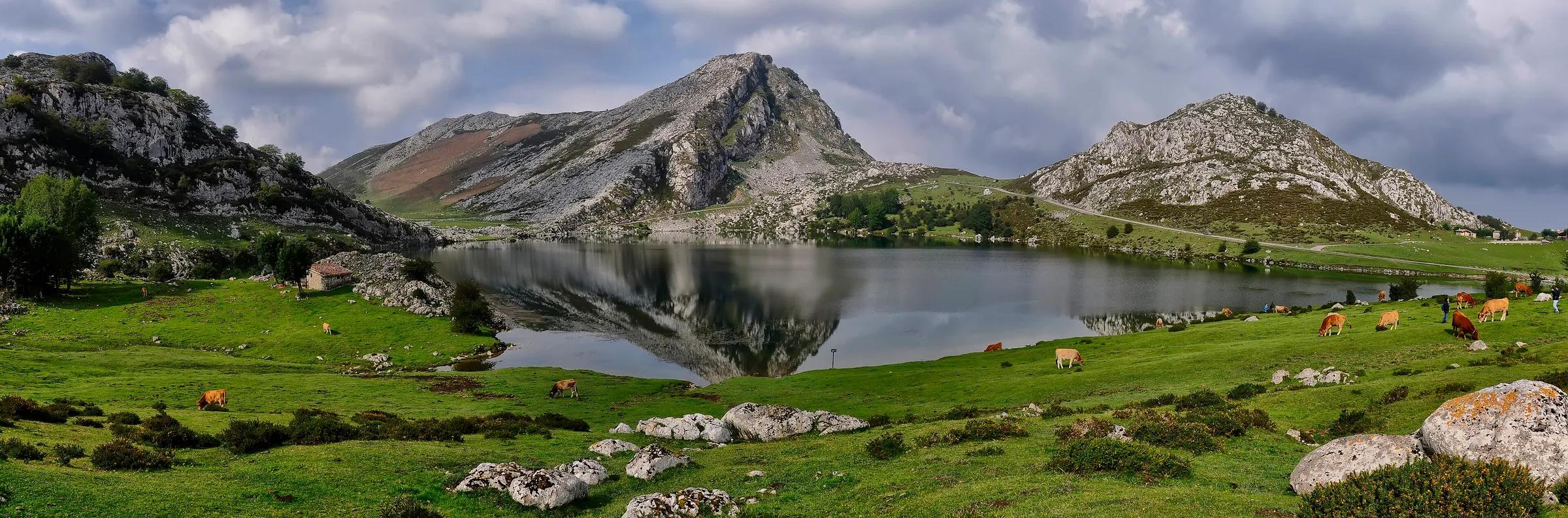
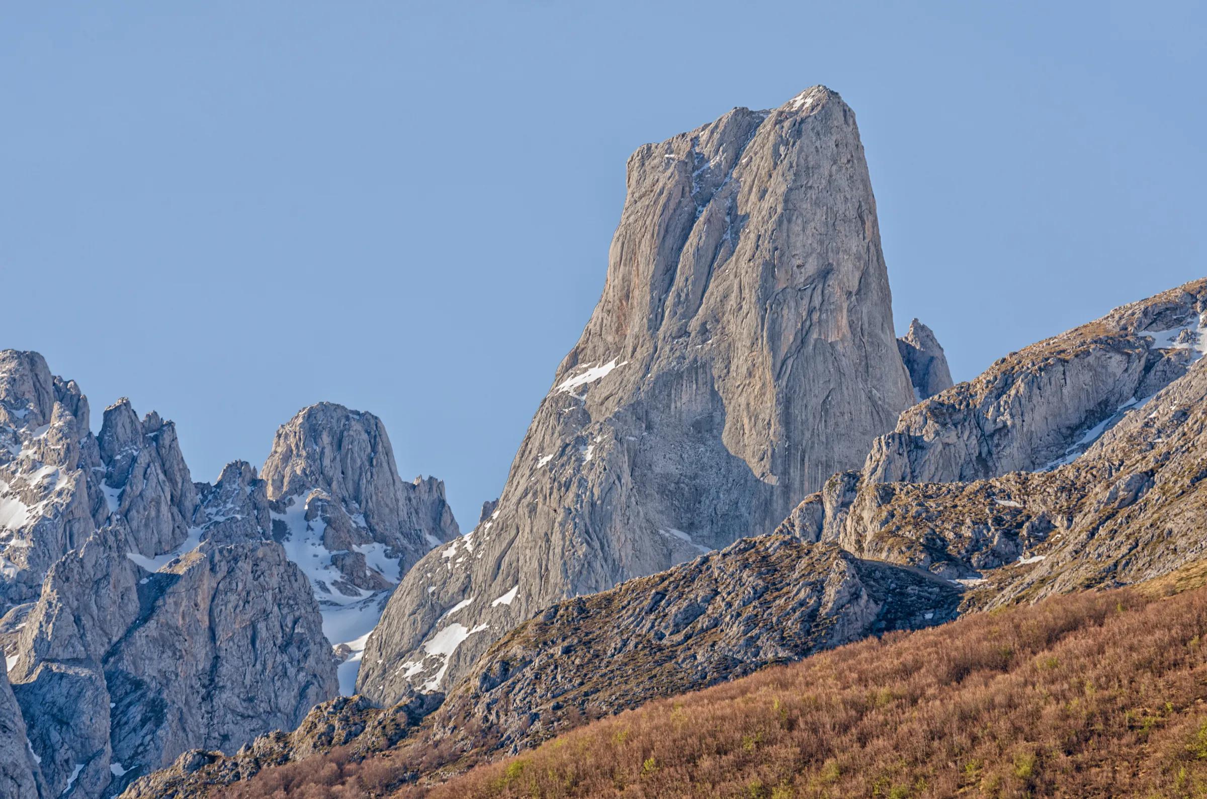
- MountainNaranjo de Bulnes (Picu Urriellu)The sheer limestone tower that symbolises the Picos de Europa.
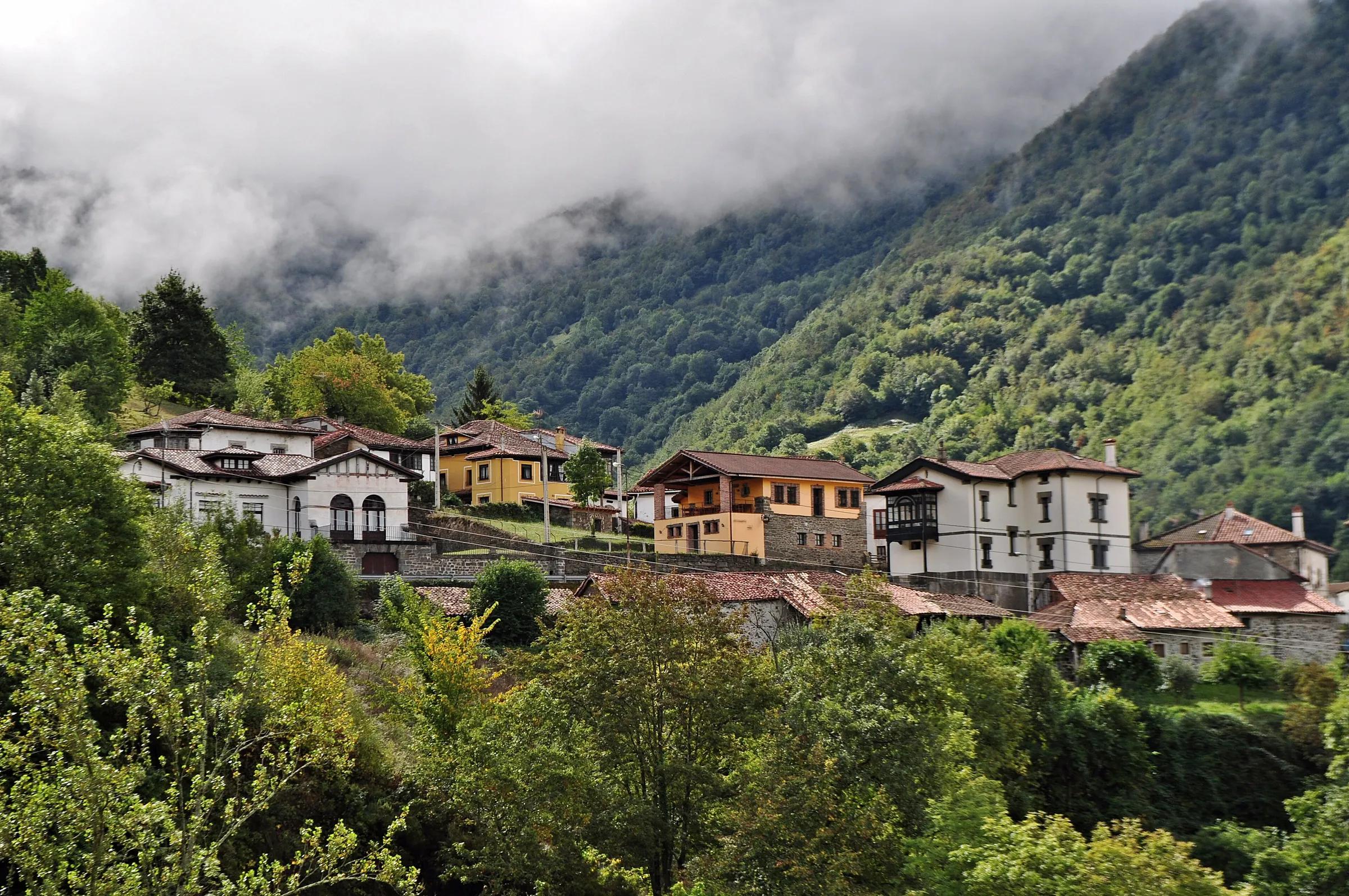
- Protected areaParque Natural de PongaA whole mountain municipality under protection: beechwoods, limestone gorges and small stone villages.
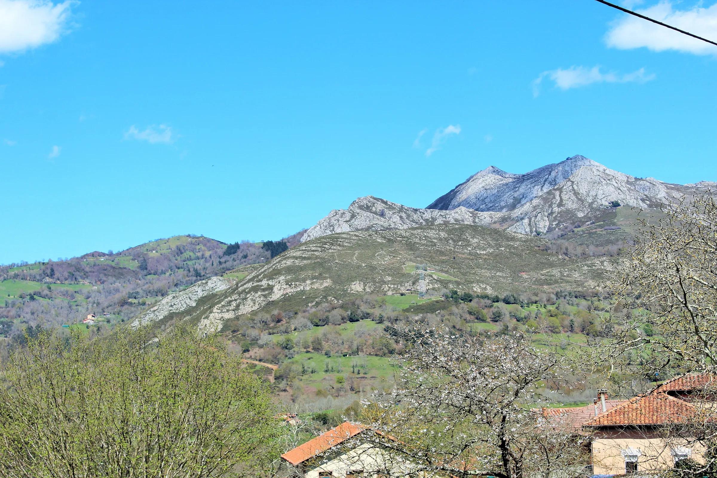
- MountainPicu PienzuThe highest point of the Sierra del Sueve, with sea and mountain views.
- LandmarkPuente Romano de Cangas de OnísA steep stone arch over the Sella, known as Roman but actually medieval.
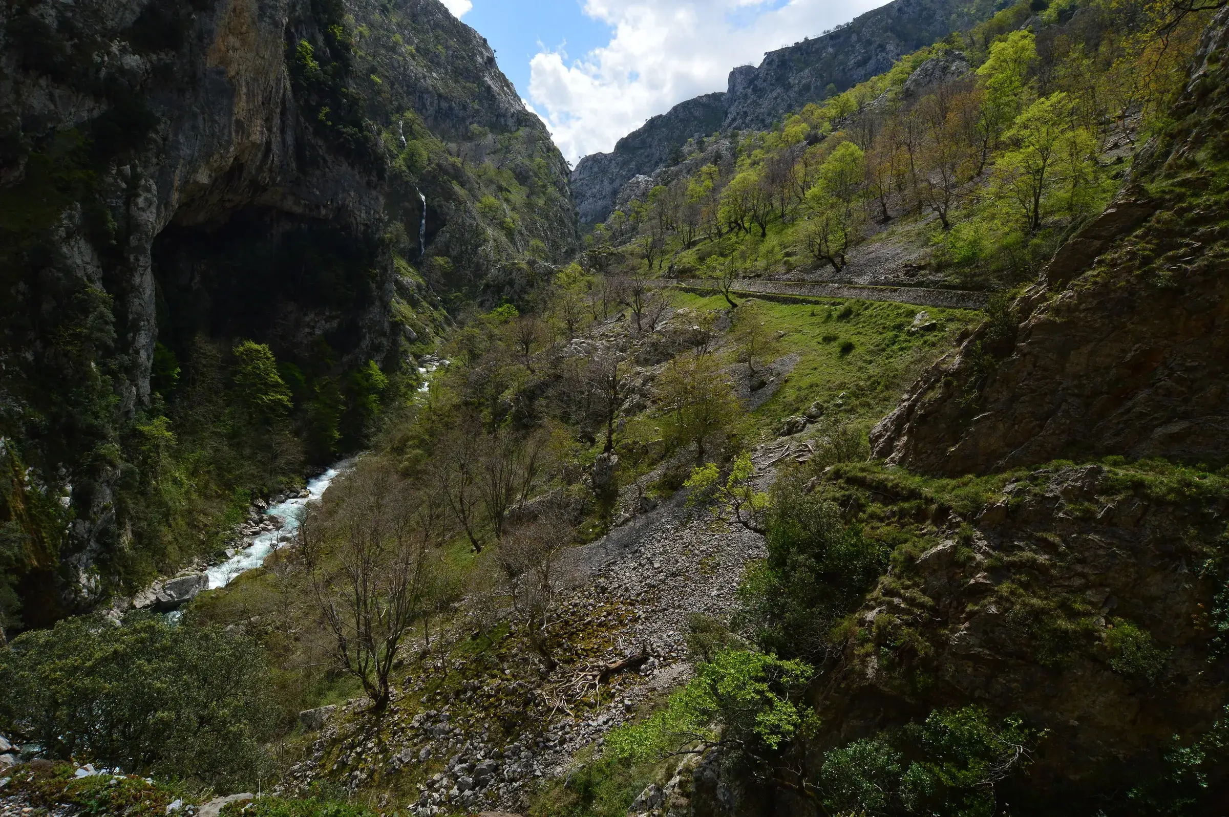
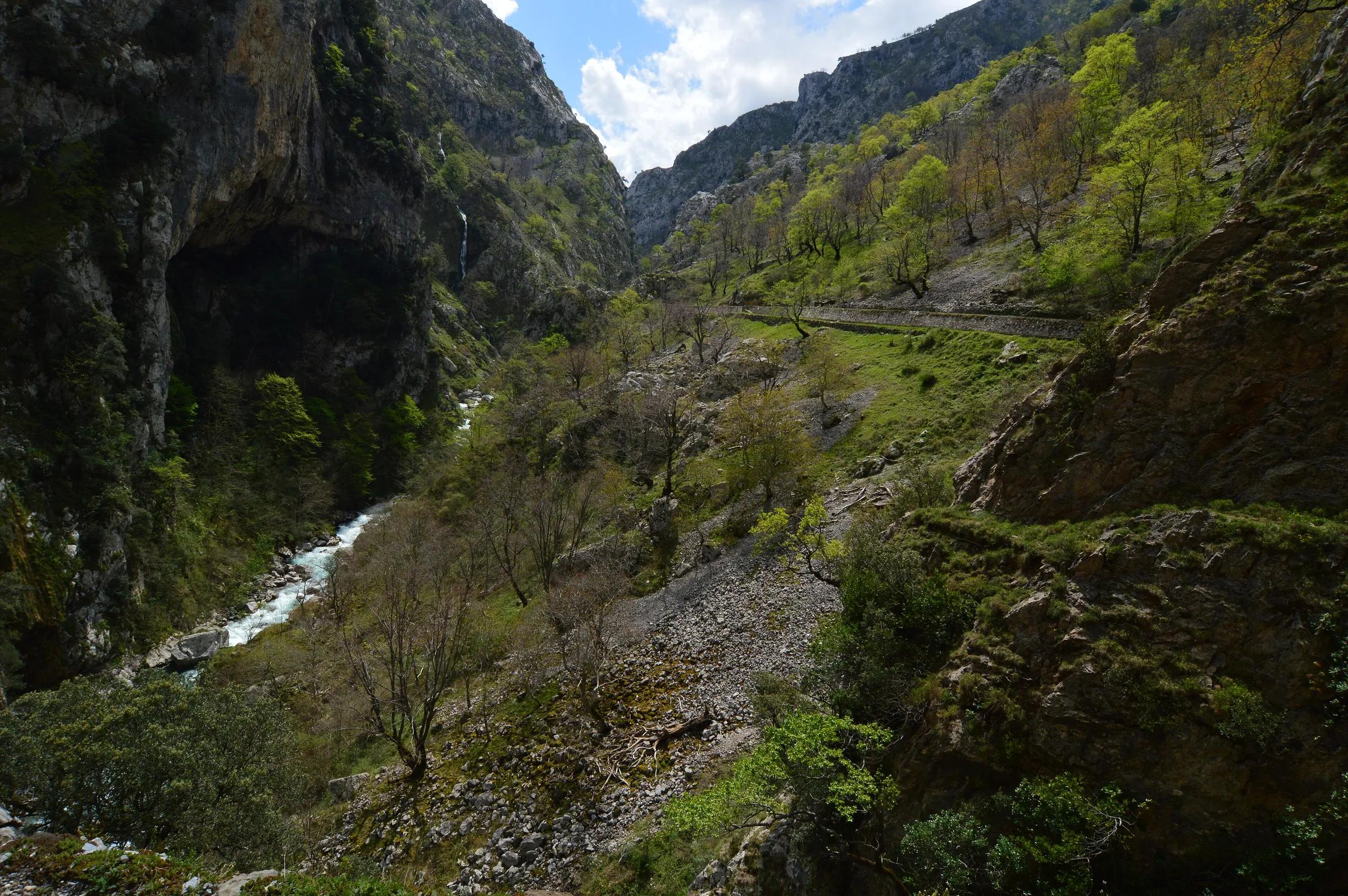
- RouteRuta del CaresThe famous gorge path cut into the cliffs between Poncebos and Caín.
- VillageSotresThe highest village of Cabrales, a herding community where walks into the Central Massif begin.
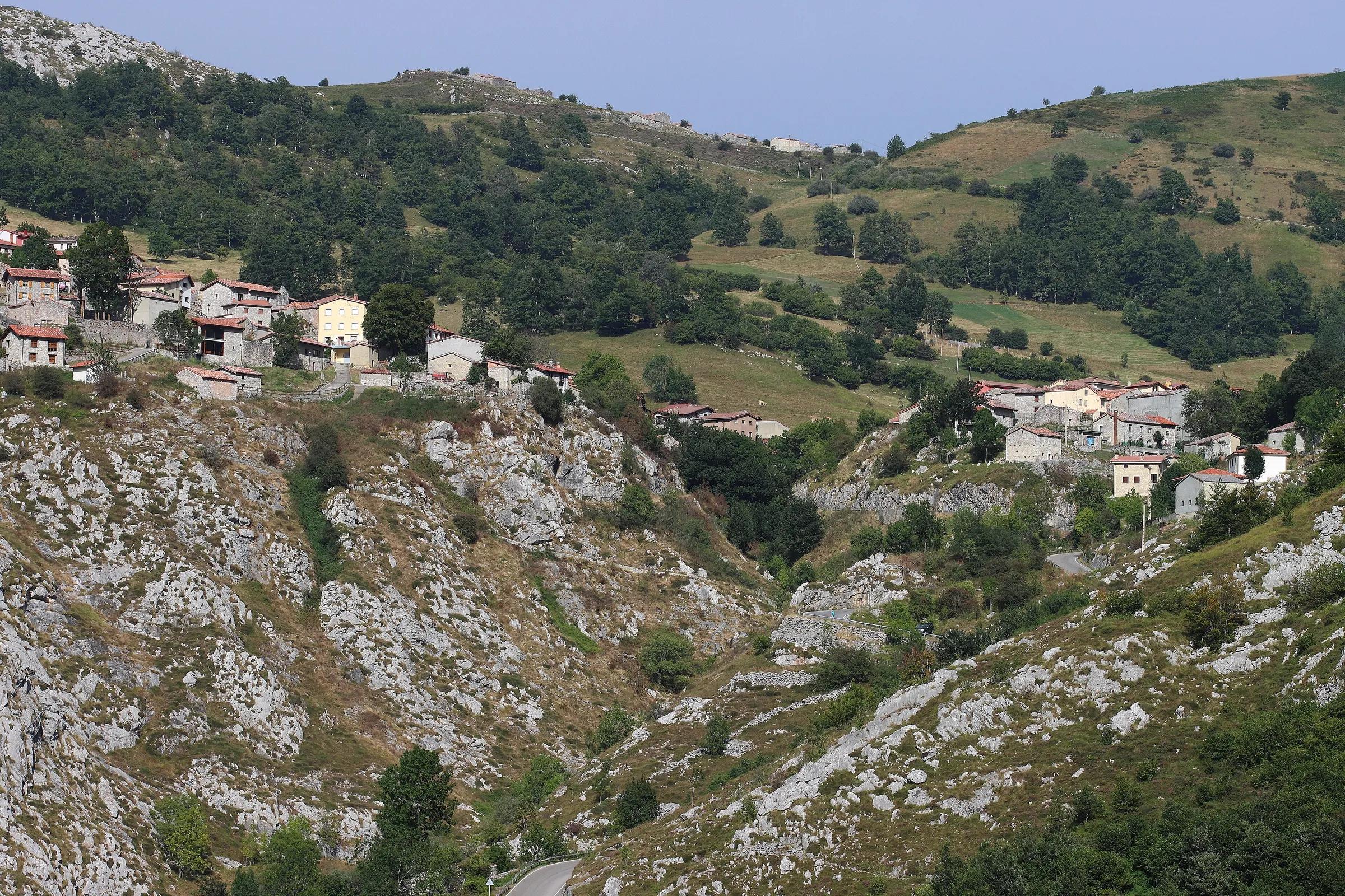
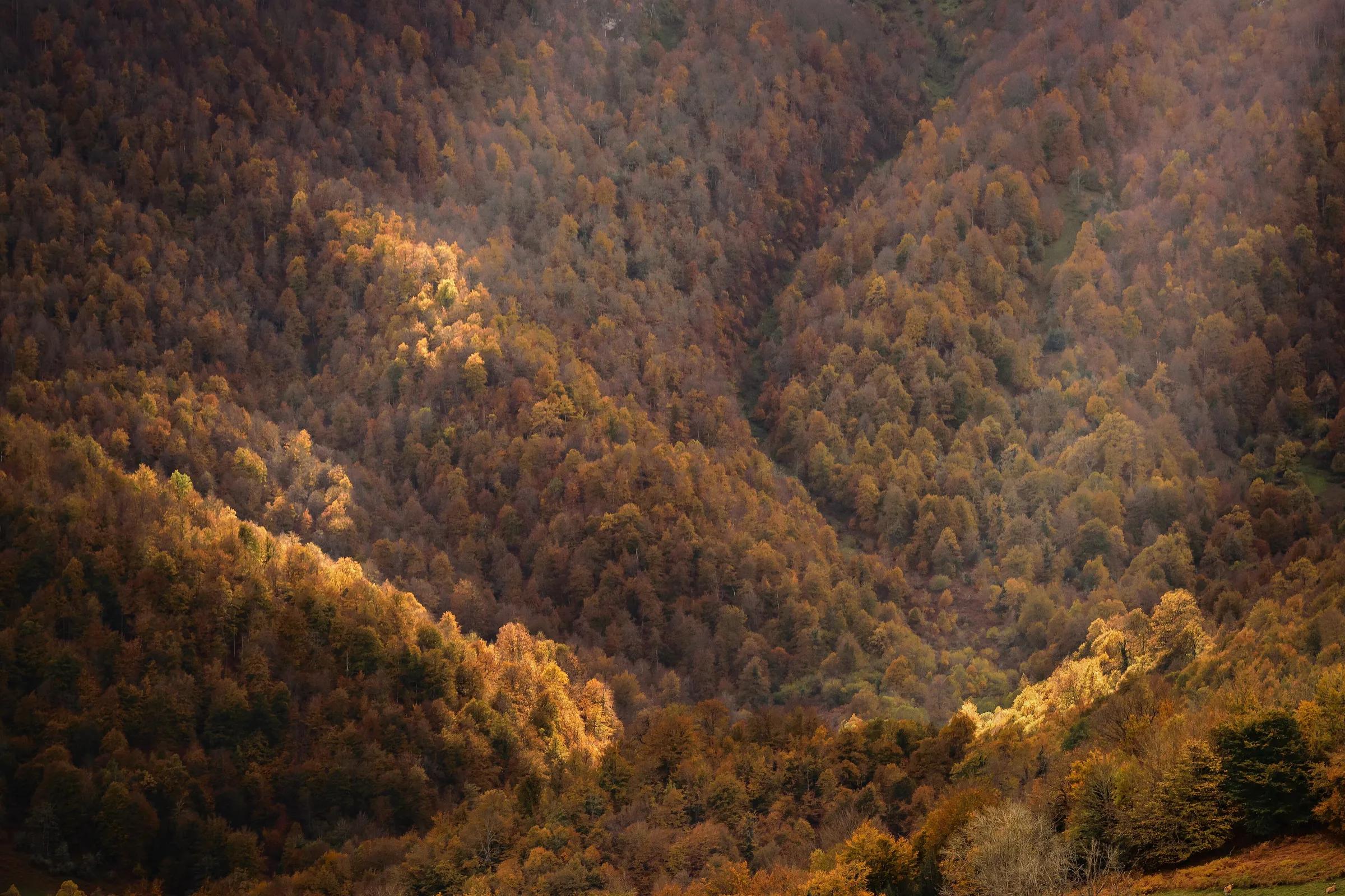
- ForestBosque de PeloñoAn old beech forest in Ponga Natural Park, quiet and green.
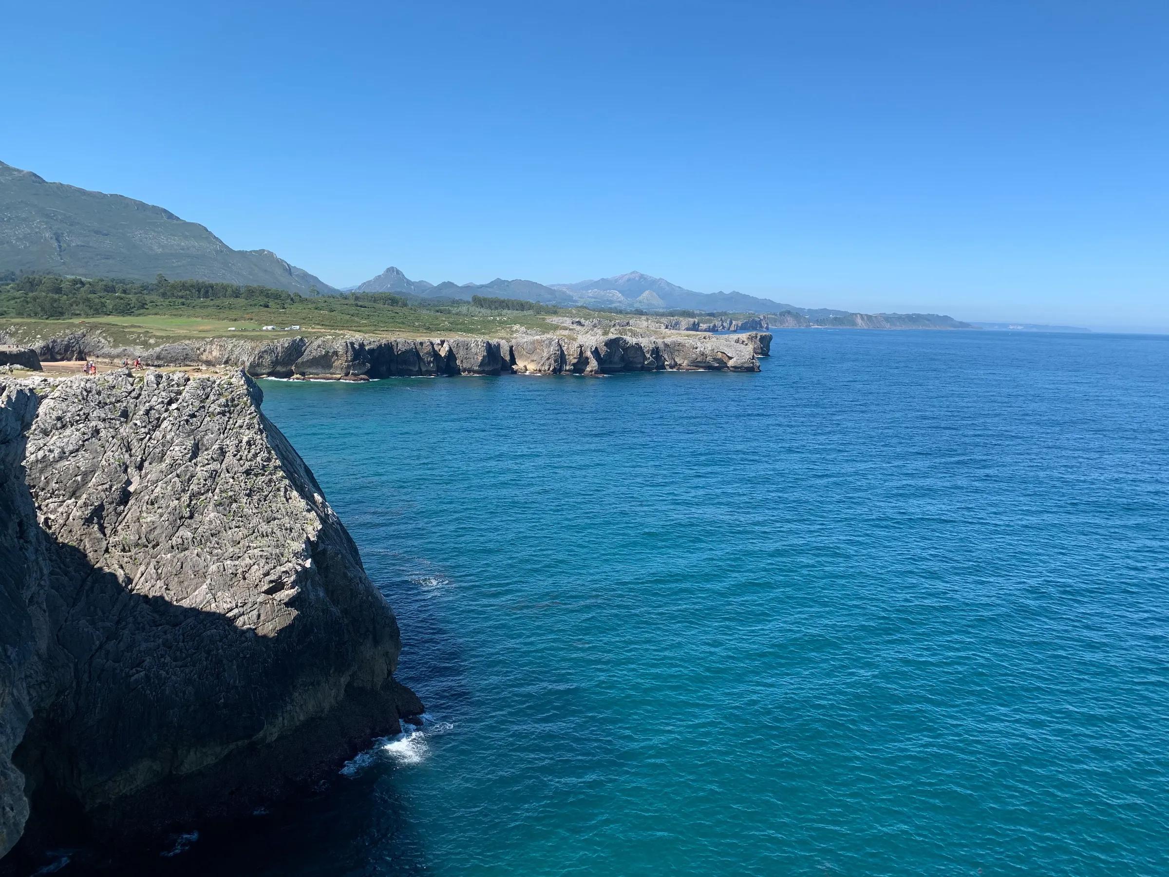
- CoastBufones de PríaBlowholes where the sea roars up through the clifftop meadow.
- CaveCueva de Tito BustilloOne of Europe's major Palaeolithic art caves, with a modern Cave Art Centre nearby.
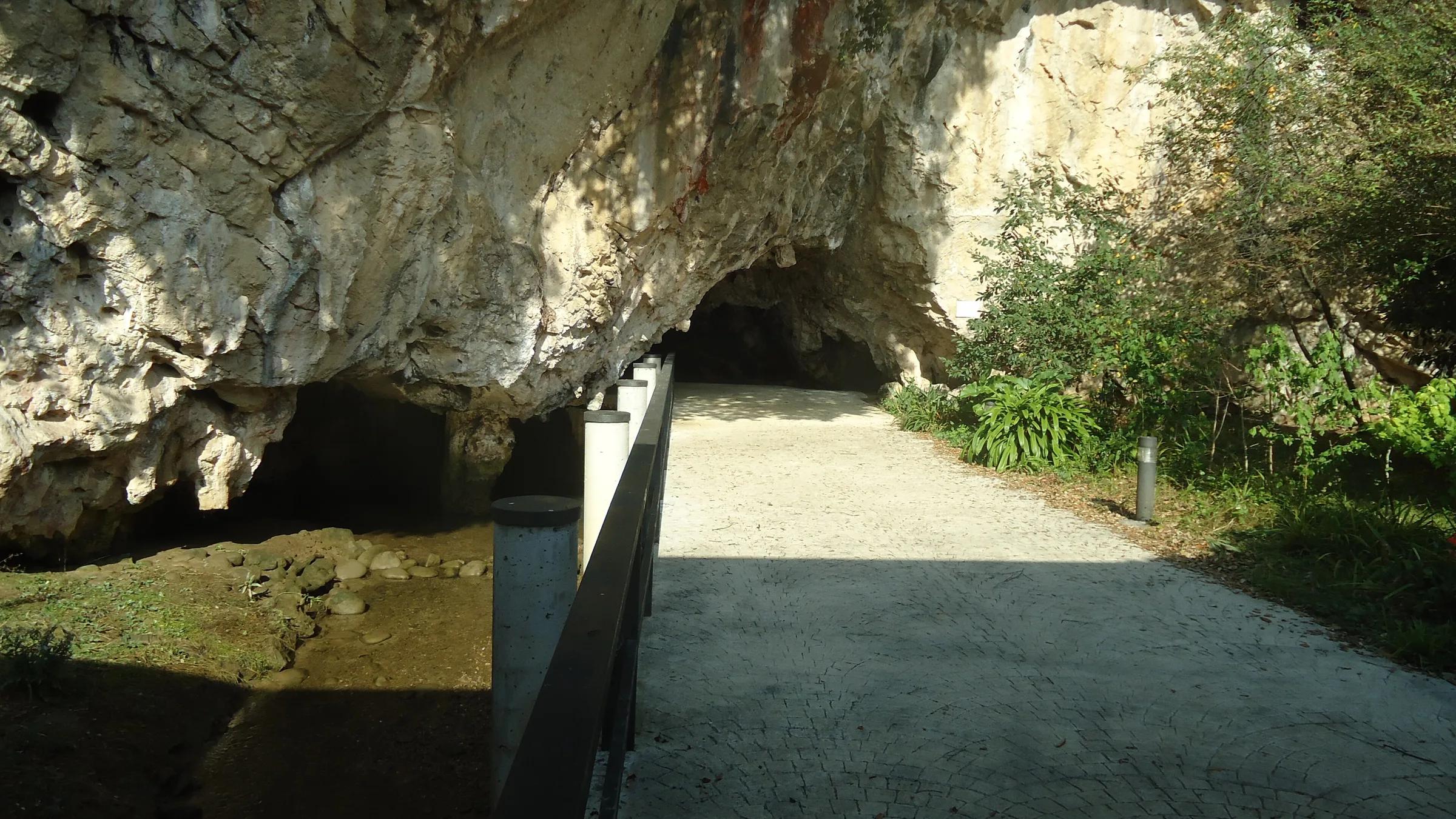
- CaveCueva del PindalA clifftop cave with Palaeolithic paintings, part of a UNESCO World Heritage site.
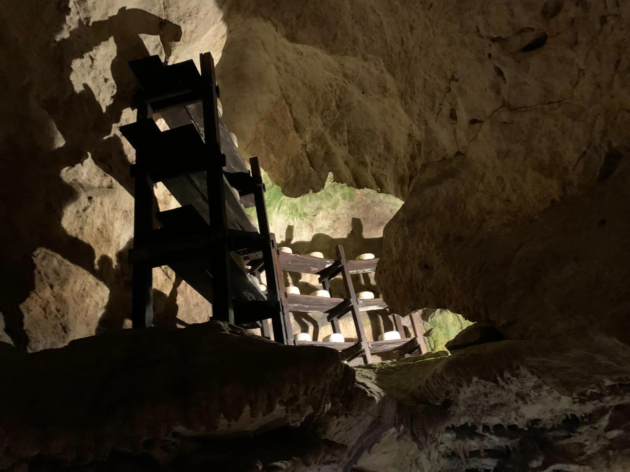
- MuseumCueva del Queso de CabralesA natural cave in Arenas explaining how blue Cabrales cheese is matured.
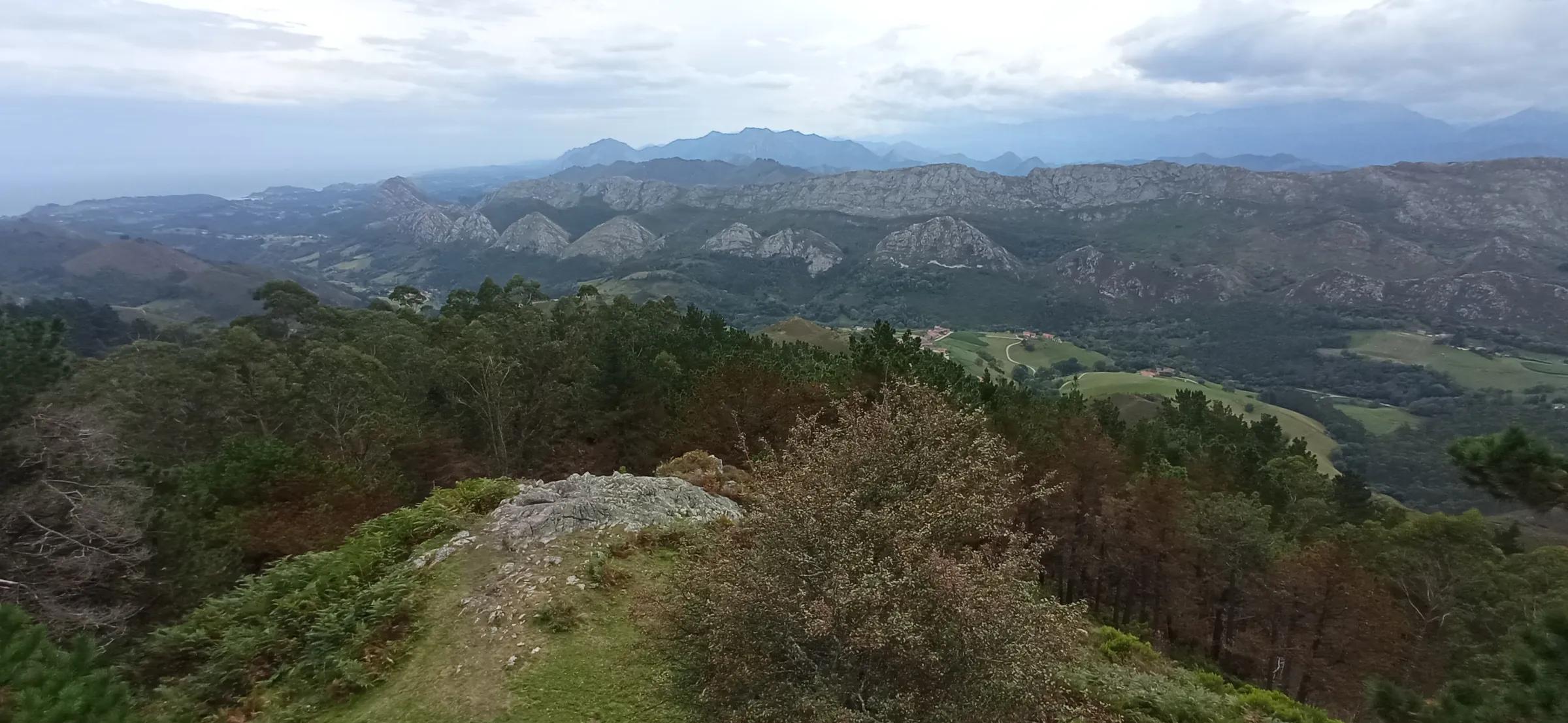
- ViewpointMirador del FituA viewpoint tower with views from the Picos de Europa to the sea.
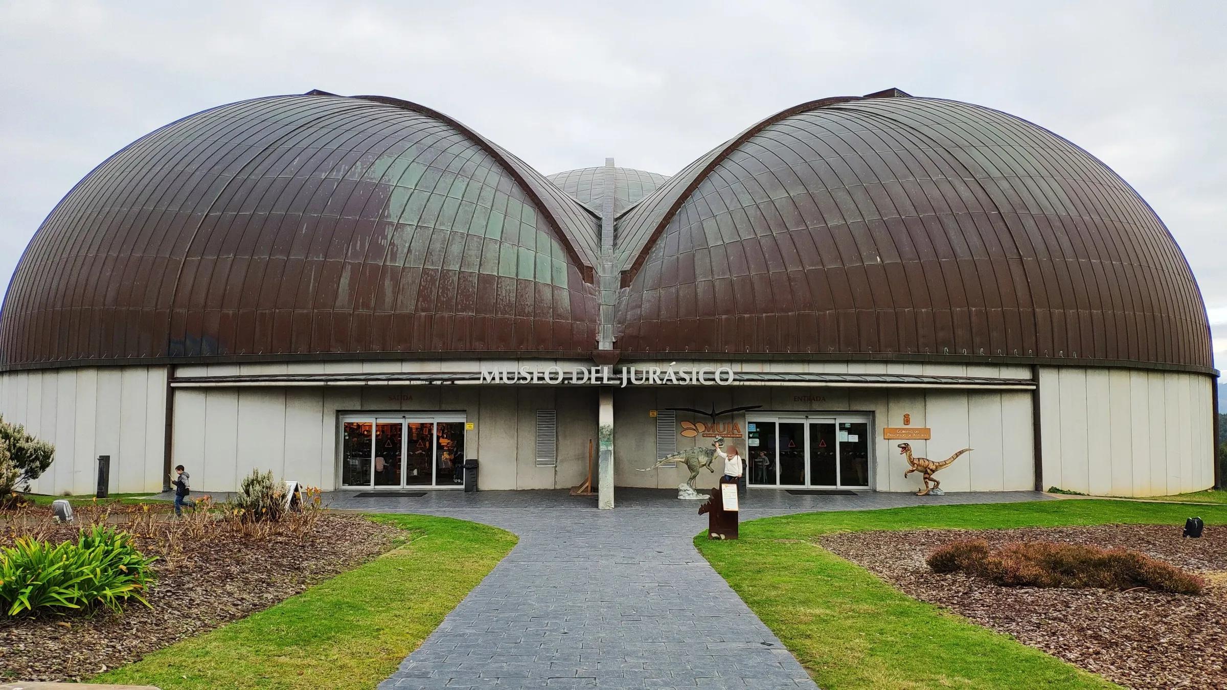
- MuseumMuseo del Jurásico de Asturias (MUJA)The Jurassic museum on the Dinosaur Coast, a favourite with families.
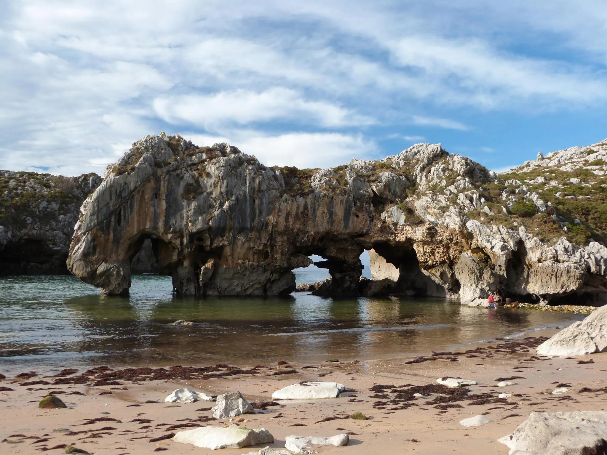
- BeachPlaya de Cuevas del MarA beach framed by rock arches and sea caves near Nueva.
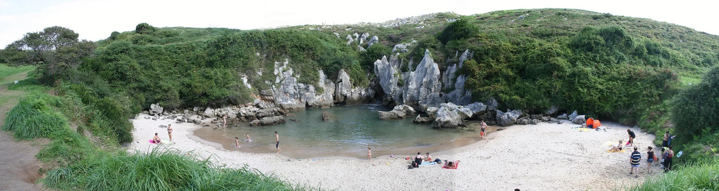
- BeachPlaya de GulpiyuriA tiny inland beach in a meadow, fed by the sea through the rock.
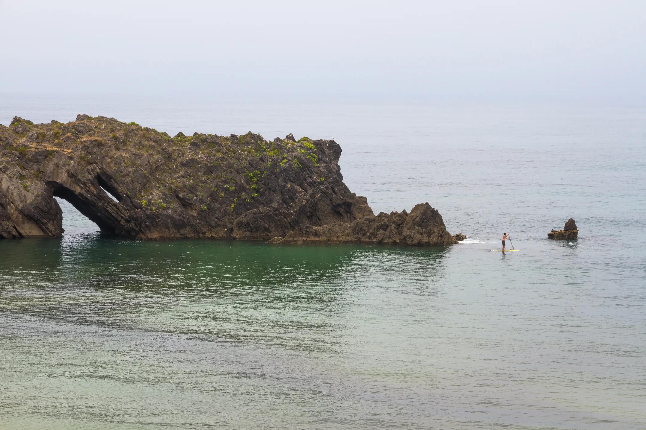
- BeachPlaya de San AntolínA long, open beach and one of the best-known surf spots near Llanes.
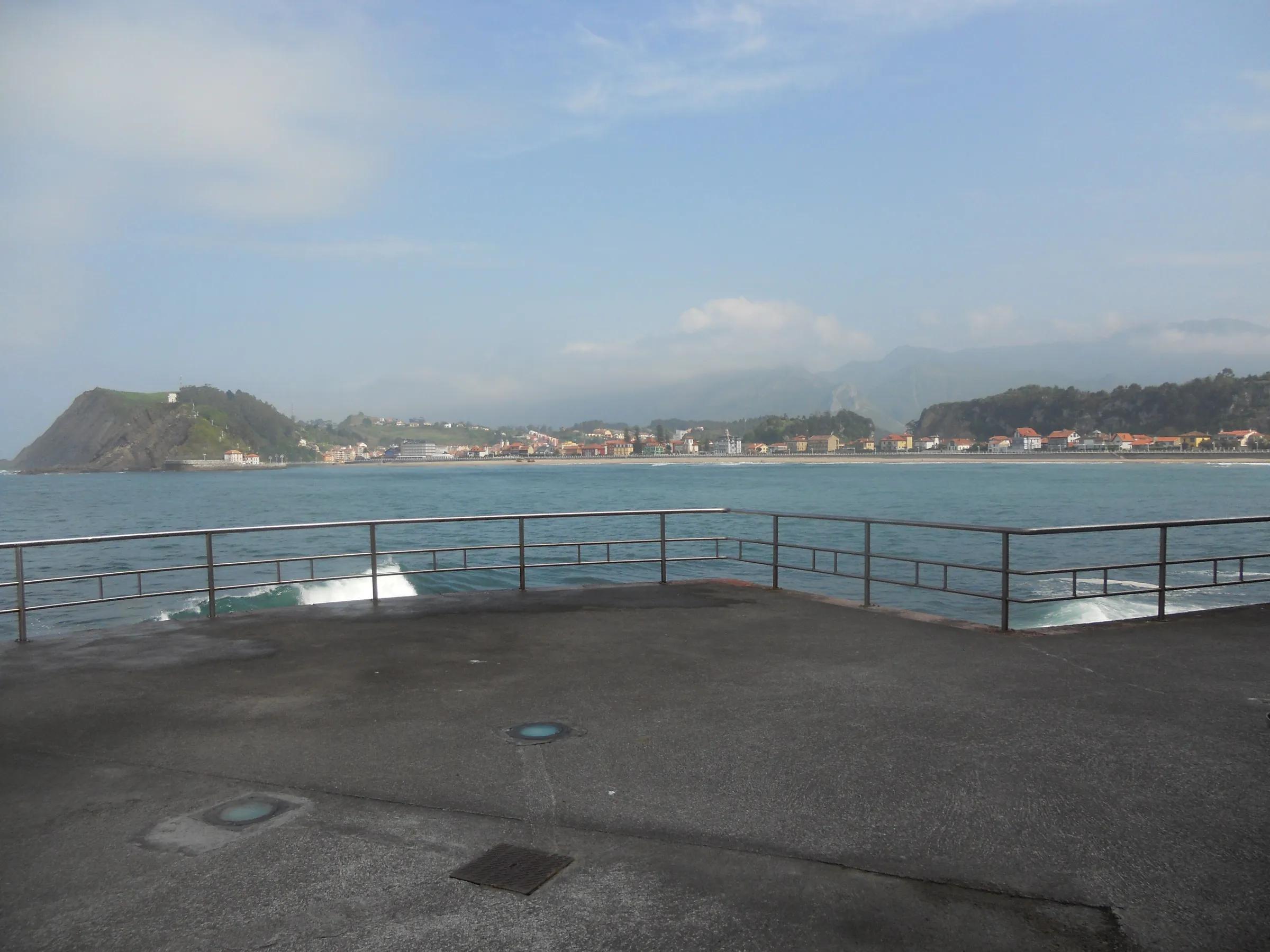
- BeachPlaya de Santa MarinaRibadesella's town beach, with dinosaur footprints at its western end.
- BeachPlaya de TorimbiaA wild shell-shaped cove below green hills, reached on foot.
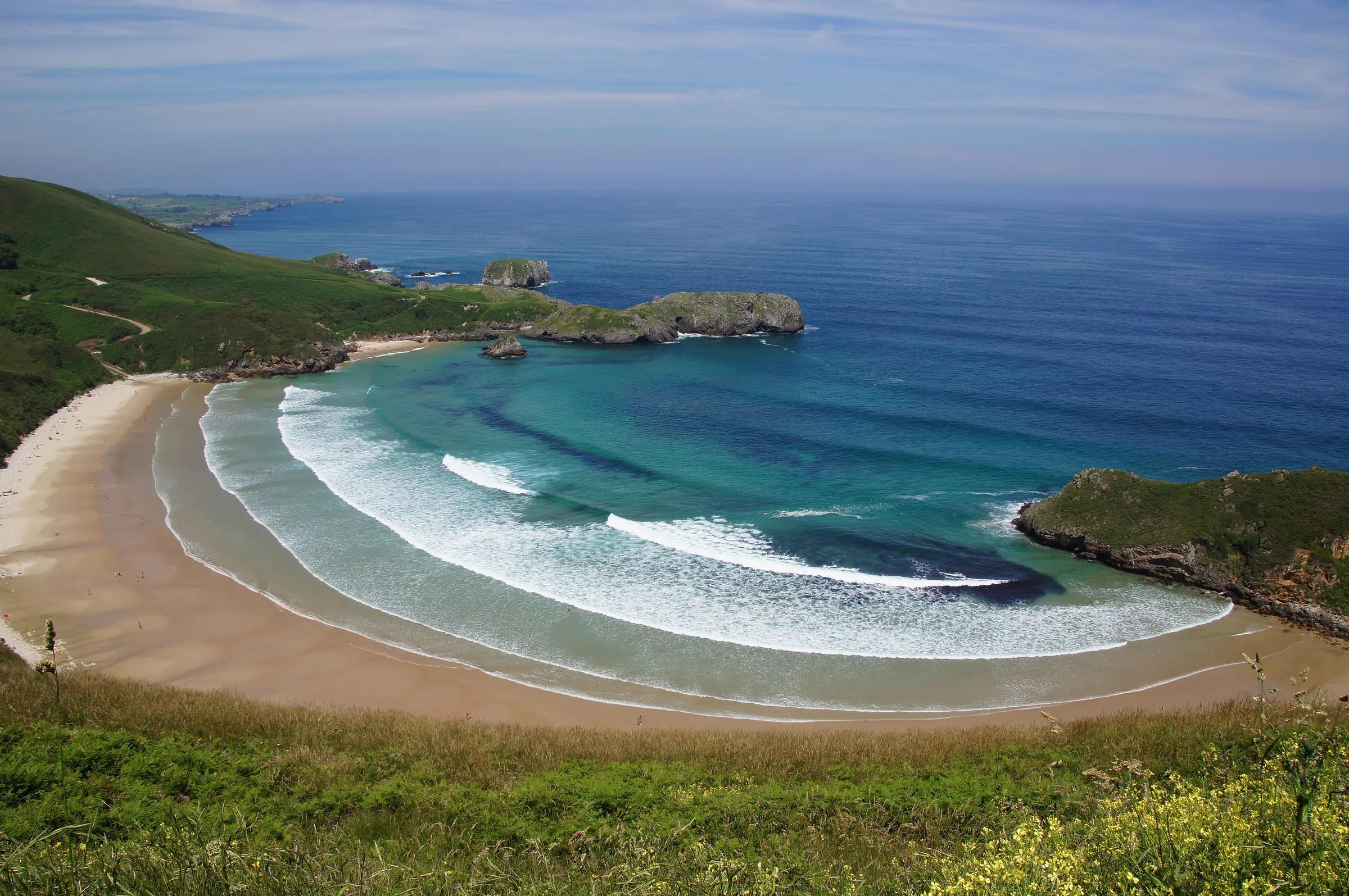
- CityGijón / XixónAsturias's largest city, wrapped around a long town beach.
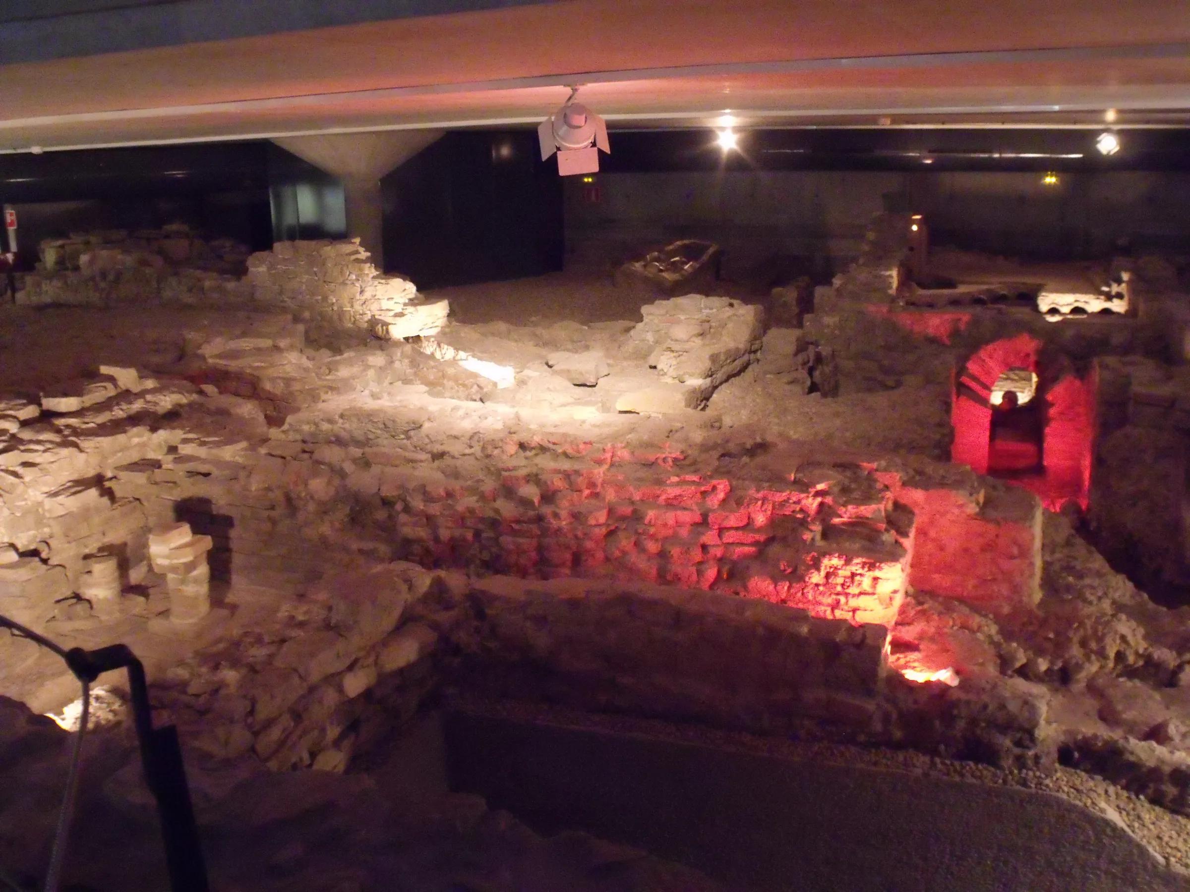
- CityOviedoThe capital of Asturias, with an old town of stone squares and a cathedral.
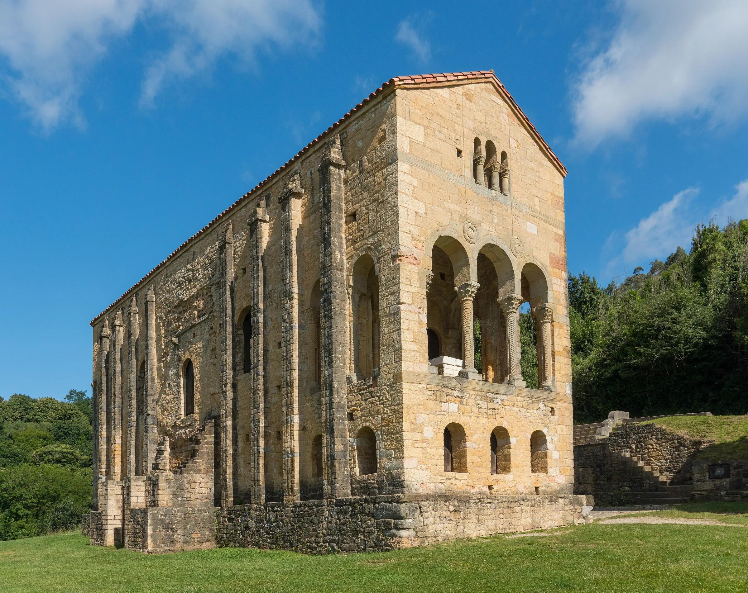
- Protected areaPicos de EuropaThree limestone massifs shared by Asturias, León and Cantabria. Spain's first national park began here in 1918, as the Montaña de Covadonga park.
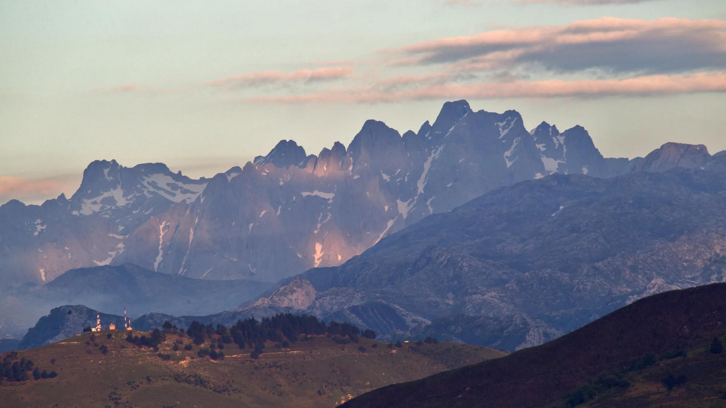
- CityAvilésA medieval old town of arcaded streets on an industrial estuary.
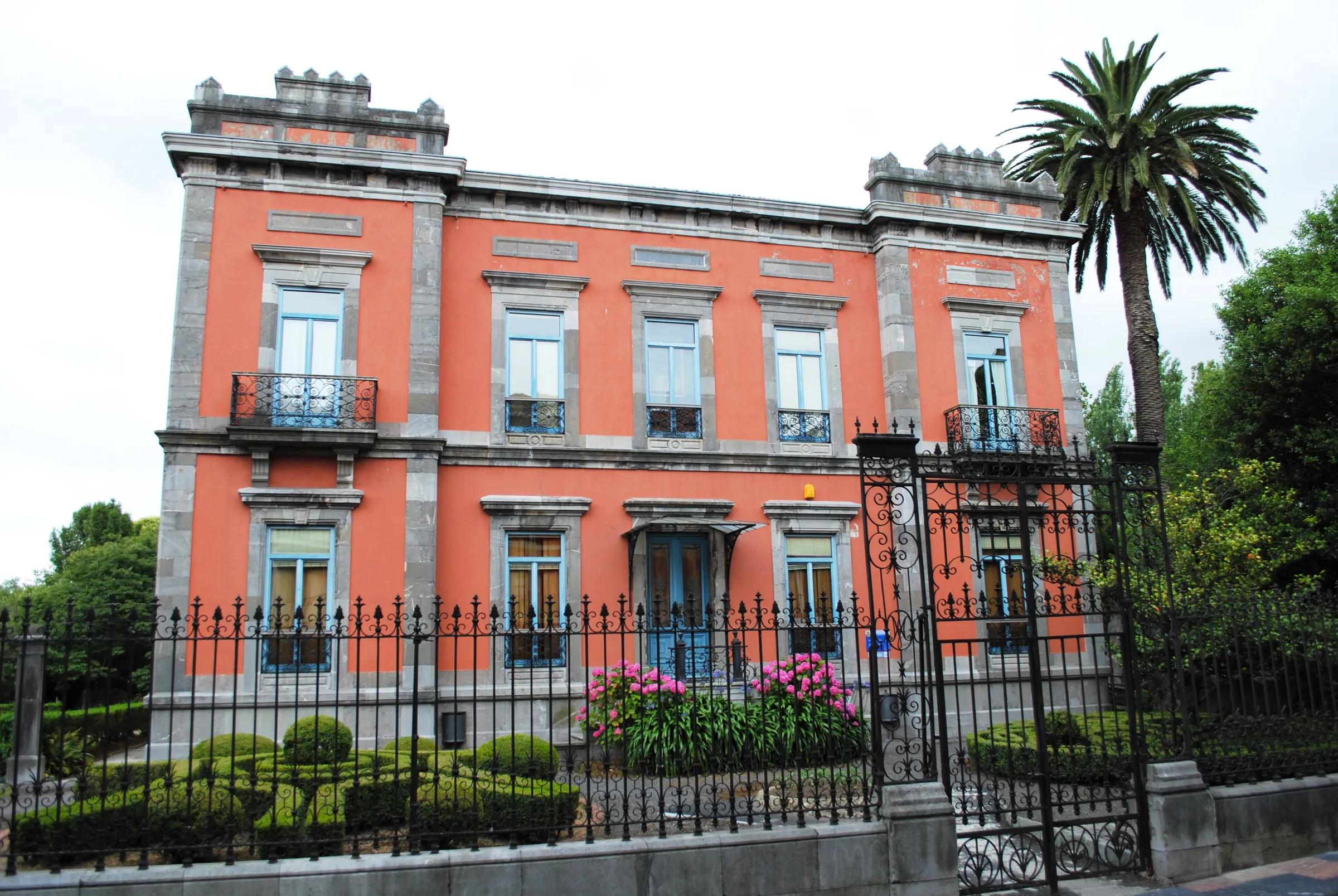
- TownCangas del NarceaThe capital of Asturias's largest municipality, in the valley of the river Narcea in the south-west.
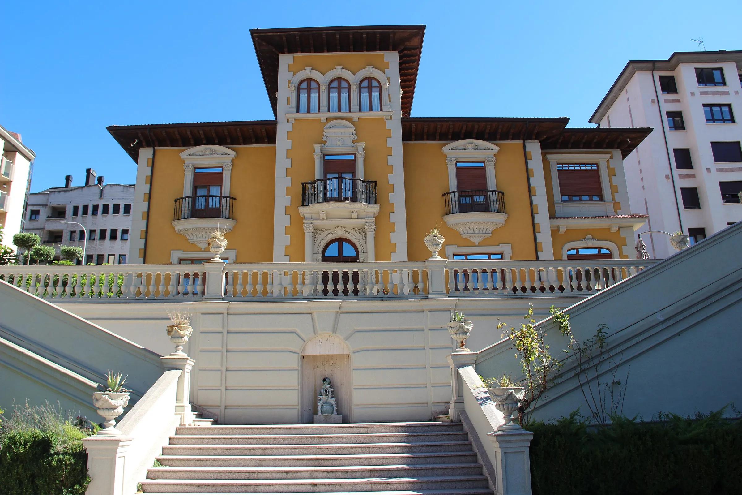
- TownMieresA town of the Caudal valley, shaped by coal mining.
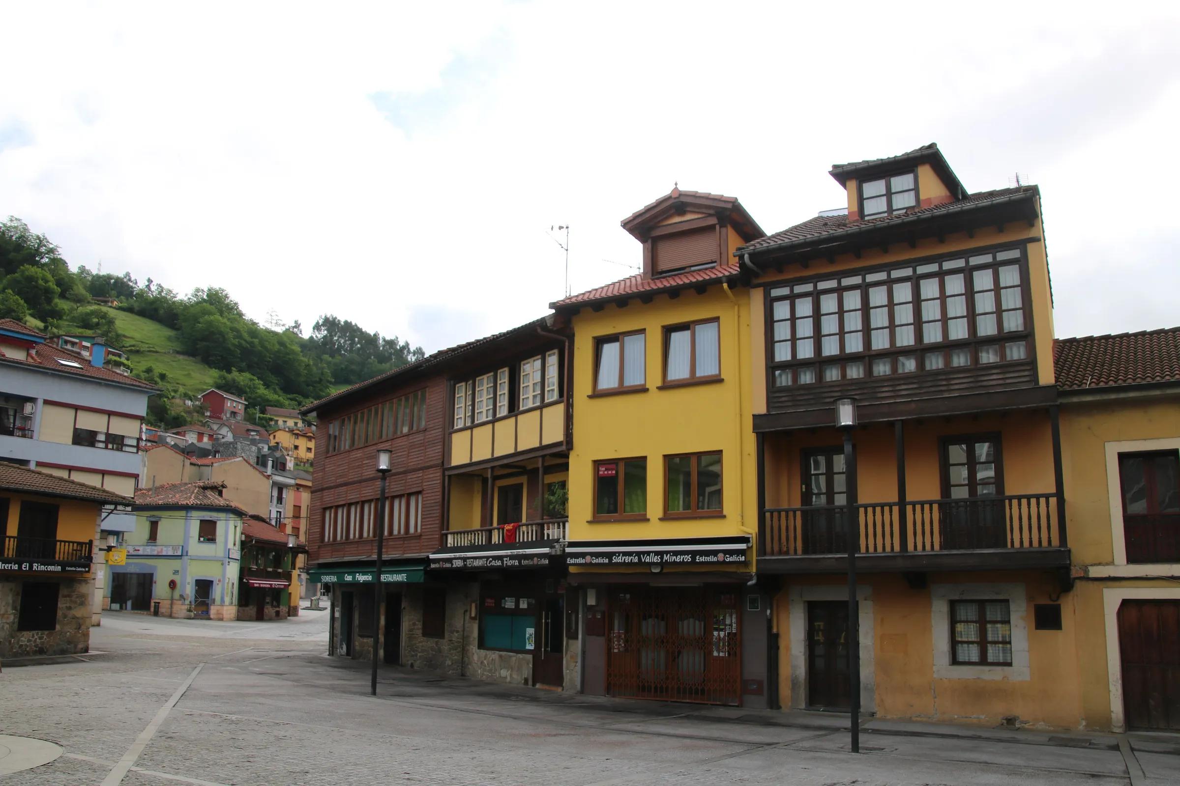
- ForestMuniellosOne of the largest and best-preserved oak forests in Spain.
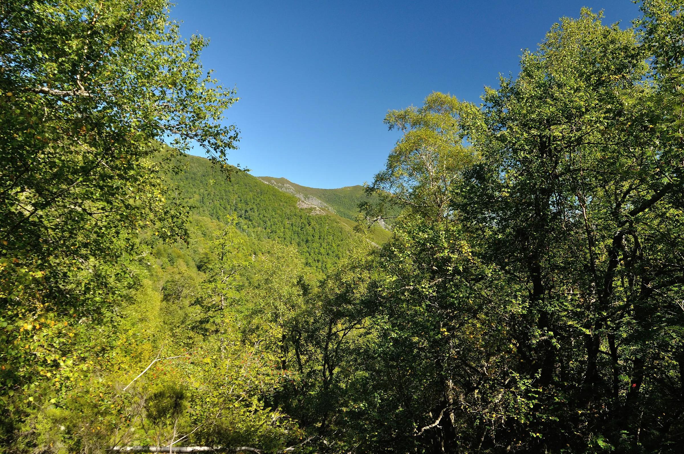
- Protected areaRedesBeechwoods and the headwaters of the Nalón: a natural park and biosphere reserve.
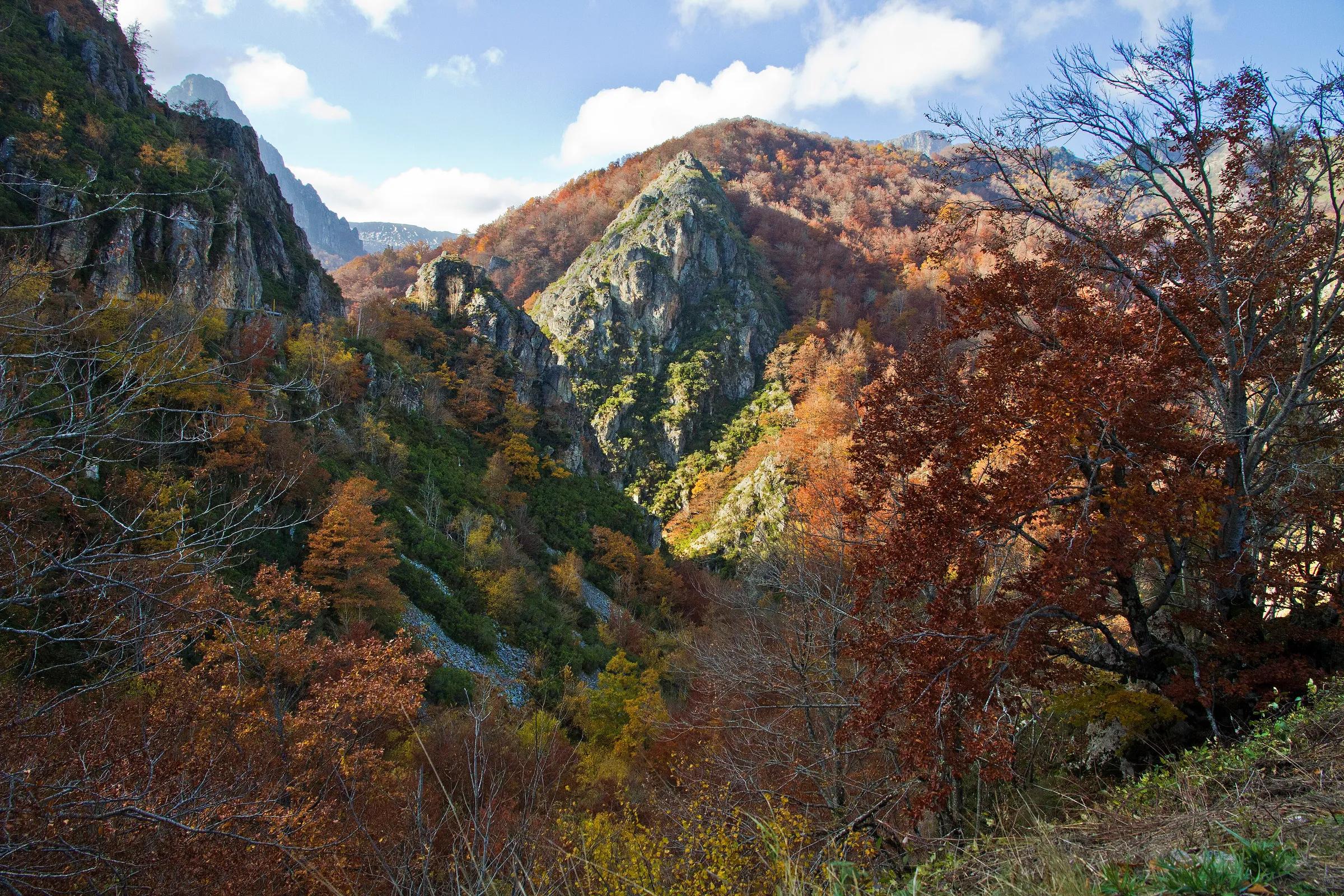
- LandmarkSanta María del NarancoThe palace of Ramiro I on the slope of Monte Naranco above Oviedo, described by Turismo Asturias as the most significant building of European pre-Romanesque art.
- RouteSenda del OsoA flat greenway on an old mining railway, through limestone gorges.
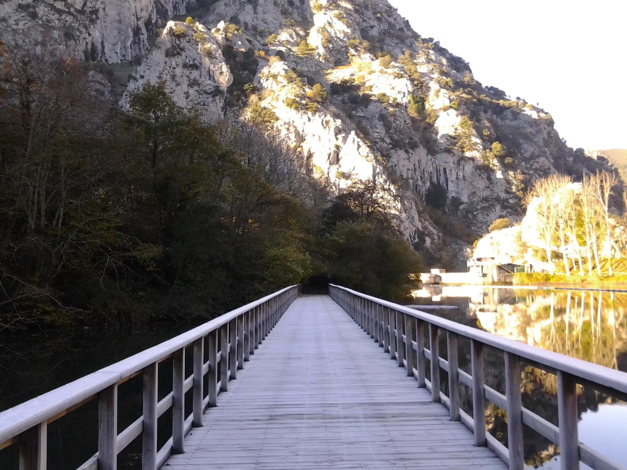
- Protected areaSomiedoA natural park and biosphere reserve where brown bears roam high valleys.
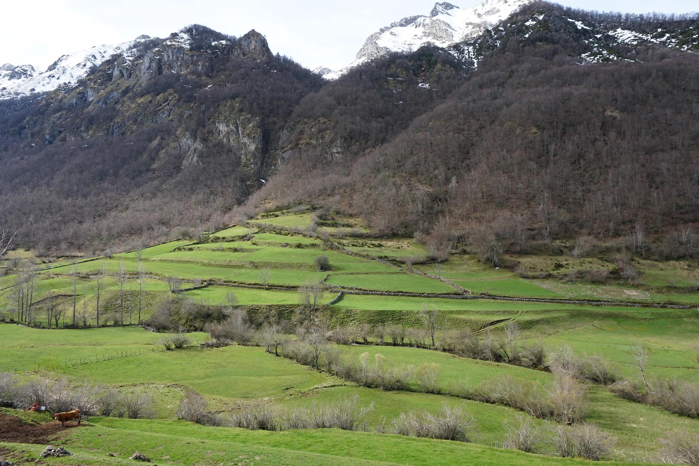
Cantabria (a single-province autonomous community)
Cantabria
The eastern neighbour, sharing the Picos de Europa across the Deva valley.
The Deva river marks part of the border with Asturias near the coast. The Picos de Europa national park spans Cantabria, Asturias and León.
8 on the map
No places in Cantabria match this filter yet.
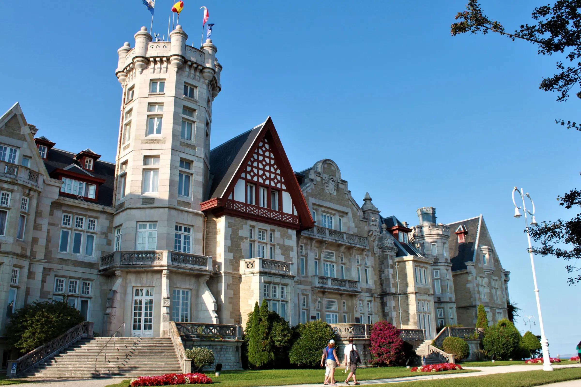
- CitySantanderCantabria's capital, on one of the great bays of the north coast.
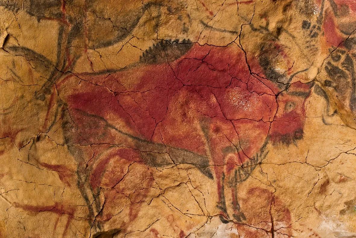
- LandmarkAltamiraPalaeolithic paintings of bison, listed by UNESCO.
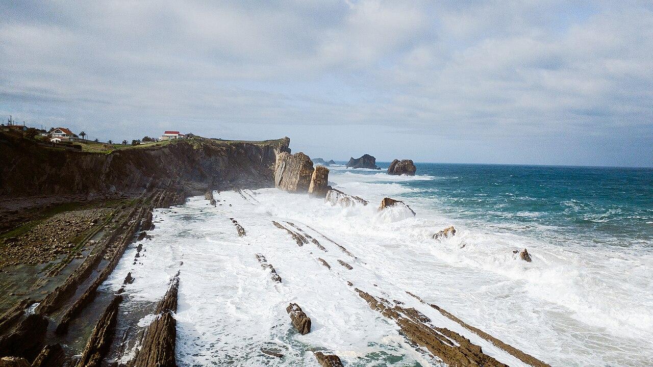
- CoastCosta QuebradaCosta Quebrada is a stretch of the Cantabrian coast where the sea wears down rock layers of differing hardness and tilt into coves, capes, islets and arches. UNESCO added it to its Global Geoparks network in 2025.
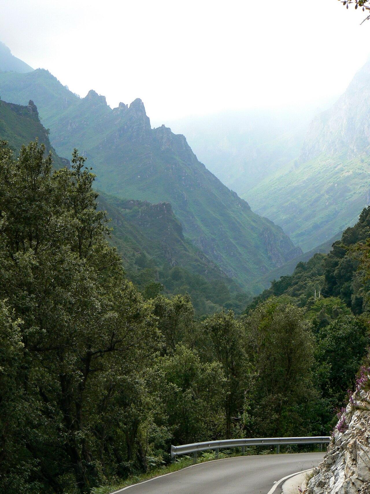
- GorgeDesfiladero de La HermidaThe river Deva has cut this narrow gorge between almost sheer limestone walls, some more than 600 m high, over roughly 22 km. It is the way into Liébana from the Cantabrian coast, followed by the N-621 road, and takes its name from the village of La Hermida.
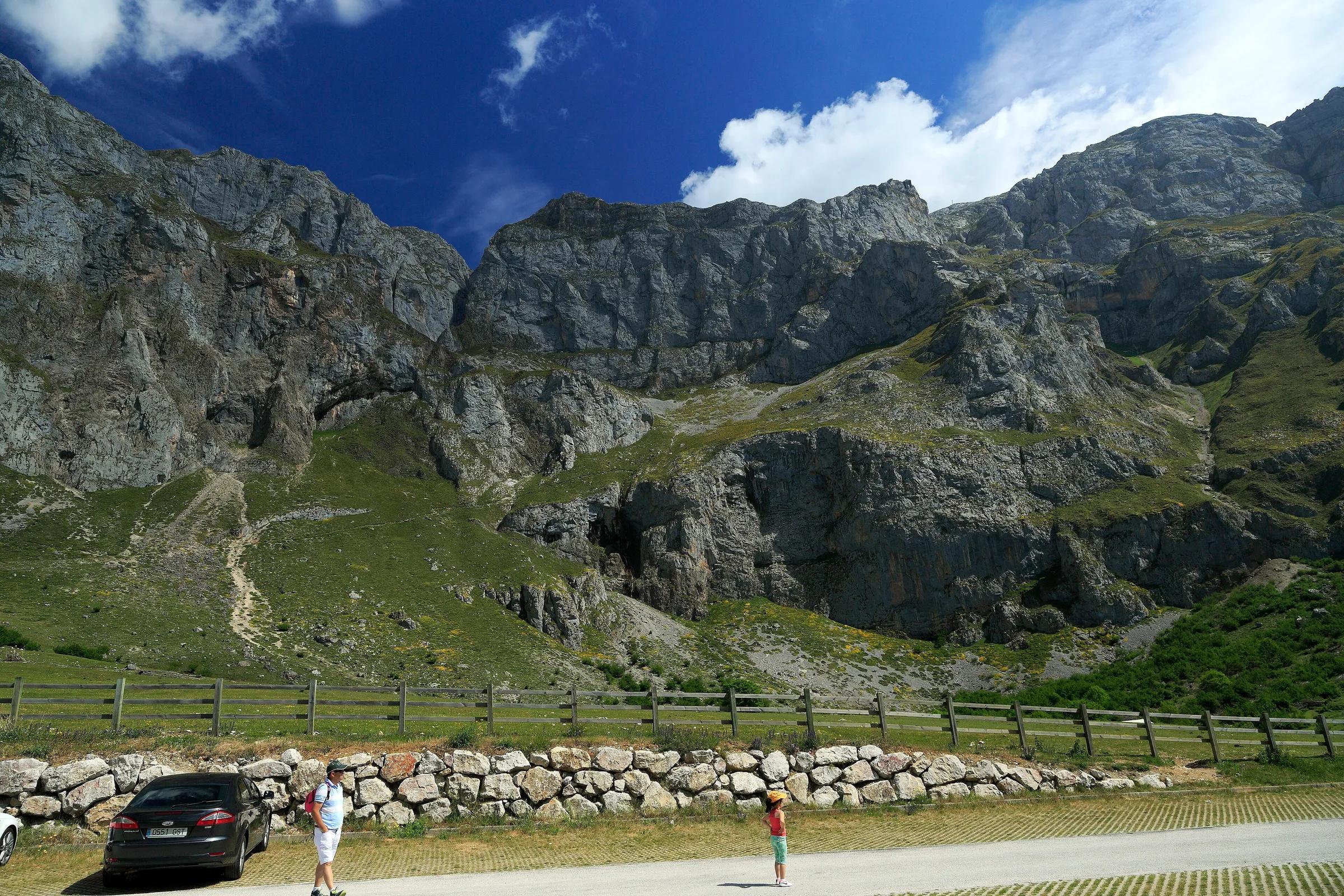
- LandmarkFuente DéA cable car up a sheer wall to the high plateau of the central Picos.
- LandmarkMonasterio de Santo Toribio de LiébanaA Franciscan monastery near Potes, in the Liébana valley, that keeps the Lignum Crucis relic; since a papal bull of 1512 it holds a Jubilee Year whenever 16 April, the feast of Santo Toribio, falls on a Sunday. Its Gothic church, in the Cistercian-influenced monastic style, was built from 1256.
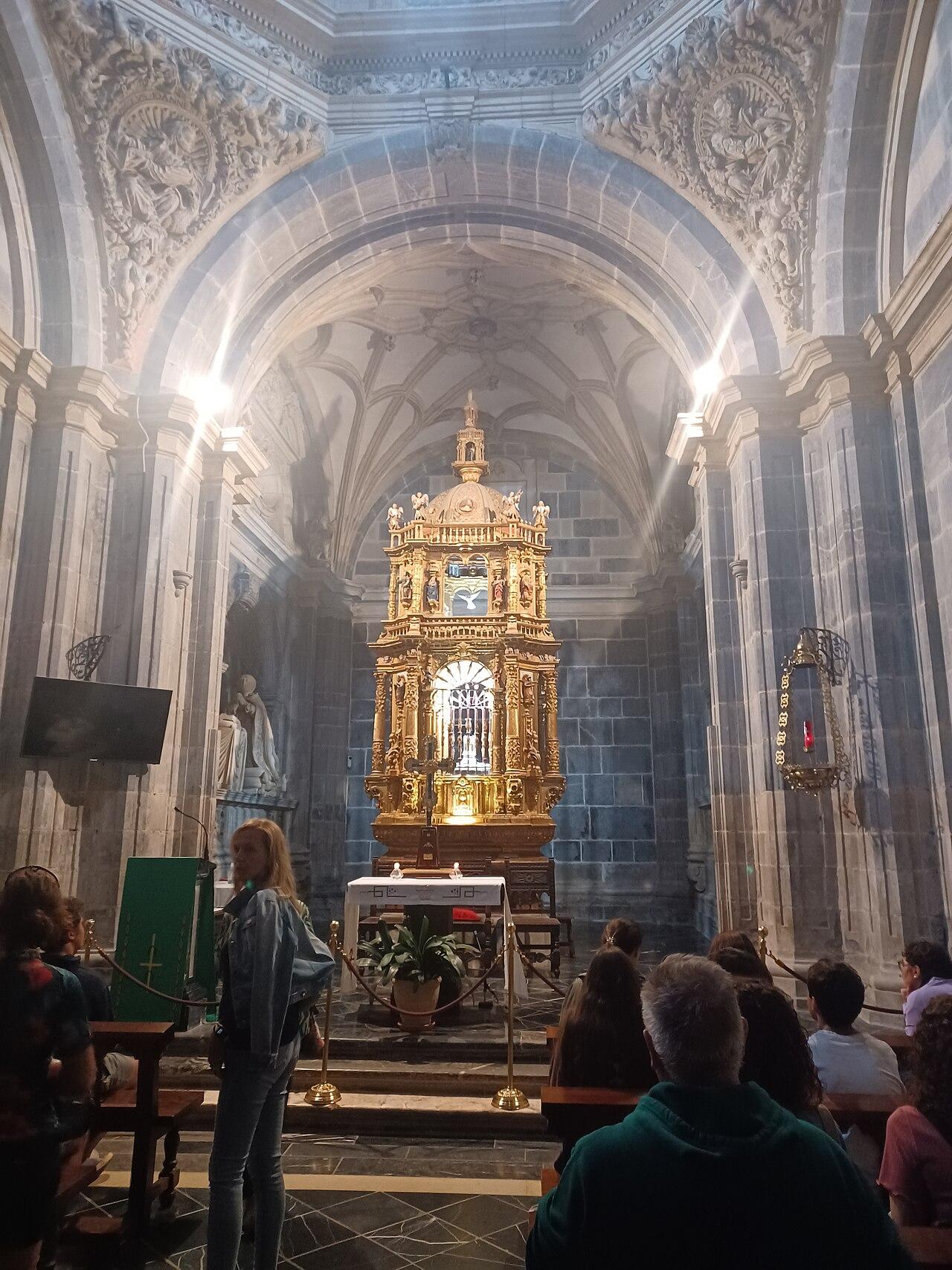
- TownPotesThe stone capital of Liébana, under the eastern Picos.
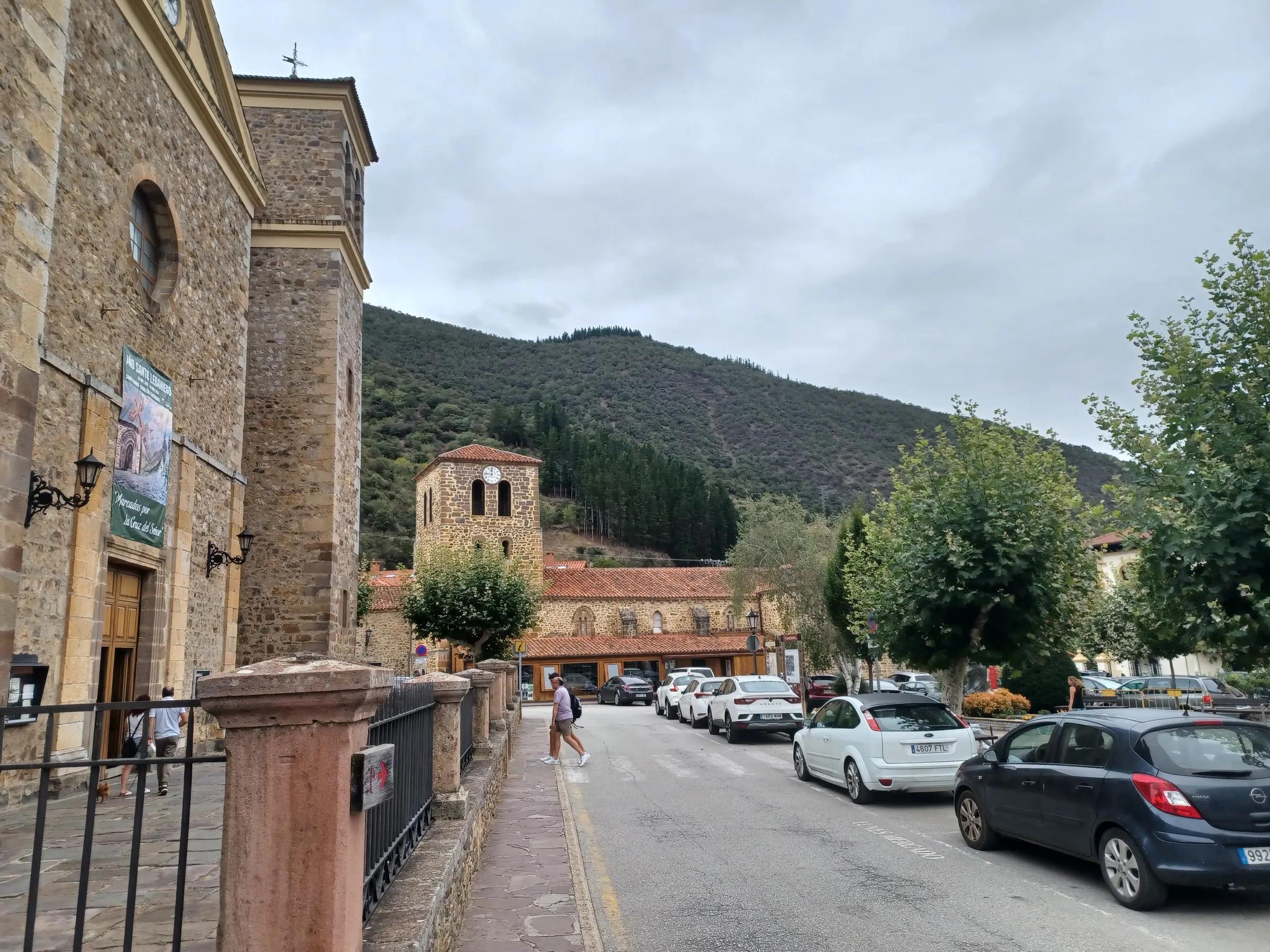
- CityTorrelavegaA market and industrial town where the Saja and Besaya rivers meet.
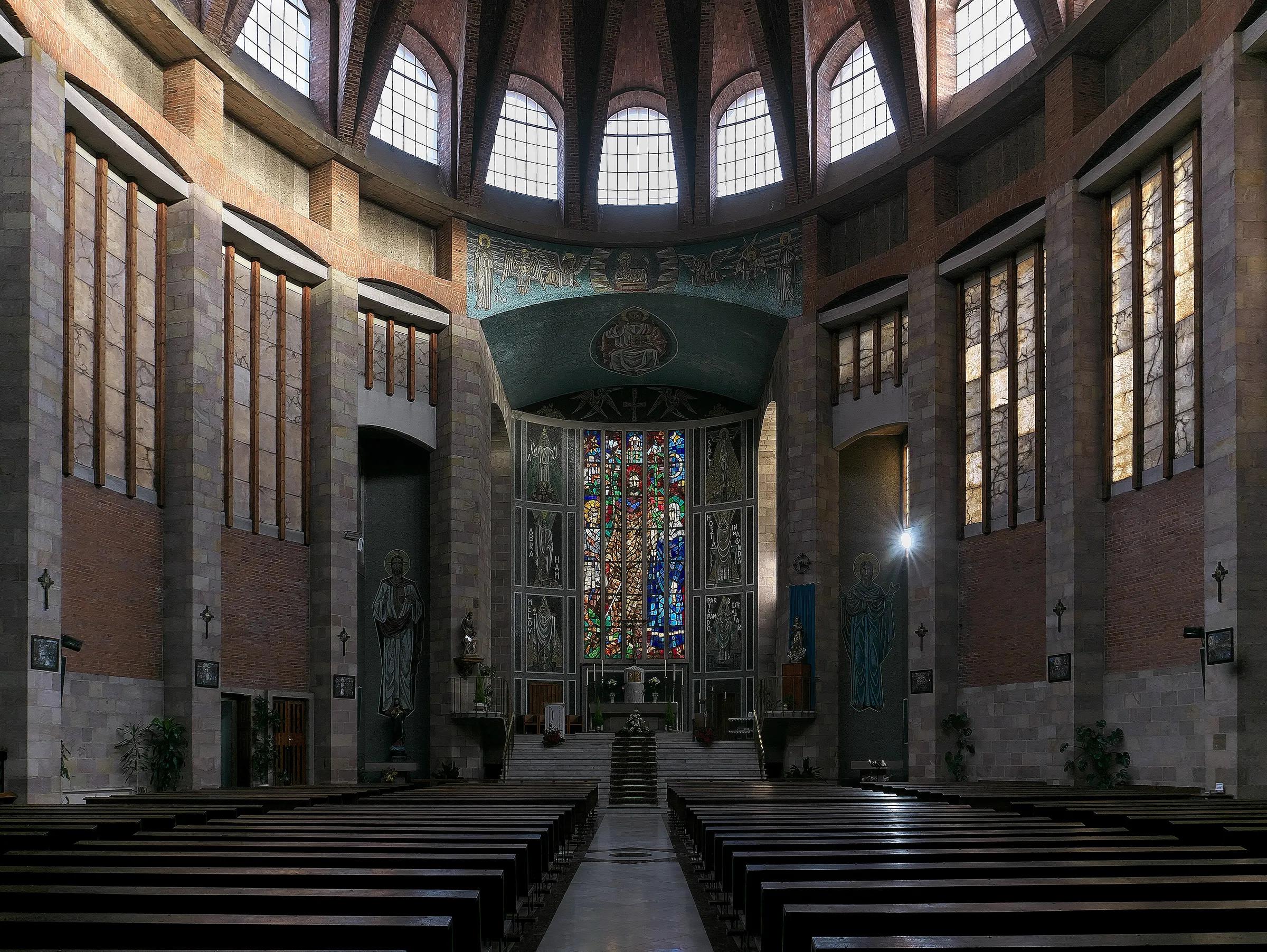
Galicia
Lugo
The western neighbour, across the Eo estuary.
The Eo river and its estuary form the border with Asturias at Ribadeo and Castropol. Both regions share a mild Atlantic climate and the Camino de Santiago's northern routes.
7 on the map
No places in Lugo match this filter yet.
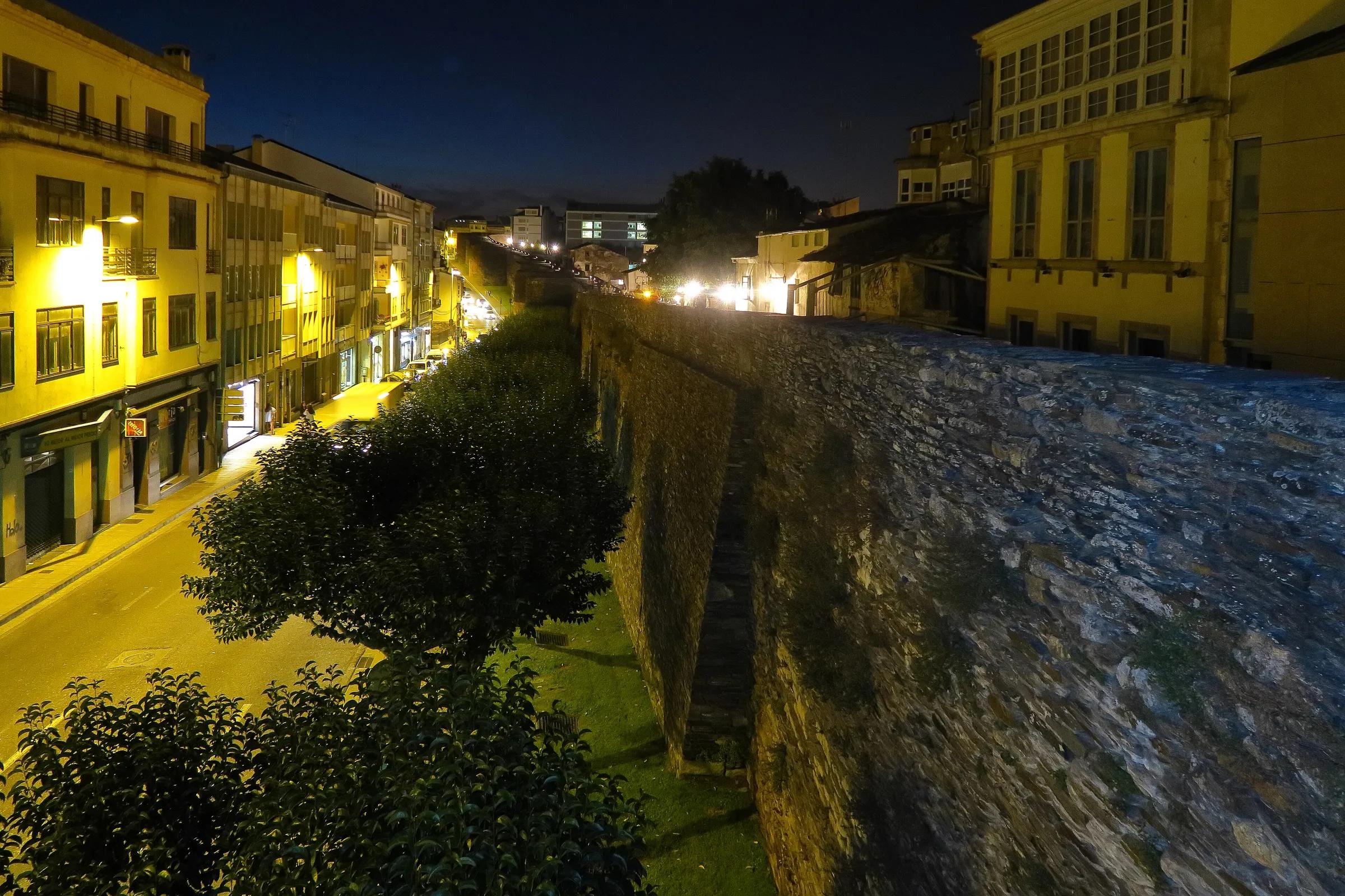
- CityLugoA city still ringed by its complete Roman wall, listed by UNESCO.
- Mountain rangeOs Ancares lucensesOs Ancares are the mountains on the Galician side of the border with León, in eastern Lugo, where roads climb narrow, deep valleys towards peaks of almost 2,000 m. The highest villages still keep pallozas, ancient round dwellings roofed with straw.
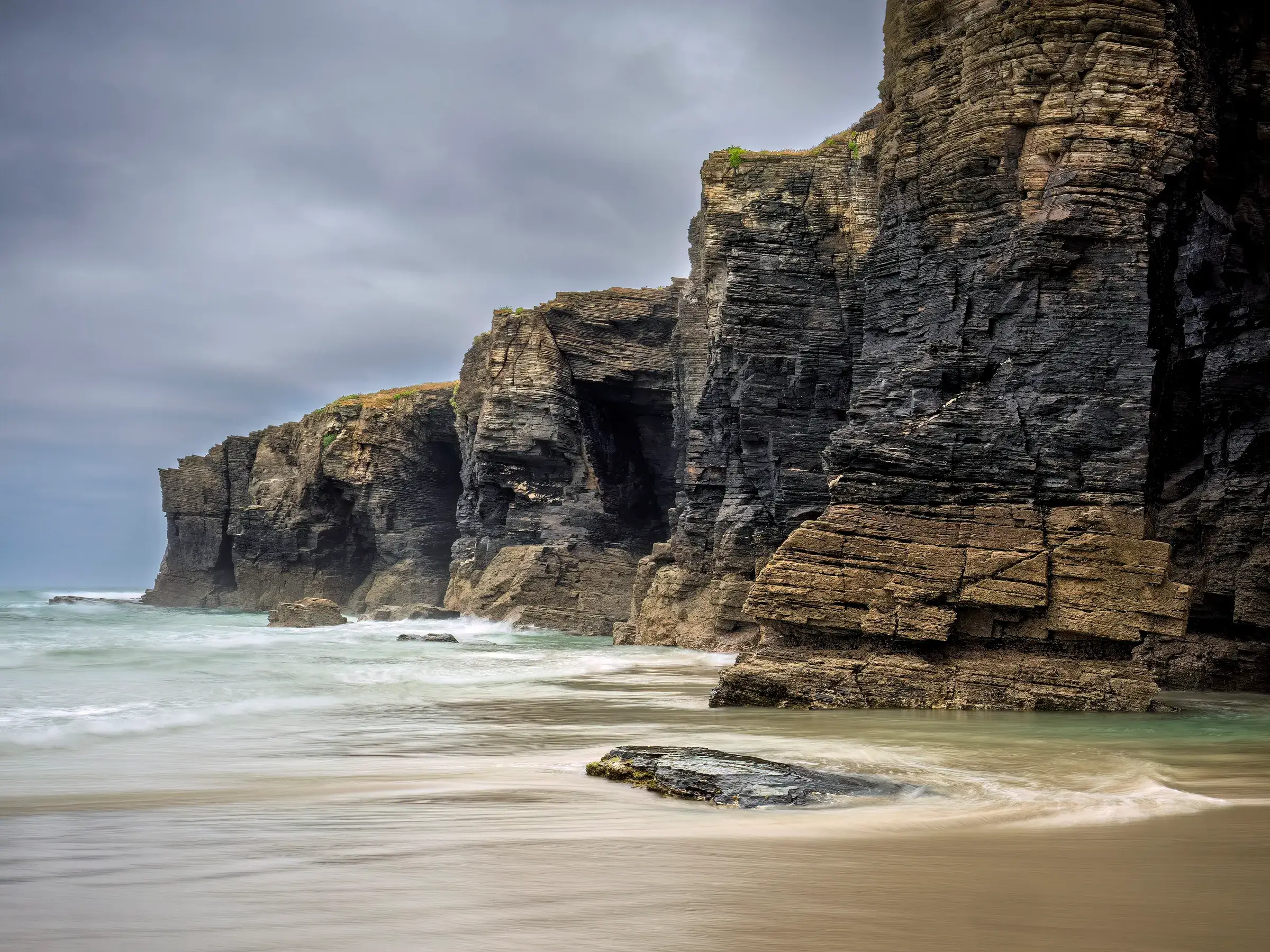
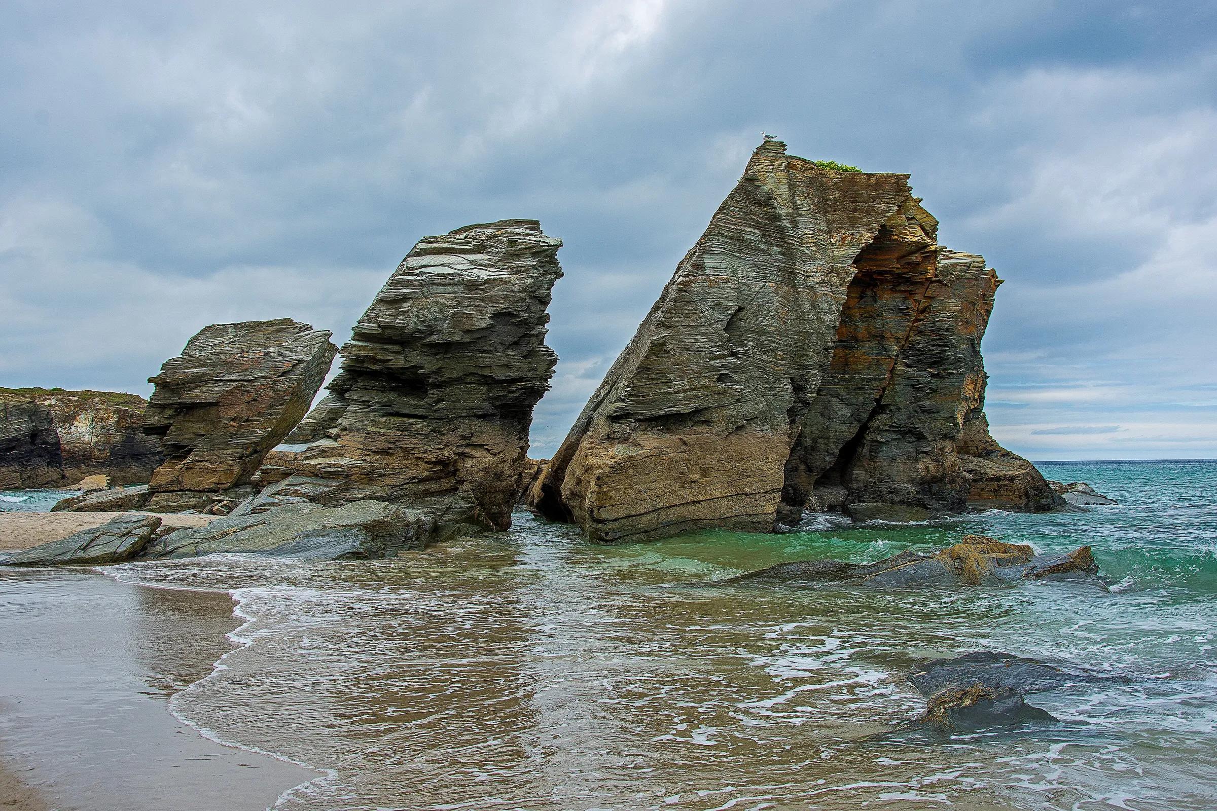
- BeachPraia das CatedraisSea arches like flying buttresses, walkable at low tide.
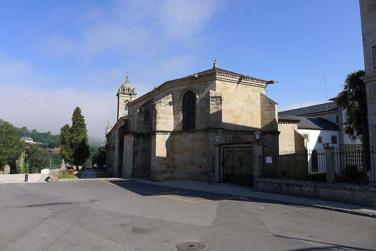
- TownSarriaSarria is a town on the Camino Francés and the usual starting point for pilgrims who walk the last 100 km to Santiago, the minimum distance on foot for the Compostela.
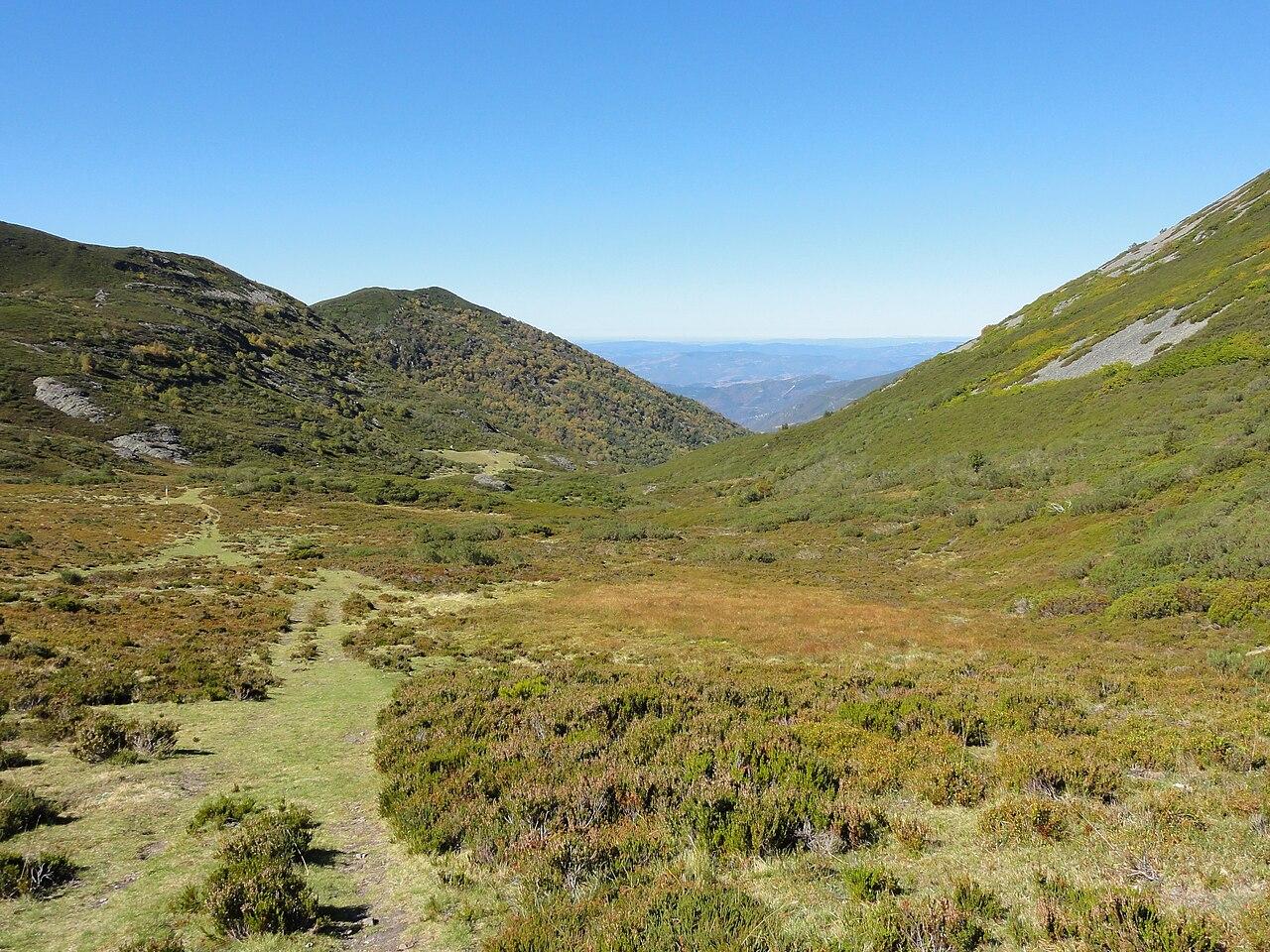
- Mountain rangeSerra do CourelO Courel is a mountain range in the far south-east of Lugo province, stretching from O Cebreiro towards the river Sil, where slate villages sit on green slopes above narrow river valleys such as those of the Lor and the Lóuzara. Its rocks, fossils and old mines earned the territory of Folgoso do Courel, Quiroga and Ribas de Sil UNESCO Global Geopark status in 2019.
- Mountain rangeSerra do XistralThe Serra do Xistral is a wind-battered range in northern Lugo that rises between the Cantabrian coast and the plains of A Terra Chá. Fog and frequent rain soak its high plateaus, creating extensive blanket bogs where free-roaming wild horses are a common sight.
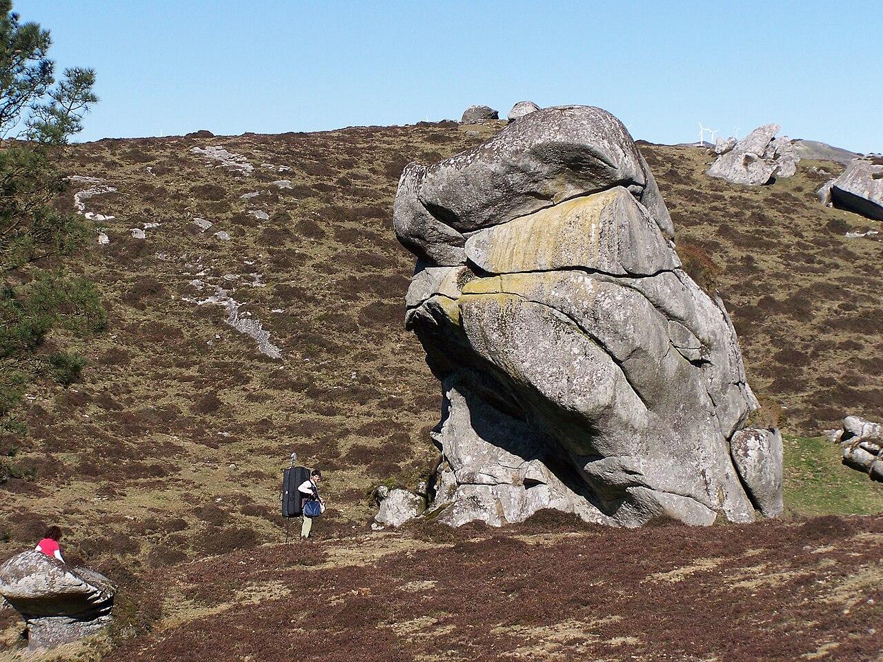
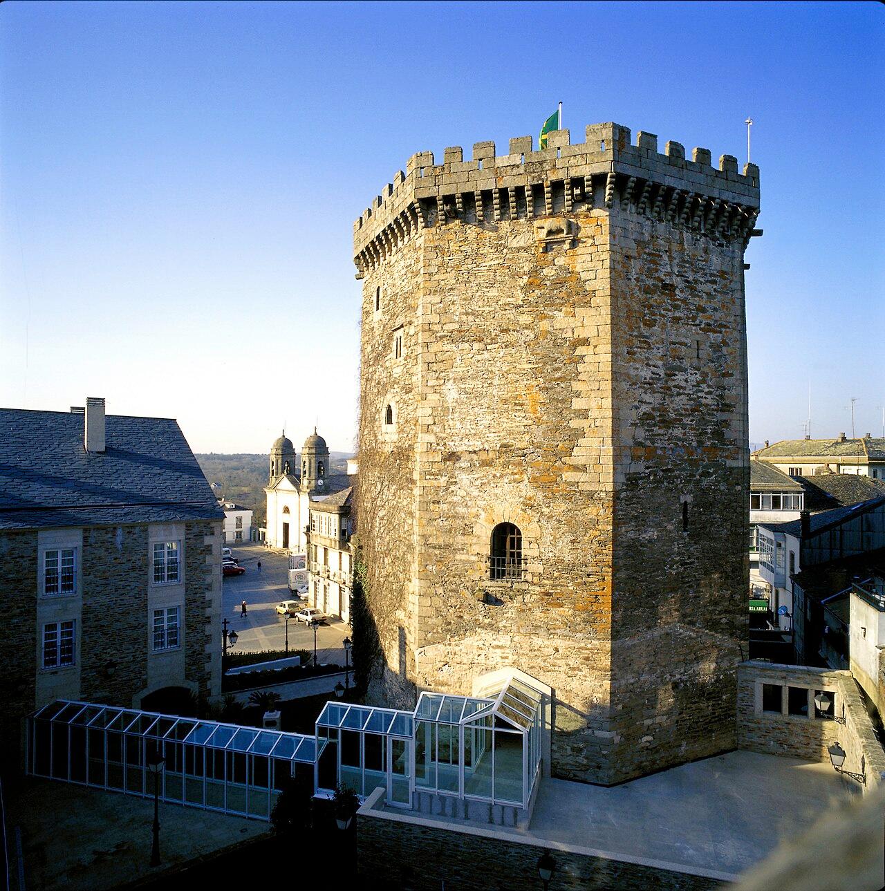
- TownVilalbaVilalba is the capital of the Terra Chá district, on the left bank of the river Ladra, one of the headstreams of the Miño. The octagonal keep of its old castle dominates the town's skyline.
Castilla y León
León
Over the mountains to the south, where the rivers turn towards the Duero.
The watershed between León and Asturias decides whether rain reaches the Bay of Biscay or the Atlantic through Portugal. The Cares trail links Caín, in León, with Poncebos, in Asturias.
7 on the map
No places in León match this filter yet.
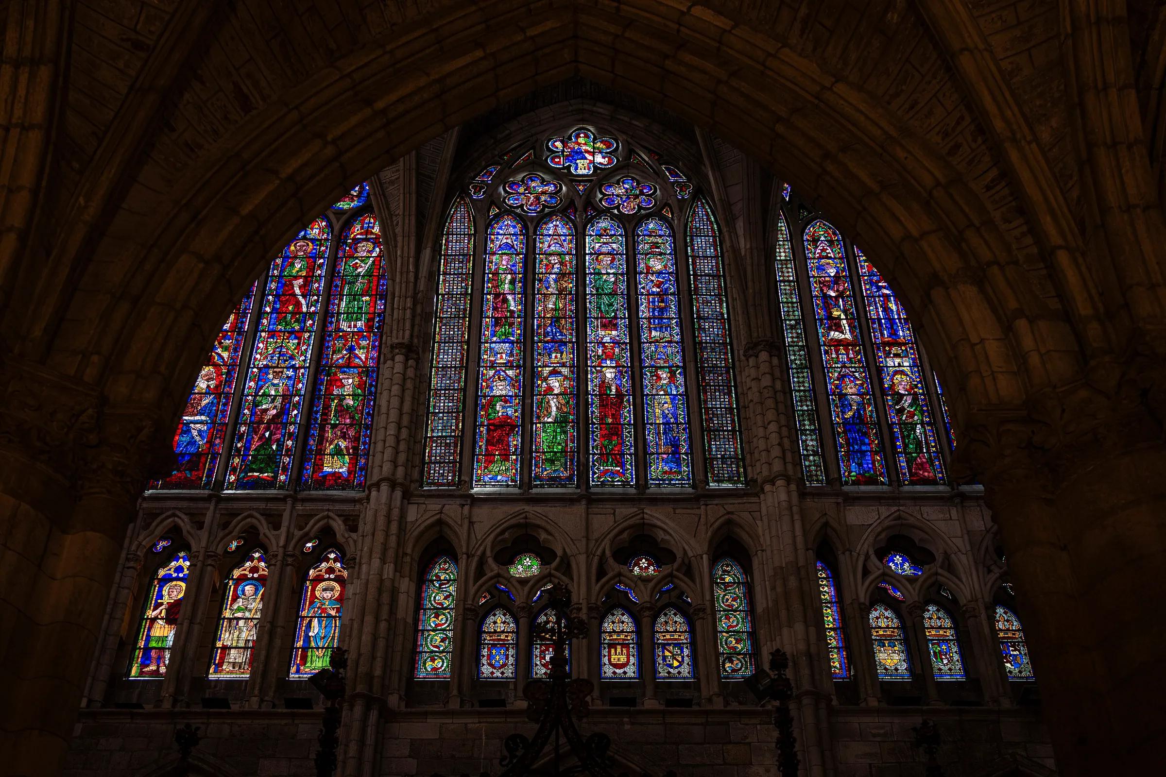
- CityLeónA Gothic cathedral famous for its stained glass, on the Camino Francés.
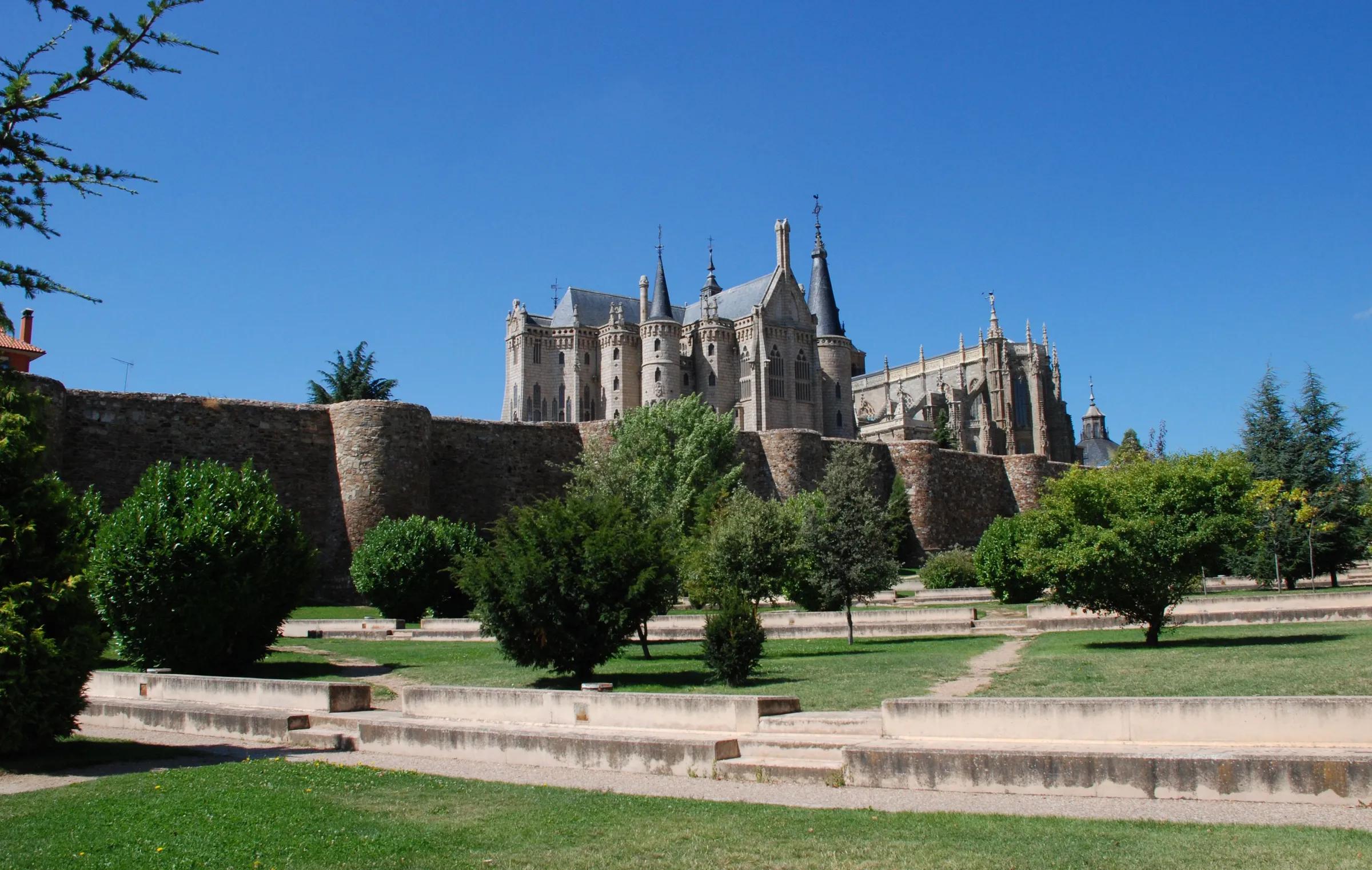
- TownAstorgaRoman Asturica Augusta, where the French Way of Saint James meets the Vía de la Plata.
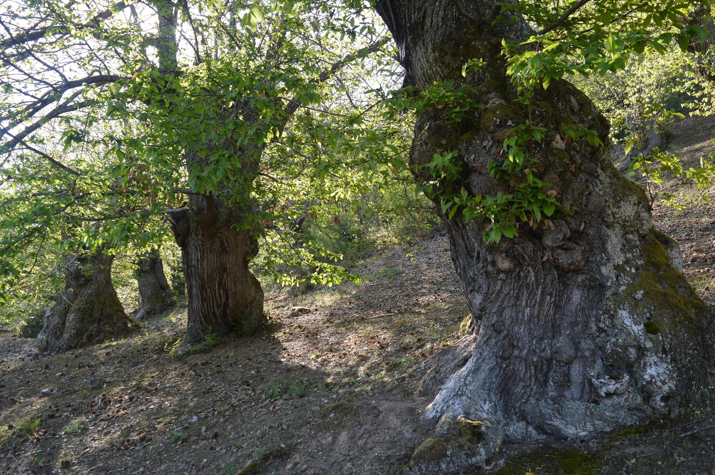
- LandmarkLas MédulasRed pinnacles left by Roman gold mining, listed by UNESCO.
- Protected areaParque Regional Montaña de Riaño y MampodreThis regional park covers 101,336 ha of high Cantabrian mountains in north-east León, at the headwaters of the Esla, Porma and Cea. Its steep valleys hold glacial lakes and the Riaño and Porma reservoirs, beneath peaks of the Mampodre massif that pass 2,000 m.
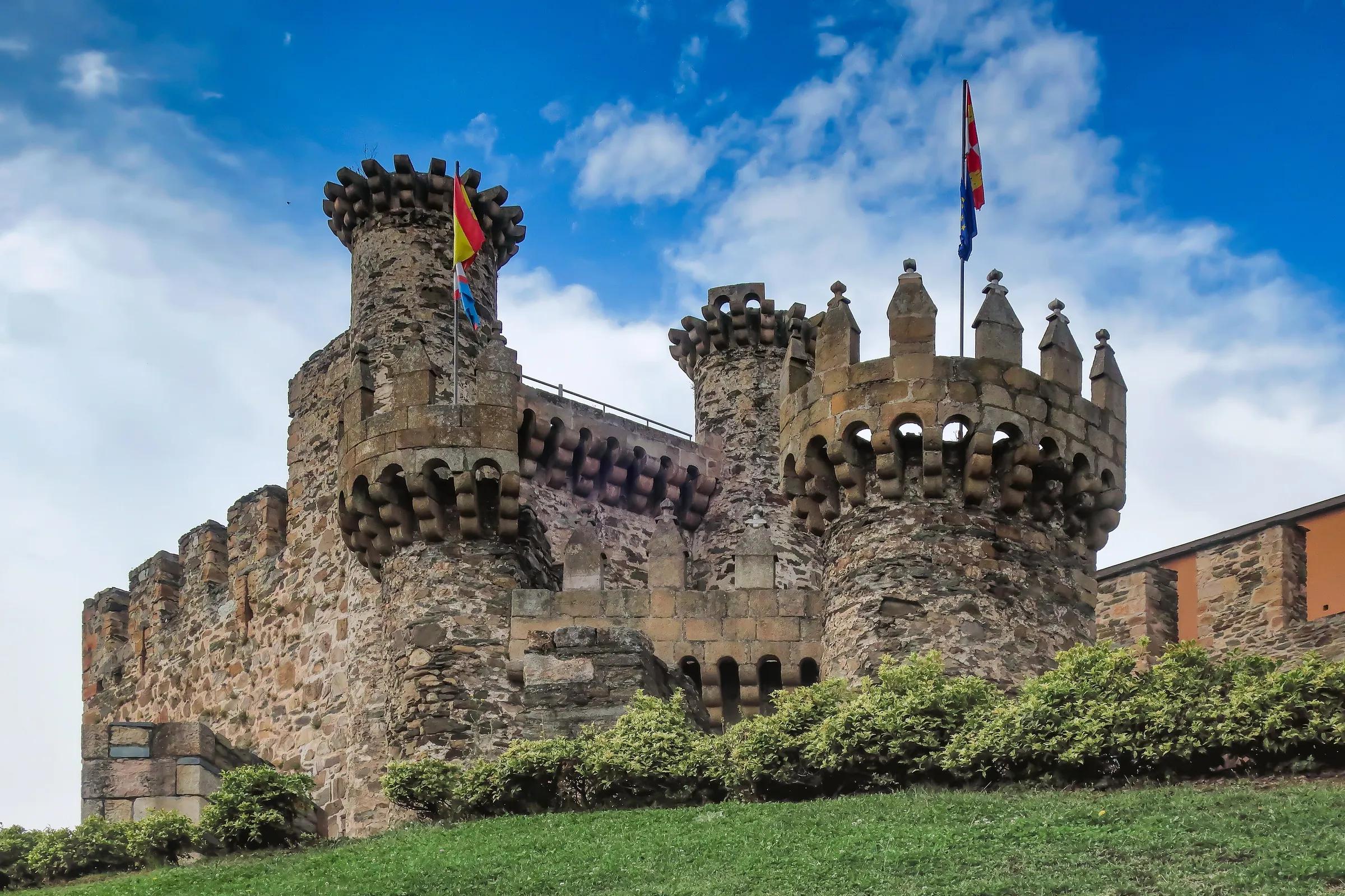
- CityPonferradaCapital of El Bierzo, with a Templar castle over the Sil.
- TownSahagúnSahagún lies between the Cea and Valderaduey rivers in the east of the province of León, and is the first town in that province on the Camino de Santiago Francés. It grew up around a shrine to the martyrs Facundus and Primitivus and was consolidated in the 11th century with the arrival of the Order of Cluny and the charter granted by King Alfonso VI.
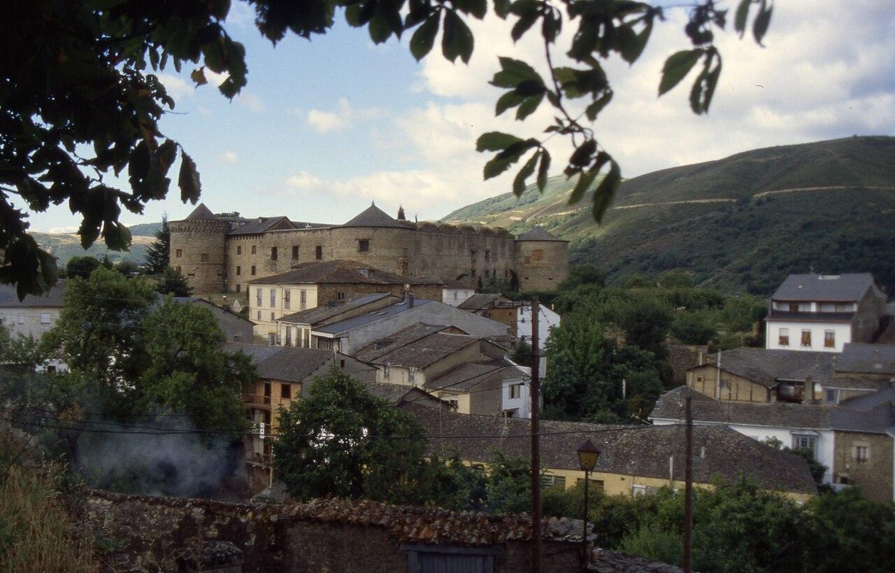
- TownVillafranca del BierzoVillafranca del Bierzo lies in the west of El Bierzo, where the Burbia and Valcarce rivers meet, on the Camino de Santiago between Ponferrada and O Cebreiro. Its name comes from the borough of French pilgrims that grew up around the Cluniac monastery founded here in 1070, in the reign of Alfonso VI.
Galicia
A Coruña
Galicia's Atlantic corner: Santiago de Compostela and the open ocean.
Regional context: the end point of the Camino routes that cross Asturias.
7 on the map
No places in A Coruña match this filter yet.
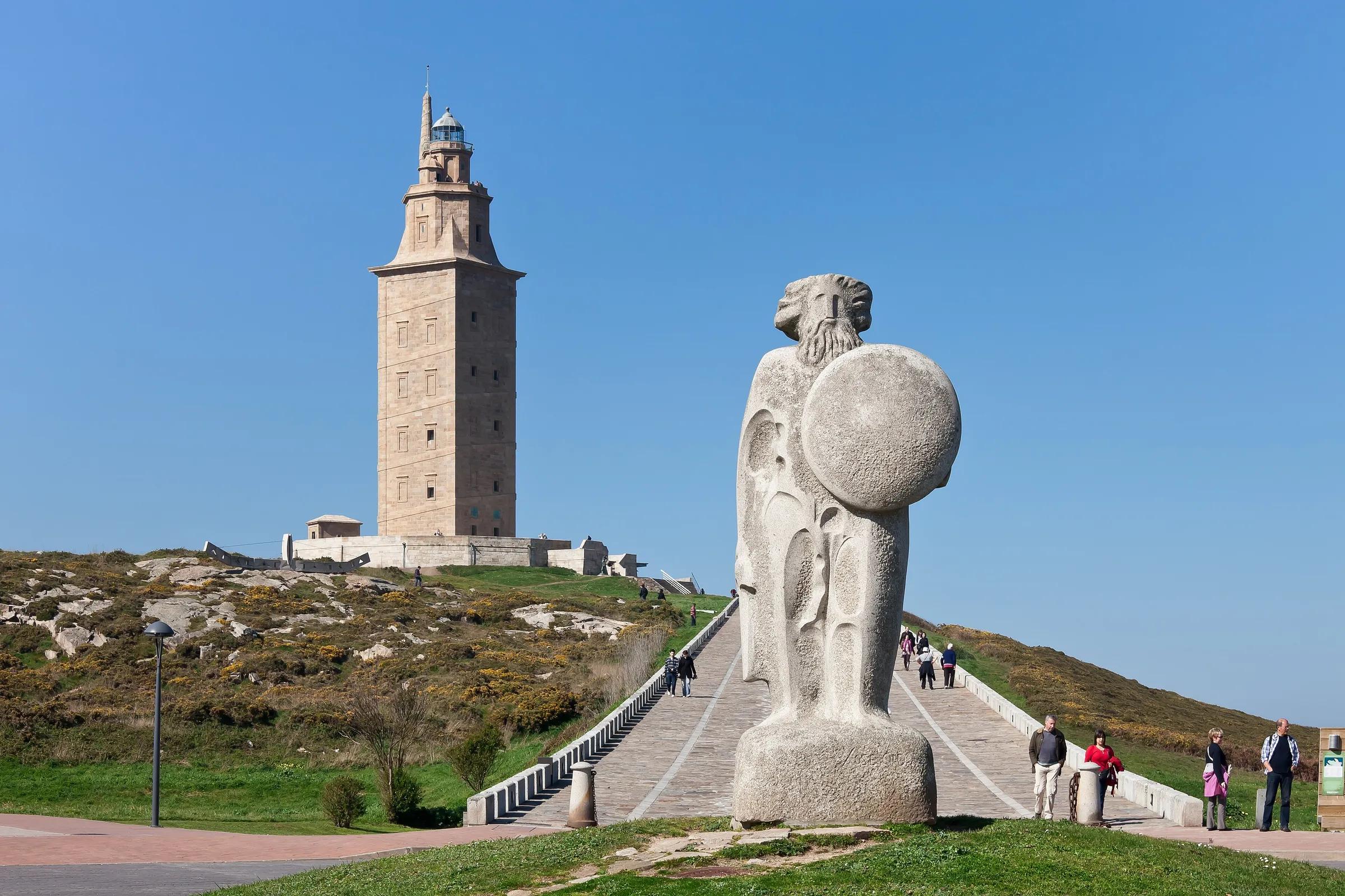
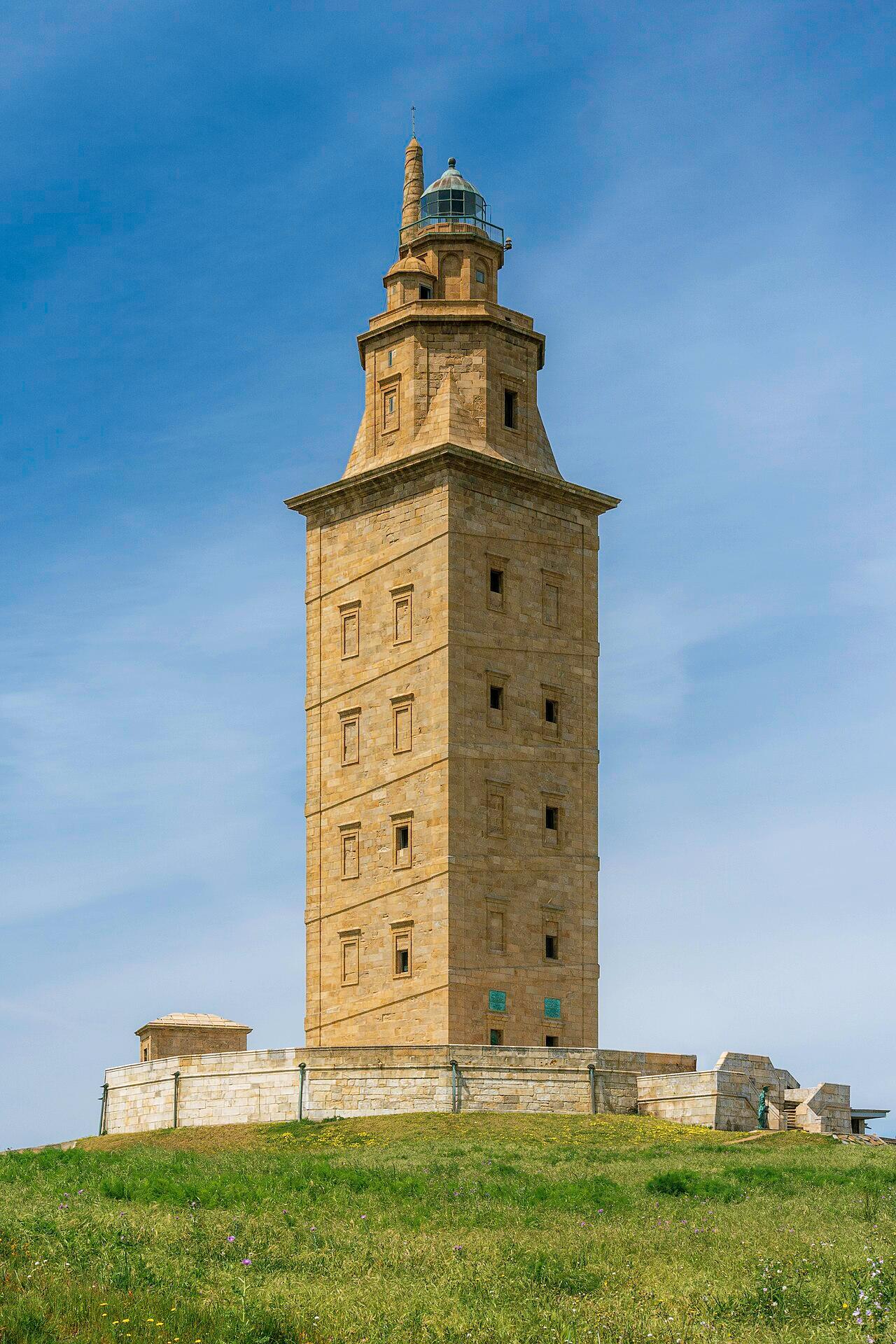
- CityA CoruñaA port city around the Tower of Hercules, a Roman lighthouse still in use.
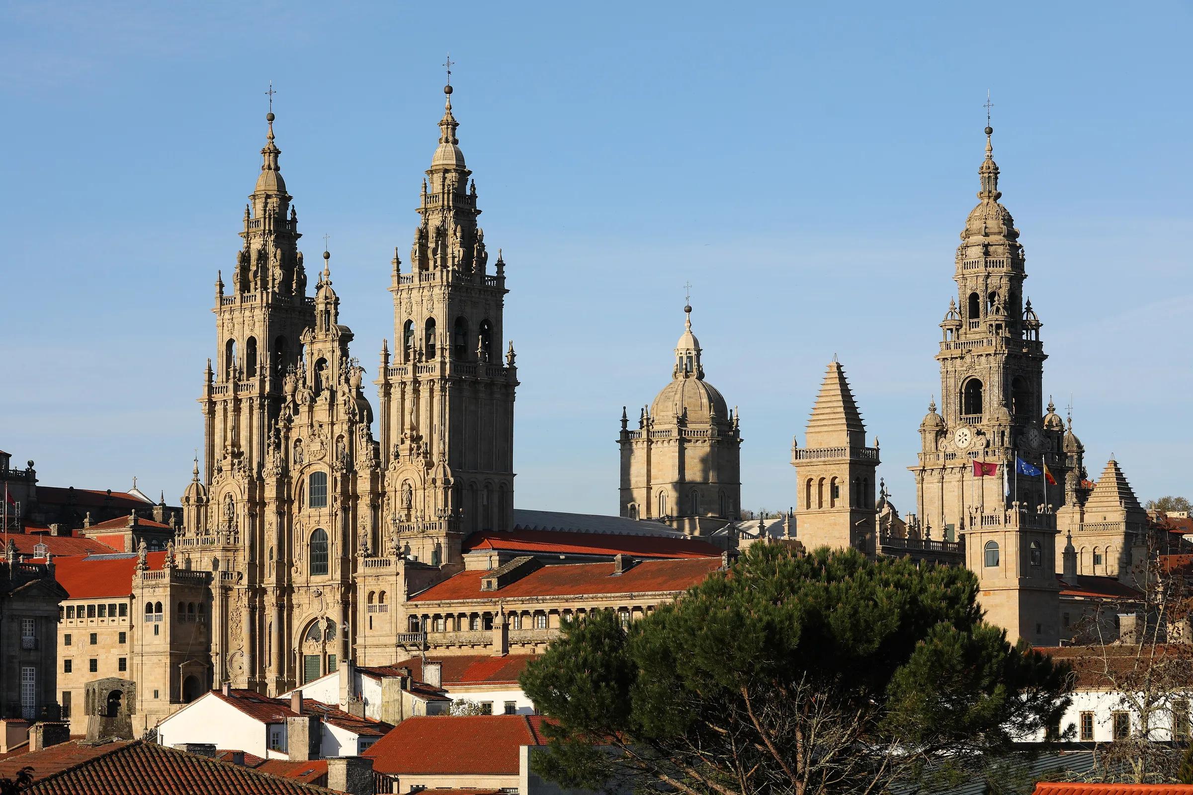
- CitySantiago de CompostelaThe goal of the Camino de Santiago, with a cathedral at its heart.
- TownCedeiraCedeira is a fishing town on the north coast of the Rías Altas, on its own small ría where the river Condomiñas flows out. Its historic centre has narrow streets of medieval layout and galleries of wood and carved stone.
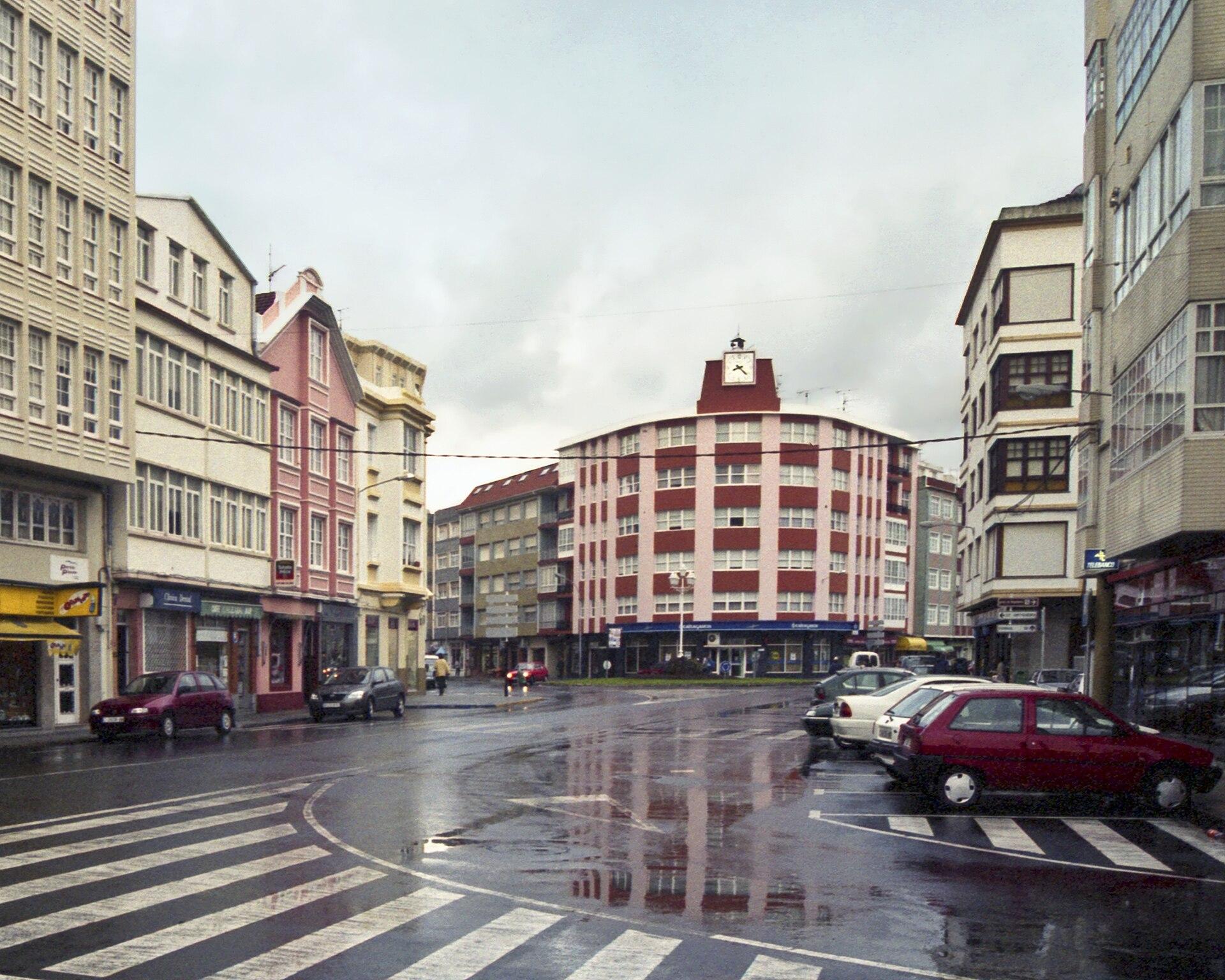
- CityFerrolFerrol is a city on the ría de Ferrol, traditionally turned to the sea, with a historic fishing and commercial port, civil and military shipyards and Spanish Navy installations. Its present layout grew out of the shipyards and the great Arsenal built during the Enlightenment.
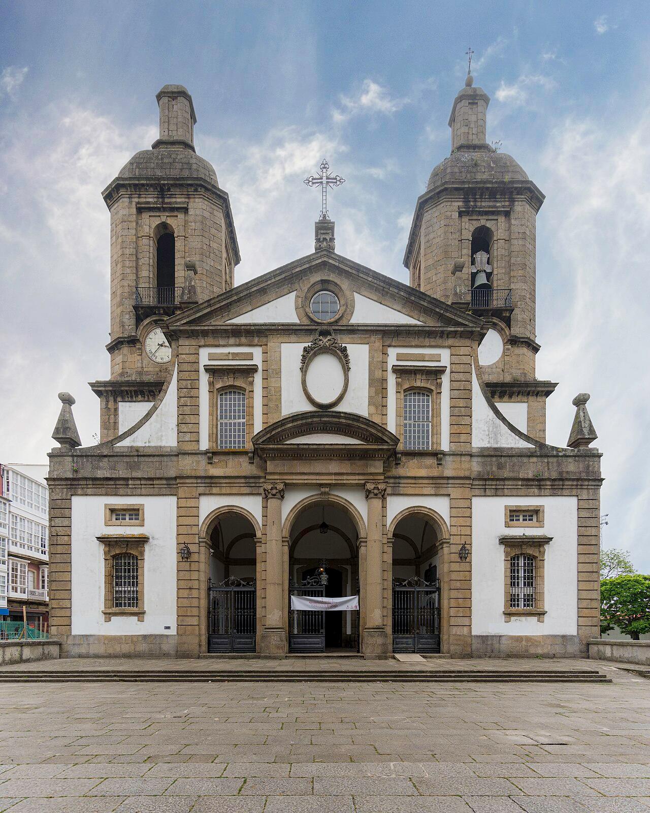
- TownNoiaNoia lies at the innermost point of the ría de Muros e Noia, the northernmost of the Rías Baixas. In the Middle Ages it served as the port of Santiago de Compostela.
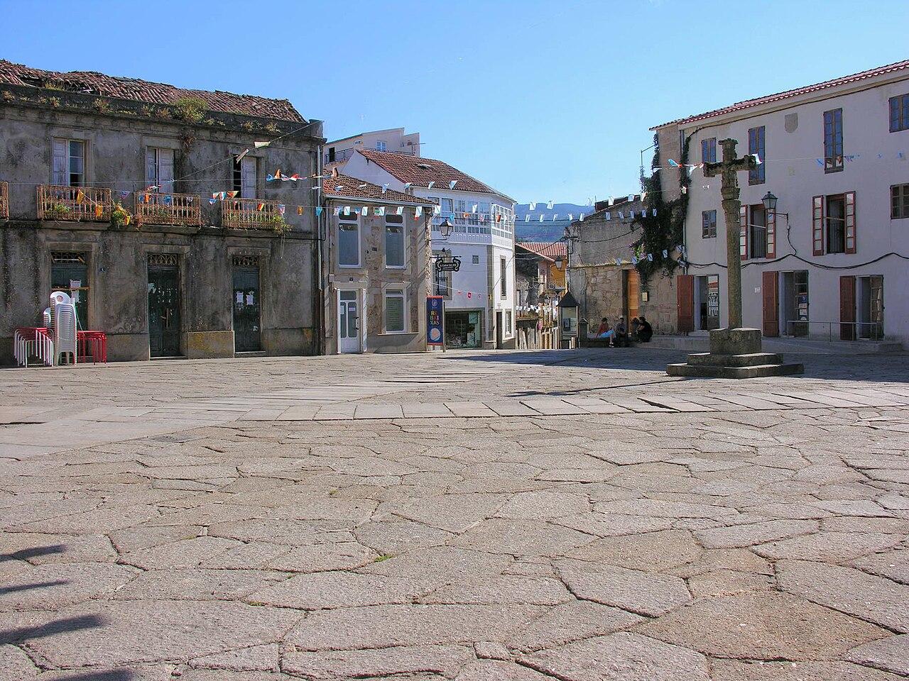
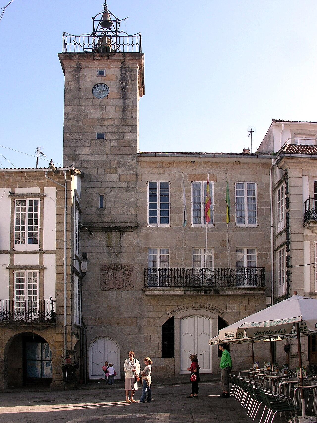
- TownPontedeumePontedeume is a town founded by Alfonso X in 1270 at the mouth of the river Eume, on the ría de Ares, and the Camino Inglés to Santiago passes through it. Its streets and squares keep arcades, houses with wooden balconies and glazed galleries, and public fountains.
- LandmarkTorre de HérculesA Roman lighthouse on a hill in A Coruña overlooking the Atlantic, built in the late 1st century and renovated in the 18th. It is still in service as a lighthouse today.
Galicia
Ourense
Inland Galicia of hot springs and river canyons.
Regional context: the Sil rises in the mountains of León, close to the Asturian border.
6 on the map
No places in Ourense match this filter yet.
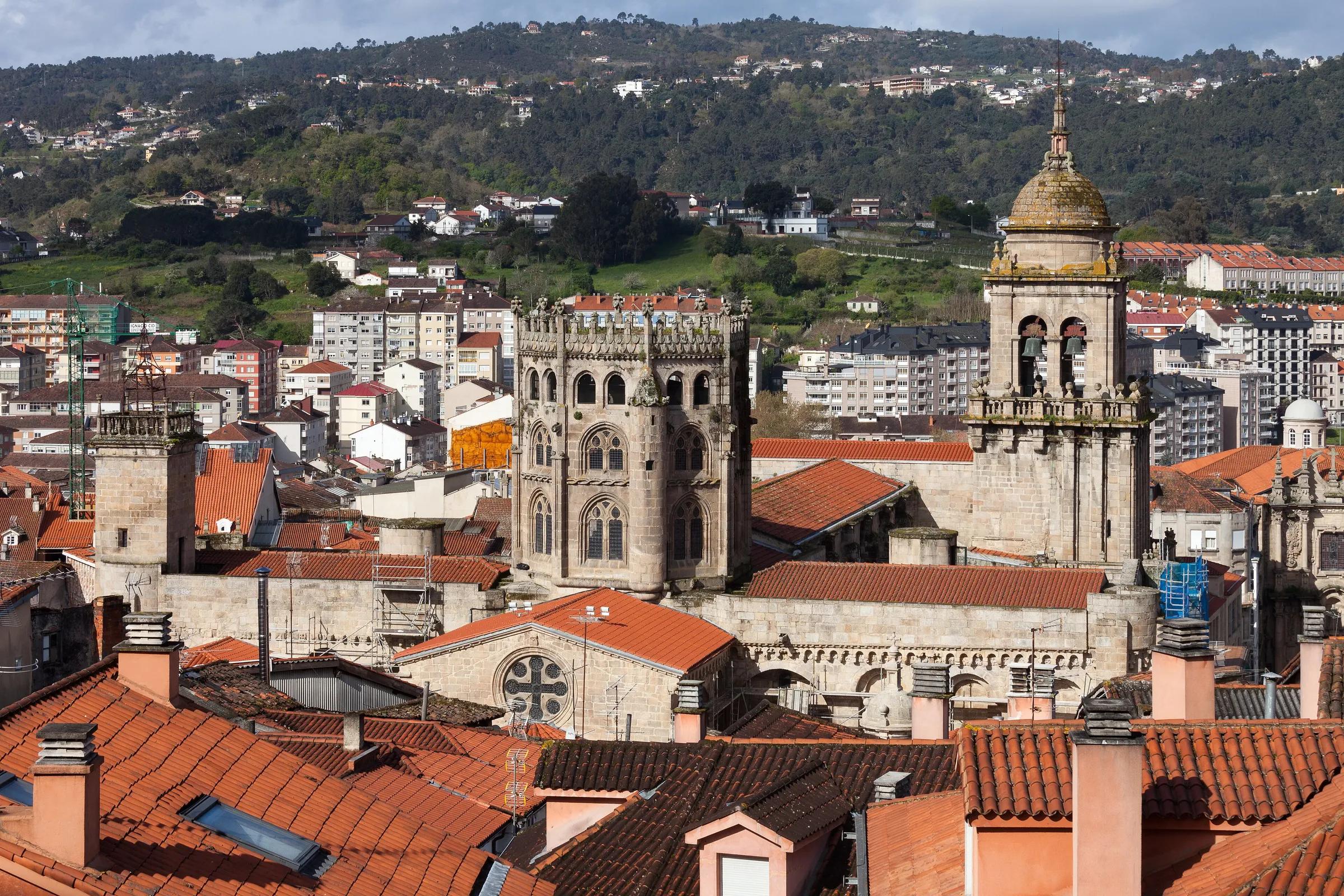
- CityOurenseA city of hot springs on the Miño. A three-kilometre thermal walk follows the river from the Campo da Feira to Outariz, past several hot pools.
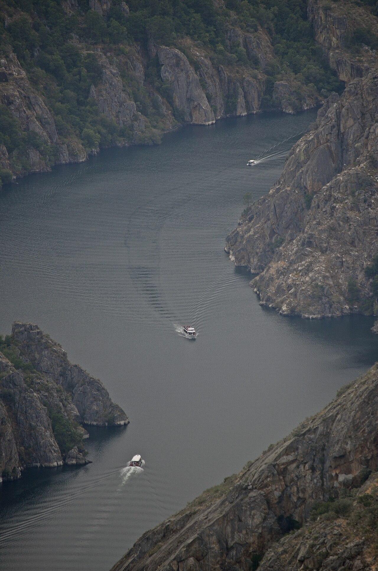
- GorgeCanón do SilFrom where it enters Galicia to its meeting with the Miño, the Sil flows through a deep valley that separates the provinces of Ourense and Lugo, hemmed in by granite walls above the now-dammed river. Vines have been grown on the sunny slopes for centuries, while well-preserved oak woods cover the shadier side.
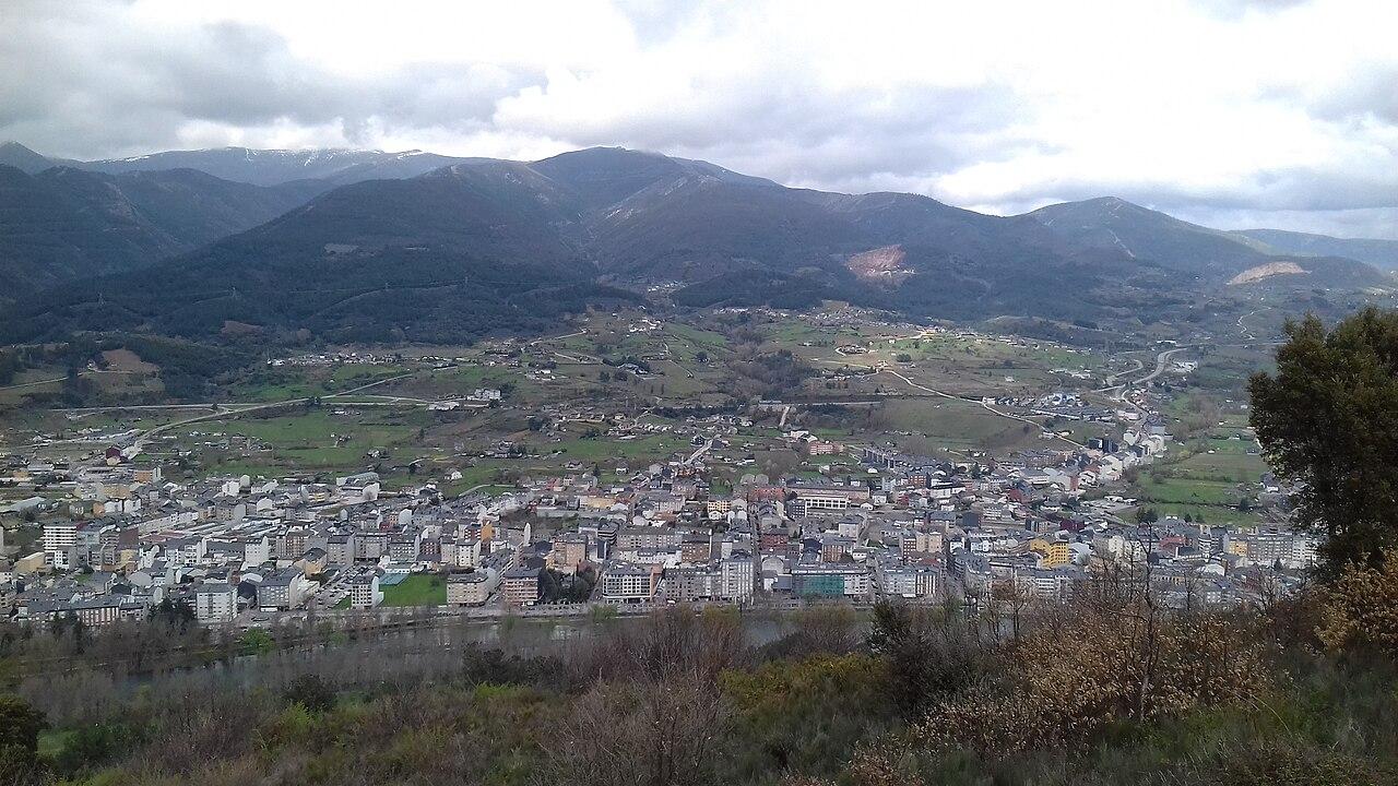
- TownCelanovaCelanova, in the Terra de Celanova district of Ourense, is the town of the monastery of San Salvador, founded by San Rosendo. Its old streets keep several houses with coats of arms.
- TownO Barco de ValdeorrasO Barco de Valdeorras, capital of the Valdeorras district, lies on the floor of the Sil valley below the Serra do Eixo. Besides slate quarrying and processing, its economy rests on wine under the Valdeorras designation of origin.
- TownRibadaviaRibadavia, capital of the O Ribeiro district, lies on the right bank of the Miño along the last stretch of the river Avia. In the Middle Ages a Jewish community prospered here, and the Jewish quarter still keeps its medieval character.
- TownVerínVerín lies in a fertile valley watered by the river Támega, near the Portuguese border, with the walled castle of Monterrei above it. It is also the home of the Monterrei wine designation of origin.
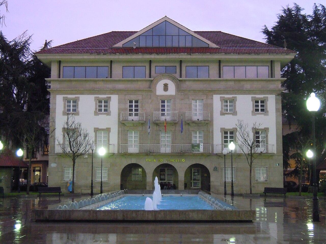
Castilla y León
Palencia
Romanesque churches and the Montaña Palentina in the north.
Regional context: it borders Cantabria and León, not Asturias.
5 on the map
No places in Palencia match this filter yet.
- CityPalenciaA cathedral city on the Carrión river. Its cathedral, known as La Bella Desconocida, hides a crypt with Visigothic and Romanesque remains.
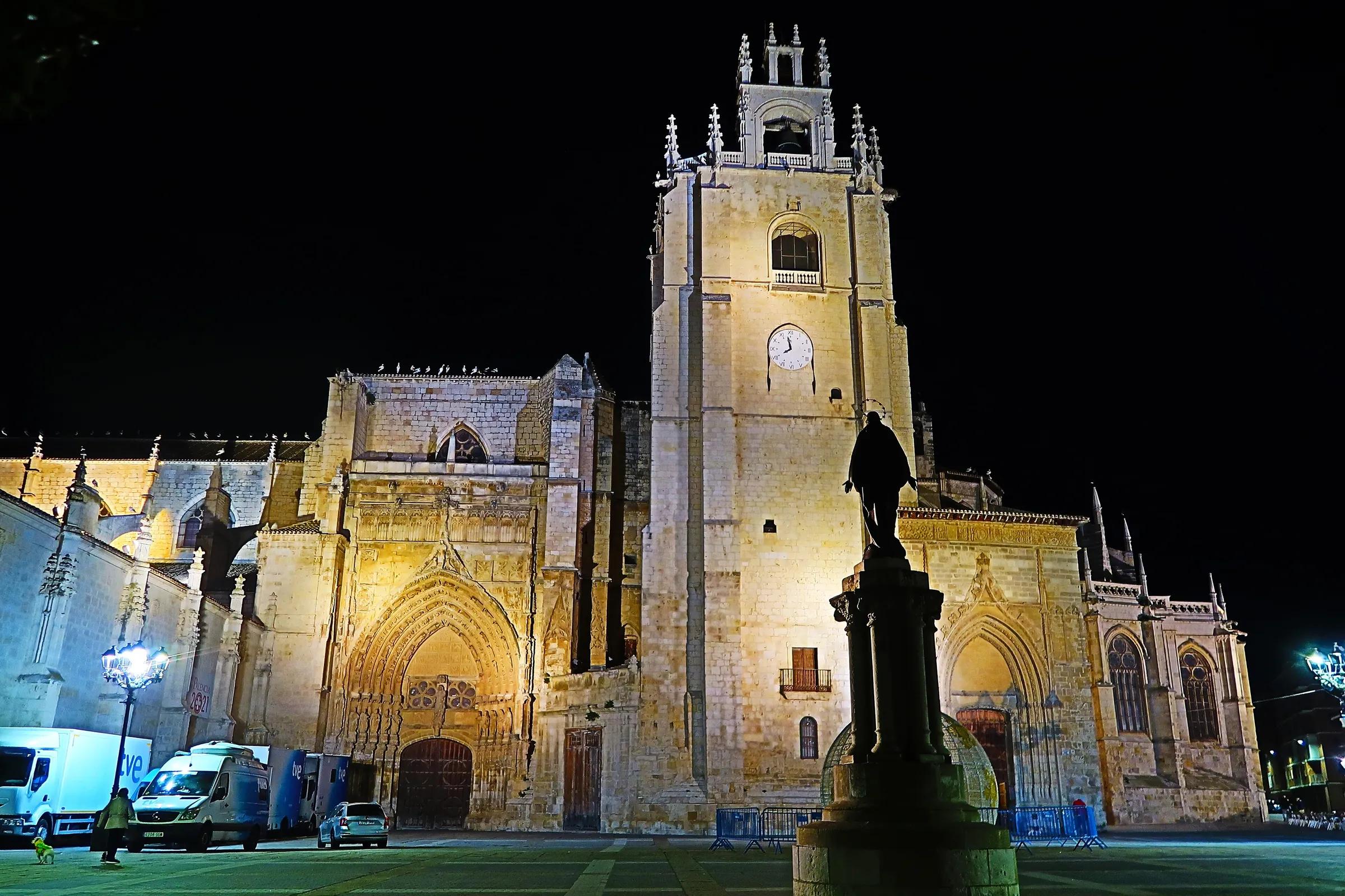
- TownAguilar de CampooAguilar de Campoo, in the north of the province of Palencia, is crossed by the River Pisuerga and is one of the gateways to the Montaña Palentina and to the Las Loras UNESCO Global Geopark. The town is known for its biscuit industry and for the Aguilar reservoir.
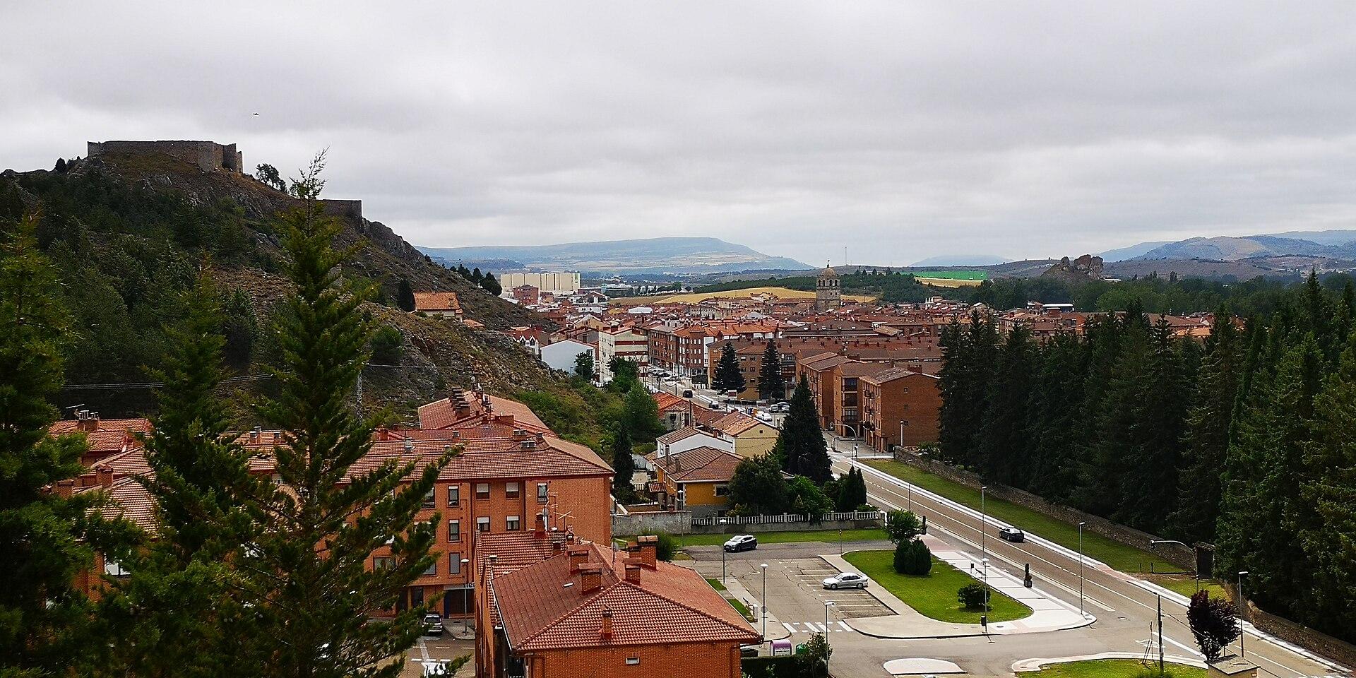
- TownCarrión de los CondesCarrión de los Condes stands on the River Carrión in the north of the Tierra de Campos and is a stop on the French Way of the Camino de Santiago. Its centre keeps several medieval churches, and three of its monuments are Bienes de Interés Cultural.
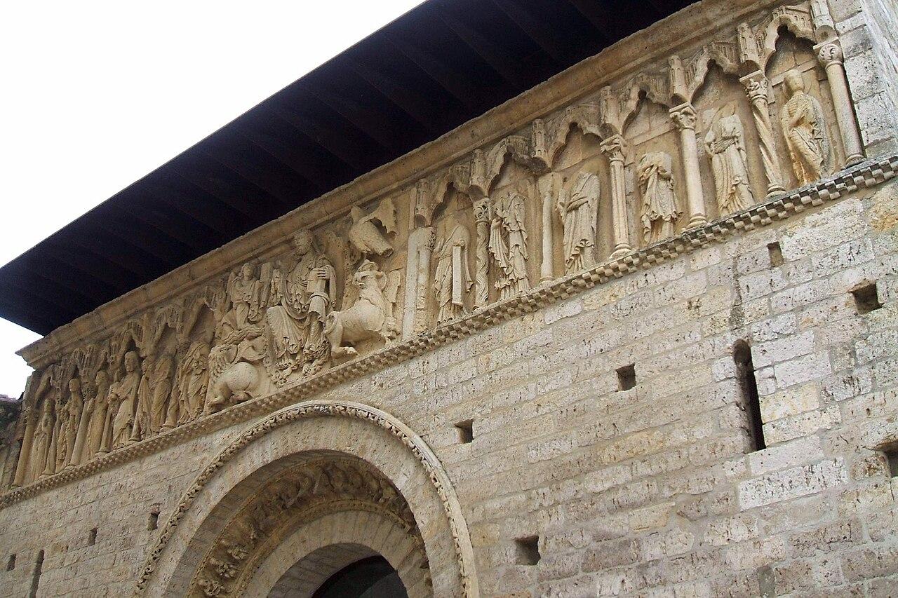
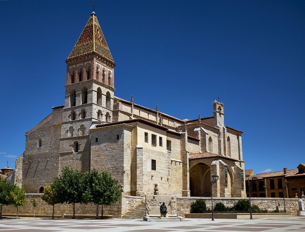
- TownParedes de NavaParedes de Nava is a town in the heart of the Tierra de Campos of Palencia, where the four towers of its churches rise above the plain. It is the birthplace of the Renaissance painter Pedro Berruguete.
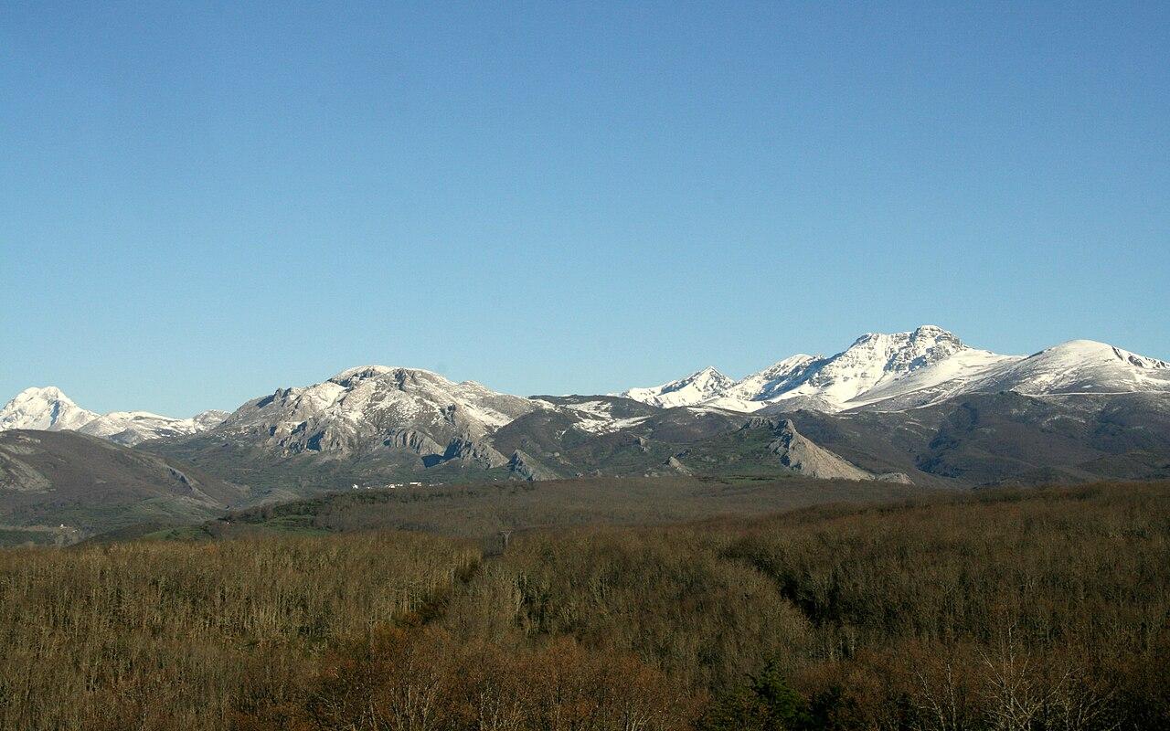
- Protected areaParque Natural Montaña PalentinaFormerly called Fuentes Carrionas y Fuente Cobre-Montaña Palentina, this natural park covers 78,360 ha in the far north of Palencia, bordering León and Cantabria. Its limestone peaks and crests pass 2,500 m, and the rivers Carrión and Pisuerga rise within it.
Castilla y León
Burgos
A Gothic cathedral and some of Europe's oldest human remains.
Regional context: on the Camino Francés, east of the mountains that frame Cantabria.
6 on the map
No places in Burgos match this filter yet.
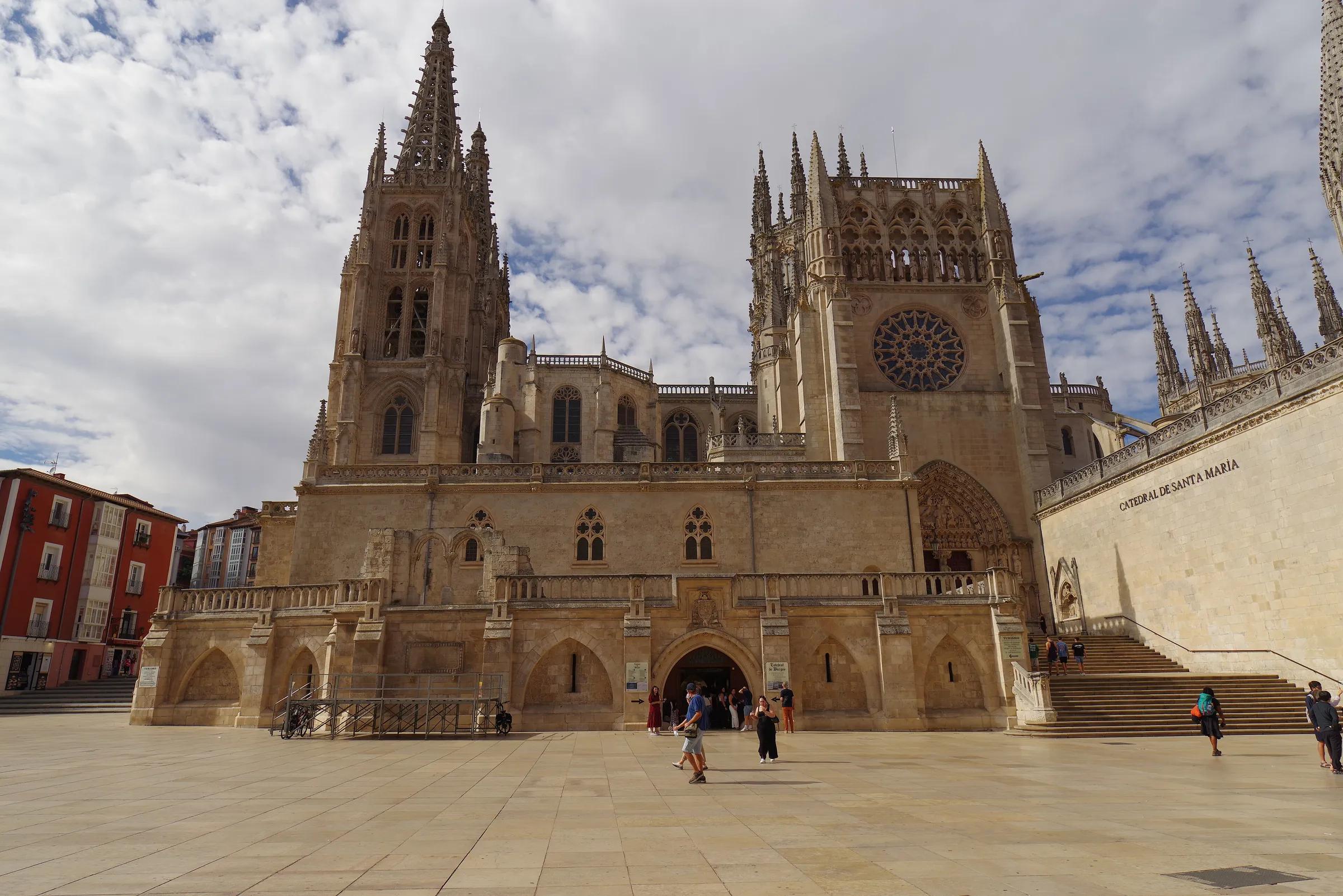
- CityBurgosIts Gothic cathedral is listed by UNESCO; nearby, the Atapuerca hills hold early human remains.
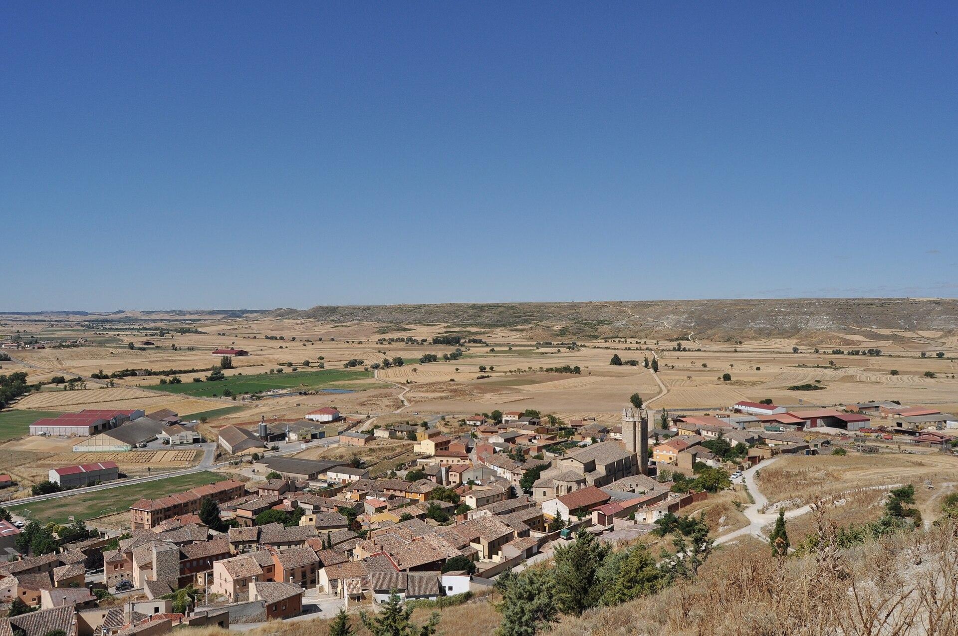
- VillageCastrojerizCastrojeriz lies at the foot of a hill crowned by its castle, beside the River Odra, on the French Way of the Camino de Santiago. It is a typical example of Camino town planning: the pilgrims' route is its long main street, which has earned it the nickname "ciudad larga".
- VillageCovarrubiasCovarrubias stands on the banks of the River Arlanza, in the Arlanza district of Burgos. In the 10th century Count Fernán González of Castile and his son García Fernández made it the capital of the Infantazgo de Covarrubias, which is why it is known as "the cradle of Castile".
- TownLermaLerma stands on a hill above the River Arlanza. Its great period came under Philip III, through the Duke of Lerma, the king's favourite, who built its important 17th-century monuments.
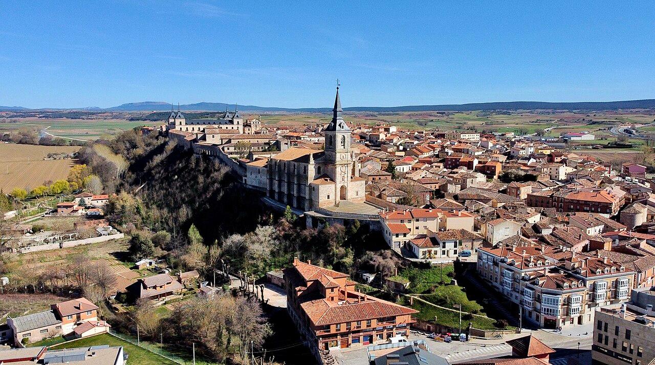
- LandmarkMonasterio de Santo Domingo de SilosA Benedictine abbey in the village of Santo Domingo de Silos, first documented in 954 as San Sebastián de Silos and later renamed after Abbot Domingo, who restored it from 1041. Its two-storey Romanesque cloister is considered one of the masterpieces of Spanish Romanesque art.
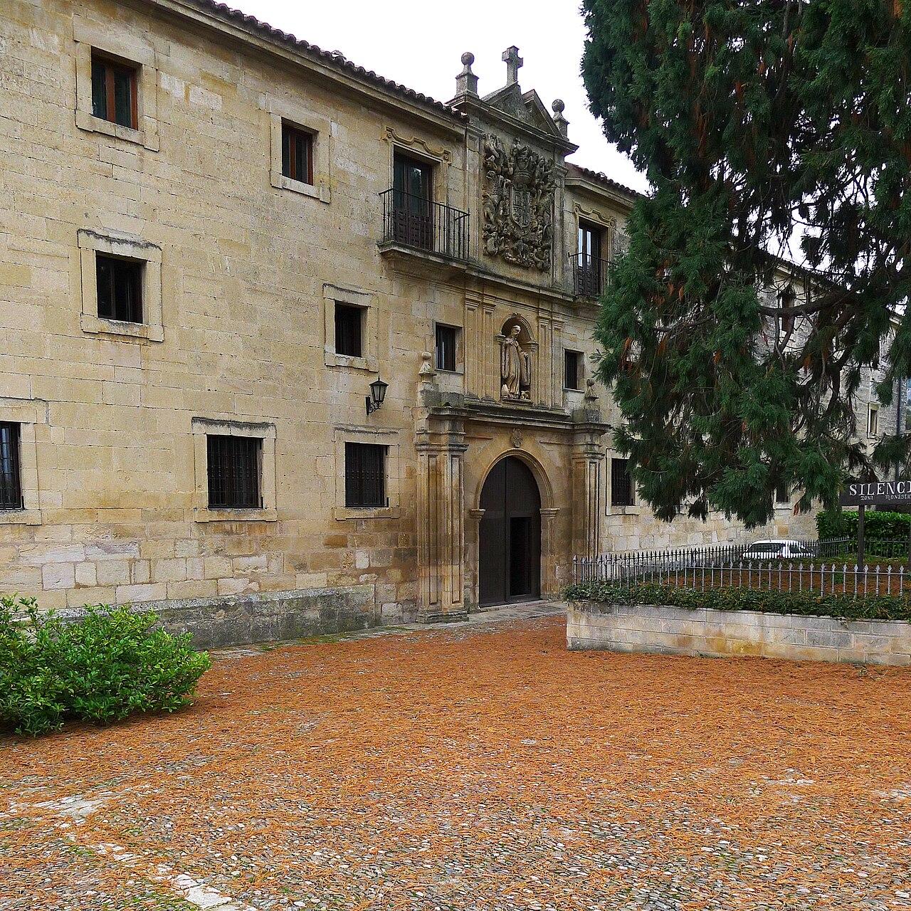
- LandmarkYacimientos de la Sierra de AtapuercaA group of cave and open-air sites in the karst hills of the Sierra de Atapuerca, east of Burgos, exposed when a cutting for a mining railway was dug through the hills at the end of the 19th century. Fossils and traces of five different human species have been found here, among them Homo antecessor, a species defined from remains about 850,000 years old.
Our picks
Short lists by our editors (walks, caves, snow days, wildlife and more), each pick with its reasons and its sources.
- Beaches of eastern Asturias
- Walks and hikes in Asturias
- Caves to visit in northern Spain
- Snow days
- Rivers and paddling
- Waterfalls
Where Tierra Luma is planned
Asturias
At the heart of our story: green valleys, rugged mountains and an Atlantic coast. Eastern Asturias is where we hope to bring Tierra Luma to life.
Principality of Asturias (a single-province autonomous community)
Asturias
A green strip between the Cantabrian Mountains and the sea, where Tierra Luma hopes to grow.
Neighbouring province
Just beyond Asturias
Follow the landscape into Cantabria, León and Lugo, where the mountain ranges, river valleys and local traditions carry on.
Further province
A little further
A Coruña, Ourense, Palencia and Burgos, each with landscapes and places worth exploring.
Explore with heart
Travel slowly, feel more
A few ways to make a journey richer, for you and for the places and people you meet. Take what speaks to you.
- Linger longerFewer places, deeper days: the village bar at dusk, the same path in the morning light.
- Taste the valleyCider poured from high, cheese ripened in caves, bread from the village oven: every meal tells a story.
- Meet the wild gentlyFrom a viewpoint or with a local guide, quietly and at a distance: that is when the wild shows itself.
- Walk the old pathsMarked trails, old caleyas and shepherds' routes lead to the most beautiful places, and leave the rest wild.
- Follow the quiet seasonsSpring blossom and autumn colour, with the famous places almost to yourself.
- Let the journey be part of itA train along the coast, a bus up the valley, a bike between villages: the slow way shows you more.
Get to know each province
Its landscape, what connects it to Asturias, its main places and the stories of its land.
Get to know Asturias
Short, steep rivers run from the mountain watershed to the Bay of Biscay through deep valleys, Atlantic woodland and meadows. In the east, the limestone of the Picos de Europa rises within sight of the beaches.
Home ground. Several of its mountain areas are UNESCO biosphere reserves, among them Somiedo, Redes and the Picos de Europa.
- Picos de Europa
- Cider culture
- Pre-Romanesque monuments of Oviedo
Where Tierra Luma hopes to grow
The search starts in eastern Piloña and rural Parres, around Villamayor, Sevares, Fíos and Bode, with Margolles–Peruyes, inland Ribadesella and some Cabrales valleys also considered. No land has been chosen or bought: this outline is a search area, not a site.
Places
- Fernando, edited by MenkinAlRire / Wikimedia Commons, CC BY-SA 4.0Read more
Towns & cultureOviedoThe capital of Asturias, with an old town of stone squares and a cathedral.
On Mount Naranco above the city stand Santa María del Naranco and San Miguel de Lillo, ninth-century pre-Romanesque buildings listed by UNESCO with other monuments of the old Kingdom of Asturias. The Camino Primitivo to Santiago starts here.
- Pre-Romanesque on Mount Naranco
- Start of the Camino Primitivo
Sources: Wikipedia (es): Oviedo · Wikipedia (es): Santa María del Naranco · Wikipedia (es): Ruta Jacobea Primitiva (Camino Primitivo)
- B25es / Wikimedia Commons, CC BY-SA 3.0Read more
Coast & beachesGijón / XixónAsturias's largest city, wrapped around a long town beach.
The old fishing quarter of Cimadevilla sits on a headland between the port and San Lorenzo beach; the remains of Roman baths lie under its square.
Sources: Wikipedia (es): Gijón · Wikipedia (es): Cimadevilla · Wikipedia (es): Termas romanas de Campo Valdés
- Juan Lacruz / Wikimedia Commons, CC BY-SA 3.0Read more
Mountains & valleysPicos de EuropaThree limestone massifs shared by Asturias, León and Cantabria. Spain's first national park began here in 1918, as the Montaña de Covadonga park.
Glaciers and water dissolving the limestone carved gorges, sinkholes and high lakes. Chamois and griffon vultures live on the cliffs; summer pastures and cheese caves show centuries of herding.
- Lakes Enol and Ercina
- The Cares gorge
- Naranjo de Bulnes
- Hiking
- Climbing
- Wildlife watching
Sources: MITECO: Parque Nacional de los Picos de Europa, historia · MITECO: Parque Nacional de los Picos de Europa, el medio natural · Wikipedia (es): Parque nacional de los Picos de Europa · Wikipedia (es): Picos de Europa · Wikipedia (es): Queso de Cabrales
- HombreDHojalata / Wikimedia Commons, CC BY-SA 3.0Read more
Towns & cultureAvilésA medieval old town of arcaded streets on an industrial estuary.
Across the estuary, the Niemeyer Centre was designed by the Brazilian architect Oscar Niemeyer.
Sources: Wikipedia (es): Avilés · Wikipedia (es): Centro Cultural Internacional Oscar Niemeyer
- Mongolo1984 / Wikimedia Commons, CC BY-SA 4.0Read more
Towns & cultureMieresA town of the Caudal valley, shaped by coal mining.
The mining valleys south of Oviedo tell the industrial side of Asturias: pit heads, workers' housing and green slopes reclaiming old tips.
Sources: Wikipedia (es): Mieres
- Tanja Freibott / Wikimedia Commons, CC BY-SA 4.0Read more
Forests & nature parksSomiedoA natural park and biosphere reserve where brown bears roam high valleys.
Somiedo is one of the strongholds of the Cantabrian brown bear. Its glacial lakes (Saliencia, Lago del Valle) and the thatched stone huts (teitos) of its summer pastures make it one of the most complete mountain landscapes in Spain.
Pinned at Pola de Somiedo, the park's main village.
- Bear watching with local guides, from a distance
- Walking to the lakes
Landscape and history
Rivers
Short rivers, steep valleys
Asturian rivers run quickly from the watershed to the sea, which keeps them cool and lively.
Read more
Salmon and trout
The Sella, Narcea and other rivers are among the Cantabrian rivers where wild Atlantic salmon still return to spawn.
Shade and clean water
Alders and willows along the banks shade the water and hold the soil during floods.
A river is a measure of everything upstream, including how land is farmed.
Coast
A coast of limestone and tide
Cliffs, coves, blowholes and beaches that sit inland behind the rocks.
Read more
Blowholes
Where the sea has dissolved channels under the cliffs, big swells push water and spray up through holes in the ground.
Tides
The tidal range is large: many coves and caves are only reachable at low tide. Check a tide table first.
Mountains, rivers and coast in one small region is why Tierra Luma is looking in eastern Asturias.
Landscape and history
Wildlife
Life on the limestone
From the beechwoods at the foot of the massifs to the bare summits, each band of the mountain has its own animals.
Read more
Cliffs and high pastures
Chamois graze the steep meadows and ledges. Griffon vultures ride the updrafts along the walls, alpine choughs gather near the summits and the wallcreeper, a small grey bird with crimson wings, climbs the rock faces.
Forest and valley
Lower down, beech and oak woods shelter roe deer, wild boar, woodpeckers and a rich community of fungi and lichens. Wolves still range through these mountains.
Watching without disturbing
Binoculars, early starts and staying on paths do more than getting close. Leave dogs on a lead near livestock and wildlife.
Grazing, forest and cliff depend on each other: when herding stops, scrub closes the meadows that many of these animals need.
Geology
Mountains made by water
The Picos are limestone formed on ancient seabeds, lifted into mountains and then carved by ice and rain.
Read more
Ice
Glaciers scooped out hollows that now hold lakes such as Enol and Ercina, and left moraines across the high valleys.
Rain dissolving rock
Slightly acidic rainwater dissolves limestone. The result is karst: closed hollows (jous), sinkholes and underground rivers. The Picos hold some of the deepest known caves in the world.
Gorges
Rivers such as the Cares and the Deva cut down as the mountains rose, leaving narrow gorges between the massifs.
Water vanishes quickly into karst: springs, caves and the cheese that matures in them all depend on this hidden plumbing.
People
Herders and cheese caves
For centuries the mountains have been a working landscape of summer pastures, stone huts and cheese.
Read more
Majadas
Each summer herders took cows, sheep and goats up to high pastures and lived in small stone huts there.
Three protected cheeses
Cabrales, Gamonéu and Los Beyos all carry protected designations; Cabrales matures in natural limestone caves.
This is the relationship Tierra Luma wants to learn from: land that feeds people because people look after it.
Adventure
Ways into the mountains
Gentle lake walks, a famous gorge trail and serious alpine routes, all within a short distance.
Read more
Easy
The circuit of the Covadonga lakes and short walks from Bulnes suit most walkers in good weather.
Classic
The Cares trail follows a path cut into the gorge walls between Poncebos and Caín.
Alpine
High routes and mountain huts, such as the refuge at the foot of the Naranjo de Bulnes, need experience, a map and a weather check: fog comes in fast.
Step out of your comfort zone, one level at a time, and come back with the mountain still intact.
Wildlife
The Cantabrian brown bear
Somiedo is one of the best places in Europe to see wild brown bears, usually far away across a valley.
Read more
A recovery story
The Cantabrian population fell close to disappearing in the twentieth century. Protection and cooperation with rural communities have helped it grow again, though it remains vulnerable.
How to watch
From viewpoints, with telescopes and local guides, at dawn or dusk. Never approach, follow or feed a bear.
A large predator living alongside villages is a sign of a landscape that still works.
People
Teitos and the vaqueiros
Stone huts thatched with broom, used by herders who moved with their cattle between valley and mountain each year.
Read more
Brañas
Groups of these huts form brañas, the summer settlements in the high meadows. Some can still be visited on foot.
Buildings made from what grows and lies around them: a lesson for any low-impact building.
Forest
An old Atlantic oak forest
Oaks, birches and hollies on steep slopes, rich in mosses, lichens and dead wood.
Read more
Why old forest matters
Old trees and fallen wood are homes for insects, fungi, bats and woodpeckers that young plantations cannot support.
The capercaillie
The Cantabrian capercaillie, a large forest grouse, is in danger of extinction; quiet, undisturbed forest is essential for it.
A food forest copies the structure of woods like this one: many layers, nothing wasted.
Get to know Cantabria
A coast of estuaries and cliffs backed by green valleys; inland, the Liébana valley sits in a sheltered bowl under the eastern massif of the Picos.
The Deva river marks part of the border with Asturias near the coast. The Picos de Europa national park spans Cantabria, Asturias and León.
- Liébana and Fuente Dé
- Altamira cave art
- Santander's bay
Places
- Nurfermi / Wikimedia Commons, CC BY-SA 4.0Read more
Coast & beachesSantanderCantabria's capital, on one of the great bays of the north coast.
The Magdalena peninsula and the city beaches face the bay entrance.
Sources: Wikipedia (es): Santander (España)
- Jl FilpoC / Wikimedia Commons, CC BY 4.0Read more
Towns & cultureTorrelavegaA market and industrial town where the Saja and Besaya rivers meet.
Sources: Wikipedia (es): Torrelavega
- Simon Burchell / Wikimedia Commons, CC BY-SA 4.0Read more
Towns & culturePotesThe stone capital of Liébana, under the eastern Picos.
Nearby, the monastery of Santo Toribio de Liébana is a pilgrimage site with its own jubilee years.
Sources: Wikipedia (es): Potes · Wikipedia (es): Monasterio de Santo Toribio de Liébana
- Falk2 / Wikimedia Commons, CC BY-SA 4.0Read more
Mountains & valleysFuente DéA cable car up a sheer wall to the high plateau of the central Picos.
- High-mountain walks from the upper station
Sources: Wikipedia (es): Teleférico de Fuente Dé · Wikipedia (es): Fuente Dé
- Museo de Altamira y D. Rodríguez / Wikimedia Commons, CC BY-SA 3.0Read more
Towns & cultureAltamiraPalaeolithic paintings of bison, listed by UNESCO.
To protect the original cave, visitors see a faithful replica in the museum; Asturias has its own decorated caves, such as Tito Bustillo and El Pindal.
Sources: Wikipedia (es): Cueva de Altamira · Wikipedia (es): Cueva de Altamira y arte rupestre paleolítico de la cornisa cantábrica (Patrimonio Mundial) · Museo Nacional y Centro de Investigación de Altamira
- Diego Lavin Marin / Wikimedia Commons, CC BY-SA 4.0Read more
Coast & beachesCosta QuebradaCosta Quebrada is a stretch of the Cantabrian coast where the sea wears down rock layers of differing hardness and tilt into coves, capes, islets and arches. UNESCO added it to its Global Geoparks network in 2025.
Pinned at La Arnía beach (Piélagos), on the Costa Quebrada cliffs; the UNESCO geopark covers 345 km² across eight municipalities from Santander to Santillana del Mar.
Protection: UNESCO Global Geopark (designated 2025); its western shore is also part of the Dunas de Liencres y Costa Quebrada Natural Park (Cantabria Law 2/2021)
- Some beaches sit high above today's sea level: raised beaches lifted during mountain building.
- The geopark also holds salt domes formed about 240 million years ago and fossil crabs preserved in pyrite.
- The geopark spans eight municipalities: Santander, Santa Cruz de Bezana, Piélagos, Miengo, Suances, Santillana del Mar, Polanco and Camargo.
Sources: UNESCO – Costa Quebrada UNESCO Global Geopark · Delegación Permanente de España ante la UNESCO – La UNESCO designa 16 nuevos geoparques (17-04-2025) · Turespaña – Costa Quebrada enters the global elite as a new UNESCO Geopark · Parque natural de las Dunas de Liencres y Costa Quebrada – Wikipedia (es) · Playa de La Arnía – Wikipedia (es) · OpenStreetMap way 129106558 (Playa de La Arnía) · Playa de la Arnía – Wikidata Q5704921
Get to know Lugo
Rolling inland farmland and the high Ancares range in the east; on the coast, the Mariña lucense with its beaches and sea arches.
The Eo river and its estuary form the border with Asturias at Ribadeo and Castropol. Both regions share a mild Atlantic climate and the Camino de Santiago's northern routes.
- Lugo's Roman walls
- Playa de las Catedrales
Places
- Malopez 21 / Wikimedia Commons, CC BY-SA 4.0Read more
Towns & cultureLugoA city still ringed by its complete Roman wall, listed by UNESCO.
- Anual / Wikimedia Commons, CC BY-SA 4.0Read more
Coast & beachesPraia das CatedraisSea arches like flying buttresses, walkable at low tide.
Check the tide table; in the busiest seasons access to the sand needs a free booking.
Sources: Wikipedia (es): Playa de Las Catedrales · Xunta de Galicia: Praia das Catedrais, reserva de visita(in Spanish)
- Tanja Freibott / Wikimedia Commons, CC BY-SA 3.0Read more
Mountains & valleysOs Ancares lucensesOs Ancares are the mountains on the Galician side of the border with León, in eastern Lugo, where roads climb narrow, deep valleys towards peaks of almost 2,000 m. The highest villages still keep pallozas, ancient round dwellings roofed with straw.
The pin marks A Campa da Braña (Cervantes), home of the interpretation and management centre of the Os Ancares National Game Reserve; the range itself rises to the east along the border with León.
Protection: Os Ancares Lucenses e Montes de Cervantes, Navia e Becerreá Biosphere Reserve (UNESCO, 2006); Natura 2000 Special Area of Conservation (Ancares–Courel)
- The walk from the chapel of O Piornedo to O Mustallar, the highest point of Os Ancares lucenses, is a full-day mountain hike.
- From A Degrada, beside the Os Ancares hostel and interpretation centre, a route of medium-high difficulty climbs to the Campa de Tres Bispos.
- Brown bear and capercaillie, species not found elsewhere in Galicia, are linked to these mountains.
Sources: Turismo de Galicia – Os Ancares (EN) · Turismo de Galicia – Os Ancares (ES) · Turismo de Galicia – ZEC Os Ancares resource · Turismo de Galicia – Biosphere Reserve Os Ancares Lucenses resource · Reserva da Biosfera Terras do Miño (Deputación de Lugo) – list of Galician biosphere reserves · Wikipedia (gl) – Serra dos Ancares · Wikipedia (gl) – Serra do Courel (Ancares-Courel Natura 2000) · Wikidata – Ancares-Courel Natura 2000 site (Q61379028) · OpenStreetMap – A Campa da Braña node · Wikidata – A Campa da Braña (Q20547526)
- Vicente Maza Gómez / Wikimedia Commons, CC BY-SA 3.0Read more
Towns & cultureSarriaSarria is a town on the Camino Francés and the usual starting point for pilgrims who walk the last 100 km to Santiago, the minimum distance on foot for the Compostela.
- On the Rúa Maior stands the church of O Salvador, an early Gothic building of the 13th century.
- A round tower is all that survives of the medieval fortress of the Marquises of Sarria; it is a Bien de Interés Cultural.
- The convent of A Madalena was founded in the early 13th century as a hospital for pilgrims and now belongs to the Mercedarian Fathers.
Sources: Sarria – Wikipedia (es) · Sarria – Wikipedia (en) · Torre de Sarria – Turismo de Galicia · Wikidata Q23992556 (settlement) · Wikidata Q174833 (municipality) · OpenStreetMap node 768282714
- Read more
Mountains & valleysSerra do CourelO Courel is a mountain range in the far south-east of Lugo province, stretching from O Cebreiro towards the river Sil, where slate villages sit on green slopes above narrow river valleys such as those of the Lor and the Lóuzara. Its rocks, fossils and old mines earned the territory of Folgoso do Courel, Quiroga and Ribas de Sil UNESCO Global Geopark status in 2019.
The pin marks Seoane do Courel, a village on the LU-651, the road that crosses O Courel from north to south; the range and the geopark cover a much wider area of Folgoso do Courel, Quiroga and Ribas de Sil.
Protection: Courel Mountains UNESCO Global Geopark (2019); part of the Ancares–Courel Natura 2000 site (Special Area of Conservation) and of the Ribeira Sacra e Serras do Oribio e Courel Biosphere Reserve
- The Campodola-Leixazós fold in Quiroga, a geological fold visible to the naked eye, declared a Natural Monument in 2012.
- The Devesa da Rogueira, a well-preserved broadleaf forest.
- Froxán, a village in Folgoso do Courel whose traditional architecture and customs earned it Bien de Interés Cultural status.
Sources: Turismo de Galicia – Serra do Courel (EN) · Turismo de Galicia – Serra do Courel (ES) · Turismo de Galicia – Xeodestino Courel · Ribeira Sacra tourism – Courel Mountains UNESCO Global Geopark · Courel Mountains UNESCO Global Geopark – Territories · Wikipedia (es) – Folgoso de Caurel · Wikipedia (gl) – Serra do Courel · Wikipedia (gl) – Seoane do Courel (village) · Wikidata – Seoane do Courel (Q25508350) · OpenStreetMap – Seoane do Courel node · Wikidata – Ancares-Courel Natura 2000 site (Q61379028)
- iamato / Wikimedia Commons, CC BY 2.0Read more
Mountains & valleysSerra do XistralThe Serra do Xistral is a wind-battered range in northern Lugo that rises between the Cantabrian coast and the plains of A Terra Chá. Fog and frequent rain soak its high plateaus, creating extensive blanket bogs where free-roaming wild horses are a common sight.
The pin marks O Cadramón, the highest point of the Xistral massif; the protected range and its bogs spread across a dozen municipalities of northern Lugo.
Protection: Serra do Xistral Special Area of Conservation (Natura 2000, ES1120015); within the Terras do Miño Biosphere Reserve
- O Cadramón, the highest point of the Xistral massif.
- Headwaters of the Eume, flowing to the Atlantic, and of the Landro, Ouro and Masma, flowing to the Cantabrian Sea.
- One of the few places in Galicia with the viviparous lizard, which reaches the western limit of its range here.
Sources: Turismo de Galicia – Serra do Xistral (EN) · Turismo de Galicia – Serra do Xistral (ES) · Reserva da Biosfera Terras do Miño (Deputación de Lugo) · Wikipedia (gl) – Serra do Xistral · Wikipedia (es) – Sierra del Gistral · Wikidata – Serra do Xistral Natura 2000 site (Q128440937) · OpenStreetMap – O Cadramón peak node
Get to know León
The south face of the Cantabrian Mountains gives way to the high plain; in the west, El Bierzo is a fertile basin of vineyards and chestnut woods.
The watershed between León and Asturias decides whether rain reaches the Bay of Biscay or the Atlantic through Portugal. The Cares trail links Caín, in León, with Poncebos, in Asturias.
- León cathedral
- Las Médulas
- Camino de Santiago
Places
- Rafa Esteve / Wikimedia Commons, CC BY-SA 4.0Read more
Towns & cultureLeónA Gothic cathedral famous for its stained glass, on the Camino Francés.
Sources: Wikipedia (es): Catedral de León
- Antonio Moreno Nadal / Wikimedia Commons, CC0 1.0Read more
Towns & culturePonferradaCapital of El Bierzo, with a Templar castle over the Sil.
Sources: Wikipedia (es): Ponferrada
- Pablo Pereira González / Wikimedia Commons, CC BY-SA 4.0Read more
Towns & cultureLas MédulasRed pinnacles left by Roman gold mining, listed by UNESCO.
The Romans brought water through long channels to collapse whole hillsides and wash out the gold; chestnut woods now grow between the ruins.
Sources: Wikipedia (es): Las Médulas
- JRA / Wikimedia Commons, Public domainRead more
Towns & cultureAstorgaRoman Asturica Augusta, where the French Way of Saint James meets the Vía de la Plata.
It grew from a camp of the Legio X Gemina; today Gaudí's episcopal palace stands beside the cathedral of Santa María.
Sources: Wikipedia · Spain.info
- Read more
Mountains & valleysParque Regional Montaña de Riaño y MampodreThis regional park covers 101,336 ha of high Cantabrian mountains in north-east León, at the headwaters of the Esla, Porma and Cea. Its steep valleys hold glacial lakes and the Riaño and Porma reservoirs, beneath peaks of the Mampodre massif that pass 2,000 m.
Pinned at Puebla de Lillo, home of the park's 'El Torreón' visitor centre (Casa del Parque); the regional park covers 101,336 ha across ten municipalities of north-east León.
Protection: Regional park (Parque Regional), declared by Castilla y León Law 12/1994 under its former name 'Picos de Europa' regional park
- Brown bear and capercaillie are its most representative species, alongside wolves and chamois.
- Beech is the main woodland, and the Pinar de Lillo is a pine forest of great interest with restricted access.
- Visitor centres (Casas del Parque) are at Puebla de Lillo, Lario (Valdeburón) and the Porma valley.
Sources: Patrimonio Natural de Castilla y León – Parque Regional Montaña de Riaño y Mampodre · Turismo Castilla y León – Parque Regional Montaña de Riaño y Mampodre · Parque regional Montaña de Riaño y Mampodre – Wikipedia (es) · Montaña de Riaño y Mampodre Regional Park – Wikidata Q18654718 · OpenStreetMap node 348627823 (Puebla de Lillo) · Puebla de Lillo – Wikidata Q24013132
- Read more
Towns & cultureSahagúnSahagún lies between the Cea and Valderaduey rivers in the east of the province of León, and is the first town in that province on the Camino de Santiago Francés. It grew up around a shrine to the martyrs Facundus and Primitivus and was consolidated in the 11th century with the arrival of the Order of Cluny and the charter granted by King Alfonso VI.
Protection: Bien de Interés Cultural (Conjunto Histórico): the town was declared by Agreement 142/2022 of the Junta de Castilla y León of 16 June 2022
- San Tirso and San Lorenzo, churches in the brick Romanesque-Mudéjar style; San Tirso is considered the prototype of the Mudéjar works of the Sahagún school.
- The ruins of the Cluniac monastery of San Benito, with the Arco de San Benito (1662, designed by Felipe Berrojo) and the Clock Tower; Alfonso VI was buried in the monastery, and his tomb and those of his four wives are now in the church of the Benedictine nuns.
- The sanctuary of La Peregrina, part of the Franciscan convent founded in 1257, built entirely of brick and standing on a rise to the south of the town.
Sources: Acuerdo 142/2022 (BOE-A-2022-10847) – Boletín Oficial del Estado · Sahagún (España) – Wikipedia (es) · Sahagún – Turismo de Castilla y León (Junta de Castilla y León) · Wikidata Q821860 · OpenStreetMap node 166890256
Get to know A Coruña
Deep rías, granite headlands and the exposed Costa da Morte.
Regional context: the end point of the Camino routes that cross Asturias.
- Santiago de Compostela
- Tower of Hercules
Places
- Luis Miguel Bugallo Sánchez (Lmbuga) / Wikimedia Commons, CC BY-SA 3.0Read more
Towns & cultureA CoruñaA port city around the Tower of Hercules, a Roman lighthouse still in use.
Sources: Wikipedia (es): Torre de Hércules
- Lmbuga (Luis Miguel Bugallo Sánchez) / Wikimedia Commons, CC BY-SA 4.0Read more
Towns & cultureSantiago de CompostelaThe goal of the Camino de Santiago, with a cathedral at its heart.
The northern routes of the Camino cross Asturias on their way here.
Sources: Wikipedia (es): Catedral de Santiago de Compostela · Wikipedia (es): Camino de Santiago de la Costa
- Jim Anzalone / Wikimedia Commons, CC BY-SA 2.0Read more
Coast & beachesCedeiraCedeira is a fishing town on the north coast of the Rías Altas, on its own small ría where the river Condomiñas flows out. Its historic centre has narrow streets of medieval layout and galleries of wood and carved stone.
- The Castelo da Concepción, an 18th-century fort on Punta Sarridal, has watched over the ría since 1747 and now houses an interpretation centre.
- The sanctuary of Santo André de Teixido stands among the cliffs of the Serra da Capelada; as the legend says, "vai de morto quen non foi de vivo" (whoever did not go alive will go when dead).
- The Serra da Capelada ends abruptly at the sea; the cliffs of Vixía de Herbeira are at its highest point.
Sources: Cedeira – Wikipedia (es) · Ría de Cedeira – Turismo de Galicia · Coñece Cedeira – Turismo Cedeira (Concello de Cedeira) · Castelo da Concepción – Turismo Cedeira (Concello de Cedeira) · Castelo da Concepción (Cedeira) – Turismo de Galicia · Igrexa de Santo André de Teixido – Turismo de Galicia · Geodestino Ferrolterra – Turismo de Galicia · Wikidata Q20551038 (settlement) · Wikidata Q1113395 (municipality) · OpenStreetMap node 163784717
- Fernando Pascullo / Wikimedia Commons, CC BY-SA 4.0Read more
Towns & cultureFerrolFerrol is a city on the ría de Ferrol, traditionally turned to the sea, with a historic fishing and commercial port, civil and military shipyards and Spanish Navy installations. Its present layout grew out of the shipyards and the great Arsenal built during the Enlightenment.
Protection: Bien de Interés Cultural: the A Magdalena quarter is a conjunto histórico-artístico
- The A Magdalena quarter is an Enlightenment grid of six parallel streets crossed by nine shorter ones, with the squares of Amboage and Armas at either end; it keeps 18th-century houses with wrought-iron balconies and white glazed wooden galleries, most of them from the 19th century.
- The castles of San Felipe and, on the opposite shore in Mugardos, La Palma guard the mouth of the ría.
- Its Holy Week has been a Fiesta de Interés Turístico Internacional since 2014.
Sources: Ferrol – Wikipedia (es) · Geodestino Ferrolterra – Turismo de Galicia · Barrio de A Magdalena (Ferrol) – Turismo de Galicia · Ferrol – Wikipedia (gl) · Ministerio de Cultura – Registro BIC: Conjunto Histórico Artístico Barrio de la Magdalena, Ferrol (RI-53-0000322) · Ciudad de Ferrol – Turismo de Galicia · Wikidata Q31916306 (settlement) · Wikidata Q485329 (municipality) · OpenStreetMap node 91254710
- Luis Miguel Bugallo Sánchez (http://commons.wikimedia.org/wiki/User:Lmbuga) / Wikimedia Commons, CC BY-SA 3.0Read more
Towns & cultureNoiaNoia lies at the innermost point of the ría de Muros e Noia, the northernmost of the Rías Baixas. In the Middle Ages it served as the port of Santiago de Compostela.
Protection: Bien de Interés Cultural (conjunto histórico): the old town (casco antiguo) was declared a conjunto histórico-artístico in 1985
- According to a legend shown on the municipal coat of arms, Noia was founded by Noah.
- The church of Santa María a Nova, a national monument since 1973, keeps more than two hundred tombstones carved with the trades of the medieval guilds.
- The town took its present shape in the late Middle Ages, with its walls (1320), the Tapal fortress, manor houses and the rebuilt churches of Santa María a Nova and San Martiño.
Sources: Noya – Wikipedia (es) · Nuestra historia – Turismo de Noia (Concello de Noia) · Geodestino Ría de Muros e Noia – Turismo de Galicia · Ministerio de Cultura – Registro BIC: Conjunto Histórico Artístico Casco Antiguo, Noia (RI-53-0000326) · Wikidata Q20542080 (settlement) · Wikidata Q818601 (municipality) · OpenStreetMap node 133573190
- Luis Miguel Bugallo Sánchez (Lmbuga) / Wikimedia Commons, CC BY-SA 3.0Read more
Towns & culturePontedeumePontedeume is a town founded by Alfonso X in 1270 at the mouth of the river Eume, on the ría de Ares, and the Camino Inglés to Santiago passes through it. Its streets and squares keep arcades, houses with wooden balconies and glazed galleries, and public fountains.
Protection: Bien de Interés Cultural (conjunto histórico): the Comarca Eumesa, which takes in Pontedeume and other municipalities, was declared a conjunto histórico-artístico in 1971
- The Torreón dos Andrade, 18 metres tall, is the last remnant of the Andrade palace and now houses the tourist office and the Andrade interpretation centre.
- The bridge that gives the town its name was rebuilt between 1863 and 1870 and remodelled in 1884–1888, leaving its present 15 arches; it replaced a Gothic bridge of 68 arches that Fernán Pérez de Andrade "o Bo" had built.
- It is one of the gateways to the Fragas do Eume Natural Park; the road to the monastery of Caaveiro starts here.
Sources: Puentedeume – Wikipedia (es) · Historia – Concello de Pontedeume · Pontedeume – Wikipedia (en) · Patrimonio – Concello de Pontedeume · Torre de Andrade (Pontedeume) – Turismo de Galicia · Rías de Ares y Betanzos – Turismo de Galicia · Ministerio de Cultura – Registro BIC: Conjunto Histórico Artístico Comarca Eumesa (RI-53-0000132) · Wikidata Q12397882 (settlement) · Wikidata Q765283 (municipality) · OpenStreetMap node 136798686
Get to know Ourense
The Miño and Sil rivers cut deep canyons lined with terraced vineyards (Ribeira Sacra).
Regional context: the Sil rises in the mountains of León, close to the Asturian border.
- Thermal springs
- Ribeira Sacra
Places
- Luis Miguel Bugallo Sánchez (Lmbuga) / Wikimedia Commons, CC BY-SA 4.0Read more
Rivers, lakes & waterfallsOurenseA city of hot springs on the Miño. A three-kilometre thermal walk follows the river from the Campo da Feira to Outariz, past several hot pools.
Sources: Turismo de Galicia: Ourense · Wikipedia (es): Orense
- Arsenio Blanco / Wikimedia Commons, CC BY-SA 4.0Read more
Rivers, lakes & waterfallsCanón do SilFrom where it enters Galicia to its meeting with the Miño, the Sil flows through a deep valley that separates the provinces of Ourense and Lugo, hemmed in by granite walls above the now-dammed river. Vines have been grown on the sunny slopes for centuries, while well-preserved oak woods cover the shadier side.
The pin marks the Balcóns de Madrid viewpoint near Parada de Sil (Ourense); the canyon runs from east to west along the border between the provinces of Ourense and Lugo.
Protection: Canón do Sil Special Area of Conservation (Natura 2000, ES1120014)
- The Os Balcóns de Madrid viewpoint above Parada de Sil, a good spot for peregrine falcon, booted eagle and goshawk.
- Catamaran trips on the river through the canyons of the Sil.
- Vineyards of the Ribeira Sacra designation of origin on slopes that reach right down to the water.
Sources: Turismo de Galicia – Galicia Birding: Canón do Sil (EN) · Turismo de Galicia – Galicia Birding: Canón do Sil (ES) · Turismo de Galicia – Ribeira Sacra e Canón do Sil · Wikipedia (gl) – Canón do Sil · Wikipedia (es) – Cañón del Sil · Wikipedia (gl) – Parada de Sil · Wikidata – Sil Canyon (Q14916370) · OpenStreetMap – Balcós dos Mouros ou de Madrid viewpoint node
- Read more
Towns & cultureCelanovaCelanova, in the Terra de Celanova district of Ourense, is the town of the monastery of San Salvador, founded by San Rosendo. Its old streets keep several houses with coats of arms.
- The monastery of San Salvador, a Bien de Interés Cultural, has a 16th-century abbey church by Melchor de Velasco and two cloisters.
- In the monastery garden stands the Mozarabic chapel of San Miguel.
- Celanova calls itself the "Vila dos Poetas": the poets Manuel Curros Enríquez and Celso Emilio Ferreiro were born here.
Sources: Celanova – Wikipedia (es) · Celanova – Wikipedia (en) · Celanova – Wikipedia (gl) · San Salvador de Celanova – Turismo de Galicia · Cultura – Turismo Celanova (Concello de Celanova) · Wikidata Q20551157 (settlement) · Wikidata Q1605505 (municipality) · OpenStreetMap node 1049910057
- Estevoaei / Wikimedia Commons, CC BY-SA 4.0Read more
Towns & cultureO Barco de ValdeorrasO Barco de Valdeorras, capital of the Valdeorras district, lies on the floor of the Sil valley below the Serra do Eixo. Besides slate quarrying and processing, its economy rests on wine under the Valdeorras designation of origin.
Sources: O Barco de Valdeorras – Wikipedia (en) · El Barco de Valdeorras – Wikipedia (es) · Torre de O Castro (O Barco de Valdeorras) – Turismo de Galicia · Wikidata Q20542588 (settlement) · Wikidata Q1607428 (municipality) · OpenStreetMap node 256200176
- Read more
Towns & cultureRibadaviaRibadavia, capital of the O Ribeiro district, lies on the right bank of the Miño along the last stretch of the river Avia. In the Middle Ages a Jewish community prospered here, and the Jewish quarter still keeps its medieval character.
Protection: Bien de Interés Cultural (conjunto histórico): the Villa de Ribadavia was declared a historic-artistic ensemble in 1947
- Near the Campo da Feira stand the ruins of the castle of the Sarmientos, Counts of Ribadavia, with its towers and walls; parts of the town wall also survive.
- The Festa da Istoria, a Fiesta de Interés Turístico Nacional, recreates the medieval Jewish world with people in period dress.
- Vines have shaped the life of the district since the 12th century; its wine is sold today under the Ribeiro designation of origin.
Sources: Ribadavia – Wikipedia (en) · Ribadavia – Wikipedia (es) · Geodestino O Ribeiro – Turismo de Galicia · Ribadavia – Wikipedia (gl) · Ministerio de Cultura – Registro BIC: Conjunto Histórico de la Villa de Ribadavia (RI-53-0000013) · Conjunto histórico Vila de Ribadavia – Turismo de Galicia · Wikidata Q24012295 (settlement) · Wikidata Q917180 (municipality) · OpenStreetMap node 373395801
- Adrián Estévez Estevoaei / Wikimedia Commons, CC BY-SA 4.0Read more
Towns & cultureVerínVerín lies in a fertile valley watered by the river Támega, near the Portuguese border, with the walled castle of Monterrei above it. It is also the home of the Monterrei wine designation of origin.
- Its Entroido (carnival), a Fiesta de Interés Turístico Nacional, is led by the cigarróns, masked figures whose cowbells, tied at the waist, fill the streets with sound.
- Three mineral waters are bottled in the town: Cabreiroá, Fontenova and Sousas.
- The castle of Monterrei, in the neighbouring municipality of Monterrei, has a triple walled enclosure that once held a monastery, a hospital and a small town.
Sources: Geodestino Verín-Viana – Turismo de Galicia · Verín – Wikipedia (es) · Verín – Wikipedia (en) · Entroido de Verín – Turismo de Galicia · Castelo de Monterrei – Turismo de Galicia · Wikidata Q24012284 (settlement) · Wikidata Q176504 (municipality) · OpenStreetMap node 1235308193
Get to know Palencia
Mountains in the far north, then wide cereal plains crossed by the Canal de Castilla.
Regional context: it borders Cantabria and León, not Asturias.
- Romanesque churches
Places
- Alonsolej / Wikimedia Commons, CC BY-SA 4.0Read more
Towns & culturePalenciaA cathedral city on the Carrión river. Its cathedral, known as La Bella Desconocida, hides a crypt with Visigothic and Romanesque remains.
Sources: Turismo Castilla y León: Cathedral of Palencia · Wikipedia (es): Catedral de San Antolín de Palencia
- Goldorak / Wikimedia Commons, CC BY-SA 4.0Read more
Towns & cultureAguilar de CampooAguilar de Campoo, in the north of the province of Palencia, is crossed by the River Pisuerga and is one of the gateways to the Montaña Palentina and to the Las Loras UNESCO Global Geopark. The town is known for its biscuit industry and for the Aguilar reservoir.
Protection: Bien de Interés Cultural (Conjunto Histórico): the town was declared a Conjunto Histórico-Artístico by Decree 194/1966 of 20 January 1966
- The monastery of Santa María la Real, a former Premonstratensian house that now holds the Centro de Estudios del Románico and the Museo del Territorio y del Románico.
- Six of the town's seven medieval gates survive; the Puerta de Reinosa keeps a Hebrew inscription.
- The castle, declared a Monumento Histórico Artístico in 1949, and the Romanesque hermitage of Santa Cecilia on a rise above the town.
Sources: Decreto 194/1966 (BOE-A-1966-2580) – Boletín Oficial del Estado · Aguilar de Campoo – Wikipedia (es) · Aguilar de Campoo – Palencia Turismo (Diputación de Palencia) · Aguilar de Campoo – Turismo de Castilla y León (Junta de Castilla y León) · Aguilar de Campoo – Wikipedia (en) · Wikidata Q398349 · OpenStreetMap node 2020074904
- Zarateman / Wikimedia Commons, CC0 1.0Read more
Towns & cultureCarrión de los CondesCarrión de los Condes stands on the River Carrión in the north of the Tierra de Campos and is a stop on the French Way of the Camino de Santiago. Its centre keeps several medieval churches, and three of its monuments are Bienes de Interés Cultural.
- The church of Santiago, whose Romanesque façade has a frieze of Christ in Majesty surrounded by the tetramorph and flanked by the twelve apostles.
- The Real Monasterio de San Zoilo, a Cluniac monastery with a Plateresque cloister.
- The church of Santa María del Camino, a Romanesque temple from the early 12th century.
Sources: Carrión de los Condes – Wikipedia (es) · Carrión de los Condes – Wikipedia (en) · Camino de Santiago Francés: Carrión de los Condes – Turismo de Castilla y León (Junta de Castilla y León) · Carrión de los Condes – Palencia Turismo (Diputación de Palencia) · Wikidata Q986557 · OpenStreetMap node 264333029
- Angel de los Rios from Valladolid, Spain / Wikimedia Commons, CC BY-SA 2.0Read more
Towns & cultureParedes de NavaParedes de Nava is a town in the heart of the Tierra de Campos of Palencia, where the four towers of its churches rise above the plain. It is the birthplace of the Renaissance painter Pedro Berruguete.
- The church of Santa Eulalia, a National Monument since 1962, whose tower combines Romanesque, Gothic and Mudéjar styles; it houses the parish museum, opened in 1964.
- The Renaissance high altarpiece of Santa Eulalia, by Esteban Jordán, with panels painted by Pedro Berruguete.
- About 1 km from the town, the Ermita and Casas del Rey on the Canal de Castilla, a hamlet that grew up around a wharf where grain was stored and shipped.
Sources: Paredes de Nava – Palencia Turismo (Diputación de Palencia) · Paredes de Nava – Wikipedia (en) · Paredes de Nava – Wikipedia (es) · Wikidata Q919652 · OpenStreetMap node 273150423
- Discasto / Wikimedia Commons, CC BY-SA 4.0Read more
Mountains & valleysParque Natural Montaña PalentinaFormerly called Fuentes Carrionas y Fuente Cobre-Montaña Palentina, this natural park covers 78,360 ha in the far north of Palencia, bordering León and Cantabria. Its limestone peaks and crests pass 2,500 m, and the rivers Carrión and Pisuerga rise within it.
Pinned at Cervera de Pisuerga, home of the park's visitor centre (Casa del Parque); the natural park covers 78,360 ha across ten municipalities of northern Palencia.
Protection: Natural park (declared by Castilla y León Law 4/2000 as Fuentes Carrionas y Fuente Cobre-Montaña Palentina); also Natura 2000 site ES4140011
- Peaks such as Curavacas and Espigüete, and viewpoints such as Piedrasluengas.
- The Casa del Parque in Cervera de Pisuerga houses 'Zona Oso', a permanent exhibition on the brown bear.
- Romanesque churches such as San Cornelio y San Cipriano in San Cebrián de Mudá and El Salvador in San Salvador de Cantamuda.
Sources: Patrimonio Natural de Castilla y León – Parque natural Montaña Palentina · Turismo Castilla y León – Parque Natural Montaña Palentina · Turismo Castilla y León – Casa del Parque Natural Montaña Palentina · MITECO – Red Natura 2000, Castilla y León (LIC/ZEC) · Parque natural Montaña Palentina – Wikipedia (es) · Montaña Palentina Natural Park – Wikidata Q6980577 · OpenStreetMap node 257437528 (Cervera de Pisuerga) · Cervera de Pisuerga – Wikidata Q24012209
 Adolfobrigido / Wikimedia Commons, CC BY-SA 4.0Read more
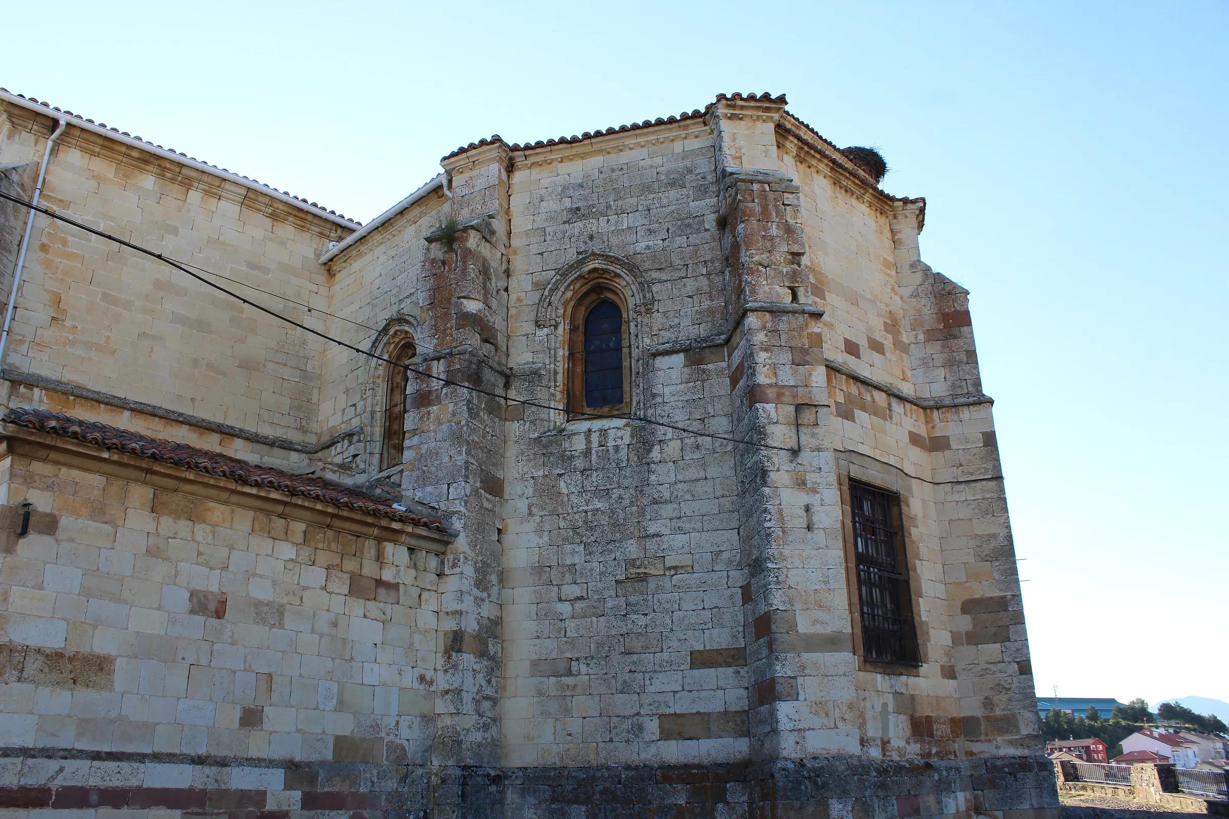
Mountains & valleysCervera de PisuergaA town on the river Pisuerga and the gateway to the Montaña Palentina natural park, whose park house is here.
The park's mountains, where both the Carrión and the Pisuerga rise, reach over 2,500 metres on the borders of León and Cantabria.
Protection: Gateway to Montaña Palentina Natural Park
Sources: Spain.info · Wikipedia
Get to know Burgos
High plains and limestone gorges cut by the young Ebro.
Regional context: on the Camino Francés, east of the mountains that frame Cantabria.
- Burgos cathedral
- Atapuerca
Places
- Javier Perez Montes / Wikimedia Commons, CC BY-SA 4.0Read more
Towns & cultureBurgosIts Gothic cathedral is listed by UNESCO; nearby, the Atapuerca hills hold early human remains.
Sources: Wikipedia (es): Catedral de Burgos · Wikipedia (es): Sierra de Atapuerca
- Luis Rogelio HM / Wikimedia Commons, CC BY-SA 2.0Read more
Towns & cultureCastrojerizCastrojeriz lies at the foot of a hill crowned by its castle, beside the River Odra, on the French Way of the Camino de Santiago. It is a typical example of Camino town planning: the pilgrims' route is its long main street, which has earned it the nickname "ciudad larga".
Protection: Bien de Interés Cultural (Conjunto Histórico): declared a Conjunto Histórico-Artístico by Decree 3709/1974 of 20 December 1974; the declaration was brought into the Conjunto Histórico category by Agreement 14/2011 of 17 February 2011
- The castle on the hill above the town, where Queen Leonor of Castile was murdered in 1359 on the orders of her nephew, Peter I.
- The ruins of the convent of San Antón, whose Antonine friars cared for pilgrims suffering from "St Anthony's fire"; only the arch that formed a tunnel, through which pilgrims passed, still stands.
- The church of San Juan with its cloister, and the collegiate church of the Virgen del Manzano.
Sources: Decreto 3709/1974 (BOE-A-1975-2192) – Boletín Oficial del Estado · Acuerdo 14/2011 (BOE-A-2011-4944) – Boletín Oficial del Estado · Castrojeriz – Turismo de Castilla y León (Junta de Castilla y León) · Castrojeriz – Wikipedia (en) · Castrojeriz – Wikipedia (es) · Wikidata Q255845 · OpenStreetMap node 492407708
- Read more
Towns & cultureCovarrubiasCovarrubias stands on the banks of the River Arlanza, in the Arlanza district of Burgos. In the 10th century Count Fernán González of Castile and his son García Fernández made it the capital of the Infantazgo de Covarrubias, which is why it is known as "the cradle of Castile".
Protection: Bien de Interés Cultural (Conjunto Histórico): the whole town was declared a Conjunto Histórico-Artístico by Decree 3261/1965 of 28 October 1965
- The Torreón de Fernán González, a 10th-century defensive tower regarded as Mozarabic work.
- The former collegiate church of San Cosme y San Damián, from the 15th century, with a 16th-century cloister and a parish museum; Princess Kristina of Norway, who married Infante Felipe of Castile, is buried there.
- The Archivo del Adelantamiento de Castilla, a 16th-century Herrerian building put up by order of Philip II to keep the records of the Adelantamiento.
Sources: Decreto 3261/1965 (BOE-A-1965-20517) – Boletín Oficial del Estado · Covarrubias – Wikipedia (es) · Covarrubias, Spain – Wikipedia (en) · Covarrubias – Turismo de Castilla y León (Junta de Castilla y León) · Wikidata Q1109944 · OpenStreetMap node 266900605
- TurismoRuralArlanza / Wikimedia Commons, CC BY-SA 4.0Read more
Towns & cultureLermaLerma stands on a hill above the River Arlanza. Its great period came under Philip III, through the Duke of Lerma, the king's favourite, who built its important 17th-century monuments.
Protection: Bien de Interés Cultural (Conjunto Histórico): declared a Conjunto Histórico-Artístico by Decree 1642/1965 of 3 June 1965
- The Ducal Palace, by Francisco de Mora and Fray Alberto de la Madre de Dios, takes up a whole side of the Plaza Mayor and is now a parador.
- The collegiate church of San Pedro, designed in 1613 by Fray Alberto de la Madre de Dios and consecrated in 1617, keeps a kneeling funerary statue in gilded bronze of Archbishop Cristóbal de Rojas by Juan de Arfe.
- The Arco de la Cárcel, the only one of the town's four medieval gateways still standing, now the seat of the Arlanza wine designation of origin.
Sources: Decreto 1642/1965 (BOE-A-1965-11793) – Boletín Oficial del Estado · Lerma (España) – Wikipedia (es) · Lerma – Turismo de Castilla y León (Junta de Castilla y León) · Lerma, Province of Burgos – Wikipedia (en) · Wikidata Q1614795 · OpenStreetMap node 266901451
- Jose Luis Filpo Cabana / Wikimedia Commons, CC BY 3.0Read more
Towns & cultureMonasterio de Santo Domingo de SilosA Benedictine abbey in the village of Santo Domingo de Silos, first documented in 954 as San Sebastián de Silos and later renamed after Abbot Domingo, who restored it from 1041. Its two-storey Romanesque cloister is considered one of the masterpieces of Spanish Romanesque art.
Protection: Bien de Interés Cultural (monument); declared a historic-artistic monument in 1931
- The lower cloister was built in two phases: the east and north walks in the second half of the 11th century, the west and south walks in the 12th, with capitals carved with biblical scenes, fabulous beasts and plants.
- The cypress in the cloister garden, planted in 1882, has become the emblem of the monastery.
- The monks won international fame for Gregorian chant with their album Chant, released in 1994.
Sources: Abadía de Silos – Historia · Abadía de Silos – El claustro románico de Silos · Monasterio de Santo Domingo de Silos – Wikipedia (es) · Abbey of Santo Domingo de Silos – Wikipedia (en) · Wikidata Q1340405 · OpenStreetMap relation 14168823
- Read more
Towns & cultureYacimientos de la Sierra de AtapuercaA group of cave and open-air sites in the karst hills of the Sierra de Atapuerca, east of Burgos, exposed when a cutting for a mining railway was dug through the hills at the end of the 19th century. Fossils and traces of five different human species have been found here, among them Homo antecessor, a species defined from remains about 850,000 years old.
The pin marks the excavation sites in the old railway cutting (Trinchera del Ferrocarril), by the Sima del Elefante. The sites can only be seen on guided visits booked in advance; CAYAC at Ibeas de Juarros is the meeting point named by the Museum of Human Evolution, so check the departure point when booking.
Protection: UNESCO World Heritage Site since 2000 (inscribed as "Archaeological Site of Atapuerca"); Bien de Interés Cultural as a Zona Arqueológica (1991); Espacio Cultural of Castile and León (2007)
- The Sima de los Huesos, almost 30 metres underground, has yielded more than 6,500 human remains of pre-Neanderthals about 400,000 years old.
- A face fragment of about 1.2 million years from the Sima del Elefante is the oldest human fossil found in a cave in Western Europe so far.
- Systematic excavations have run since 1978, and the research team returns to the sites every summer.
Sources: Fundación Atapuerca – Los yacimientos de la sierra de Atapuerca · Fundación Atapuerca – Qué visitar(in Spanish) · Museo de la Evolución Humana – Yacimientos · Museo de la Evolución Humana – CAYAC · Museo de la Evolución Humana – home · Turismo Castilla y León – Atapuerca · Archaeological site of Atapuerca – Wikipedia (en) · Sitio arqueológico de Atapuerca – Wikipedia (es) · Wikidata Q923894 · OpenStreetMap node 2404519769
Every place on the map
The same provinces and places, as a list.
AsturiasPrincipality of Asturias (a single-province autonomous community) · 420 places
A green strip between the Cantabrian Mountains and the sea, where Tierra Luma hopes to grow.
- ArriondasTown
- Cangas de OnísTown
- InfiestoTown
- LlanesTown
- PiloñaMunicipality
- RibadesellaTown
- BulnesVillage
- CovadongaLandmark
- Cubos de la MemoriaLandmark
- Lagos de CovadongaLake
- Naranjo de Bulnes (Picu Urriellu)Mountain
- Parque Natural de PongaProtected area
- Picu PienzuMountain
- Puente Romano de Cangas de OnísLandmark
- Ruta del CaresRoute
- SotresVillage
- Bosque de PeloñoForest
- Bufones de PríaCoast
- Cueva de Tito BustilloCave
- Cueva del PindalCave
- Cueva del Queso de CabralesMuseum
- Mirador del FituViewpoint
- Museo del Jurásico de Asturias (MUJA)Museum
- Playa de Cuevas del MarBeach
- Playa de GulpiyuriBeach
- Playa de San AntolínBeach
- Playa de Santa MarinaBeach
- Playa de TorimbiaBeach
- Gijón / XixónCity
- OviedoCity
- Picos de EuropaProtected area
- AvilésCity
- Cangas del NarceaTown
- MieresTown
- MuniellosForest
- RedesProtected area
- Santa María del NarancoLandmark
- Senda del OsoRoute
- SomiedoProtected area
- Acuario de GijónMuseum
- Alcornocal de BoxoProtected area
- Alto del GamoniteiroMountain
- Arenas de CabralesVillage
- Banzáu de La ḤocicaLake
- Cabo de PeñasCape
- Cabo VidioCape
- Campa TorresLandmark
- Casa de les RadiosMuseum
- Castillo de GauzónLandmark
- Castillo de Las CaldasLandmark
- Castillo de SotoLandmark
- Castillo de TudelaLandmark
- Castro de CoañaLandmark
- Catedral de San Salvador de OviedoLandmark
- Centro NiemeyerMuseum
- Ciudadela de Celestino SolarMuseum
- CudilleroTown
- Cueva de CondeLandmark
- Cuevas de la LlueraLandmark
- Desfiladero de Los BeyosGorge
- Ecomuseo la PonteMuseum
- Embalase de San Andrés de los TaconesLake
- Embalse de ArbónLake
- Embalse de DoirasLake
- Embalse de La FloridaLake
- Embalse de SalimeLake
- Embalse de TrasonaLake
- Entrepeñes y Playa de VegaBeach
- Faro de Cabo VidioCape
- Faro de CandásCape
- Faro de CudilleroCape
- Faro de LastresCape
- Faro de LlanesCape
- Faro de LuarcaCape
- Faro de RibadesellaCape
- Faro de Tapia de CasariegoCape
- Faro de TazonesCape
- Faro de TorresCape
- Fundación Archivo de Indianos - Museo de la EmigraciónMuseum
- Lago del ValleLake
- Lago ErcinaLake
- Lagos de SalienciaLake
- Las Praderas de NavaMountain
- LastresTown
- LuarcaTown
- Monasterio de San SalvadorLandmark
- MonsacroMountain
- Monte AusevaMountain
- Monte DevaMountain
- Museo Alfercam (Avilés)Museum
- Museo BarjolaMuseum
- Museo de CovadongaMuseum
- Museo de la Historia Urbana de AvilésMuseum
- Museo de la Semana Santa (Villaviciosa)Museum
- Museo de la Siderurgia de AsturiasMuseum
- Museo de la Sidra de AsturiasMuseum
- Museo del Oro de Asturias MOAMuseum
- Museo Evaristo ValleMuseum
- Museo Nicanor PiñoleMuseum
- Museo Prerrománico de San Martín de SalasMuseum
- NaviaTown
- Olla de San VicenteRiver
- Palacio de OmañaMuseum
- Parque de la Prehistoria de TevergaMuseum
- Parque nacional de Picos de EuropaProtected area
- Parque natural de las Fuentes del Narcea, Degaña e IbiasProtected area
- Parque natural de Las Ubiñas - La MesaProtected area
- Pena QueimadaMountain
- Peña RuedaMountain
- Pico TurbinaMountain
- Playa Arenal de MorísBeach
- Playa de AndrínBeach
- Playa de ArnaoBeach
- Playa de BahínasBeach
- Playa de BallotaBeach
- Playa de BallotaBeach
- Playa de BañuguesBeach
- Playa de BarayoBeach
- Playa de BorizuBeach
- Playa de CadavedoBeach
- Playa de CarniciegaBeach
- Playa de CarranquesBeach
- Playa de CazoneraBeach
- Playa de CobijeroBeach
- Playa de CuevaBeach
- Playa de El CuernoBeach
- Playa de El DiqueBeach
- Playa de El EscanuBeach
- Playa de El MurallónBeach
- Playa de El RegueroBeach
- Playa de El TranqueroBeach
- Playa de EspañaBeach
- Playa de FabalBeach
- Playa de Foxos o BarraBeach
- Playa de FrejulfeBeach
- Playa de GuadamíaBeach
- Playa de L’AirínBeach
- Playa de La AtalayaBeach
- Playa de La CabañaBeach
- Playa de La Concha (Artedo)Beach
- Playa de La GueirúaBeach
- Playa de la ÑoraBeach
- Playa de La Ribera del MolínBeach
- Playa de La VallinaBeach
- Playa de los QuebrantosBeach
- Playa de LuancoBeach
- Playa de MexotaBeach
- Playa de MisiegoBeach
- Playa de MuniellesBeach
- Playa de OrtigueraBeach
- Playa de OturBeach
- Playa de PantorgaBeach
- Playa de PenarrondaBeach
- Playa de PeñarrubiaBeach
- Playa de PonienteBeach
- Playa de PooBeach
- Playa de PorcíaBeach
- Playa de Puerto ChicoBeach
- Playa de RebolleresBeach
- Playa de RepresasBeach
- Playa de SalenciaBeach
- Playa de SalinasBeach
- Playa de San Pedro de La RiberaBeach
- Playa de Santa María del Mar (Castrillón)Beach
- Playa de SerantesBeach
- Playa de ToróBeach
- Playa de VerdicioBeach
- Playa de VillanuevaBeach
- Playa de ViodoBeach
- Playa de XagóBeach
- Playa de XiloBeach
- Playa del ArbeyalBeach
- Playa del Moro (Asturias)Beach
- Playa del Silencio (El Gavieiru)Beach
- Playa La Huelga y Playa de la CanalinaBeach
- Playas de Berbes, Vega y La SierraBeach
- Playas de Entremares y de BuelnaBeach
- Playas de Los Campizales y El CarreiroBeach
- Playas de Xan-Xún y Las LlanasBeach
- Playas de Xivares, Peña María y AboñoBeach
- Reserva de la Biosfera Río Eo, Oscos y Tierras de BurónProtected area
- Ría de VillaviciosaRiver
- Ruta del AlbaRoute
- Santa Cueva de CovadongaCave
- Santo FirmeMountain
- Sierra de CueraMountain
- Sierra del SueveMountain range
- Tapia de CasariegoTown
- TaramundiVillage
- TazonesVillage
- Torre de Santa María (Picos de Europa)Mountain
- Turbera de Las DueñasProtected area
- Valle del HuernaValley
- Valle del NalónValley
- Vega de ArioViewpoint
- VillaviciosaTown
- Yacimiento arqueológico de CimadevillaLandmark
CantabriaCantabria (a single-province autonomous community) · 219 places
The eastern neighbour, sharing the Picos de Europa across the Deva valley.
- SantanderCity
- AltamiraLandmark
- Costa QuebradaCoast
- Desfiladero de La HermidaGorge
- Fuente DéLandmark
- Monasterio de Santo Toribio de LiébanaLandmark
- PotesTown
- TorrelavegaCity
- AilaBeach
- Alto del CinchoMountain
- Bárcena MayorVillage
- Bolera de los MorosLandmark
- Cabo de AjoCape
- Cabo QuejoCape
- Casona de TudancaMuseum
- Castillo de ArgüesoLandmark
- Castillo de CorbaneraLandmark
- Castillo de El CollaoLandmark
- Castillo de San Vicente de la BarqueraMuseum
- Castillo de Santa Ana (Castro Urdiales)Landmark
- Castillo de VispieresLandmark
- Castro de El CinchoLandmark
- Castro de Las RabasLandmark
- Castros del monte DobraLandmark
- Centro BotínMuseum
- CerríasBeach
- Colegiata de Santa JulianaLandmark
- Collado de la Fuente del ChivoMountain
- ComillasTown
- Complejo kárstico del monte de La GarmaLandmark
- Cueto CordelMountain
- Cueva de CullalveraLandmark
- Cueva de El CastilloCave
- Cueva de El PendoLandmark
- Cueva de El SoplaoCave
- Cueva del MirónLandmark
- DícidoBeach
- El SardineroBeach
- Embalse de La CohillaLake
- Embalse de Los Corrales de BuelnaLake
- Embalse del EbroLake
- Faro de AjoCape
- Faro de Cabo MayorCape
- Faro de MouroCape
- Faro de Punta del Torco de AfueraCape
- Faro de Punta SillaCape
- Faro del CaballoCape
- Faro del Castillo de Santa AnaCape
- Faro del PescadorCape
- Faro SantanderMuseum
- IjánMountain
- La AtalayaMountain
- La MarucaBeach
- La Rasa de la InagotableMountain
- La RiberucaBeach
- La SalvéBeach
- LaredoTown
- Los Caballos / UmbredaBeach
- Monasterio de San Sebastián de HanoLandmark
- Monasterio de SuesaLandmark
- Montaña orientalProtected area
- Monte BucieroMountain
- Monte DobraMountain
- Monte HijedoForest
- Morra de LechugalesMountain
- Museo de Arte Moderno y Contemporáneo de Santander y CantabriaMuseum
- Museo de la Naturaleza de CantabriaMuseum
- Museo de las Amas de Cría PasiegasMuseum
- Naves de GamazoMuseum
- Palacio de ElsedoMuseum
- Parque natural Collados del AsónProtected area
- Parque natural de las Marismas de Santoña, Victoria y JoyelProtected area
- Parque Natural de OyambreProtected area
- Parque Natural Saja-BesayaProtected area
- Peña BrezMountain
- Peña CabargaMountain
- Peña RemoñaMountain
- Peña ViejaMountain
- Peñacastillo (montaña)Mountain
- Pico de la PadiornaMountain
- Pico JanoMountain
- Pico SamelarMountain
- Picos de BusampiroMountain
- Playa de ArenillasBeach
- Playa de BarnejoBeach
- Playa de CanallaveBeach
- Playa de CovachosBeach
- Playa de El CamelloBeach
- Playa de El TostaderoBeach
- Playa de la ArenaBeach
- Playa de la ArníaBeach
- Playa de la FuenteBeach
- Playa de La MagdalenaBeach
- Playa de la Virgen del MarBeach
- Playa de LangreBeach
- Playa de Los BarcosBeach
- Playa de los PeligrosBeach
- Playa de LuañaBeach
- Playa de MataleñasBeach
- Playa de Merón (San Vicente de la Barquera)Beach
- Playa de MogroBeach
- Playa de RisBeach
- Playa de San Juan de la CanalBeach
- Playa de Santa JustaBeach
- Playa de SomocuevasBeach
- Playa de TregandínBeach
- Playa de ValdearenasBeach
- Playa del PedreruBeach
- Playa del RegatónBeach
- Playa del Sable (Val de San Vicente)Beach
- PortioBeach
- Pozón de la DoloresLake
- San Vicente de la BarqueraTown
- Santillana del MarTown
- SantoñaTown
- Secuoyas del Monte CabezónProtected area
- Sierra de Peña SagraMountain
- Sierra del EscudoProtected area
- Sierra del Escudo de CabuérnigaProtected area
- Torre de los Horcados RojosMountain
- Valle de IguñaValley
- Valle de LuenaValley
- Valle del MieraValley
- Valle del NansaValley
- Valle del SajaValley
- Yacimiento arqueológico de Camesa-RebolledoLandmark
- Yacimiento arqueológico del cementerio de MaliañoLandmark
- Yacimientos de La Espina del Gallego, Cildá, El Cantón y Campo de Las CercasLandmark
- Zona arqueológica de Santa María de HitoLandmark
LugoGalicia · 124 places
The western neighbour, across the Eo estuary.
- LugoCity
- Os Ancares lucensesMountain range
- Praia das CatedraisBeach
- SarriaTown
- Serra do CourelMountain range
- Serra do XistralMountain range
- VilalbaTown
- A MarrondaProtected area
- Ancares - CourelProtected area
- As CatedraisProtected area
- Basílica de San Martín de MondoñedoLandmark
- Castelo de NaviaLandmark
- Castillo da FrouxeiraLandmark
- Castillo de AndradeLandmark
- Castillo de CaldalobaLandmark
- Castillo de CastroverdeLandmark
- Castillo de DoirasLandmark
- Castillo de FerreiraLandmark
- Castillo de O CastrodouroLandmark
- Castillo de PambreLandmark
- Castillo de TorésLandmark
- Castro CandazLandmark
- Castro de FazouroLandmark
- Castro de ViladongaLandmark
- Cova do Rei CintoloCave
- Cueva de las ChovasCave
- Cueva EirósCave
- Devesa da RogueiraForest
- Ecomuseo de ArxerizMuseum
- Embalse de Los PearesLake
- Embalse de MontefuradoLake
- Embalse de SequeirosLake
- Encoro de Pé de ViñaLake
- Faro de Punta AtalayaCape
- Faro de Punta RoncadoiraCape
- Fervenza do EscouridalWaterfall
- Fortaleza de SarriaLandmark
- FozTown
- Iglesia de Santa MarinaLandmark
- Laguna de CospeitoLake
- MaderotecaMuseum
- Monasterio de la Concepción (Vivero)Landmark
- Monasterio de los PicosLandmark
- Monasterio de Nuestra Señora de ValdefloresLandmark
- Monasterio de San Julián de SamosLandmark
- MondoñedoTown
- Monte CorneiraMountain
- Monte FareloMountain
- Monte MontefuradoMountain
- Mosteiro de San Cibrao de MontecubeiroLandmark
- Mosteiro de San Salvador de Ferreira de PantónLandmark
- Mosteiro de Santo Estevo de AtánLandmark
- Muralla romana de LugoLandmark
- Museo de Nosa Señora da AntigaMuseum
- Museo del Ferrocarril de GaliciaMuseum
- Museo Interactivo de la Historia de LugoMuseum
- Museo Provincial de LugoMuseum
- O CebreiroVillage
- Parga - Ladra - TámogaProtected area
- PiornedoVillage
- Praia de Arealonga, BarreirosBeach
- Ria de Foz - MasmaProtected area
- RibadeoTown
- RinloVillage
- Río CabeProtected area
- Río OuroProtected area
- Ruta da antiga vía do ferrocarril Viloudriz - RibadeoRoute
- Sala de exposiciones Porta MiñáMuseum
- Salto do CoroWaterfall
- Seimeira de VilagocendeWaterfall
- Sierra de MeiraMountain
- Sierra del FaroMountain
- Souto da RetortaForest
- Termas romanas de Lucus AugustiLandmark
- Valle de LemosValley
- ViveiroTown
- Xacemento de ProendosLandmark
LeónCastilla y León · 142 places
Over the mountains to the south, where the rivers turn towards the Duero.
- LeónCity
- AstorgaTown
- Las MédulasLandmark
- Parque Regional Montaña de Riaño y MampodreProtected area
- PonferradaCity
- SahagúnTown
- Villafranca del BierzoTown
- Abadía de San Andrés de EspinaredaLandmark
- AquianaMountain
- Archivo Gráfico de la Era PopMuseum
- As MédulasLandmark
- BabiaValley
- Cabeza de la YeguaMountain
- Caín de ValdeónVillage
- Castillo de AviadosLandmark
- Castillo de BalboaLandmark
- Castillo de BenalLandmark
- Castillo de CeaLandmark
- Castillo de CornatelLandmark
- Castillo de CorullónLandmark
- Castillo de Grajal de CamposLandmark
- Castillo de Laguna de NegrillosLandmark
- Castillo de los TemplariosLandmark
- Castillo de Palacios de la ValduernaLandmark
- Castillo de SarracínLandmark
- Castillo de Valencia de Don JuanLandmark
- Castillo de Villanueva de JamuzLandmark
- Castillo de VillapadiernaLandmark
- Castillo-palacio de los Marqueses de VillafrancaLandmark
- Castro de ChanoLandmark
- Castro de la Peña del Hombre o de Coba de MouraLandmark
- Castro VentosaLandmark
- Catedral de LeónLandmark
- Convento de San MarcosLandmark
- Cueto RosalesMountain
- Cueva de ValporqueroCave
- Embalse de BárcenaLake
- Embalse de Barrios de LunaLake
- Embalse de CampañanaLake
- Embalse de CasaresLake
- Embalse de Las RozasLake
- Embalse de VillamecaLake
- Embalse del PormaLake
- FunterínMountain
- Hoces de VegacerveraGorge
- Iglesia martirial de Marialba de la RiberaLandmark
- La CamperonaMountain
- Lago AusenteLake
- Laguna de las VerdesLake
- LanciaLandmark
- LlagarinoMountain
- Macizo del MampodreMountain range
- Mojón de Tres ProvinciasMountain
- Monasterio de San BenitoLandmark
- Monasterio de San Miguel de EscaladaLandmark
- Monasterio de San Pedro de EslonzaLandmark
- Monasterio de San Pedro de las DueñasLandmark
- Monasterio de San Pedro de MontesLandmark
- Monasterio de Santa María de CarbajalLandmark
- Monasterio de Santa María de TrianosLandmark
- Montes AquilianosMountain range
- Montes de LeónMountain range
- Museo de Arte Contemporáneo de Castilla y LeónMuseum
- Museo de la Arriería MaragataMuseum
- Museo de la EnergíaMuseum
- Museo de la Fauna salvajeMuseum
- Museo de las Alhajas en la Vía de la PlataMuseum
- Museo de los Pueblos LeonesesMuseum
- Museo Romano de AstorgaMuseum
- Museo Sierra PambleyMuseum
- Peña TenMountain
- Peñalba de SantiagoVillage
- Pico CuiñaMountain
- Pico de los CabronesMountain
- Pico GilboMountain
- Pico ToneoMountain
- Pico TuertoMountain
- Pico YordasMountain
- Posada de ValdeónVillage
- Priorato de San Guillermo de PeñacoradaLandmark
- Real Colegiata de San IsidoroLandmark
- RiañoVillage
- Sierra de la Cabrera (León y Zamora)Mountain range
- TambarónMountain
- TelenoMountain
- Torre del LlambriónMountain
- Torre SantaMountain
- Valle de FornelaValley
- Valle de RiosolValley
- Valle de SajambreValley
A CoruñaGalicia · 198 places
Galicia's Atlantic corner: Santiago de Compostela and the open ocean.
- A CoruñaCity
- Santiago de CompostelaCity
- CedeiraTown
- FerrolCity
- NoiaTown
- PontedeumeTown
- Torre de HérculesLandmark
- A AmeixidaBeach
- A Casa do MelMuseum
- A FrouxeiraBeach
- A Pena FuradaLandmark
- Acantilados de LoibaMountain
- Acantilados de Vixía de HerbeiraMountain range
- BaldaioBeach
- BetanzosTown
- Betanzos-MandeoProtected area
- Cabo FisterraCape
- Cabo OrtegalCape
- Cabo VillanoCape
- CapeladaMountain
- Castelo da LúaLandmark
- Castelo de EirísLandmark
- Castelo do Pico SacroLandmark
- Castillo de La PalmaLandmark
- Castillo de la Rocha ForteLandmark
- Castillo de MesíaLandmark
- Castillo de MoecheLandmark
- Castillo de NaraíoLandmark
- Castillo de NogueirosaLandmark
- Castillo de San FelipeLandmark
- Castillo de Santa CruzLandmark
- Castillo de VimianzoLandmark
- Castillo del CardenalLandmark
- Castillo del PríncipeLandmark
- Castriño de ConxoLandmark
- Castro de A CidáLandmark
- Castro de BaroñaLandmark
- Castro de BorneiroLandmark
- Castro de ElviñaLandmark
- Castro de Porto de BaixoLandmark
- Castro de Punta NeixónLandmark
- Castro dos PradosLandmark
- Catedral de Santiago de CompostelaLandmark
- Colección Fernando Blanco de LemaMuseum
- Convento de San Francisco del Valle de DiosLandmark
- Costa ÁrtabraProtected area
- Costa da MorteCoast
- Costa de DexoProtected area
- Embalse de PortodemourosLake
- Embalse de Santa UxíaLake
- Encoro da RibeiraLake
- Encoro das ForcadasLake
- Encoro de Abegondo - CecebreProtected area
- Estaca de BaresCape
- Esteiro do TambreProtected area
- Faro de Cabo CorrubedoCape
- Faro de cabo VillanoCape
- Faro de Estaca de BaresCape
- Faro de las islas SisargasCape
- Faro de OzaCape
- Faro de Punta CandelariaCape
- Faro de Punta InsuaCape
- Faro de Punta LaxeCape
- Faro de Punta NarigaCape
- Fervenza das HortasWaterfall
- Fervenza de EntrecrucesWaterfall
- Fervenza do BelelleWaterfall
- Fervenza do ÉzaroWaterfall
- Fragas do EumeProtected area
- Iglesia de Nosa Señora das AreasLandmark
- Iglesia de San FructuosoLandmark
- Iglesia de San Martín de NoyaLandmark
- Iglesia de Santa María a Nova de NoiaLandmark
- Iglesia del Antiguo Monasterio de San Salvador de CinesLandmark
- Iglesia del Carmen de AbaixoLandmark
- Igrexa de San Mamede de CarnotaLandmark
- Igrexa de San Xián de BastavalesLandmark
- Igrexa de San Xoán de BarcalaLandmark
- Igrexa de Santa María de DodroLandmark
- IroiteMountain
- Laguna y arenal de ValdoviñoProtected area
- LangosteiraBeach
- Monasterio de San Martín de JubiaLandmark
- Monasterio de Santa CatalinaLandmark
- Monasterio de Santa María de MezonzoLandmark
- Monte do GozoMountain
- Monte e lagoa de LouroProtected area
- Monte EnxameadoMountain
- Monte PedrosoMountain
- Monte PindoMountain
- Monte XaloMountain
- Montes de BoceloMountain
- Mosteiro de San Pedro de SoandresLandmark
- Museo Catedralicio de Santiago de CompostelaMuseum
- Museo Centro GaiásMuseum
- Museo das MariñasMuseum
- Museo de Automoción e HistoriaMuseum
- Museo Estrella GaliciaMuseum
- Museo Galego de Arte Contemporánea 'Carlos Maside'Museum
- Museo GranellMuseum
- Museo Pedagóxico de Galicia (Mupega)Museum
- Museo Provincial de Bellas ArtesMuseum
- MuxíaTown
- NiñónsBeach
- O Enredo do AbelleiroMuseum
- O Monte de San PedroMountain
- Ortigueira - MeraProtected area
- PantínBeach
- Parque natural de las Dunas de Corrubedo y Lagunas de Carregal y VixánProtected area
- Penedos de Pasarela e TrabaProtected area
- Pico SacroMountain
- Playa de AdormiderasBeach
- Playa de DoniñosBeach
- Playa de Esteiro (Mañón)Beach
- Playa de MorouzosBeach
- Playa de O PicónBeach
- Playa de OzaBeach
- Ponte NafonsoLandmark
- Praia da AguieiraBeach
- Praia da ArnelaBeach
- Praia das FurnasBeach
- Praia de CoiraBeach
- Praia de FonforrónBeach
- Praia de LumebóBeach
- Praia de OrbeiroBeach
- Praia de PonzosBeach
- Praia de QueirugaBeach
- Praia de RebordeloBeach
- Praia de VerBeach
- Praia do SonBeach
- Praia dos CristaisBeach
- Puente de A Ponte MaceiraLandmark
- Puente de PontecesuresLandmark
- RazoBeach
- Rio SieiraBeach
- Río TambreProtected area
- San Antonio de EspasanteBeach
- San RoqueBeach
- Serra do CareónMountain
- Sistema fluvial Ulla-DezaProtected area
- Torre de la PenelaLandmark
- Torres de MensLandmark
- TremuzoMountain
- Villa romana de CambreMuseum
- Xubia - CastroProtected area
OurenseGalicia · 113 places
Inland Galicia of hot springs and river canyons.
- OurenseCity
- Canón do SilGorge
- CelanovaTown
- O Barco de ValdeorrasTown
- RibadaviaTown
- VerínTown
- AllarizTown
- Aquis OriginisLandmark
- Aquis QuerquennisLandmark
- As BurgasHot springs
- Baixa Limia–Serra do XurésProtected area
- Basílica de la Asunción de Augas SantasLandmark
- Bidueiral de MontederramoProtected area
- Capilla y necrópolis de San Victor de BarxacovaLandmark
- Castillo da PeroxaLandmark
- Castillo de Castro CaldelasLandmark
- Castillo de MonterreyLandmark
- Castillo de RibadaviaLandmark
- Castillo de SandianesLandmark
- Castillo de VillamarínLandmark
- Castro de SantoméLandmark
- Catedral de OurenseLandmark
- Colegiata de Santa MaríaLandmark
- Covas e adegas de SeadurCave
- Embalse de BaoLake
- Embalse de CachamuíñaLake
- Embalse de Santa BadiaLake
- Embalse de SantiagoLake
- Embalse de VelleLake
- Iglesia de Cristo ReyLandmark
- Iglesia de la Asunción de Nuestra SeñoraLandmark
- Iglesia de la InmaculadaLandmark
- Iglesia de la MilagrosaLandmark
- Iglesia de la Santísima TrinidadLandmark
- Iglesia de la Vera Cruz de O CarballiñoLandmark
- Iglesia de María AuxiliadoraLandmark
- Iglesia de San Andrés de ProenteLandmark
- Iglesia de San BernabéLandmark
- Iglesia de San EstebanLandmark
- Iglesia de San FranciscoLandmark
- Iglesia de San JoséLandmark
- Iglesia de San Julián de AsturesesLandmark
- Iglesia de San LázaroLandmark
- Iglesia de San MiguelLandmark
- Iglesia de San Pedro de La MezquitaLandmark
- Iglesia de San Pío XLandmark
- Iglesia de San XoánLandmark
- Iglesia de Santa AnaLandmark
- Iglesia de Santa CombaLandmark
- Iglesia de Santa Eufemia del CentroLandmark
- Iglesia de Santa Eufemia la Real del Norte - Santo DomingoLandmark
- Iglesia de Santa LucíaLandmark
- Iglesia de Santa MaríaLandmark
- Iglesia de Santa María de BearizLandmark
- Iglesia de Santa María la Real (Entrimo)Landmark
- Iglesia de Santa TeresitaLandmark
- Igrexa de San Martiño de ValongoLandmark
- Igrexa de San Salvador de ManínLandmark
- Igrexa de San Salvador de SanguñedoLandmark
- Igrexa de San Tomé de Maside o NovoLandmark
- Igrexa de San Tomé de SerantesLandmark
- Igrexa de San Xoán de SadurnínLandmark
- Igrexa de Santa María de GomarizLandmark
- Macizo CentralProtected area
- Mina de ValborrazLandmark
- Monasterio de San Paio de AbeledaLandmark
- Monasterio de Santa María (Junquera de Espadañedo)Landmark
- Monte PenagacheMountain
- Monte San TrocadoMountain
- Museo da Emigración a Guinea EcuatorialMuseum
- Museo Galego do EntroidoMuseum
- O TeixadalForest
- Parada de SilVillage
- Parque Arqueolóxico da Cultura CastrexaMuseum
- Parque natural de InvernaderoProtected area
- Peña NegraMountain
- Peña TrevincaMountain
- Pena VeidosaProtected area
- Penedo dos Tres ReinosMountain
- Río TámegaProtected area
- Sierra del EjeMountain
- Torre de PenaLandmark
- Valle del río NaveaProtected area
PalenciaCastilla y León · 73 places
Romanesque churches and the Montaña Palentina in the north.
- PalenciaCity
- Aguilar de CampooTown
- Carrión de los CondesTown
- Paredes de NavaTown
- Parque Natural Montaña PalentinaProtected area
- Cañón de la HoradadaLandmark
- Castillo de Aguilar de CampooLandmark
- Castillo de AmpudiaLandmark
- Castillo de AstudilloLandmark
- Castillo de Belmonte de CamposLandmark
- Castillo de Castrillo de VillavegaLandmark
- Castillo de los Condes de SaldañaLandmark
- Castillo de los EnríquezLandmark
- Castillo de Monzón de CamposLandmark
- Castillo de PalenzuelaLandmark
- Castillo de SarmientoLandmark
- Castillo de TorremormojónLandmark
- Castro de La LomaLandmark
- Catedral de PalenciaLandmark
- Cervera de PisuergaTown
- Convento de San PabloLandmark
- Cueva de los FrancesesCave
- Cueva del CobreCave
- CuravacasMountain
- Dolmen de la VelillaLandmark
- Embalse de AguilarLake
- Embalse de CamporredondoLake
- Embalse de CerveraLake
- EspigüeteMountain
- Fuentes CarrionasMountain range
- Iglesia de San Martín de ToursLandmark
- Iglesia de San Pedro (Cisneros)Museum
- Iglesia de Santa María (Becerril de Campos)Museum
- Laguna de la Nava de FuentesLake
- Laguna de PedrazaLake
- Las TuercesProtected area
- Monasterio de la ConsolaciónLandmark
- Monasterio de San Isidro de DueñasLandmark
- Monasterio de San Pelayo de CerratoLandmark
- Monasterio de San Salvador de Nogal de las HuertasLandmark
- Monasterio de San ZoiloLandmark
- Monasterio de Santa ClaraLandmark
- Monasterio de Santa Clara (Carrión de los Condes)Landmark
- Monasterio de Santa Cruz de RibasLandmark
- Monasterio de Santa María de MaveLandmark
- Monasterio de Santa María la Real (Aguilar de Campoo)Landmark
- Monte BernorioMountain
- Museo de Arte ContemporáneoMuseum
- Museo de PalenciaMuseum
- Museo del Agua, PalenciaMuseum
- Oppidum de Monte BernorioLandmark
- Peña LabraMountain
- Pico MurciaMountain
- ValdecebollasMountain
- Valle de CampooValley
- Villa Romana La OlmedaLandmark
BurgosCastilla y León · 103 places
A Gothic cathedral and some of Europe's oldest human remains.
- BurgosCity
- CastrojerizVillage
- CovarrubiasVillage
- LermaTown
- Monasterio de Santo Domingo de SilosLandmark
- Yacimientos de la Sierra de AtapuercaLandmark
- AmayaLandmark
- Casa fuerte de los RojasLandmark
- Cascada de Pedrosa de TobalinaWaterfall
- Castillo de BurgosLandmark
- Castillo de CastrovidoLandmark
- Castillo de Coruña del CondeLandmark
- Castillo de FríasLandmark
- Castillo de Lara de los InfantesLandmark
- Castillo de los RojasLandmark
- Castillo de los VelascoLandmark
- Castillo de Mazuelo de MuñóLandmark
- Castillo de Monasterio de RodillaLandmark
- Castillo de Olmillos de SasamónLandmark
- Castillo de Peñaranda de DueroLandmark
- Castillo de Santa Gadea del CidLandmark
- Castillo de SotopalaciosLandmark
- Castillo de VirtusLandmark
- Catedral de BurgosLandmark
- CluniaLandmark
- Cruz de MotricoMountain
- Desfiladero de La YeclaGorge
- Desfiladero de PancorboGorge
- Dolmen de La CabañaLandmark
- Embalse de CastrovidoLake
- Embalse de ÚzquizaLake
- Embalse del ArlanzónLake
- Embalse del OrdunteLake
- Ermita y Necrópolis de San NicolásLandmark
- Espacio Natural de la Sierra de la DemandaMountain range
- FríasTown
- Gran DolinaLandmark
- Monasterio de la Visitación de Santa MaríaLandmark
- Monasterio de Nuestra Señora de FresdelvalLandmark
- Monasterio de Nuestra Señora de los VallesLandmark
- Monasterio de San AntónLandmark
- Monasterio de San Juan de OrtegaLandmark
- Monasterio de Santa ClaraLandmark
- Monasterio de Santa María de La VidLandmark
- Monasterio de Santo DomingoLandmark
- Monasterio del EspinoLandmark
- Museo de DinosauriosMuseum
- Museo de la Evolución HumanaMuseum
- Museo de los Condestables de CastillaMuseum
- Museo del Bonsái (Villagonzalo Pedernales)Museum
- Museo del Libro Fadrique de BasileaMuseum
- Museo del RetabloMuseum
- Museo Marceliano Santa MaríaMuseum
- Ojo GuareñaCave
- Orbaneja del CastilloVillage
- Parque natural de Hoces del Alto Ebro y RudrónProtected area
- Parque natural de Montes Obarenes-San ZadornilProtected area
- Pico San MillánMountain
- Pozo AzulRiver
- Pozo NegroLake
- Presa de AlbaLake
- Termas romanas de Clunia SulpiciaLandmark
- Territorio ArtlanzaMuseum
- Valle de ValdivielsoValley
- Villa romana de Baños de ValdearadosLandmark
- Yacimiento arqueológico de CuyacabrasLandmark
- Yacimiento de RevengaLandmark