
Ponga
Parque Natural de Ponga
A mountain municipality given over to forest
- Hiking & walking
- Cycling
- Canyoning
- Horse riding
- Wildlife watching
- Mountains & valleys
- Towns & culture
- Forests & nature parks
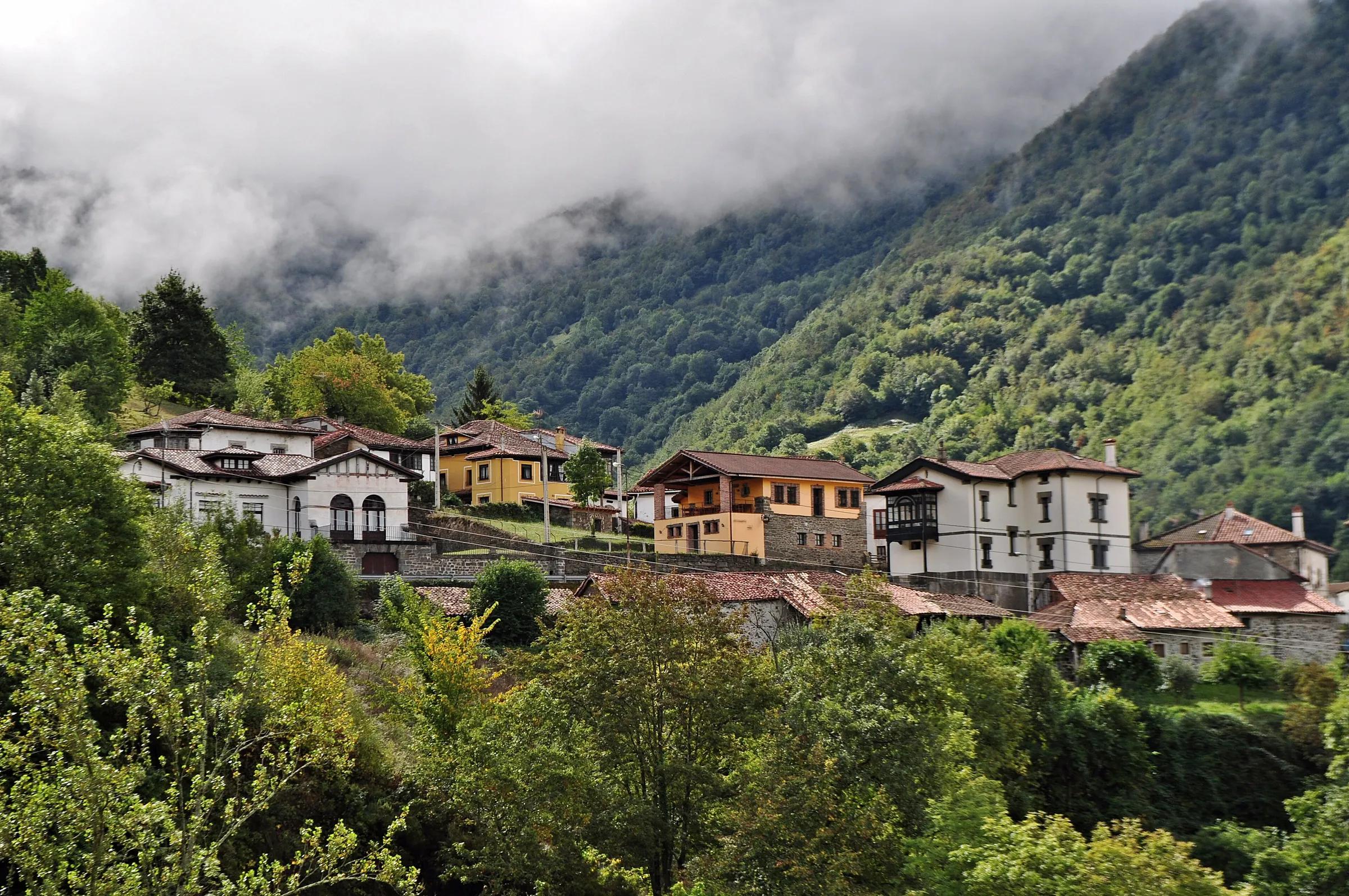
Wamba Wambez / Wikimedia Commons, CC BY-SA 3.0
Ponga Natural Park takes in the entire municipality of Ponga, in the eastern Cantabrian Mountains, and since 2018 the same territory has been a UNESCO Biosphere Reserve. Peña Ten, at 2,142 m, stands on its southern edge, while the Ponga river cuts north through a chain of gorges and the Sella carves the Beyos gorge along its eastern side. More than a third of the land is forest, and the villages, led by San Juan de Beleño, are small and few.
Why go
- Mountain Asturias at its quietest, a whole municipality given over to forest, pasture and peaks.
- Two dramatic river gorges, the Beyos on the Sella and the narrows of the Ponga.
- Viewpoints and mountain routes for every level, from Les Bedules and Taranes to the summit of Tiatordos.
- Living village culture, from wood crafts in Beleño to the masked Guirria on New Year's Day.
Travel, stay and experience
Getting around, where to stay and what to experience around Parque Natural de Ponga, from the guide's own records.
Getting around
- Aeropuerto de León (LEN) · 78 km in a straight line
- Estación de autobuses de Cangas de Onís · 18 km in a straight line
Where to stay
16 registered places to stay within 10 km (straight line). Nearest:
- Los Belenos · 1 km in a straight line
- Apartamentos Rurales Casa Severa · 2 km in a straight line
- Hotel rural El Quintanal · 4 km in a straight line
Mapped by volunteers on OpenStreetMap; nothing is booked here.
Things to experience
Straight-line distances, not travel times. Tierra Luma shows no availability or prices and takes no bookings.
What to do here
Villages
Start in San Juan de Beleño
The park's reception and interpretation centre is in the capital, with an exhibition on the forest as an ecosystem and information on routes and viewpoints. The village also has an ecomuseum devoted to wood.
Mountains
Taranes and Les Bedules viewpoints
Turismo Asturias singles out these two viewpoints for reading the park's layout of valleys, woods and ridges without a long walk.
Hiking
Foz de la Escalada and Tiatordos
A demanding mountain route from Taranes threads the Foz de la Escalada gorge and climbs Tiatordos, one of the peaks of the Cordal de Ponga. It is for experienced walkers in settled weather.
Rivers
The Beyos gorge
On the park's eastern edge the Sella has cut the Beyos gorge on its way north towards Amieva, a deep limestone passage followed by the N-625.
Food & culture
El Guirria on 1 January
In San Juan de Beleño the year opens with the Fiesta de El Guirria y del Aguinaldo, declared of tourist interest in Asturias: a masked figure roams the village escorted by riders, chasing and kissing the women.
Leave room for discovery
Ideas, not instructions: take what suits your day.
- Food and a break
- There is no town close by in our records: bring food and water for the day, and take your rubbish home.
- If you have time
- Watch how the light moves across the slopes.
- Look for signs of wildlife (tracks, feathers, birdsong) without disturbing it.
Routes from here
Activities here
- Wildlife · With a guideBirdwatching at the Lakes of Covadonga and in PongaLakes of Covadonga (Picos de Europa), the Beyos gorge (Ponga) and the River Sella; departures from Cangas de Onís.
- Canyoning · With a guideCanyoning in eastern AsturiasCanyons in the east of Asturias, for example the Vallegón and Carangas in Ponga and the Viboli in Amieva, reached through the Desfiladero de los Beyos.
- Horse riding · With a guideHorse riding in Ponga and Los OscosAreas listed for the company include the Ponga Natural Park and Los Oscos.
- Road cycling · On your own · ChallengingRoad cycling in Ponga: Sellaño, Beleño and Les BedulesSellañu – Sobrefoz – San Juan de Beleño – Les Bedules, Ponga Natural Park.
- Activity · With a guideZiplines and the 'Bridge of the Clouds' at Vidosa, Los BeyosVidosa, Desfiladero de Los Beyos, Ponga (Ponga Natural Park).
Things to do nearby
Activities whose place lies within 25 km in a straight line (not a road distance).
- Via ferrata · 7 km awayVidosa via ferrata, Los Beyos gorgeVidosa, in the Desfiladero de los Beyos, municipality of Ponga (eastern Asturias); the operator's departures are from Arriondas.
- Mountain biking · 11 km awayMountain biking in Redes: the Brañagallones loopBezanes, Caso, in the Redes Natural Park.
- Food · 15 km awayQuesu Casín cheese fair in CasoCouncil of Caso, in the Redes Natural Park.
- Horse riding · 15 km awayHorse riding in the Redes Natural ParkRedes Natural Park, Caso and Sobrescobio.
- Skiing · 15 km awaySnowshoeing in the Redes Natural ParkRedes Natural Park, Caso and Sobrescobio (central-eastern Asturias).
- Wildlife · 15 km awayThe red deer rut (berrea) in Aller and RedesAller (central Asturias) and the Redes Natural Park (Sobrescobio and Caso).
About this place
Protected as: Parque Natural de Ponga (Ley 4/2003, de 24 de marzo) and Reserva de la Biosfera de Ponga (UNESCO, 25 July 2018); also a ZEPA and the ZEC Ponga-Amieva (Natura 2000).
Landscape and rock
Ponga is mountain country from edge to edge. Peña Ten, at 2,142 m the park's highest point, closes it to the south, and the Cordal de Ponga, with Maciéndome, Tiatordos and Campigüeños, forms its western wall. Two rivers shape the interior: the Ponga runs south to north through a succession of gorges, while the Sella crosses the far east of the park and leaves behind the Beyos gorge as it heads into Amieva. Geologists place the whole territory in the Cantabrian Zone, within the unit known as the Ponga Nappe, and limestone narrows such as the Foz de la Escalada break up the slopes between village and summit.
Nature and wildlife
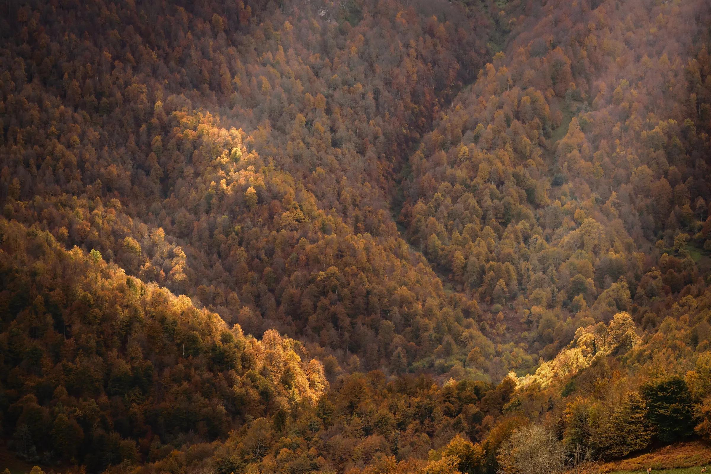
Forest is what sets Ponga apart: more than a third of the park is mature woodland, mostly beech with stands of sessile oak, concentrated in the upper basins of the Ponga and the Sella. The law that created the park names Valle Moro alongside Peloño as its outstanding woods. Those large, unbroken forests matter for two emblematic, endangered animals. The eastern population of the brown bear reaches the limit of its range here, and the extent of the woodland favours the Cantabrian capercaillie, one of the reasons the territory was recognised as a biosphere reserve.
History and culture
Ponga has always been a place of few people and many hillsides. Its villages keep the traditional building style of stone, timber and tile, and wood remains part of local identity, with an ecomuseum in San Juan de Beleño devoted to it. The calendar's best-known date is 1 January, when the Fiesta de El Guirria y del Aguinaldo fills the capital: a masked character, half sprite and half carnival figure, roams the streets escorted by riders, and neighbours feed the visiting aguinalderos. The festival is officially recognised as being of tourist interest in Asturias.
How to get there
Transport and visitor services nearby
- Centro de Visitantes Pedro Pidal (Lagos de Covadonga)Visitor centre · 18 km
- Oficina de turismo de Cangas de OnísTourist office · 18 km
- Estación de autobuses de Cangas de OnísBus station · 18 km
- Oficina de turismo de ParresTourist office · 22 km
- Estación de ArriondasTrain station · 22 km
- Oficina de turismo de OnísTourist office · 22 km
Straight-line distances, never travel times.
Plan your visit
- The AS-261 climbs from the Sella valley to San Juan de Beleño, the natural base for exploring the park.
- Visit the interpretation centre in Beleño first for current route conditions; check its opening days before you go.
- For the Peloño beech forest, the park's best-known walk, see its own page.
Accessibility
Narrow mountain roads link the villages. Viewpoints and the Beleño centre are easy to reach; the boardwalk at the Les Bedules viewpoint is adapted for reduced mobility. Most trails are rough mountain paths.
Visit with care
A biosphere reserve is meant to keep people and nature working together, and in Ponga that means a small, rural community living from the land. Drive the narrow roads slowly, park only where it does not block gates, tracks or village lanes, and close every gate behind you. In the forests, the capercaillie and the bear need quiet: keep to marked paths, keep dogs on a lead and avoid the woods at dawn and dusk in spring. Buy local, stay in the villages if you can, and ask at the Beleño centre before setting out on the high routes.
Local services nearby
- Cangas AventuraAdventure operator · 18 km
- Los Cauces AventuraAdventure operator · 22 km
- Frontera VerdeAdventure operator · 22 km
- Jaire AventuraAdventure operator · 22 km
Straight-line distances, never travel times.
Safety
- High routes such as Tiatordos are demanding: check the forecast, carry a map or track, and turn back if cloud comes down.
- Mobile coverage is patchy in the valleys; tell someone your plan before heading out.
Getting here & services nearby
The nearest published airport, stations and visitor centres, in a straight line from this place. Check routes and timetables with the operator.
- Aeropuerto de León (LEN)Airport · 78 kmView details
- Estación de autobuses de Cangas de OnísBus station · 18 kmView details
- Estación de ArriondasTrain station · 22 kmView details
- Estación de RibadesellaTrain station · 31 kmView details
- Centro de Visitantes Pedro Pidal (Lagos de Covadonga)Visitor centre · 18 kmView details
- Oficina de turismo de Cangas de OnísTourist office · 18 kmView details
- Cangas AventuraAdventure operator · 18 kmView details
- Los Cauces AventuraAdventure operator · 22 kmView details
Also in Ponga
Nearby
Within 30 km in a straight line. Distances are not travel times: valleys and mountain roads decide those.
More places nearby
- Pico PierzuMountain · Asturias · 5 kmExplore place
- TiatordosMountain · Asturias · 5 kmExplore place
- Desfiladero de Los BeyosGorge · Asturias · 7 kmExplore place
- Pico PileñesMountain · Asturias · 8 kmExplore place
- Peña TenMountain · León · 10 kmExplore place
- Banzáu de La ḤocicaLake · Asturias · 11 kmExplore place