
Picos de Europa · Cangas de Onís
Lagos de Covadonga
Two glacial lakes held in by what the ice left behind
- Hiking & walking
- Cycling
- Skiing & snowboarding
- Wildlife watching
- Mountains & valleys
- Rivers, lakes & waterfalls
- Forests & nature parks
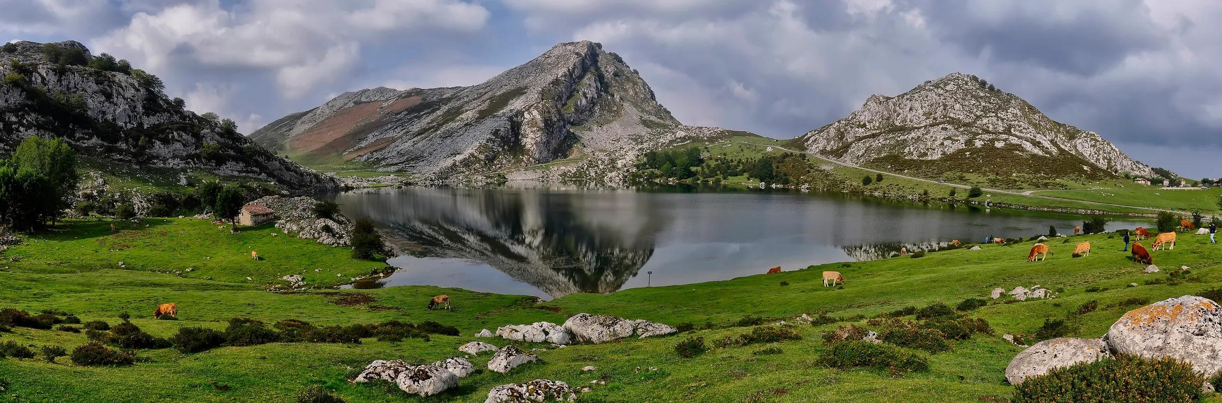
Pacodonderis / Wikimedia Commons, CC BY-SA 4.0
Lake Enol (about 1,070 m) and Lake Ercina (about 1,110 m) lie roughly a kilometre apart on a high limestone plateau. Cows graze the open pastures, and the road up from Covadonga is one of the best-known climbs in Spanish cycling.
Why go
- The easiest way into the high mountains of the national park.
- Short, family-friendly walks between the lakes.
Travel, stay and experience
Getting around, where to stay and what to experience around Lagos de Covadonga, from the guide's own records.
Getting around
- Aeropuerto de Asturias (OVD) · 90 km in a straight line
- Estación de autobuses de Cangas de Onís · 14 km in a straight line
Where to stay
78 registered places to stay within 10 km (straight line). Nearest:
- La Llastria · 4 km in a straight line
- La Terrentosa · 4 km in a straight line
- Apartamentos rurales Gamonedo · 4 km in a straight line
Mapped by volunteers on OpenStreetMap; nothing is booked here.
Things to experience
Straight-line distances, not travel times. Tierra Luma shows no availability or prices and takes no bookings.
What to do here
Hiking
Lakes circuit
A short marked circuit links Enol, Ercina and the old Buferrera mines area.
Cycling
Ride the climb
Cyclists are not affected by the motor-vehicle restrictions. The climb is long and steep, best left to experienced riders.
Wildlife
Watch for mountain wildlife
Griffon vultures circle overhead and chamois live on the higher slopes.
Leave room for discovery
Ideas, not instructions: take what suits your day.
- Food and a break
- For lunch, Caín de Valdeón is about 10 km away in a straight line: wander its streets and see what tempts you. Or bring a picnic and stay outdoors.
- If you have time
- Stop at a bend in the path and just listen.
- Bring binoculars, keep your distance and let the animals come into view.
Routes from here
Activities here
- Wildlife · With a guideBearded vultures in the Picos de EuropaPicos de Europa National Park (Onís and Cangas de Onís); the foundation's centre is in Benia de Onís.
- Wildlife · With a guideBirdwatching at the Lakes of Covadonga and in PongaLakes of Covadonga (Picos de Europa), the Beyos gorge (Ponga) and the River Sella; departures from Cangas de Onís.
- Road cycling · ChallengingRoad cycling: the climb to the Lagos de CovadongaThe climb starts at the roundabout leading to the Lagos road near the Basilica of Covadonga and ends at Lake Enol and Lake Ercina; the circular route starts and ends in Cangas de Onís.
- Skiing · With a guideSnowshoeing in the Picos de EuropaPicos de Europa National Park (Asturian side): Cangas de Onís, Onís, Cabrales, Lakes of Covadonga.
Things to do nearby
Activities whose place lies within 25 km in a straight line (not a road distance).
- Hiking · 1 km awayVega de Ario from the Lakes of CovadongaBuferrera/Lake Ercina car park, Lakes of Covadonga, Cangas de Onís (Picos de Europa National Park).
- Climbing · 2 km awayPeña Santa de Enol (Torre de Santa María)Western Massif (Cornión), Picos de Europa National Park; start at Pandecarmen, Lakes of Covadonga, Cangas de Onís.
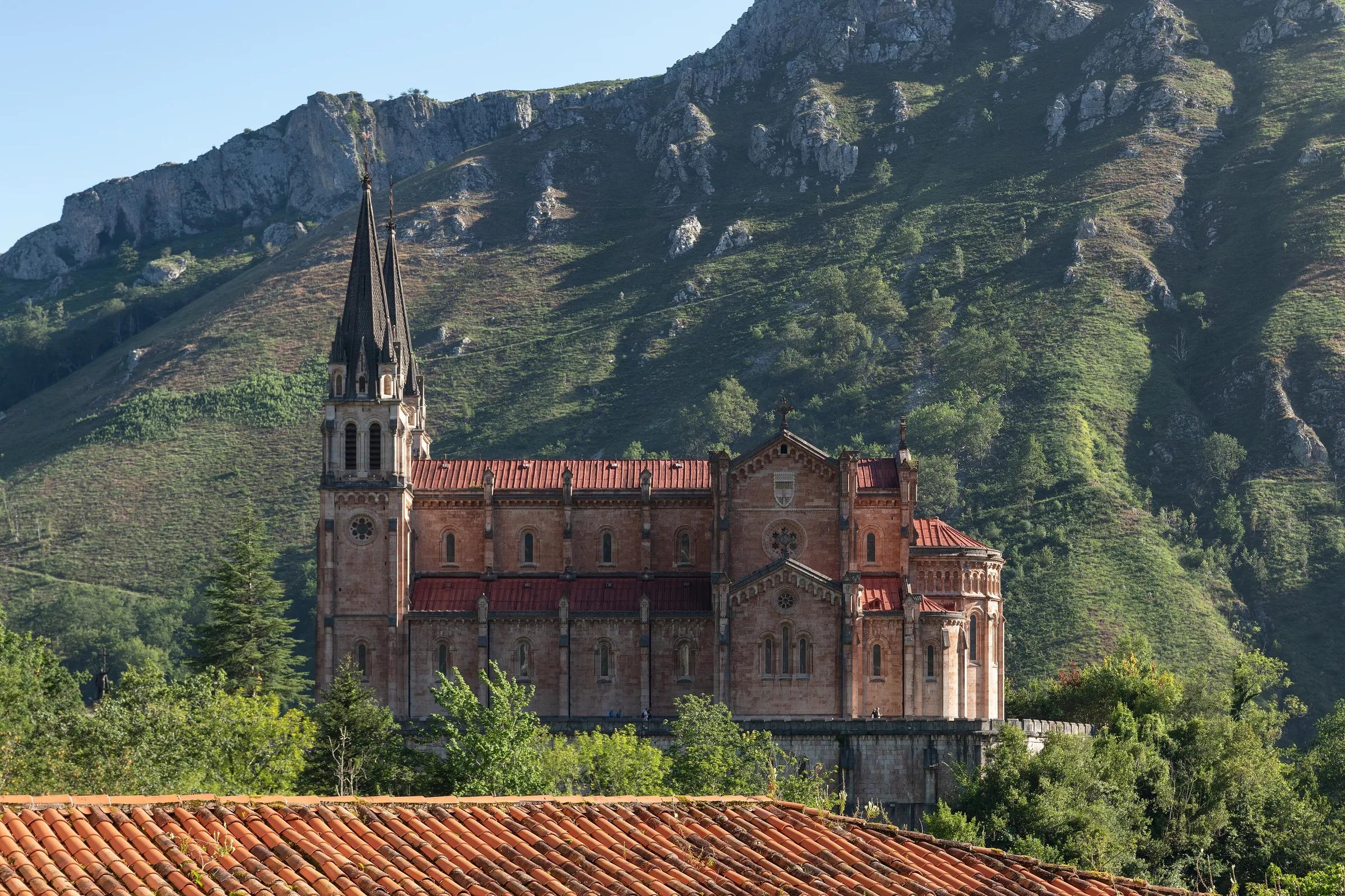
- Culture · 6 km awayCovadonga: the Santa Cueva and the basilicaCovadonga, Cangas de Onís, on the road up to the Lakes of Covadonga.
- Trail running · 7 km awayTravesera Integral Picos de EuropaPicos de Europa National Park, through Cangas de Onís, Onís and Cabrales; start at El Repelao (Covadonga), finish at Arenas de Cabrales.
- Via ferrata · 12 km awayVidosa via ferrata, Los Beyos gorgeVidosa, in the Desfiladero de los Beyos, municipality of Ponga (eastern Asturias); the operator's departures are from Arriondas.
- Activity · 12 km awayZiplines and the 'Bridge of the Clouds' at Vidosa, Los BeyosVidosa, Desfiladero de Los Beyos, Ponga (Ponga Natural Park).
Local services
Practical services
Listed for information. Tierra Luma has no commercial relationship with this business and takes no bookings.
About this place
Protected as: Parque Nacional de los Picos de Europa and Picos de Europa Biosphere Reserve (UNESCO, 2003); Lake Enol and Lake Ercina are also listed as Reservas Naturales Lacustres in Spain's national catalogue of hydrological reserves.
Landscape and rock
The lakes are a textbook piece of ice-age scenery. According to the Spanish Geological Survey (IGME), Enol and Ercina formed as the glaciers retreated at the end of the last glacial stage: ice scoured out the hollows, and the debris it left behind acted as a natural dam that holds the water in. The rock all around is the grey limestone that builds the Picos de Europa, laid down on an ancient sea floor some 300 million years ago and since shaped by ice and karst. A third lake, the Bricial, only fills during the spring thaw, and nearby Vega de Comeya is a karst depression that once held a lake of its own.
Nature and wildlife
Enol is a deep mountain lake with clear, alkaline, nutrient-poor water. Its official reserve record describes underwater meadows dominated by stoneworts (charophytes) and pondweeds (Potamogeton), with mint, rushes and horsetails along the shore. The smaller Ercina has an unusually rich mix of aquatic, amphibious and marshy plants for its size. Both lakes are rated in good ecological condition, but the same records note the main human pressures: livestock grazing on the surrounding pastures and the sheer number of visitors. For Ercina they also warn that sediment could slowly fill the basin.
History and culture
These mountains hold a special place in Spanish conservation: in 1918 the area around Covadonga became the country's first national park, today's Picos de Europa National Park. The lakes also carry an industrial past. On the circular walk you pass the old Buferrera mines, where iron and manganese were extracted until mining stopped in the 1970s; tunnels and installations have been restored so visitors can look around. Miners even built a retaining wall at Ercina to stop the lake draining to the west. The Pedro Pidal visitor centre, named after the promoter of Spain's national parks, sits at the start of the loop.
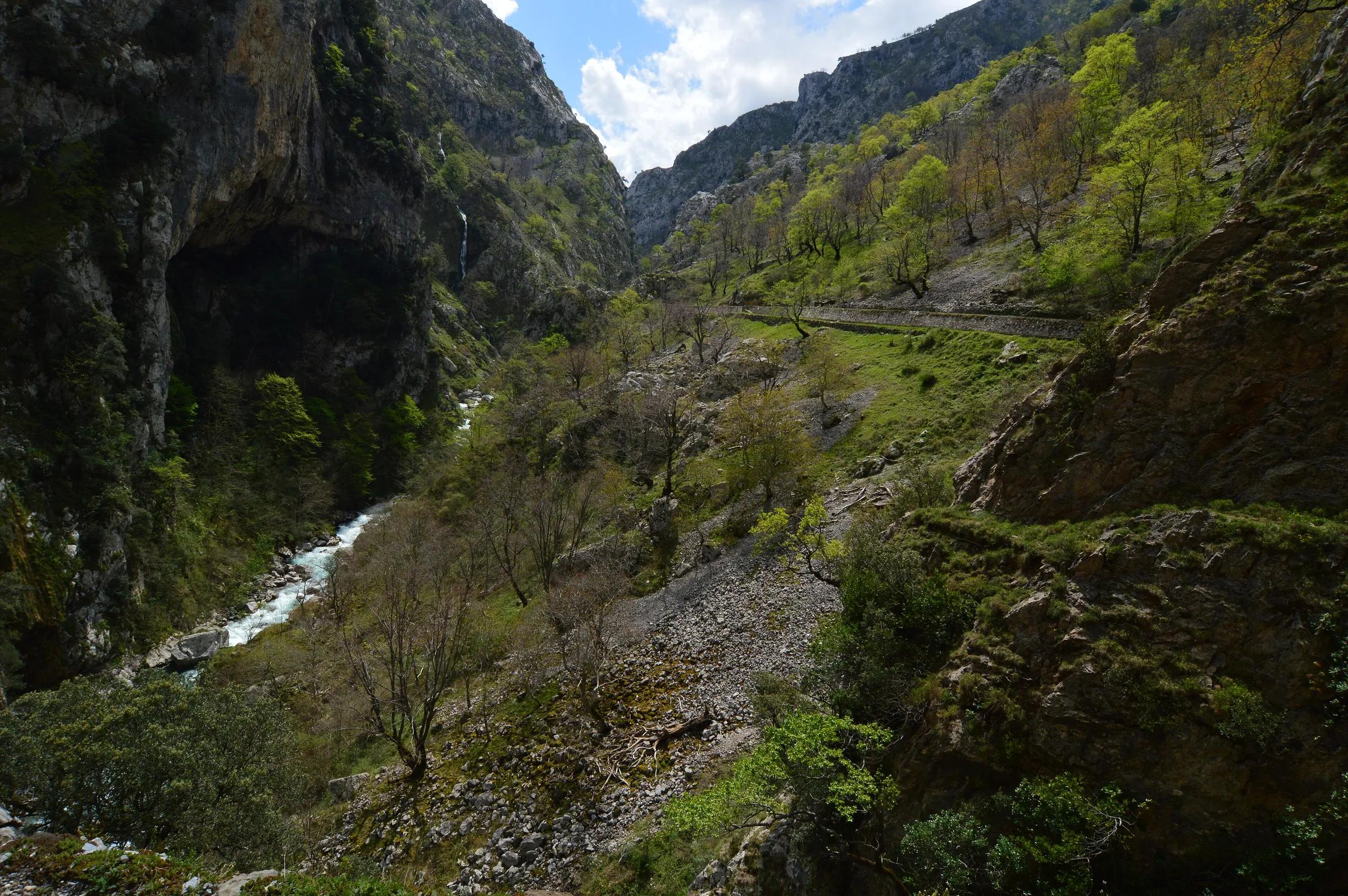
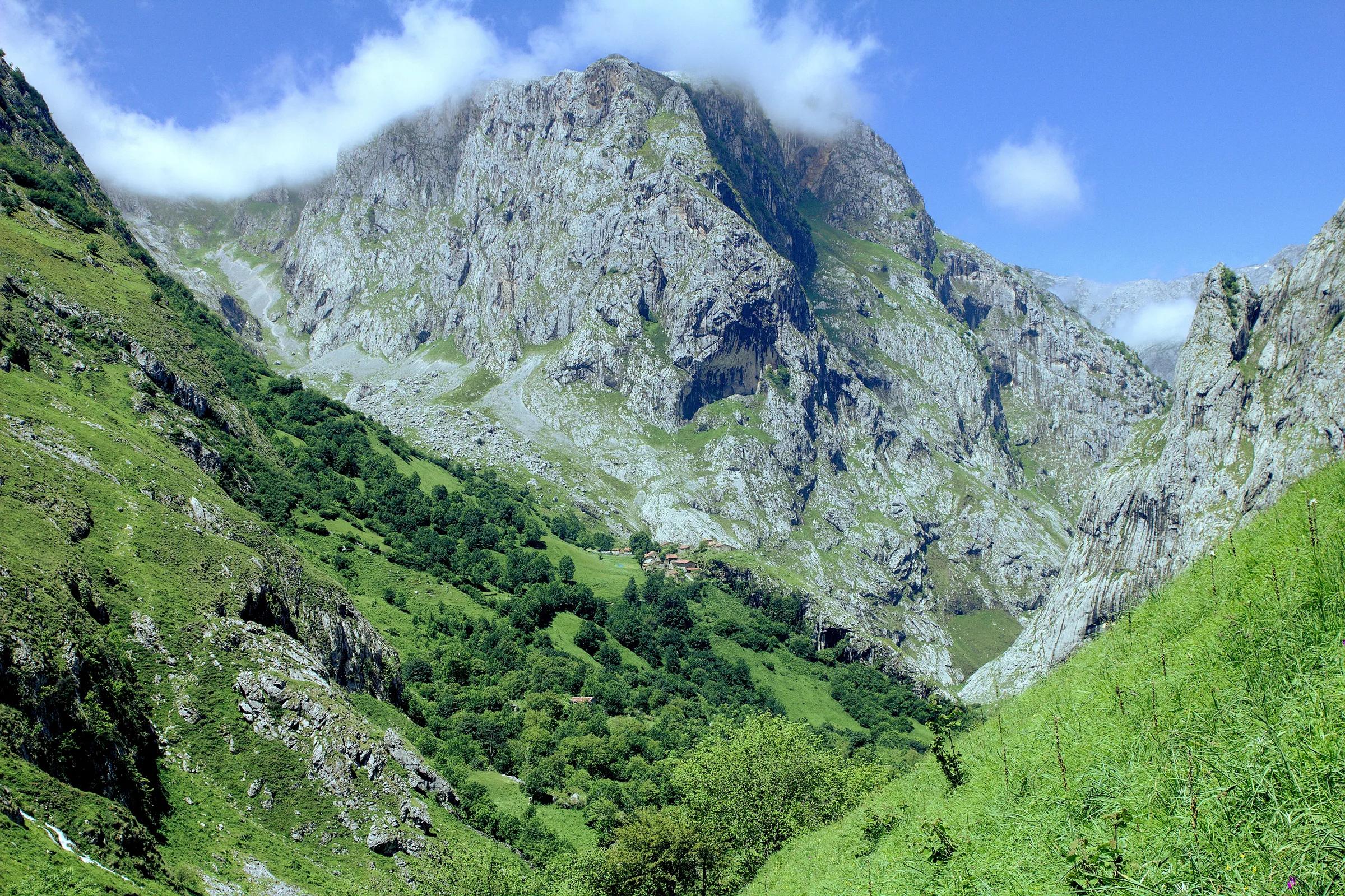
Gerardo Almeida / Wikimedia Commons, CC BY-SA 3.0 Pacodonderis / Wikimedia Commons, CC BY-SA 4.0 Pacodonderis / Wikimedia Commons, CC BY-SA 4.0
How to get there
Transport and visitor services nearby
- Centro de Visitantes Pedro Pidal (Lagos de Covadonga)Visitor centre · 1 km
- Oficina de turismo de OnísTourist office · 7 km
- Estación de autobuses de Cangas de OnísBus station · 14 km
- Oficina de turismo de Cangas de OnísTourist office · 14 km
- Oficina de turismo de CabralesTourist office · 14 km
- Oficina de turismo de ParresTourist office · 20 km
Straight-line distances, never travel times.
Plan your visit
- During regulated periods the road is closed to private cars and a park-and-ride bus runs from Cangas de Onís and Covadonga. In 2026, according to Turismo Asturias, that means late March to mid-April, the May weekends, 1 June to 18 October and several autumn and early-December dates. Check the official calendar before you travel.
Accessibility
Vehicles with an accredited reduced-mobility parking card may use the road during regulated periods (not motorhomes or vehicles over 5 m). Paths around the lakes are uneven.
Visit with care
The CO-4 road from Covadonga is the only way up by car, and to protect the lakes it is closed to private vehicles around the clock during the busiest periods, when a public bus service runs instead. Cyclists may still ride up, and people with a recognised disability can drive with their accreditation. Outside those dates the park can add extra controls if the road or car parks fill up, so check the current access plan on the official Asturias tourism site before you go. Inside the national park dogs must always be on a lead. Keep to the paths, give grazing cattle space and take all your litter home.
Local services nearby
- Cangas AventuraAdventure operator · 14 km
- Los Cauces AventuraAdventure operator · 20 km
- Frontera VerdeAdventure operator · 20 km
- Jaire AventuraAdventure operator · 20 km
- Canoas OrienteAdventure operator · 22 km
Straight-line distances, never travel times.
Safety
- Weather changes fast at altitude; carry a warm layer even in summer.
In the journal
Getting here & services nearby
The nearest published airport, stations and visitor centres, in a straight line from this place. Check routes and timetables with the operator.
- Aeropuerto de Asturias (OVD)Airport · 90 kmView details
- Estación de autobuses de Cangas de OnísBus station · 14 kmView details
- Estación de ArriondasTrain station · 20 kmView details
- Estación de RibadesellaTrain station · 21 kmView details
- Casa DagoVisitor centreView details
- Centro de Visitantes Pedro Pidal (Lagos de Covadonga)Visitor centre · 1 kmView details
- Oficina de turismo de OnísTourist office · 7 kmView details
- Cangas AventuraAdventure operator · 14 kmView details
Nearby
Within 30 km in a straight line. Distances are not travel times: valleys and mountain roads decide those.
More places nearby
- Lago ErcinaLake · Asturias · 1 kmExplore place
- Pico La JorcadaMountain · Asturias · 6 kmExplore place
- Vega de ArioViewpoint · Asturias · 6 kmExplore place
- Monte AusevaMountain · Asturias · 6 kmExplore place
- Museo de CovadongaMuseum · Asturias · 7 kmView details
- La VerdilluengaMountain · Asturias · 7 kmExplore place
Continue exploring
- All places in Asturias
- About Asturias
- Mountains & valleys
- Rivers, lakes & waterfalls
- Forests & nature parks
- Eastern Asturias Adventure
- Three days: Picos de Europa and the Sella