
Picos de Europa · Cabrales
Ruta del Cares
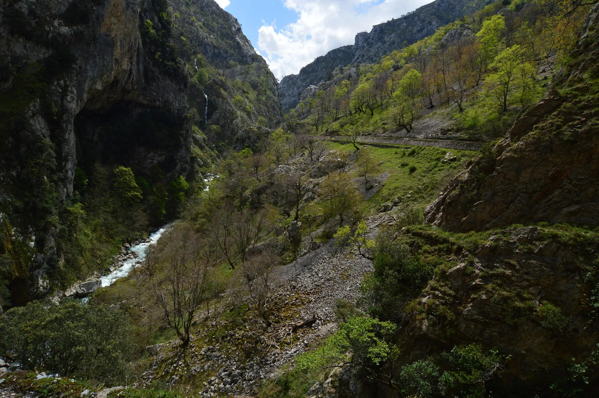
A path cut into the rock between two massifs
Javier Mendia García from leioa / Wikimedia Commons, CC BY 2.0
The Cares trail (official route PR-PNPE 3) follows a channel built for a hydroelectric scheme, high above the Cares river. It links Poncebos in Asturias with Caín in León through a deep limestone gorge. Most people walk in from one end and return the same way.
Why go
- One of the most spectacular walks in Spain.
- Mostly level after the initial climb from Poncebos.
Travel, stay and experience
Getting around, where to stay and what to experience around Ruta del Cares, from the guide's own records.
Getting around
- Aeropuerto Seve Ballesteros-Santander (SDR) · 84 km in a straight line
- Estación de Llanes · 19 km in a straight line
Where to stay
136 registered places to stay within 10 km (straight line). Nearest:
- Mirador de Cabrales · 1 km in a straight line
- Hotel Garganta del Cares · 1 km in a straight line
- Hostal Poncebos · 1 km in a straight line
Mapped by volunteers on OpenStreetMap; nothing is booked here.
Things to experience
Straight-line distances, not travel times. Tierra Luma shows no availability or prices and takes no bookings.
What to do here
Hiking
Walk the gorge
Poncebos to Caín is roughly 11–12 km each way. Many walkers turn back at any point; the first section from Poncebos climbs before levelling out.
Leave room for discovery
Ideas, not instructions: take what suits your day.
- Food and a break
- For lunch, Bulnes is about 3 km away in a straight line: wander its streets and see what tempts you. Or bring a picnic and stay outdoors.
- If you have time
- Stop at a bend in the path and just listen.
- Bring binoculars, keep your distance and let the animals come into view.
Routes from here
Things to do nearby
Activities whose place lies within 25 km in a straight line (not a road distance).
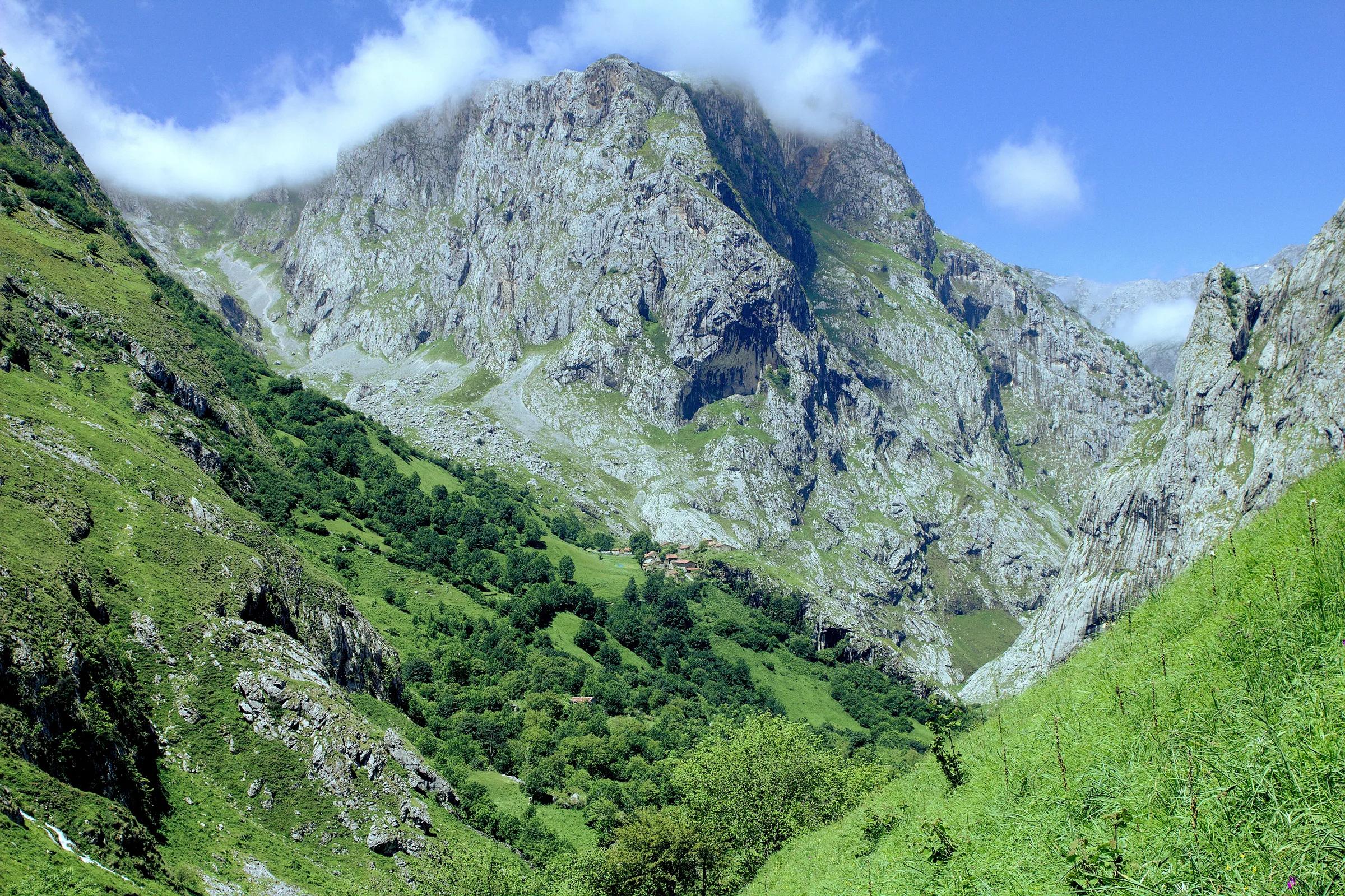
- Activity · 1 km awayBulnes: funicular or the Canal del Texu pathPoncebos (Cabrales), where the funicular and the Canal del Texu start, up to Bulnes.
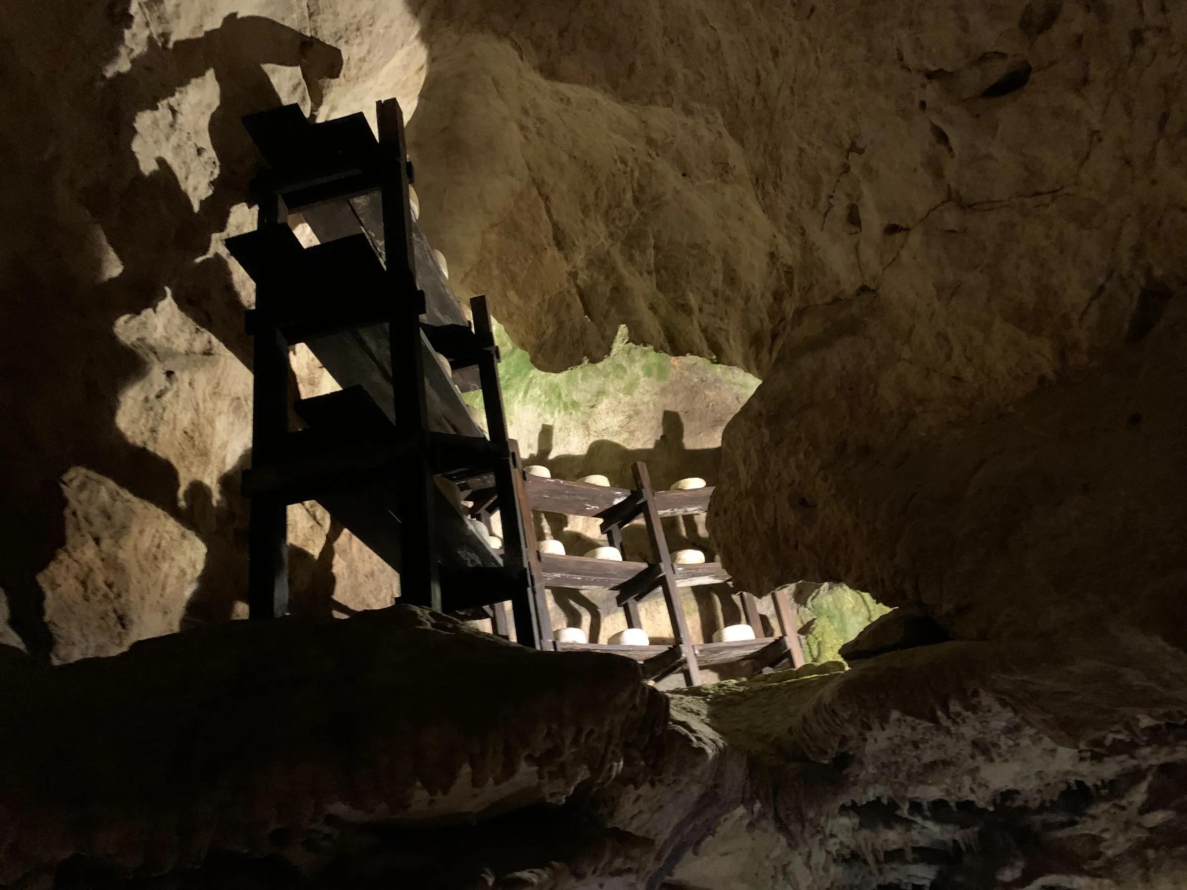
- Food · 5 km awayCabrales cheese cave, ArenasBarrio Cares, Arenas de Cabrales, on the way out towards Poncebos.
- Canyoning · 5 km awayFamily canyoning in the Buró canyon, CabralesBuró canyon, near Arenas de Cabrales (eastern Asturias).
- Climbing · 5 km awayTorrecerredo, the highest peak of the Picos de EuropaCentral Massif of the Picos de Europa National Park, Cabrales; start at the Pandébano col above Sotres.
- Climbing · 5 km awayAlpine climbing on Peña CastilCentral Massif, Picos de Europa National Park, Cabrales (La Terenosa hut).
- Skiing · 5 km awaySnowshoeing in the Picos de EuropaPicos de Europa National Park (Asturian side): Cangas de Onís, Onís, Cabrales, Lakes of Covadonga.
Local services
Outdoor & adventure
Practical services
Listed for information. Tierra Luma has no commercial relationship with this business and takes no bookings.
About this place
Protected as: Inside the Parque Nacional de los Picos de Europa, Spain's first national park, which is also a UNESCO Biosphere Reserve.
Landscape and rock
The Cares river does something remarkable here: it cuts straight through the Picos de Europa, opening a narrow gorge between the Western and Central massifs. On either side rise walls of grey limestone, and for long stretches the path is cut directly into the rock face, with the river far below. At Poncebos, the Asturian end of the walk, the Duje, born at the foot of the cliffs of Peña Vieja, joins the Cares. This is karst country, and the park itself notes that frost shattering, roots and passing animals can loosen rocks from the slopes at any time.
Nature and wildlife
The official park guide notes that the Cares route has important botanical as well as geological singularities. Keep an eye on the cliffs: the national park describes the griffon vulture as a bird of its rocky crags, and the chamois as the most characteristic mammal of the Picos, living among high rocks and pastures and coming down to the woods in winter. The park counts some sixty mammal species in all, with the wolf among its most emblematic. Sightings are never guaranteed, so treat any encounter as a gift and watch from a distance.
History and culture
The trail began as a working path. The electricity company Electra de Viesgo built a canal to carry water from Caín to a small hydroelectric power station at Camarmeña, near Poncebos, and a narrow, precarious track was opened so that workers could look after the channel. That service path was later improved and became the walk people know today. It is the best-known trail in the national park, often nicknamed the 'Garganta Divina', or Divine Gorge, for its spectacular scenery.
Javier Mendia García from leioa / Wikimedia Commons, CC BY 2.0
How to get there
Directions lead to the start: the Poncebos trailhead (Asturias side). The route itself is on foot only.
Transport and visitor services nearby
- Oficina de turismo de CabralesTourist office · 5 km
- Centro de Visitantes Pedro Pidal (Lagos de Covadonga)Visitor centre · 13 km
- Oficina de turismo de OnísTourist office · 15 km
- Estación de LlanesTrain station · 19 km
- Oficina de turismo de LlanesTourist office · 19 km
- Oficina de turismo de Peñamellera BajaTourist office · 21 km
Straight-line distances, never travel times.
Plan your visit
- The trail is managed by the Picos de Europa National Park. Check the official route page for conditions.
- When checked on 4 November 2026, the Picos de Europa National Park, which manages the route, said it has reopened along its whole length: after a metal walkway was placed where part of the path had sunk, it can again be walked in full in both directions between Poncebos and Caín. The park warns of falling stones along the whole route, more likely on and just after rainy or windy days. Check its notices before you go.
Accessibility
Not accessible for wheelchairs or pushchairs. Unfenced drops along much of the path.
Visit with care
Rockfalls happen here: after one injured two walkers, the park reopened the route but asked visitors to take extra care on the narrowest stretches, to avoid the trail in rain or strong wind, and to check its status before setting out. Long sections run beside a drop with no railing, and grazing animals above can knock stones down, so wear proper boots and carry enough water, since there is no drinking water on the way. Castilla y León's tourism office says dogs must be kept on a lead and that extendable leads are not allowed. Take all litter home and give livestock room to pass.
Safety
- Long unprotected drops: keep children close and stay on the inside of the path.
- Carry water and sun protection; there is little shade.
Getting here & services nearby
The nearest published airport, stations and visitor centres, in a straight line from this place. Check routes and timetables with the operator.
- Aeropuerto Seve Ballesteros-Santander (SDR)Airport · 84 kmView details
- Estación de LlanesTrain station · 19 kmView details
- Estación de autobuses de Cangas de OnísBus station · 26 kmView details
- Estación de UnqueraTrain station · 29 kmView details
- Punto de información Poncebos · Ruta del CaresVisitor centreView details
- Oficina de turismo de CabralesTourist office · 5 kmView details
- Centro de Visitantes Pedro Pidal (Lagos de Covadonga)Visitor centre · 13 kmView details
- Oficina de turismo de OnísTourist office · 15 kmView details
Nearby
Within 30 km in a straight line. Distances are not travel times: valleys and mountain roads decide those.
More places nearby
- Arenas de CabralesVillage · Asturias · 5 kmDiscover village
- Cabezo LlorososMountain · Asturias · 5 kmExplore place
- Parque nacional de Picos de EuropaProtected area · Asturias · 5 kmExplore nature park
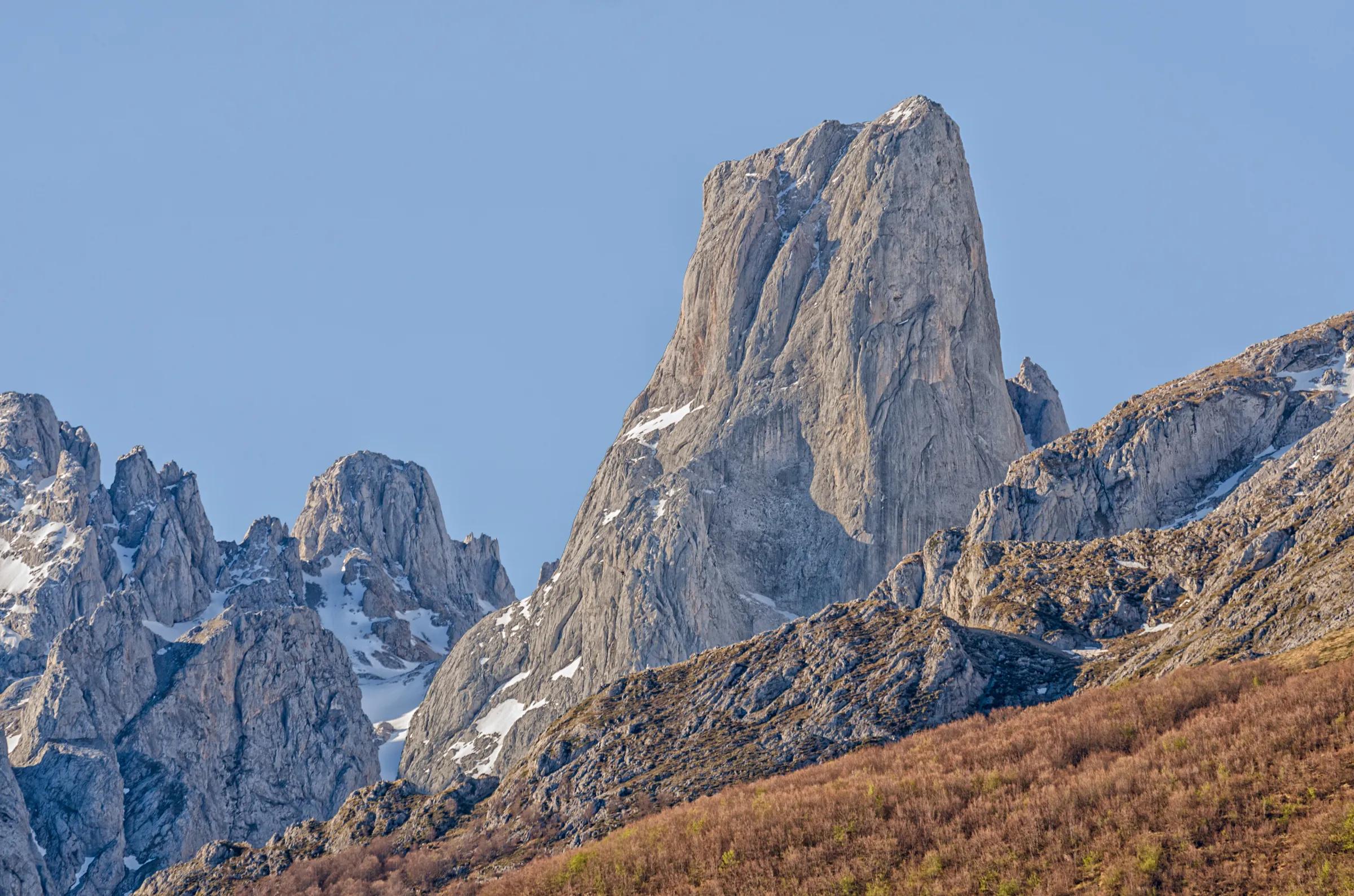
- Neverón de UrrielluMountain · Asturias · 6 kmExplore place
- Picos de EuropaProtected area · Asturias · 6 kmExplore nature park
- Pico de los CabronesMountain · León · 7 kmExplore place
Continue exploring
- All places in Asturias
- About Asturias
- Mountains & valleys
- Rivers, lakes & waterfalls
- Forests & nature parks
- Three days: Picos de Europa and the Sella