
Picos de Europa · Cabrales
Naranjo de Bulnes (Picu Urriellu)
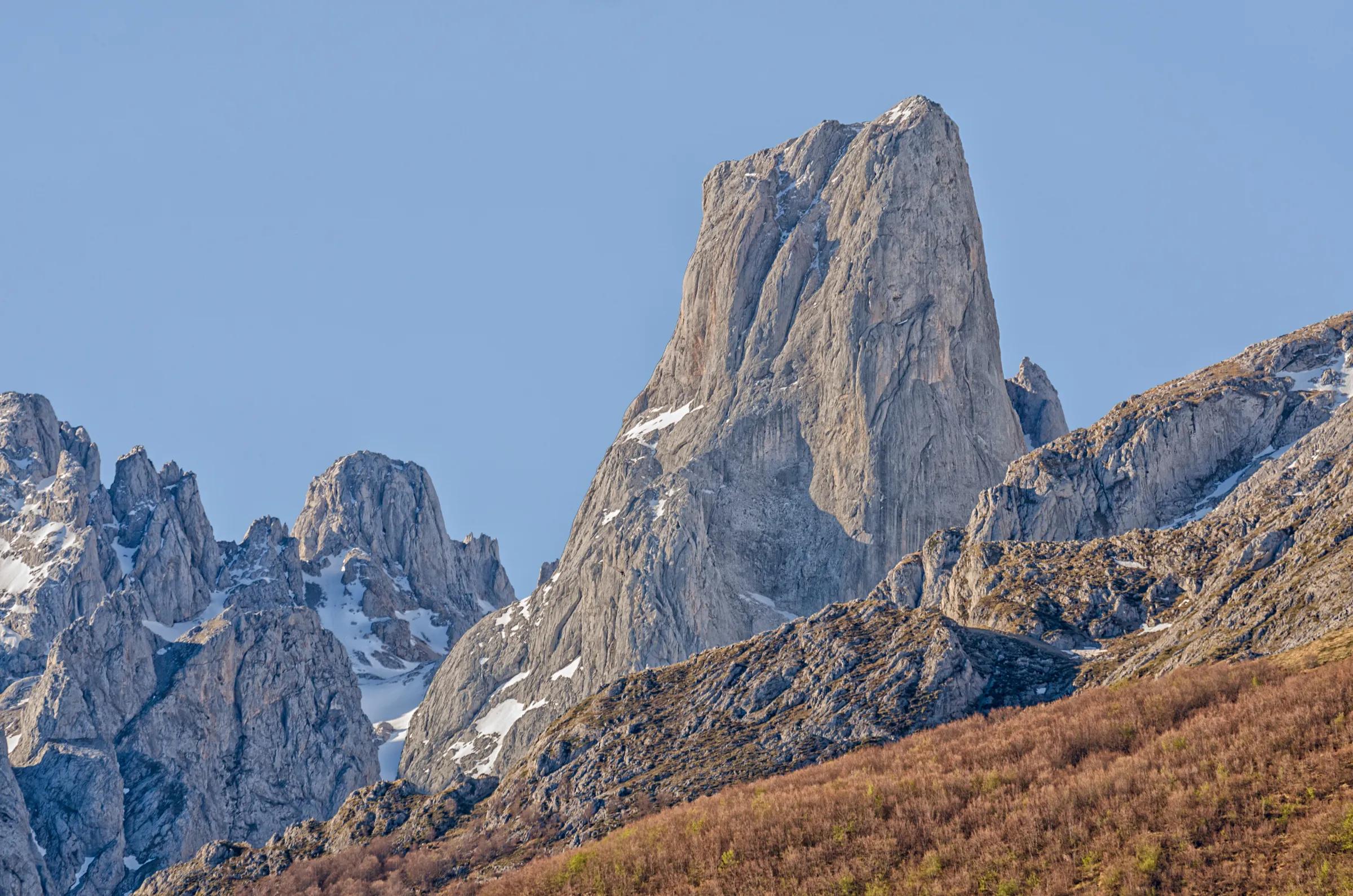
Picu Urriellu, the limestone tower of the Central Massif
Javier Montes / Wikimedia Commons, CC BY-SA 4.0
Picu Urriellu rises to 2,519 m in the central massif. Its summit is a technical rock climb, first made in 1904 by Pedro Pidal and Gregorio Pérez, 'El Cainejo'. Hikers come for the view of its west face from the Vega de Urriellu.
Why go
- The icon of the Picos, seen up close.
Travel, stay and experience
Getting around, where to stay and what to experience around Naranjo de Bulnes (Picu Urriellu), from the guide's own records.
Getting around
- Aeropuerto Seve Ballesteros-Santander (SDR) · 85 km in a straight line
- Estación de Llanes · 25 km in a straight line
Where to stay
32 registered places to stay within 10 km (straight line). Nearest:
- La Casa del Chiflón · 4 km in a straight line
- La Aldea de Bulnes · 4 km in a straight line
- El Caprichu de Bulnes · 4 km in a straight line
Mapped by volunteers on OpenStreetMap; nothing is booked here.
Things to experience
Straight-line distances, not travel times. Tierra Luma shows no availability or prices and takes no bookings.
What to do here
Hiking
High-mountain approach
Approaches to the Vega de Urriellu are long mountain days for experienced, well-equipped hikers.
Leave room for discovery
Ideas, not instructions: take what suits your day.
- Food and a break
- For lunch, Bulnes is about 4 km away in a straight line: wander its streets and see what tempts you. Or bring a picnic and stay outdoors.
- If you have time
- Turn back whenever you like: the view is yours at any height.
- Bring binoculars, keep your distance and let the animals come into view.
Routes from here
Activities here
- Activity · On your own · ModerateBulnes: funicular or the Canal del Texu pathPoncebos (Cabrales), where the funicular and the Canal del Texu start, up to Bulnes.
- ClimbingClimbing the Picu Urriellu (Naranjo de Bulnes)Central Massif (Urrieles) of the Picos de Europa, municipality of Cabrales; the base is the Vega de Urriellu refuge.
Things to do nearby
Activities whose place lies within 25 km in a straight line (not a road distance).
- Climbing · 1 km awayAlpine climbing on Peña CastilCentral Massif, Picos de Europa National Park, Cabrales (La Terenosa hut).
- Skiing · 1 km awaySnowshoeing in the Picos de EuropaPicos de Europa National Park (Asturian side): Cangas de Onís, Onís, Cabrales, Lakes of Covadonga.
- Trekking · 1 km awayHut-to-hut trekking in the Picos de Europa (Anillo de Picos)Picos de Europa National Park (Asturias, León and Cantabria); Asturian refuges on the ring include Vega de Ario, Vegarredonda, Vega de Urriellu, Jou de los Cabrones and La Terenosa.
- Wildlife · 1 km awayBearded vultures in the Picos de EuropaPicos de Europa National Park (Onís and Cangas de Onís); the foundation's centre is in Benia de Onís.
- Food · 4 km awayGamonéu cheese: dairy visits in OnísBenia de Onís and surroundings, at the foot of the Picos de Europa (eastern Asturias).
- Climbing · 5 km awayTorrecerredo, the highest peak of the Picos de EuropaCentral Massif of the Picos de Europa National Park, Cabrales; start at the Pandébano col above Sotres.
About this place
Protected as: Within the Parque Nacional de los Picos de Europa.
Landscape and rock
Picu Urriellu stands in the Central Massif of the Picos de Europa, a tower of pale Palaeozoic limestone. Iron oxides in the rock can give it a warm, orange-pink glow late in the day. At its foot spreads the Vega de Urriellu, a hollow shaped by glaciers during the Quaternary, where the mountain refuge sits. Its west face rises straight above the vega, which is why many walkers are happy simply to reach the refuge and look up.
History and culture
Locally the mountain has always been Picu Urriellu, a name probably linked to Los Urrieles, the old term for the Central Massif. The name Naranjo de Bulnes first appears in writing on the 1855 map of Asturias by the German geologist and engineer Wilhelm Schulz; the historian José Antonio Odriozola thought it probably came from a misunderstanding, while others point to the orange tint of the rock. Neither explanation is proven. A saying from Bulnes has the peak insist on its 'natural' name, Urriellu. The first ascent was made on 5 August 1904 by Pedro Pidal, Marqués de Villaviciosa, and Gregorio Pérez, 'El Cainejo', by the Canal de la Celada.
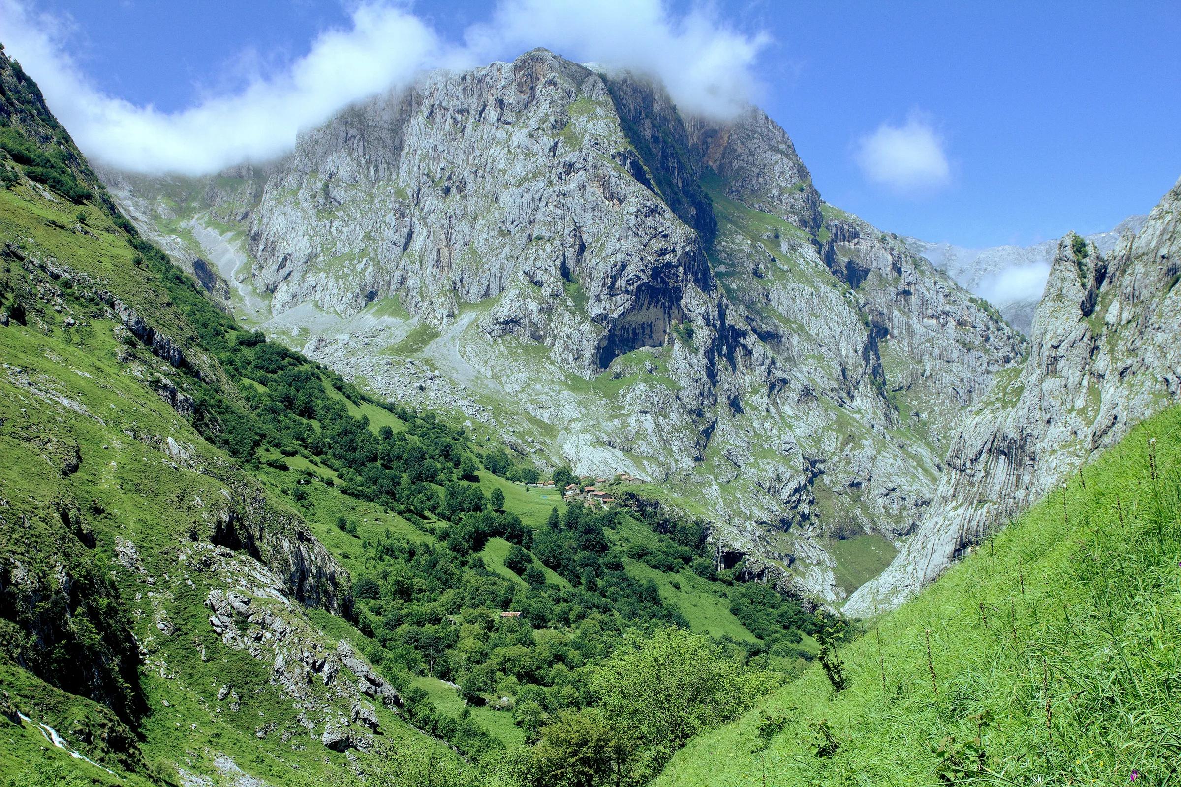
Falk2 / Wikimedia Commons, CC BY-SA 4.0
How to get there
Transport and visitor services nearby
- Oficina de turismo de CabralesTourist office · 11 km
- Centro de Visitantes Pedro Pidal (Lagos de Covadonga)Visitor centre · 15 km
- Oficina de turismo de OnísTourist office · 19 km
- Oficina de turismo de Peñamellera BajaTourist office · 24 km
- Oficina de turismo de LlanesTourist office · 25 km
- Estación de LlanesTrain station · 25 km
Straight-line distances, never travel times.
Plan your visit
- Climbing the tower requires rope skills or a qualified guide.
Accessibility
High-mountain terrain only.
Visit with care
The summit is a technical rock climb, best left to experienced climbers or those with a qualified guide. For walkers, the park's official route to the Vega de Urriellu (PR-PNPE 21) comes up from Sotres via the Pandébano pass; the park guide suggests splitting it into two days with a night at the Delgado Úbeda refuge, and rates it harder in winter. Parking at Pandébano is limited and fills fast in summer, so arrive early or start from Sotres. Carry your rubbish back down, keep noise low near the refuge and give livestock on the high pastures space.
Safety
- Serious mountain terrain: check the forecast, carry navigation and tell someone your plan.
Getting here & services nearby
The nearest published airport, stations and visitor centres, in a straight line from this place. Check routes and timetables with the operator.
- Aeropuerto Seve Ballesteros-Santander (SDR)Airport · 85 kmView details
- Estación de LlanesTrain station · 25 kmView details
- Estación de autobuses de Cangas de OnísBus station · 29 kmView details
- Estación de UnqueraTrain station · 32 kmView details
- Oficina de turismo de CabralesTourist office · 11 kmView details
- Centro de Visitantes Pedro Pidal (Lagos de Covadonga)Visitor centre · 15 kmView details
- Oficina de turismo de OnísTourist office · 19 kmView details
- Oficina de turismo de Peñamellera BajaTourist office · 24 kmView details
Nearby
Within 30 km in a straight line. Distances are not travel times: valleys and mountain roads decide those.
More places nearby
- Neverón de UrrielluMountain · Asturias · 1 kmExplore place
- Parque nacional de Picos de EuropaProtected area · Asturias · 1 kmExplore nature park
- Torre del Tiro del OsoMountain · León · 2 kmExplore place
- Pico de los CabronesMountain · León · 3 kmExplore place
- Torre de los Horcados RojosMountain · Cantabria · 3 kmExplore place
- Aguja de la CanalonaMountain · Cantabria · 3 kmExplore place