
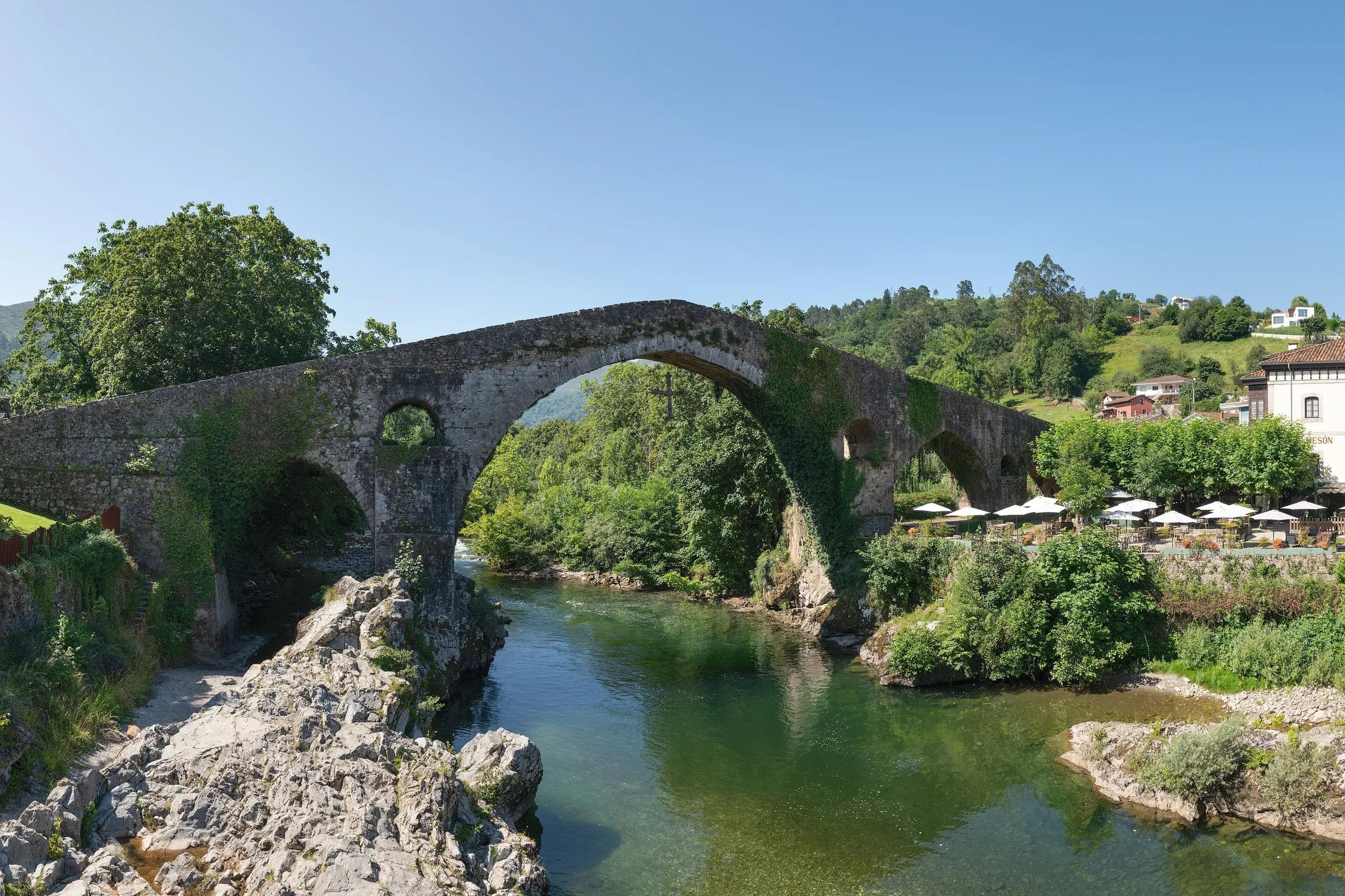
Sella valley · Cangas de Onís
Puente Romano de Cangas de Onís
A medieval arch with the Victory Cross beneath it
Giorgio Galeotti / Wikimedia Commons, CC BY-SA 4.0
Despite its name, the bridge is medieval; its exact date is debated, and it is often linked to the reign of Alfonso XI in the 14th century. A replica of the Victory Cross, the symbol of Asturias, hangs beneath its central arch.
Why go
- The most photographed landmark in Cangas.
Travel, stay and experience
Getting around, where to stay and what to experience around Puente Romano de Cangas de Onís, from the guide's own records.
Getting around
- Aeropuerto de Asturias (OVD) · 76 km in a straight line
- Estación de autobuses de Cangas de Onís · 1 km in a straight line
Where to stay
65 registered places to stay within 10 km (straight line). Nearest:
- Imperion · 1 km in a straight line
- Hotel El Sella · 1 km in a straight line
- Hotel Puente Romano · 1 km in a straight line
Mapped by volunteers on OpenStreetMap; nothing is booked here.
Things to experience
Straight-line distances, not travel times. Tierra Luma shows no availability or prices and takes no bookings.
What to do here
Food & culture
Cross the arch
Walk over the steep cobbled deck, then view it from the riverbank.
Leave room for discovery
Ideas, not instructions: take what suits your day.
- Food and a break
- For lunch, Cangas de Onís is about 1 km away in a straight line: wander its streets and see what tempts you. Or bring a picnic and stay outdoors.
- If you have time
- Follow the river a little way and see where it leads.
- Ask someone local what this place means to them.
Things to do nearby
Activities whose place lies within 25 km in a straight line (not a road distance).
- Road cycling · 0 km awayRoad cycling: the Reconquista loop over El FitoCangas de Onís – Arriondas – Alto del Fito – Caravia – Ribadesella – Nueva and back (eastern Asturias).
- Road cycling · 0 km awayRoad cycling: the climb to the Lagos de CovadongaThe climb starts at the roundabout leading to the Lagos road near the Basilica of Covadonga and ends at Lake Enol and Lake Ercina; the circular route starts and ends in Cangas de Onís.
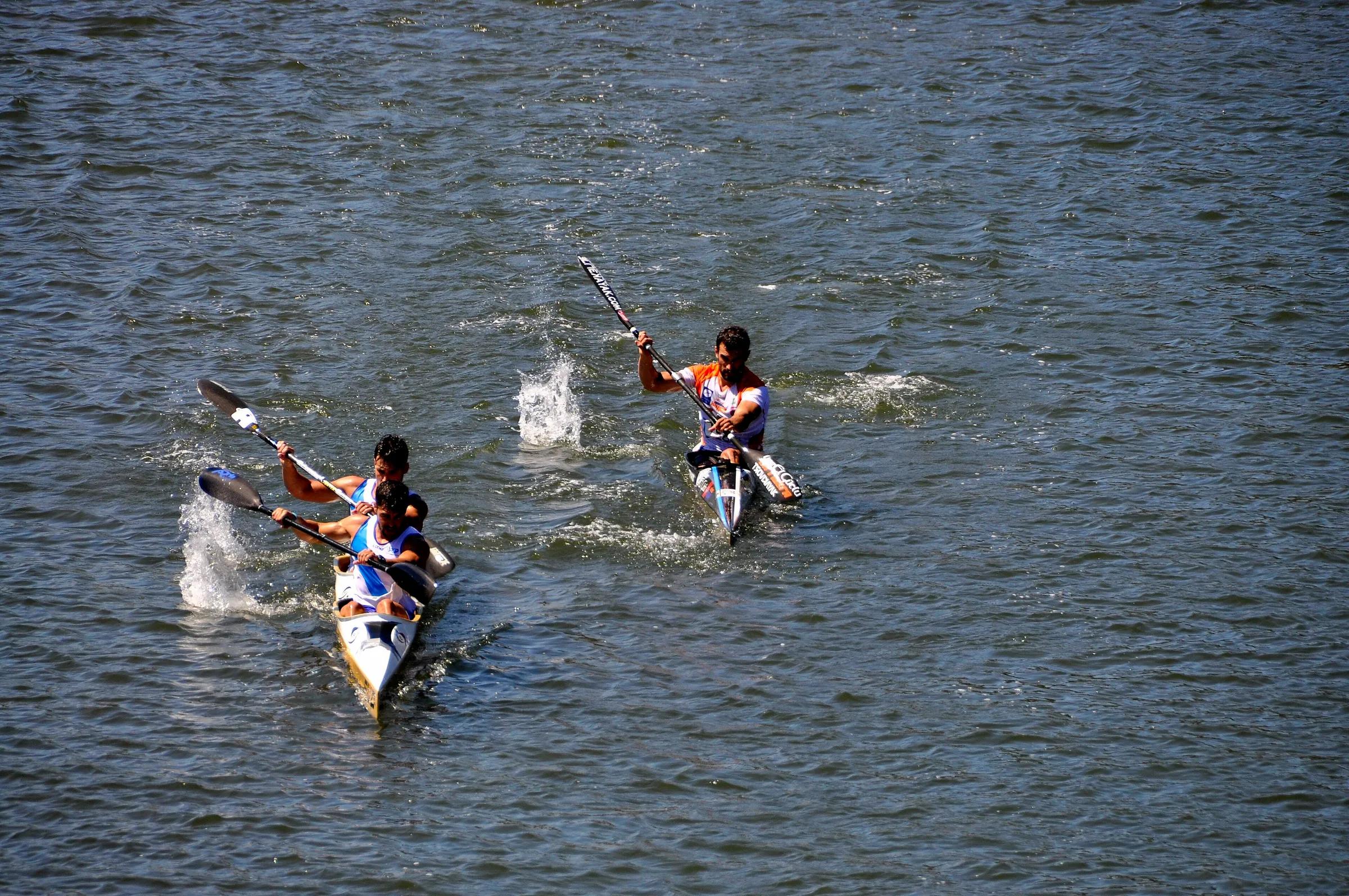
- Canoeing · 6 km awayCanoeing down the Sella riverOn the Sella from Arriondas downstream towards Ribadesella, with take-out points at about 7, 11 and 16 km (Toraño, Llordón and Llovio).
- Rafting · 6 km awayRafting in eastern AsturiasEastern Asturias: Arriondas (Parres), Cangas de Onís and Ribadedeva.
- Trail running · 8 km awayTravesera Integral Picos de EuropaPicos de Europa National Park, through Cangas de Onís, Onís and Cabrales; start at El Repelao (Covadonga), finish at Arenas de Cabrales.
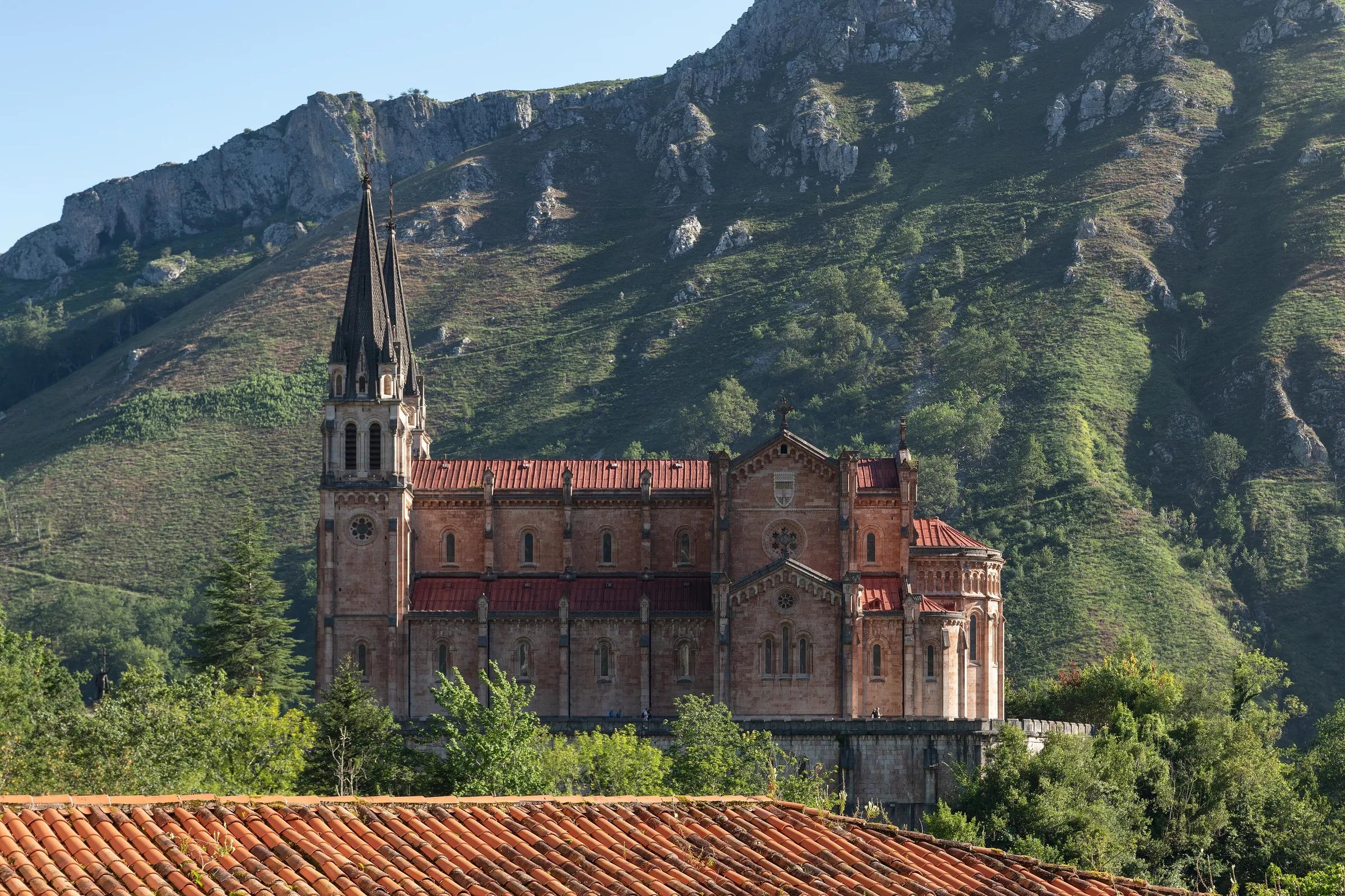
- Culture · 8 km awayCovadonga: the Santa Cueva and the basilicaCovadonga, Cangas de Onís, on the road up to the Lakes of Covadonga.
Related places
- Located within
- Cangas de Onís· Town
About this place
Protected as: Declared a Monumento Histórico-Artístico in 1931; listed today as a Bien de Interés Cultural.
Landscape and rock
The bridge spans the Sella, the main river of eastern Asturias, which rises across the regional border in León and runs on to the sea at Ribadesella. Here the river marks the line between the municipalities of Cangas de Onís and Parres, and the bridge links the two. Just downstream of the arches, the Sella is joined by the Güeña, the stream that shares the town's valley. From the high centre of the bridge you look down onto clear green water flowing between wooded banks.
History and culture
Locals call it the Puente Vieyu or Puentón, and despite its 'Roman' label it is a medieval bridge. Its exact date is debated: Spain's official tourism site suggests the late 13th century, other guides link it to the reign of Alfonso XI in the 14th, and one regional tourism page mentions 16th-century work using stone from the monastery church of San Martín de Dueñas. Its tall, pointed central arch is Gothic in character. The bridge you see today owes much to a major restoration by the architect Luis Menéndez-Pidal between 1940 and 1942. Hanging beneath the central arch is a copy of the Victory Cross, the early 10th-century jewelled cross kept in Oviedo Cathedral and the emblem of Asturias.
Pacodonderis / Wikimedia Commons, CC BY-SA 4.0
How to get there
Directions lead to the bridge in Cangas de Onís.
Transport and visitor services nearby
- Oficina de turismo de Cangas de OnísTourist office · 1 km
- Estación de autobuses de Cangas de OnísBus station · 1 km
- Oficina de turismo de ParresTourist office · 6 km
- Estación de ArriondasTrain station · 6 km
- Oficina de turismo de OnísTourist office · 13 km
- Oficina de turismo de CaraviaTourist office · 13 km
Straight-line distances, never travel times.
Plan your visit
- In the town centre, a short walk from the tourist office.
Accessibility
The deck is steep and cobbled; the riverbank view is easier to reach.
Visit with care
This is a protected monument, so treat it gently: don't climb on the parapets or the arches, and never scratch or mark the stonework. The deck is narrow and steep, so on busy days wait your turn for photos and keep the way clear for others. If you head down to the riverbanks for the classic view, use existing paths and leave nothing behind; the Sella is a salmon river, so keep litter well away from the water.
Local services nearby
- Cangas AventuraAdventure operator · 1 km
- Los Cauces AventuraAdventure operator · 5 km
- Frontera VerdeAdventure operator · 6 km
- Jaire AventuraAdventure operator · 6 km
- Canoas OrienteAdventure operator · 13 km
Straight-line distances, never travel times.
Getting here & services nearby
The nearest published airport, stations and visitor centres, in a straight line from this place. Check routes and timetables with the operator.
- Aeropuerto de Asturias (OVD)Airport · 76 kmView details
- Estación de autobuses de Cangas de OnísBus station · 1 kmView details
- Estación de ArriondasTrain station · 6 kmView details
- Estación de RibadesellaTrain station · 14 kmView details
- Oficina de turismo de Cangas de OnísTourist office · 1 kmView details
- Cangas AventuraAdventure operator · 1 kmView details
- Los Cauces AventuraAdventure operator · 5 kmView details
- Frontera VerdeAdventure operator · 6 kmView details
Nearby
Within 30 km in a straight line. Distances are not travel times: valleys and mountain roads decide those.
More places nearby
- Cueva de los AzulesCave · Asturias · 1 kmExplore place
- Olla de San VicenteRiver · Asturias · 3 kmExplore place
- BodeVillage · Asturias · 6 kmDiscover village
- Santa Cueva de CovadongaCave · Asturias · 8 kmExplore place
- Museo de CovadongaMuseum · Asturias · 8 kmView details
- Monte AusevaMountain · Asturias · 8 kmExplore place