
Activity · Trekking
O Camiño dos Faros: the lighthouse trail of the Costa da Morte
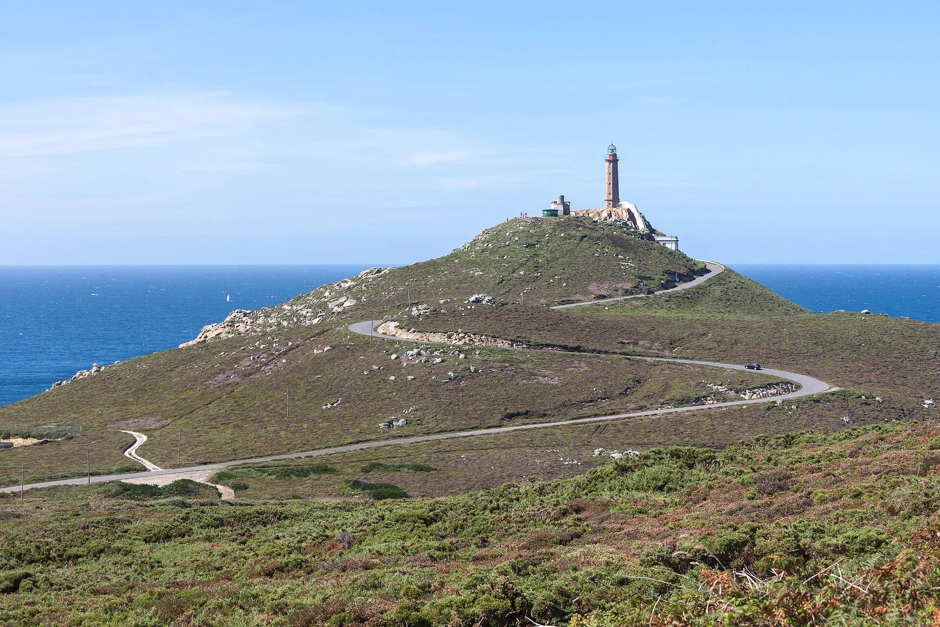
O Camiño dos Faros is a coastal walking route of about 200 km from Malpica to Cabo Fisterra, divided into eight stages of roughly nine hours each. It passes the lighthouses of Punta Nariga, Roncudo, Laxe, Cabo Vilán, Muxía and Touriñán, with cliffs, dunes, beaches and fishing villages on the way. Its promoters rate it of medium difficulty, with about 5,000 m of cumulative ascent and steep, rugged stretches.
Luis Miguel Bugallo Sánchez (Lmbuga) / Wikimedia Commons, CC BY-SA 3.0
Travel, stay and experience
Getting around, where to stay and what to experience around O Camiño dos Faros: the lighthouse trail of the Costa da Morte, from the guide's own records.
Getting around
- Aeropuerto de A Coruña (LCG) · 45 km in a straight line
- Estación de A Coruña · 44 km in a straight line
Where to stay
16 registered places to stay within 10 km (straight line). Nearest:
- Aparthotel Porto Cabana · 1 km in a straight line
- Casa Camiño dos Faros · 1 km in a straight line
- Apartamentos Turísticos Playa de Osmo · 5 km in a straight line
Mapped by volunteers on OpenStreetMap; nothing is booked here.
Things to experience
Straight-line distances, not travel times. Tierra Luma shows no availability or prices and takes no bookings.
Where it takes place
The Costa da Morte coast between Malpica de Bergantiños and Cabo Fisterra (A Coruña).
Safety
- The coast is steep, with cliff sections and repeated climbs of around 100 m; it is not a beach walk.
Leave room for discovery
Ideas, not instructions: take what suits your day.
- Food and a break
- There is no town close by in our records: bring food and water for the day, and take your rubbish home.
- If you have time
- Check the tide, then walk the shore as it changes.
- Go at the pace of the slowest in your group, and enjoy it.
Related activities
The same kind of activity first, then the nearest (in a straight line).
- Hiking & mountain trails · HikingWalk to the Ézaro waterfall, where the Xallas falls into the seaO Ézaro, Dumbría, Costa da Morte (A Coruña).
- Hiking & mountain trails · HikingClimbing Monte Pindo to A MoaMonte Pindo, Carnota, Costa da Morte (A Coruña).
- Hiking & mountain trails · HikingWalking in the Fragas do EumeFragas do Eume Natural Park, around 10 km from Pontedeume (province of A Coruña).
- Hiking & mountain trails · HikingHiking in the Ribeira SacraRibeira Sacra, along the Sil and Miño (provinces of Lugo and Ourense).
Nearby
Within 30 km in a straight line. Distances are not travel times: valleys and mountain roads decide those.
More places nearby
- Praia de RebordeloBeach · A Coruña · 3 kmExplore place
- Museo Etnolúdico de GaliciaMuseum · A Coruña · 4 kmView details
- Castro de BorneiroLandmark · A Coruña · 4 kmView details
- Praia dos CristaisBeach · A Coruña · 7 kmExplore place
- Faro de Punta LaxeCape · A Coruña · 7 kmExplore place
- NiñónsBeach · A Coruña · 7 kmExplore place