
Activity · Hiking
Fuente Cobre trail to the source of the Pisuerga
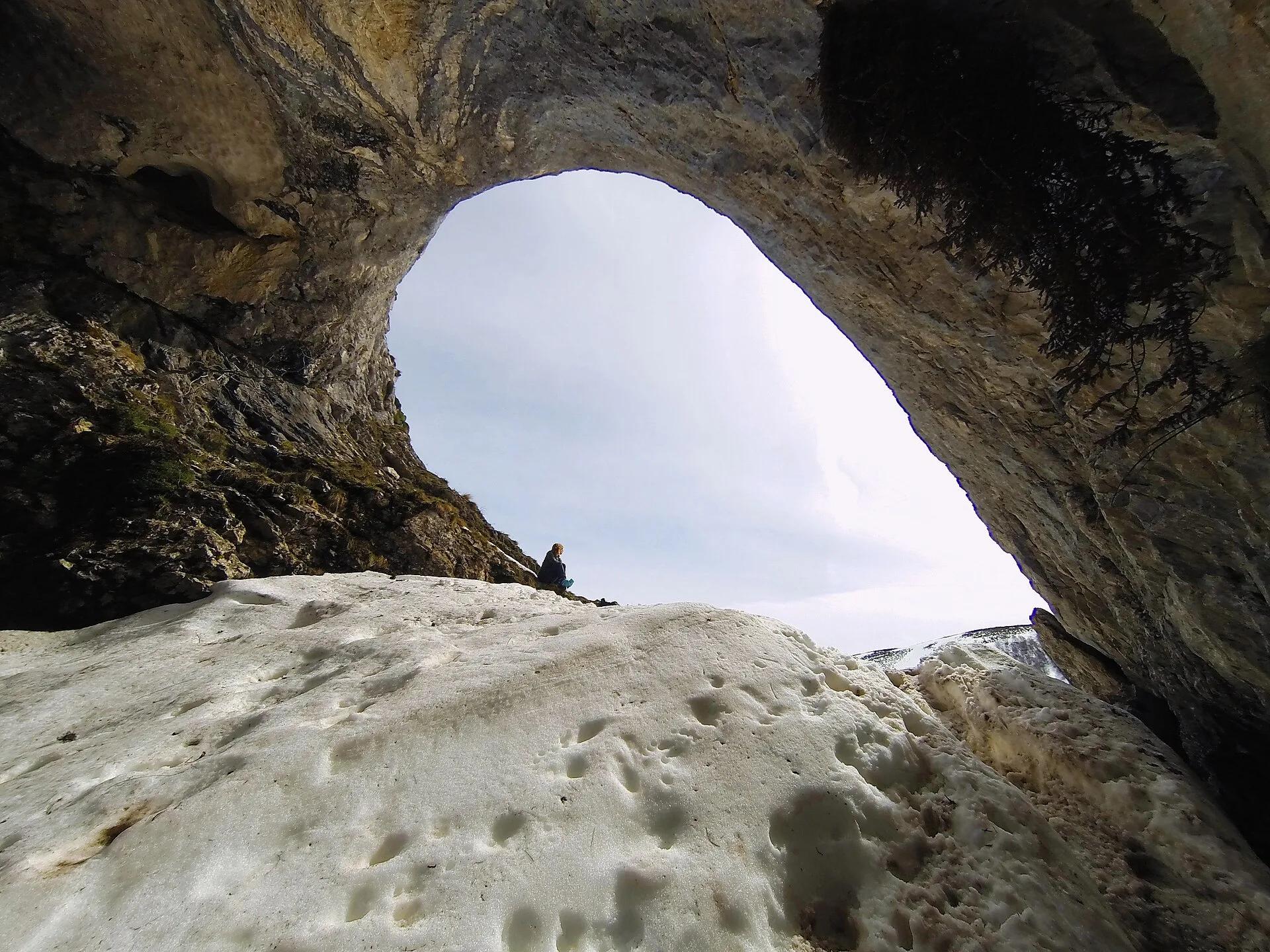
The P2 trail in the Montaña Palentina Natural Park is described by the regional tourism board as one of the most frequented in the area. It starts at the Santa María de Redondo car park, crosses the Redondos valley through oak and beech woods and reaches the Fuente or Cueva del Cobre, traditionally held to be the source of the Pisuerga. The regional listing gives it as a circular walk of 13 km with 400 m of ascent and medium difficulty.
Alejandro Vallejo Ortega / Wikimedia Commons, CC BY-SA 4.0
Travel, stay and experience
Getting around, where to stay and what to experience around Fuente Cobre trail to the source of the Pisuerga, from the guide's own records.
Getting around
- Aeropuerto Seve Ballesteros-Santander (SDR) · 66 km in a straight line
- Estación de Aguilar de Campoo · 25 km in a straight line
Where to stay
12 registered places to stay within 10 km (straight line). Nearest:
- EL CASUCO · 5 km in a straight line
- LAS ENCINAS · 5 km in a straight line
- CASA RURAL TORIBIO · 6 km in a straight line
From the official tourism register; listed is not recommended, and nothing is booked here.
Things to experience
Straight-line distances, not travel times. Tierra Luma shows no availability or prices and takes no bookings.
Where it takes place
Santa María de Redondo (La Pernía), in the Montaña Palentina Natural Park, northern Palencia.
Season
The national tourism board notes that access to the park may be restricted between February and June during the brown bear breeding season, and advises checking before going in those months.
Safety
- Only the entrance chamber of the Cueva del Cobre can be visited; the interior requires caving knowledge or equipment.
Visit with care
- The park can have restricted access between February and June because of brown bear breeding.
Leave room for discovery
Ideas, not instructions: take what suits your day.
- Food and a break
- There is no town close by in our records: bring food and water for the day, and take your rubbish home.
- If you have time
- Ask the guide about the thing that surprised you most.
- Watch how the light moves across the slopes.
Related activities
The same kind of activity first, then the nearest (in a straight line).
- Hiking & mountain trails · TrekkingGR 1 Sendero Histórico across the Montaña PalentinaMontaña Palentina Natural Park, from Salcedillo in the east to Velilla del Río Carrión in the west.
- Hiking & mountain trails · HikingLas Tuerces rock labyrinth walkVillaescusa de las Torres, between Villaescusa and Mave, near Aguilar de Campoo (Palencia), next to the Cañón de la Horadada.
- Hiking & mountain trails · HikingHorcados Rojos from the Fuente Dé cable carFrom the upper station of the Fuente Dé cable car into the Central Massif of the Picos de Europa.
- Hiking & mountain trails · HikingWalk from the Fuente Dé cable car across the Puertos de ÁlivaUpper station of the Fuente Dé cable car (El Cable) down to Fuente Dé, Camaleño valley, Liébana.
Nearby
Within 30 km in a straight line. Distances are not travel times: valleys and mountain roads decide those.
More places nearby
- ValdecebollasMountain · Palencia · 2 kmExplore place
- Montes de Campoo-ValderredibleMountain range · Cantabria · 5 kmExplore place
- Valle de CampooValley · Palencia · 6 kmExplore place
- Pico BóvedaMountain · Cantabria · 7 kmExplore place
- Collado de la Fuente del ChivoMountain · Cantabria · 7 kmExplore place
- Castro de AbiadaLandmark · Cantabria · 7 kmView details