
Activity · Hiking
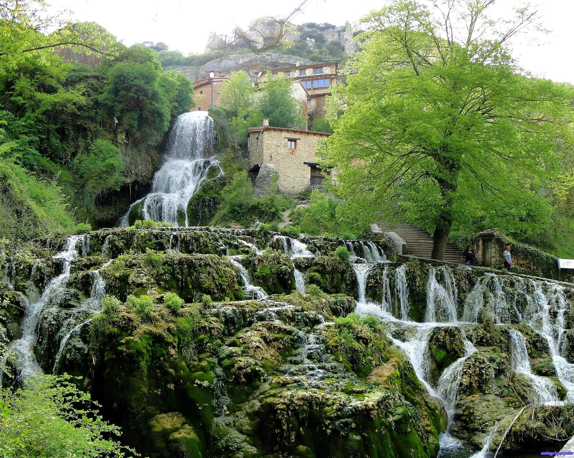
Orbaneja del Castillo: the waterfall through the village
In Orbaneja del Castillo a waterfall springs from the Cueva del Agua just above the village and splits it in two, dropping about 25 metres in rapids and turquoise terraced pools towards the Ebro. The cave, explored since 1964, extends for more than 20 km; its first section is open to the public, the rest only to expert cave divers. On the plateau above, Las Eras keeps a group of round and square stone huts.
santiago lopez-pastor from España / Wikimedia Commons, CC BY-SA 2.0
Travel, stay and experience
Getting around, where to stay and what to experience around Orbaneja del Castillo: the waterfall through the village, from the guide's own records.
Getting around
- Aeropuerto Seve Ballesteros-Santander (SDR) · 66 km in a straight line
- Estación de Aguilar de Campoo · 36 km in a straight line
Where to stay
19 registered places to stay within 10 km (straight line). Nearest:
- EL ABUELO II · 1 km in a straight line
- EL MOLINO DE LA CASCADA · 1 km in a straight line
- LA PUEBLA · 1 km in a straight line
From the official tourism register; listed is not recommended, and nothing is booked here.
Things to experience
Straight-line distances, not travel times. Tierra Luma shows no availability or prices and takes no bookings.
Where it takes place
Orbaneja del Castillo (Valle de Sedano), northern Burgos.
Safety
- The spring's flow rises sharply in heavy rain and snowmelt.
Leave room for discovery
Ideas, not instructions: take what suits your day.
- Food and a break
- Explore the streets of Orbaneja del Castillo and find somewhere inviting for lunch.
- If you have time
- Look up: doorways, balconies and old stonework tell their own story.
- Notice how the air changes as you step back into daylight.
Related activities
The same kind of activity first, then the nearest (in a straight line).
- Hiking & mountain trails · HikingLas Tuerces rock labyrinth walkVillaescusa de las Torres, between Villaescusa and Mave, near Aguilar de Campoo (Palencia), next to the Cañón de la Horadada.
- Hiking & mountain trails · HikingThe source of the Asón waterfallCollados del Asón Natural Park, Soba, in the Asón valley (eastern Cantabria).
- Hiking & mountain trails · HikingFuente Cobre trail to the source of the PisuergaSanta María de Redondo (La Pernía), in the Montaña Palentina Natural Park, northern Palencia.
- Hiking & mountain trails · TrekkingCamino del Cid: El Destierro stage from VivarFrom Vivar del Cid (Burgos) south through the province of Burgos into Soria and Guadalajara.
Nearby
Within 30 km in a straight line. Distances are not travel times: valleys and mountain roads decide those.
More places nearby
- Parque natural de Hoces del Alto Ebro y RudrónProtected area · Burgos · 1 kmExplore nature park
- Zona arqueológica de Santa María de HitoLandmark · Cantabria · 7 kmView details
- Dolmen de La CabañaLandmark · Burgos · 11 kmView details
- Pozo AzulRiver · Burgos · 11 kmExplore place
- El CastroMountain · Cantabria · 12 kmExplore place
- Abrigo del CubularLandmark · Cantabria · 12 kmView details