
Activity · Hiking
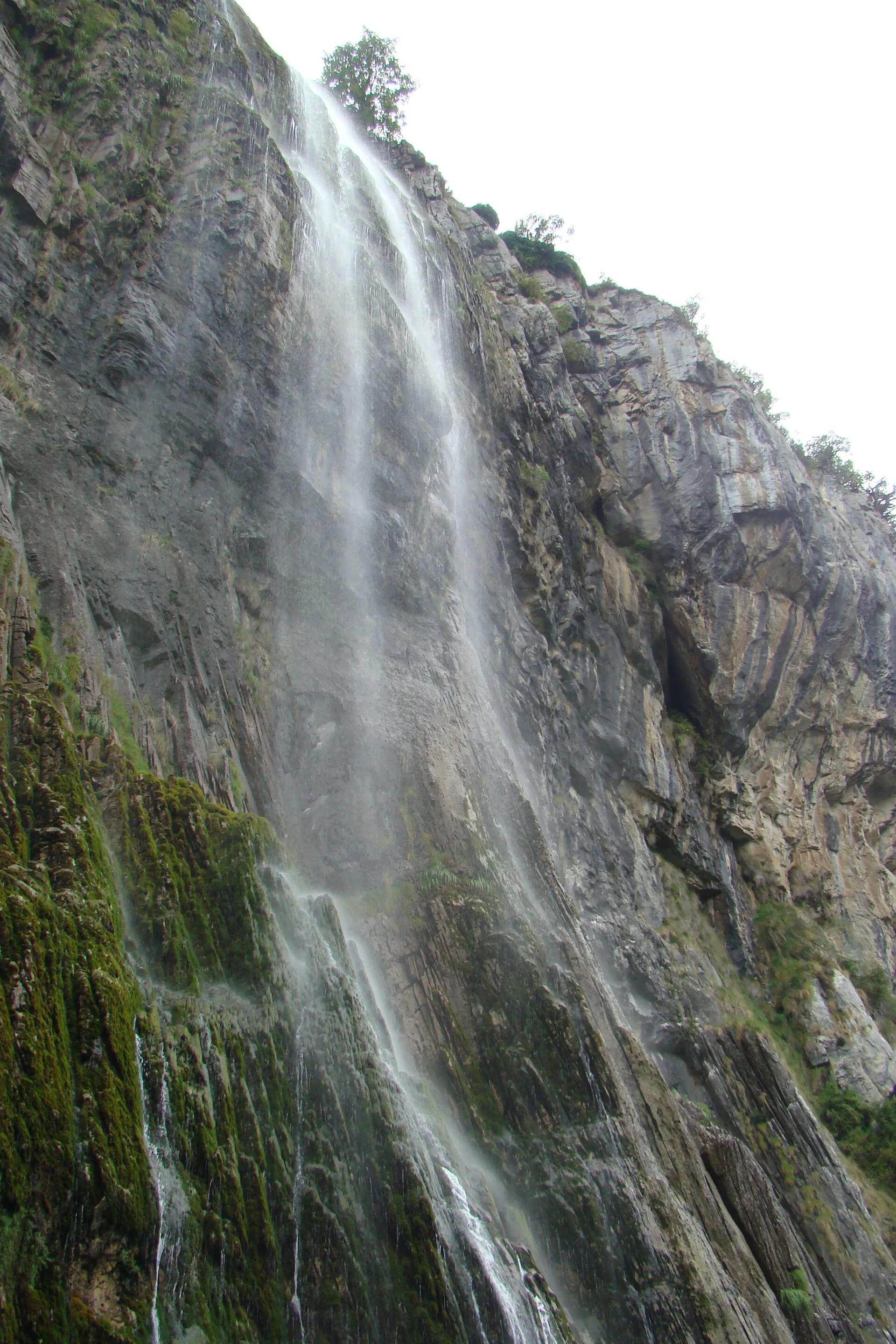
The source of the Asón waterfall
In the Collados del Asón Natural Park the river Asón is born as a horsetail waterfall falling more than 70 m from a limestone wall. Several routes and viewpoints bring you close to it, and the Mirador de la Reina looks over the Gándara falls. The park's interpretation centre is at La Gándara (Soba).
Pepepitos / Wikimedia Commons, public domain
Travel, stay and experience
Getting around, where to stay and what to experience around The source of the Asón waterfall, from the guide's own records.
Getting around
- Aeropuerto Seve Ballesteros-Santander (SDR) · 31 km in a straight line
- Estación de Santander · 34 km in a straight line
Where to stay
10 registered places to stay within 10 km (straight line). Nearest:
- Albergue El Carrascal · 2 km in a straight line
- Posada el mirador · 2 km in a straight line
- Albergue La Incera · 4 km in a straight line
Mapped by volunteers on OpenStreetMap; nothing is booked here.
Things to experience
Straight-line distances, not travel times. Tierra Luma shows no availability or prices and takes no bookings.
Where it takes place
Collados del Asón Natural Park, Soba, in the Asón valley (eastern Cantabria).
Leave room for discovery
Ideas, not instructions: take what suits your day.
- Food and a break
- There is no town close by in our records: bring food and water for the day, and take your rubbish home.
- If you have time
- Watch how the light moves across the slopes.
- Go at the pace of the slowest in your group, and enjoy it.
Related activities
The same kind of activity first, then the nearest (in a straight line).
- Hiking & mountain trails · HikingOrbaneja del Castillo: the waterfall through the villageOrbaneja del Castillo (Valle de Sedano), northern Burgos.
- Hiking & mountain trails · HikingFuente Cobre trail to the source of the PisuergaSanta María de Redondo (La Pernía), in the Montaña Palentina Natural Park, northern Palencia.
- Hiking & mountain trails · HikingLas Tuerces rock labyrinth walkVillaescusa de las Torres, between Villaescusa and Mave, near Aguilar de Campoo (Palencia), next to the Cañón de la Horadada.
- Hiking & mountain trails · TrekkingGR 1 Sendero Histórico across the Montaña PalentinaMontaña Palentina Natural Park, from Salcedillo in the east to Velilla del Río Carrión in the west.
Nearby
Within 30 km in a straight line. Distances are not travel times: valleys and mountain roads decide those.
More places nearby
- Valle de SobaValley · Cantabria · 2 kmExplore place
- MortillanoMountain · Cantabria · 5 kmExplore place
- Montaña orientalProtected area · Cantabria · 6 kmExplore nature park
- Peña RocíasMountain · Cantabria · 7 kmExplore place
- PorracolinaMountain · Cantabria · 7 kmExplore place
- Cueva de El HazaLandmark · Cantabria · 13 kmView details