
 Thomas Holbach / Wikimedia Commons, CC BY-SA 4.0
Journeys & Road Trips · Road trip
From the Montaña Palentina to Las Merindades
Romanesque churches, the source of the Pisuerga and a labyrinth of rock in northern Palencia, then the waterfall villages, caves and medieval bridges of northern Burgos.
North of the wheatfields of Castile, the land lifts and breaks. Flat-topped hills stand over pale fields, limestone erupts into towers and corridors, and the rivers that will water half the meseta are still young enough to disappear into caves and come out again. This road trip crosses that border country from west to east: from the Romanesque villages around Aguilar de Campoo and the mountains above Cervera de Pisuerga, over the high plateau of Las Loras, and down into Las Merindades, where the Ebro has cut its way past Orbaneja del Castillo and under the rock of Frías.
The lie of the land
Two provinces, one long transition. In northern Palencia the Montaña Palentina, a natural park, rises to peaks such as Curavacas and Espigüete, and the Carrión and Pisuerga both begin here. Its woods of beech, Pyrenean oak and holm oak shelter brown bears, wolves, otters and chamois. East of Aguilar the country flattens into a karst upland, cut by canyons and riddled with caves, which carries on into Burgos. Then the Ebro takes over, entrenched between cliffs. The villages are small and far apart; the churches are many.
Day one: Aguilar de Campoo and the Romanesque north
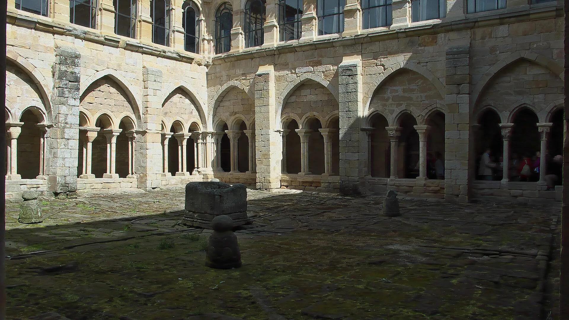
The regional tourism board describes the Montaña Palentina as holding one of the largest concentrations of Romanesque buildings in Europe, and Aguilar de Campoo is the natural place to start. The monastery of Santa María la Real, on the edge of town, houses the ROM exhibition centre, opened in 2006 in the church and sacristy, which explains how a medieval community lived. Its cloister, with Gothic arches, is quietly beautiful. Above the town, the castle walls crown a rocky hill.
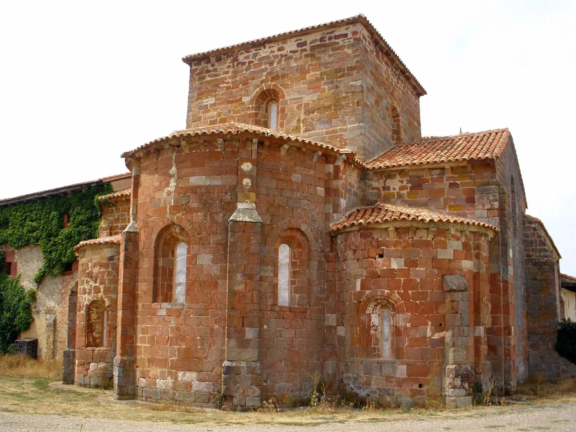
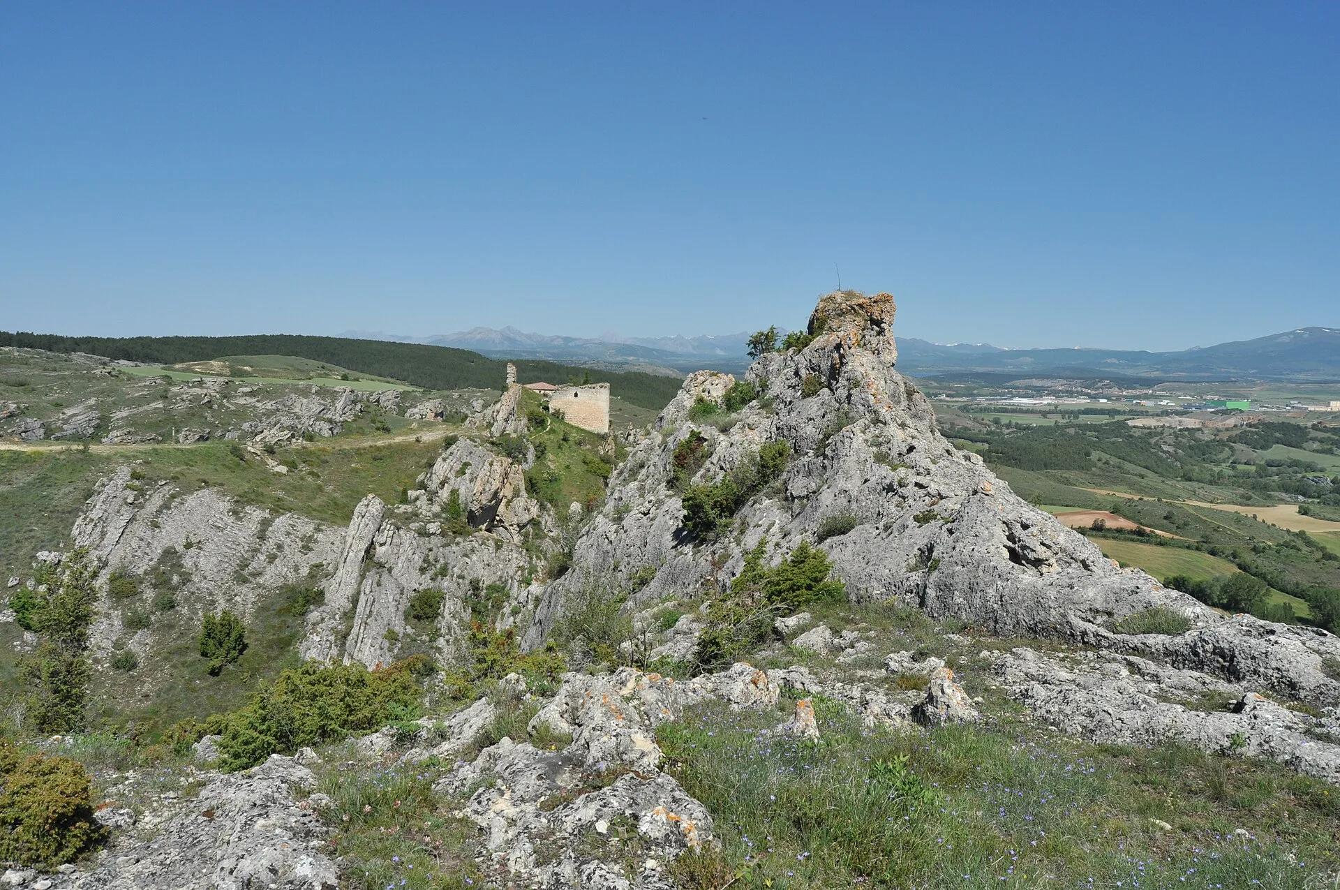
From Aguilar, small churches lie in every direction: Santa Cecilia at Vallespinoso de Aguilar, one of the most famous monuments of the Romanesque north; the twelfth-century church of San Juan at Moarves de Ojeda; the red-stone apses of Santa María de Mave; the carved portal of San Cipriano at Revilla de Santullán. Choose two or three rather than all of them. Then drive to Las Tuerces, a karst landscape shaped by water on limestone, with a maze of rock corridors, mushroom-shaped stones and natural arches, beside the Cañón de la Horadada carved by the Pisuerga. Sleep in Aguilar.
 Jose Luis Filpo Cabana / Wikimedia Commons, CC BY 3.0
 Zarateman / Wikimedia Commons, CC BY 3.0
 Luis Rogelio HM / Wikimedia Commons, CC BY-SA 2.0
Day two: Cervera de Pisuerga and the source of the river
Drive west into the mountains to Cervera de Pisuerga, the gateway to the natural park, where the park's visitor centre (the Casa del Parque) is free to enter. Beyond the town the road climbs towards La Pernía and the village of Santa María de Redondo, where the walk to Fuente Cobre begins. The regional tourism board lists it as a circular route of 11 kilometres, about four hours on foot, of medium difficulty, following the young Pisuerga up its valley to the cave long held to be the river's source: a great arched mouth in a pale limestone slope.
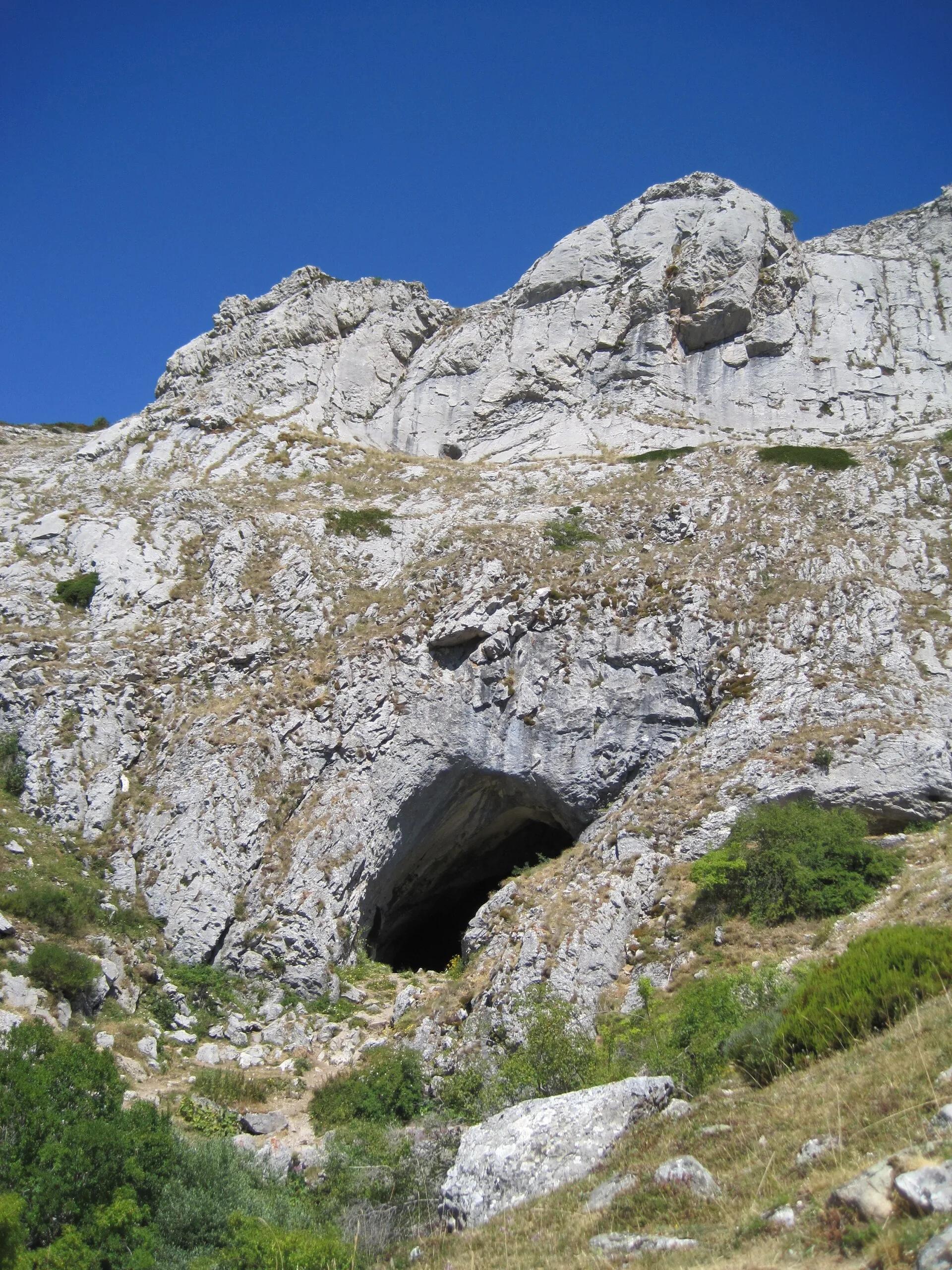
This is bear country, and the right way to share it is quietly: stay on the path, keep dogs on a lead and leave any wildlife watching to the early and late hours, from a distance. Return to Cervera for the night.
Day three: Orbaneja del Castillo and Ojo Guareña
Cross east into Burgos and drop to the Ebro. Orbaneja del Castillo, in the Valle de Sedano, lies sandwiched between the river's walls, a small stone village with a waterfall of more than 25 metres running through it over moss-covered tufa. The water comes from the Cueva del Agua above the houses; the regional tourism board notes that the cave is closed in winter until Easter. Around the village, the canyons of the upper Ebro and the Rudrón are protected as a natural park.
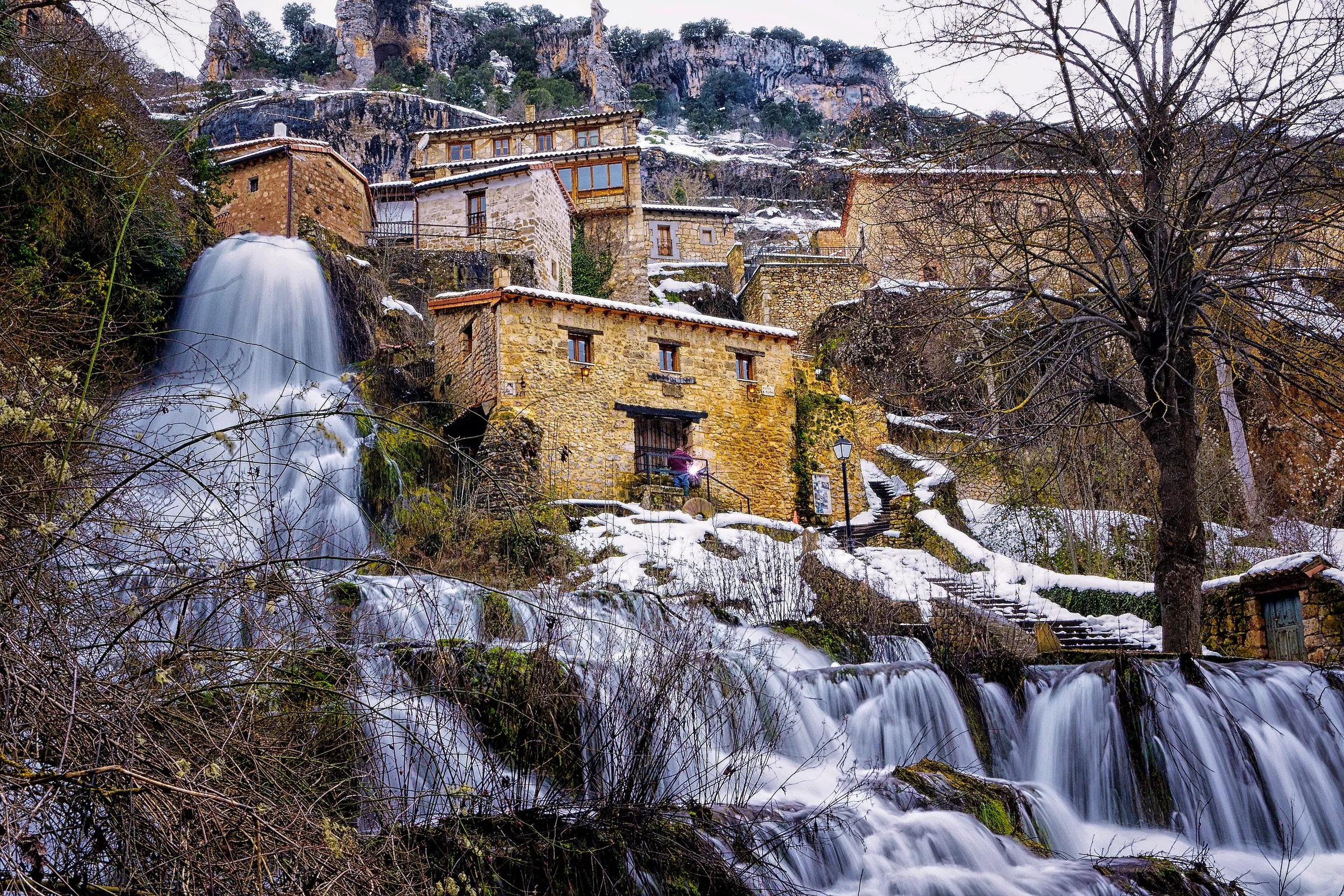
Continue north-east to Ojo Guareña in the Merindad de Sotoscueva, described by the regional tourism board as the second most extensive cave system in the Iberian Peninsula, with some 110 kilometres of surveyed galleries. Its best-known door is the hermitage of San Bernabé, an eighteenth-century chapel built over a prehistoric cave, with painted walls and a Baroque altarpiece. The park's visitor centre is at Quintanilla del Rebollar, and it is the place to ask how and when the cave can be visited.
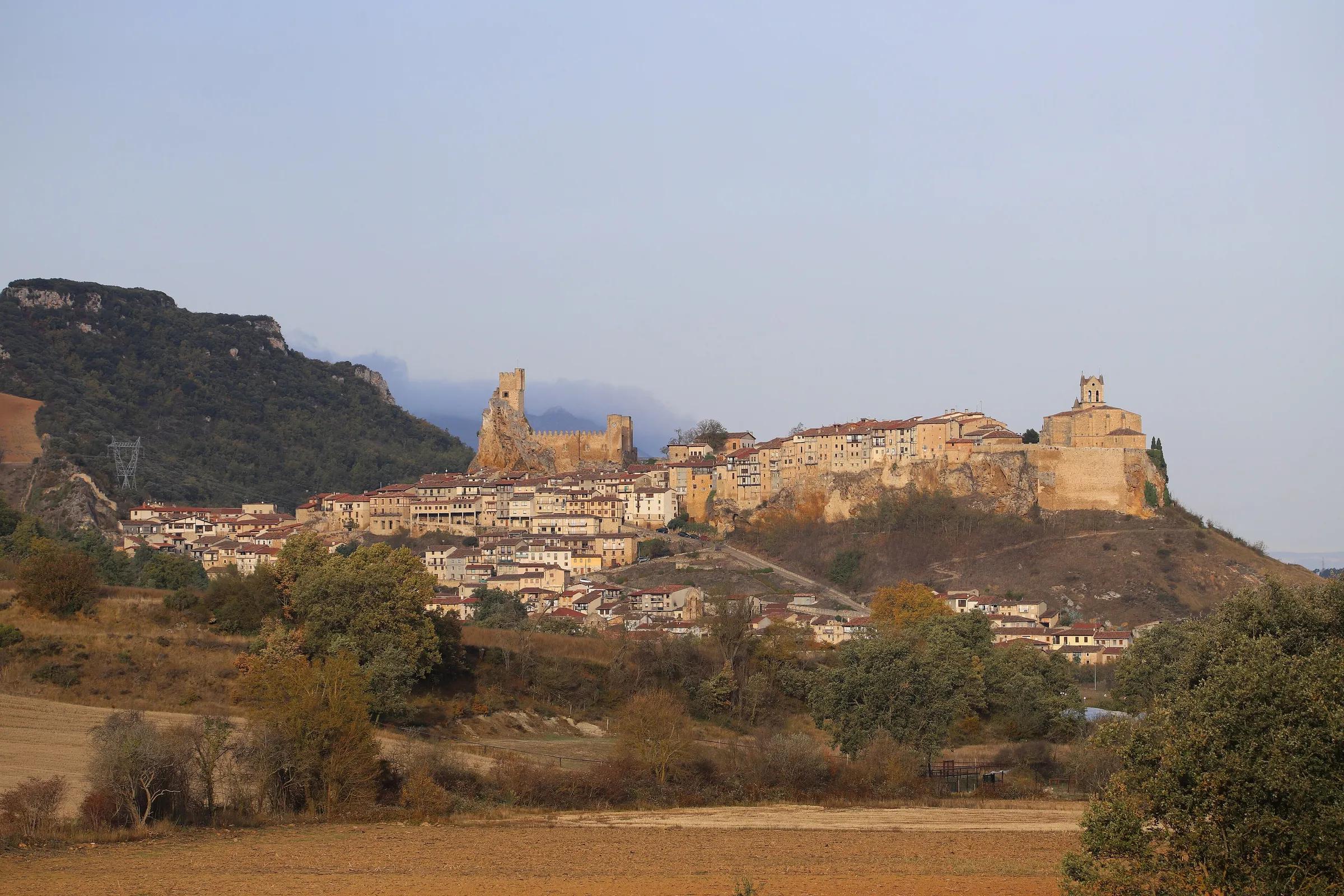
From the caves, drive on to Frías for the night. The town's historic centre stretches along a long rocky outcrop, with the castle at one end and the church of San Vicente at the other; some houses seem to hang over the drop.
Day four: Frías and the Tobalina valley
Frías rewards an unhurried morning. The castle of the Dukes of Frías stands on the highest, rockiest point of the hill, looking over the Tobalina valley. Below the town, a medieval bridge with a fourteenth-century defensive tower crosses the Ebro. The Romanesque portal of San Vicente is no longer here: after the tower collapsed in 1904 it was taken to New York. A short drive away, the cliffs of the Tobera gorge shelter a hermitage and an old stone bridge.
On the road
- Distances between villages are long and services are few. Fill the tank in the larger towns and carry water and food for the day.
- Mountain roads in the Montaña Palentina can carry snow and ice in winter; check the road conditions before crossing.
- Roads into Orbaneja and along the Ebro are narrow; park where the village asks you to and walk in.
- Many Romanesque churches are locked outside guided visits. Check how each one opens before you plan a detour.
Make it your own
In three days, leave out Fuente Cobre and go straight from Aguilar to the Ebro; with five, spend a day walking in Las Tuerces and another in the Ebro canyons. Drop a stop, stay longer. The route copies into My trips, where you can rearrange it as you like.
The route
From the Montaña Palentina to Las Merindades
Long distances between villages: plan fuel and meals ahead.
Day 1
Aguilar and the Romanesque north
- Monasterio de Santa María la Real (Aguilar de Campoo)
The ROM centre and the cloister.
- Monasterio de Santa María de Mave
Red-stone Romanesque apses.
- Las Tuerces
The rock labyrinth above the Horadada canyon.
Day 2
Cervera and Fuente Cobre
- Cueva del Cobre
The walk from Santa María de Redondo to the source of the Pisuerga.
Day 3
Orbaneja and Ojo Guareña
- Orbaneja del Castillo
The waterfall through the village; the cave is closed in winter.
- Ojo Guareña
The hermitage of San Bernabé; ask the Casa del Parque about visits.
Day 4
Frías and Tobalina
- Castillo de Frías
The castle of the Dukes of Frías and the medieval bridge.
- Cascada de Pedrosa de Tobalina
Water spilling over a travertine ledge into a green pool.
Copy this route to My trips
An editable trip: drop a stop, stay longer, add your own. Nothing is booked.
Practical details checked on 8 November 2026. Rules, access and seasons change. Check the official sources below before you go.
Sources
- Turismo de Castilla y León: Románico Palentinochecked 8 November 2026
- Turismo de Castilla y León: Museo del Románico (ROM), Aguilar de Campoochecked 8 November 2026
- Turismo de Castilla y León: Paisaje Protegido y Monumento Natural de Las Tuerceschecked 8 November 2026
- Turismo de Castilla y León: Parque Natural Montaña Palentinachecked 8 November 2026
- Turismo de Castilla y León: Senda de Fuente Cobre, nacimiento del río Pisuergachecked 8 November 2026
- Turismo de Castilla y León: Orbaneja del Castillochecked 8 November 2026
- Turismo de Castilla y León: Monumento Natural Ojo Guareñachecked 8 November 2026
- Turismo de Castilla y León: Fríaschecked 8 November 2026
- Spain.info (Turespaña): Fríaschecked 8 November 2026
Take it further
If this story set you thinking, here is where to take it next.
Series
In the series The seven provinces around
Journeys & Road Trips
From the Montaña Palentina to Las Merindades
Adventure & Outdoors
Fuente Dé and the high Picos
Life & Culture
Las Médulas: the mountains the Romans brought down
Places & Destinations
Potes and the Liébana valley
Places & Destinations
Praia das Catedrais: tides and booking
Journeys & Road Trips
The Ribeira Sacra and the Sil canyon