
 Pablo Pereira González / Wikimedia Commons, CC BY-SA 4.0
Life & Culture · Feature
Las Médulas: the mountains the Romans brought down
In the Bierzo, red pinnacles rise out of chestnut woods: what is left of the largest gold mine of Roman Hispania, a landscape made by water and labour, and scarred again by fire in 2025.
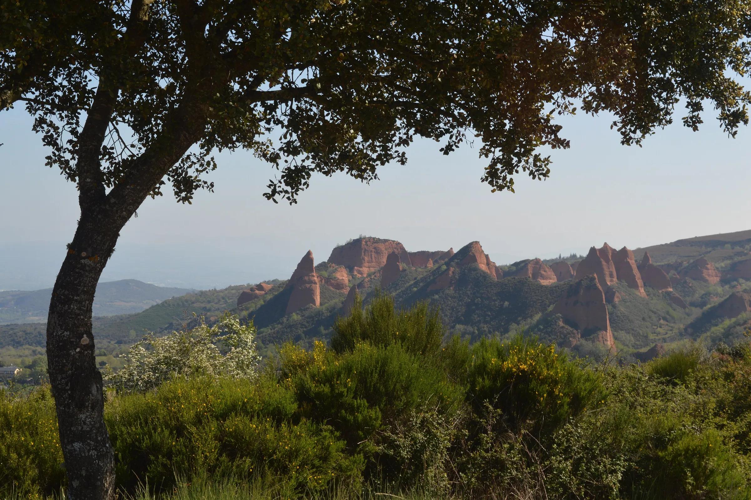
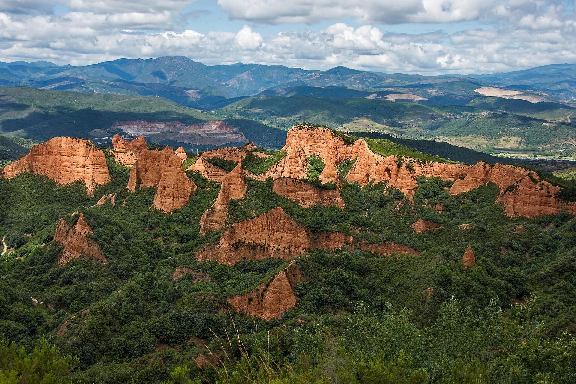
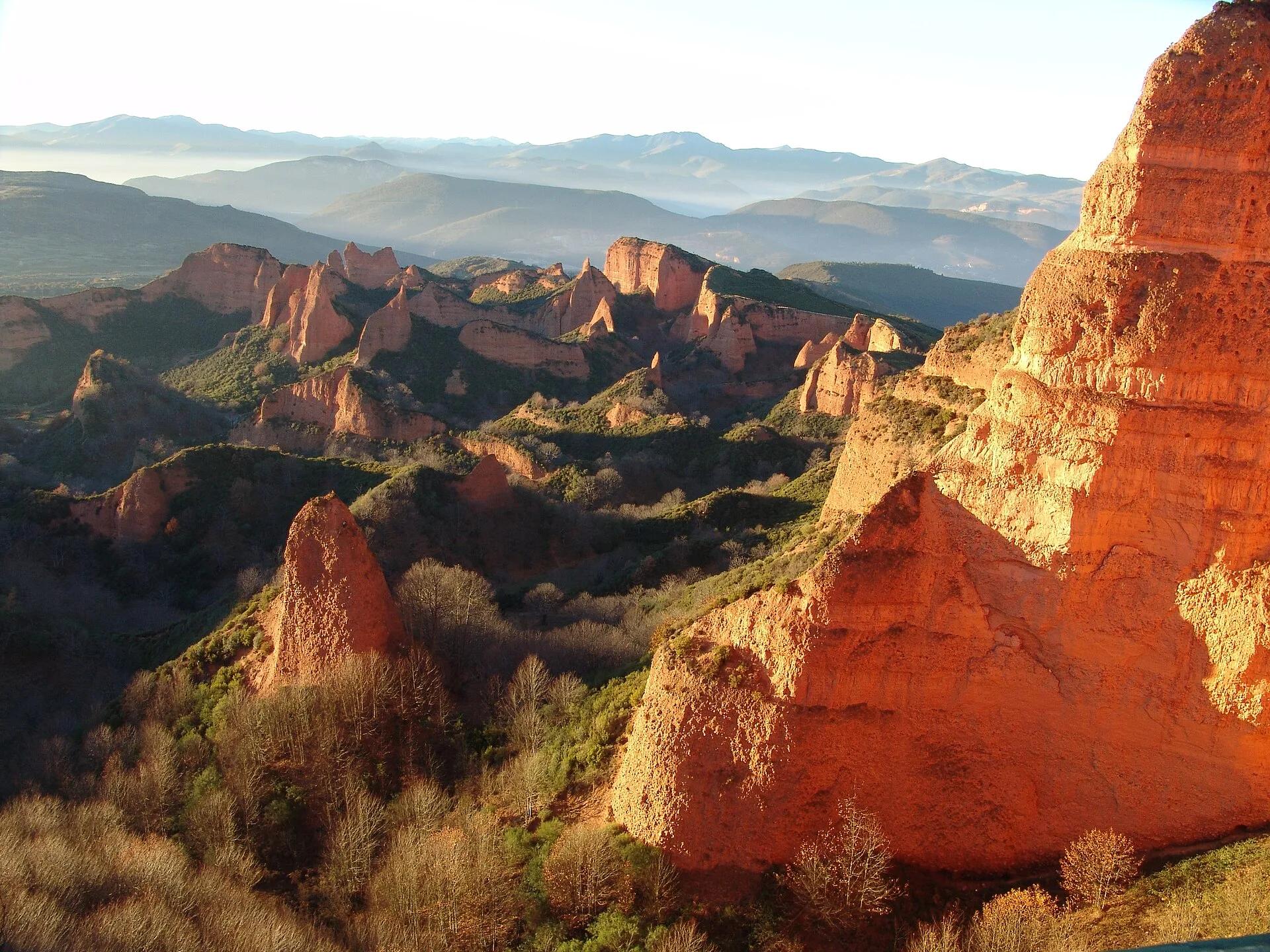
The first sight stops people mid-sentence. Out of a green sea of chestnut and oak rise towers, needles and ridges of earth the colour of rust and terracotta, carved into folds and hollows as if a giant had pressed his fingers into soft clay. In low sun they glow; under cloud they turn the colour of old brick. Nothing about them looks natural, and nothing about them is. Las Médulas, in the far west of the province of León, is what remains when an empire takes a mountain apart in search of gold.
Chapter oneA landscape made by hand
The site lies in the Bierzo, some twenty kilometres from Ponferrada according to Turespaña, on the north-western slope of the Montes Aquilanos, between the villages of Las Médulas and Carucedo. In the first century AD, Rome opened a gold mine here and, over the following generations, transformed the land. The mine was worked in the open air: instead of following a vein with tunnels and leaving the hill standing, the Romans brought the hill itself down and washed it.
In December 1997 UNESCO inscribed Las Médulas on the World Heritage List. The Junta's Fundación Patrimonio Natural notes that this was the first time a cultural landscape in Spain won that international recognition: a place where the shape of the land itself is the monument. The red pinnacles are the remains of hills that were not entirely consumed; the hollows are the spaces where the rest of the mountain used to be.
Chapter twoRuina montium
The technique has a name that sounds like a sentence: ruina montium, the wrecking of mountains. Its fuel was water. Turespaña notes that the Romans brought water from the rivers Eria and Cabrera, more than a hundred kilometres of channels across the mountains, and stored it above the workings. Galleries were driven into the hill; then water was released into them, and the pressure broke the mountain from within. The collapsed earth was washed through channels, and the gold, heavy and fine, was caught along the way.
Pliny the Elder, who gave the technique its name, described this kind of mining in the thirty-third book of his Natural History. He does not name Las Médulas, but his account of the third, hardest method of finding gold reads like a description of what happened here: miners working for months without seeing daylight, a sentinel posted on a peak to give the warning, and the moment the supports are cut.
The mountain, rent to pieces, is cleft asunder, hurling its debris to a distance with a crash which it is impossible for the human imagination to conceive; and from the midst of a cloud of dust, of a density quite incredible, the victorious miners gaze upon this downfall of Nature.
Pliny the Elder, Natural History 33.21, translated by John Bostock and H. T. Riley (1855); Spanish rendering by the Tierra Luma editors
Pliny goes on to describe the channels, the steep falls that let the water be thrown rather than flow, the men hanging on ropes to cut ledges in the rock, and the beds of gorse laid in the washing trenches to catch the gold. He reports that Asturia, Gallaecia and Lusitania together yielded, according to some authorities, twenty thousand pounds of gold a year, the greater part from Asturia. And he adds that the washed earth, carried down to the sea, had extended the shores of Spain.
Chapter threeChestnuts after gold
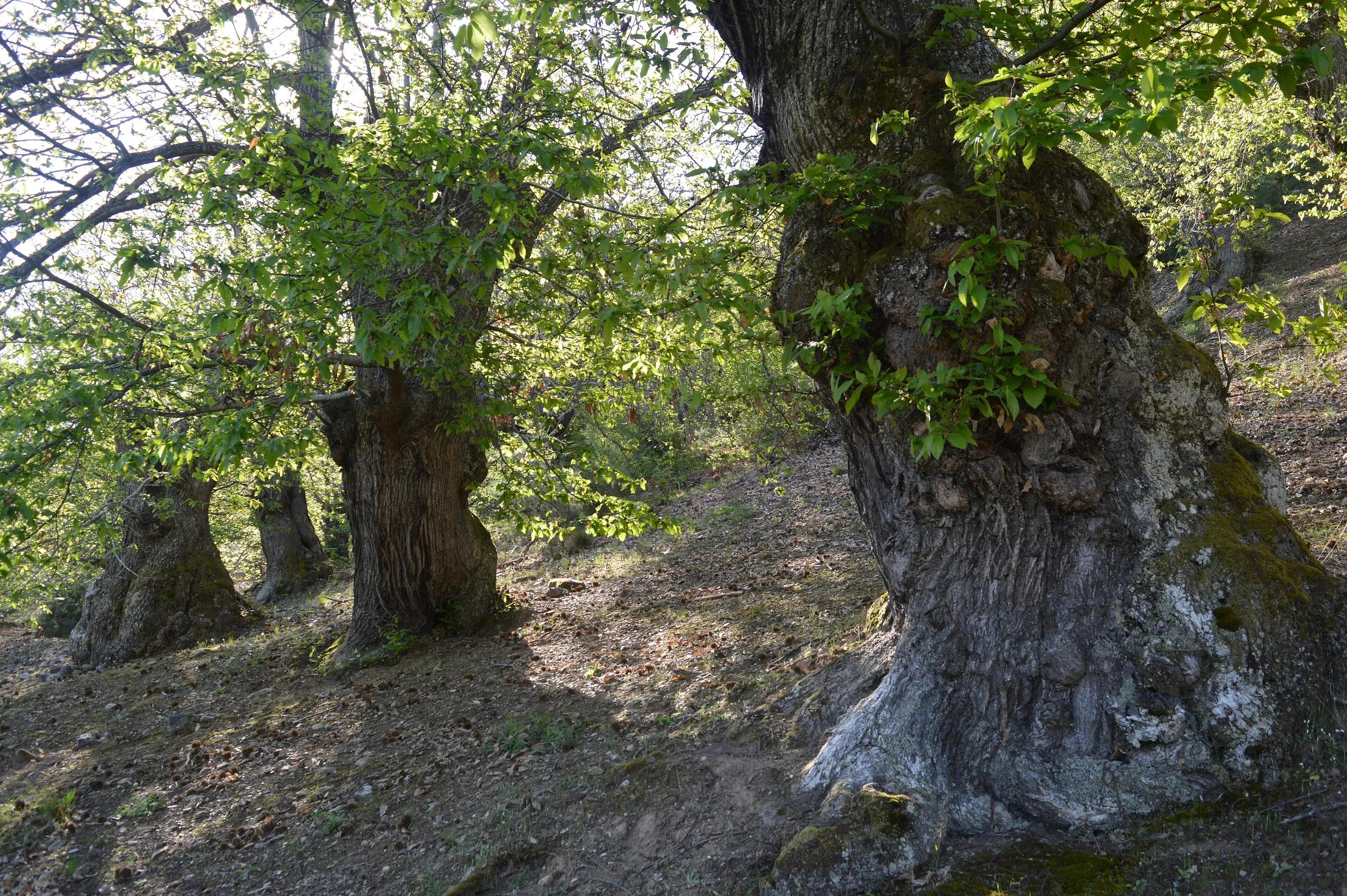
When the mining ended, the woods returned, and people planted. Turespaña describes a landscape covered by chestnut trees, and for centuries the chestnut was bread and timber for the villages of the Bierzo. Some trees here grew to enormous girth, their trunks hollowed and twisted with age, standing among the red earth like a second set of monuments, living ones.
In August 2025 a forest fire that broke out at Yeres swept through the municipalities of Borrenes, Carucedo and Puente de Domingo Flórez and into Las Médulas. Among the damage the Junta de Castilla y León listed were the Aula Arqueológica, the site's archaeological visitor centre, the Orellán viewpoint, the building at the entrance to the gallery of La Cuevona and the Valiñas Norte footbridge and viewpoint. The Junta reopened part of the Orellán viewpoint in October 2025 and finished repairing it that November; the Aula was demolished to be built anew. A year after the fire, the Diario de León reported that the scars were still visible, that the local residents' association counted many centuries-old chestnut trees as lost for good, and that visitors were coming back, but slowly.
 Pablo Pereira González / Wikimedia Commons, CC BY-SA 4.0
 Pablo Pereira González / Wikimedia Commons, CC BY-SA 4.0
 Rafael Ibáñez Fernández / Wikimedia Commons, CC BY-SA 3.0
Chapter fourThe view from Orellán
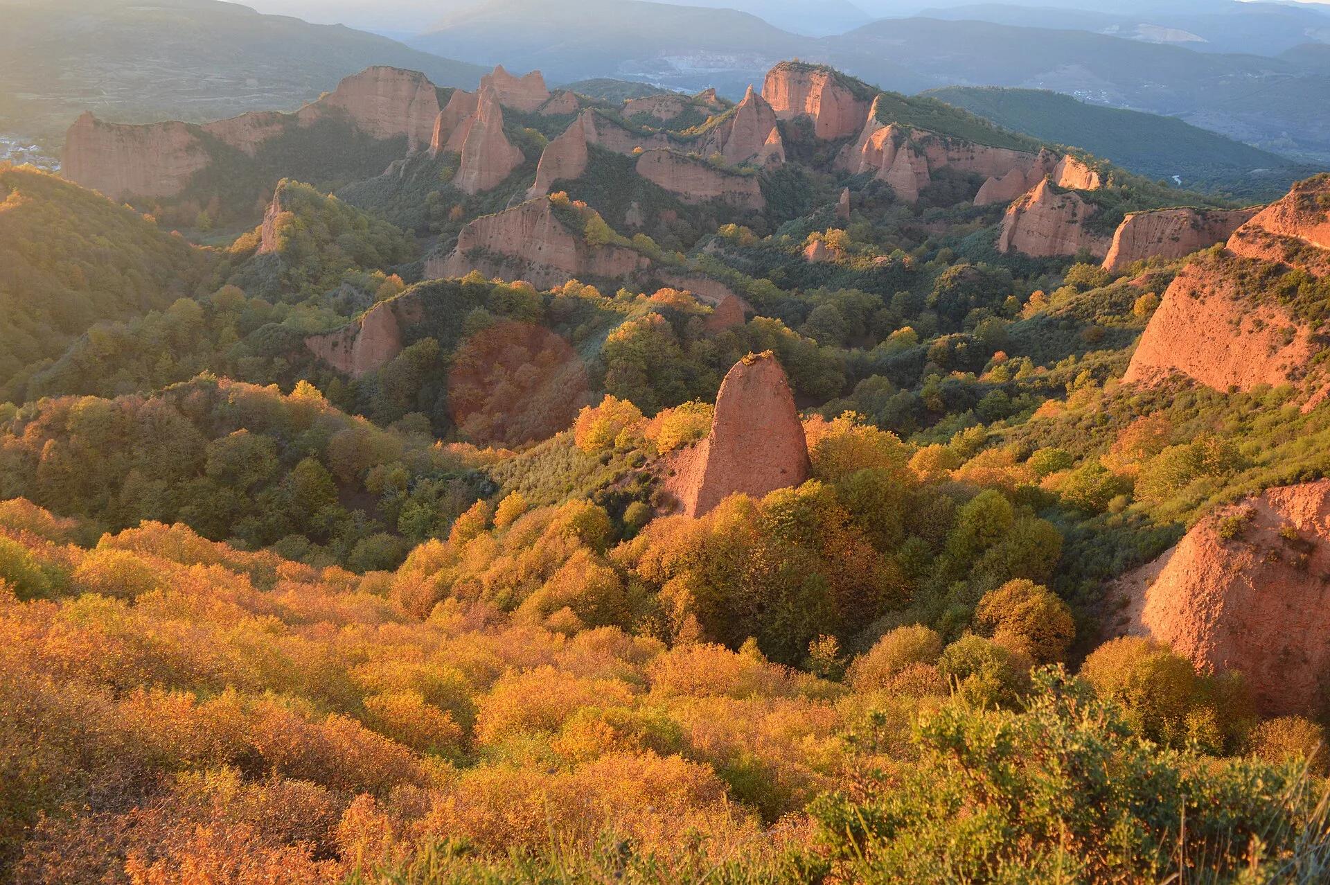
To understand the scale, climb to the Mirador de Orellán. From the viewpoint, which Turespaña calls one of the best views of the whole site, the pinnacles spread out below like a red city among the trees, and the logic of the mine becomes visible: the edges where the hill was cut, the hollows where it fell, the ridges that were left. Early and late in the day, when the light is low, the colours are deepest.
Chapter fiveVisiting today
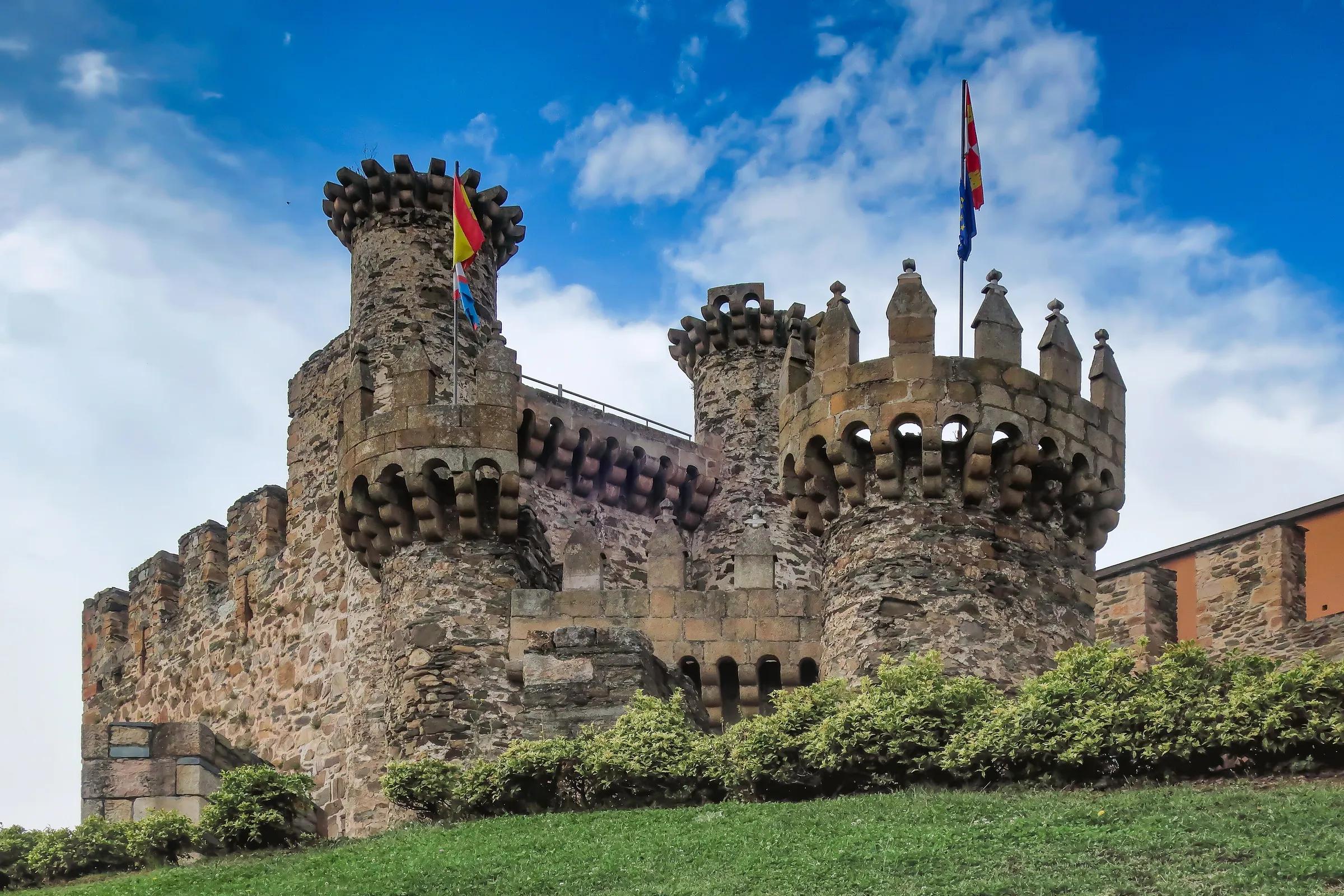
Las Médulas is a landscape to walk rather than to look at from a car. Turismo de Castilla y León lists signed walking routes across the site, among them a perimeter path, and a circular cycle route for those who prefer two wheels; the Casa del Parque has offered guided visits, with times that change by season. Close by, the Lago de Carucedo is a calm place to end the day, and Ponferrada, with its Templar castle, is the natural base in the Bierzo.
Spring and autumn are the gentlest seasons for walking, and autumn adds the colour of the chestnut woods. Whenever you come, give the place time. It was shaped over generations by thousands of hands and an unimaginable amount of water; it repays a slow afternoon better than a quick photograph.
Practical details checked on 8 November 2026. Rules, access and seasons change. Check the official sources below before you go.
Sources
- Turespaña (spain.info) — Las Médulas, León (UNESCO 1997, water from the Eria and Cabrera)checked 8 November 2026
- Turespaña (spain.info) — Las Médulas destination (1st century AD, ruina montium, Orellán, chestnuts)checked 8 November 2026
- Pliny the Elder, Natural History 33.21 (Bostock & Riley translation), Perseus Digital Librarychecked 8 November 2026
- Diario de León — Las Médulas, un año después del incendio (9 Aug 2026)checked 8 November 2026
- Ministerio de Cultura — Patrimonio Mundial: Las Médulas (inscribed 1997; ruina montium)checked 8 November 2026
- Junta de Castilla y León, Patrimonio Cultural — Las Médulas (UNESCO inscription December 1997)checked 8 November 2026
- Fundación Patrimonio Natural de Castilla y León — Las Médulas, datos generales (first Spanish cultural landscape on the List)checked 8 November 2026
- Junta de Castilla y León — Reconstrucción de infraestructuras afectadas en Las Médulaschecked 8 November 2026
- Junta de Castilla y León — Plan de recuperación de Las Médulas (press note, 25 Aug 2025)checked 8 November 2026
- Junta de Castilla y León — Orellán viewpoint repairs completed (press note, 21 Nov 2025)checked 8 November 2026
- Turismo de Castilla y León — Las Médulas (routes, cycle route, guided visits)checked 8 November 2026
Take it further
If this story set you thinking, here is where to take it next.
Series
In the series The seven provinces around
Journeys & Road Trips
From the Montaña Palentina to Las Merindades
Adventure & Outdoors
Fuente Dé and the high Picos
Life & Culture
Las Médulas: the mountains the Romans brought down
Places & Destinations
Potes and the Liébana valley
Places & Destinations
Praia das Catedrais: tides and booking
Journeys & Road Trips
The Ribeira Sacra and the Sil canyon